Filters: Tags: Habitat (X) > Date Range: {"choice":"year"} (X) > partyWithName: U.S. Geological Survey (X)
9 results (81ms)|
Filters
Date Types (for Date Range)
Categories Tag Types Tag Schemes |
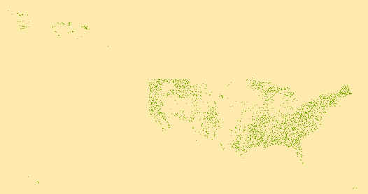
This data set includes paired air and water temperature data from 204 sites throughout the southern Appalachian region of the United States. Sites were located in randomly selected subwatersheds identified as capable of supporting populations of brook trout. Located at the downstream outlet of the subwatersheds, each site consisted of a logger placed underwater paired with a logger affixed to the bank or a tree. Stream and air temperatures were measured every 30 minutes using the remote logger system. Loggers were deployed from 2010 to 2015. The paired air and water temperatures were summarized into daily and weekly minimum, maximum, and mean values. Site information is included for the temperature data, including...
Categories: Data;
Tags: Appalachian Region,
Southeastern US,
brook trout,
climatologyMeteorologyAtmosphere,
environment,

These data were released prior to the October 1, 2016 effective date for the USGS’s policy dictating the review, approval, and release of scientific data as referenced in USGS Survey Manual Chapter 502.8 Fundamental Science Practices: Review and Approval of Scientific Data for Release. This dataset contains directory structure for use with the Shoreline Management Tool as described in Open File Report 2012-1247 entitled "The Shoreline Management Tool: An ArcMap Tool for Analyzing Water Depth, Inundated Area, Volume, and Selected Habitats, with an Example for the Lower Wood River Valley, Oregon". The ShorelineDirectory contains folder in which the Shoreline Management Tool will operate and create output files. The...

Geospatial data that is a derivative land cover product depicting woodland on topographic maps.

These data were released prior to the October 1, 2016 effective date for the USGS’s policy dictating the review, approval, and release of scientific data as referenced in USGS Survey Manual Chapter 502.8 Fundamental Science Practices: Review and Approval of Scientific Data for Release. The layers within this geodataset describe physical habitat characteristics in the North and South Fork Shenandoah rivers. They represent conditions during summer low-flow periods when canoeing was possible.The data are derived from GPS field surveys and GIS editing to commplete habitat units around islands or river bends.
Geospatial data that is a derivative land cover product depicting woodland on topographic maps.

These data were released prior to the October 1, 2016 effective date for the USGS’s policy dictating the review, approval, and release of scientific data as referenced in USGS Survey Manual Chapter 502.8 Fundamental Science Practices: Review and Approval of Scientific Data for Release. This dataset was collected with a PLGR government-issue GPS, and through manual measurement in the field. Points were gathered while canoeing along the North Fork Shenandoah River. Each location marked a change in meso-scale habitat type. GPS points were supplemented with GIS-derived points in areas where manual measurements were made. The points were used to generate a line coverage. This coverage represents physical habitat at...
Categories: pre-SM502.8;
Tags: Habitat,
Inland Waters,
NSDI,
North Fork Shenandoah River,
USGS Science Data Catalog (SDC)

These data were released prior to the October 1, 2016 effective date for the USGS’s policy dictating the review, approval, and release of scientific data as referenced in USGS Survey Manual Chapter 502.8 Fundamental Science Practices: Review and Approval of Scientific Data for Release. Data collected with the GeoXT Trimble GPS unit using ArcPad 6.1. (summer 2006-2007). Files were created within a geodatabase to create a data dictionary for use in ArcPad during data collection. Drop down lists for habitat type, substrate, depth, width, length, and descriptions were included. Data files produced on theGeoXT were point shapefiles that could be checked back into the geodatabase and viewable as a layer. Points were...
Categories: pre-SM502.8;
Tags: Habitat,
Inland Waters,
NSDI,
South Fork Shenandoah River,
USGS Science Data Catalog (SDC)

These data were released prior to the October 1, 2016 effective date for the USGS’s policy dictating the review, approval, and release of scientific data as referenced in USGS Survey Manual Chapter 502.8 Fundamental Science Practices: Review and Approval of Scientific Data for Release. This dataset contains directory structure for use with the Shoreline Management Tool as described in Open File Report 2012-1247 entitled "The Shoreline Management Tool: An ArcMap Tool for Analyzing Water Depth, Inundated Area, Volume, and Selected Habitats, with an Example for the Lower Wood River Valley, Oregon". The ShorelineDirectory contains folders in which the Shoreline Management Tool will operate and create output files....
Categories: pre-SM502.8;
Tags: Agency Lake, Oregon,
Klamath Basin, Oregon,
Klamath Lake, Oregon,
LiDAR,
NSDI,

These data were released prior to the October 1, 2016 effective date for the USGS’s policy dictating the review, approval, and release of scientific data as referenced in USGS Survey Manual Chapter 502.8 Fundamental Science Practices: Review and Approval of Scientific Data for Release. The layers within this geodataset describe physical habitat characteristics in the North and South Fork Shenandoah rivers. They represent conditions during summer low-flow periods when canoeing was possible.The data are derived from GPS field surveys and GIS editing to complete habitat units around islands or river bends.
Categories: pre-SM502.8;
Tags: Habitat,
InlandWaters,
NSDI,
Shenandoah River,
USGS Science Data Catalog (SDC),
|

|
