|
|

These data identify, in general, the areas where final critical habitat for the Mountain Yellow-legged frog (Rana muscosa) occur.
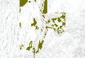
This data set represents greater SAGE GROUSE brooding use areas in Utah as determined by UDWR field biologists in 2010.

This dataset represents CALIFORNIA BIGHORN SHEEP use areas in Utah as determined by wildlife biologists during 2001. In May 2006 the dataset was converted from a Critical, High, Substantial and Limited value system to a Crucial/Substantial value system.

This data set represents SAGE GROUSE (Greater sage-grouse and Gunnison sage-grouse) brooding use areas in Utah as determined by UDWR field biologists in spring 1999. In May 2006 the dataset was converted from a Critical, High, Substantial and Limited value system to a Crucial/Substantial value system.

Bighorn sheep distribution and winter ranges were reviewed and updated during 2002. The layer does not necessarily include overall distribution or winter range within Tribal lands/Indian Reservations or National Park Service lands. Overall distribution polygons represent general or year round habitat. Winter range polygons represent areas occupied by the species from November 15 to March 1. The polygon attribute to select overall distribution and/or winter range areas for big horn sheep is BHS_USE.
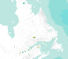
The datatset is a compilation of all permanent (legally established) protected areas in Quebec, Canada.
Tags: canada,
habitat,
landscape,
marine,
park, All tags...
protected areas,
quebec,
rangeland,
reserve,
sanctuary,
wildland,
wildlife management area, Fewer tags

These data identify, in general, the areas where final critical habitat for ACANTHAMINTHA ILICIFOLIA (SAN DIEGO THORNMINT) occur.
Tags: acanthamintha ilicifolia,
california,
carlsbad,
critical,
habitat, All tags...
occurrence,
san diego thornmint,
species,
u.s. fish and wildlife service,
usfws, Fewer tags

These data identify the areas where final critical habitat has been mapped by the USFWS for invertebrate species. These data were compiled by the Conservation Biology Institute (CBI) from a series of individual shapefiles published by the USFWS (http://criticalhabitat.fws.gov/). For more information on the process for mapping the critical habitat for each species, please see the metadata for each species listed on the USFWS web site. This particular dataset contains the fish species critical habitat areas that are represented by polygons. Critical habitat represented by lines are contained in a separate dataset. Critical habitat designations have not been made for all listed endangered species. Where critical habitat...

These data identify the areas where final critical habitat has been mapped by the USFWS for plant species in the western United States. These data were compiled by the Conservation Biology Institute (CBI) from a series of individual shapefiles published by the USFWS (http://criticalhabitat.fws.gov/). For more information on the process for mapping the critical habitat for each species, please see the metadata for each species listed on the USFWS web site. Critical habitat designations have not been made for all listed endangered species. Where critical habitat has been mapped, this dataset only contains those species for which GIS datasets have been made publicly available. Other critical habitat maps exist for...
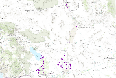
CBI's species distribution model for Gila woodpecker (Melanerpes uropygialis) is based on expert knowledge of suitable habitat and species occurances in the DRECP study site. For the Imperial Valley population, the Gila woodpecker model includes 'Southwestern North American riparian evergreen and deciduous woodland' vegetation and areas with sparse to 40% tree canopy cover. For the eastern Gila woodpecker population, the model includes 'Riparian', 'Southwestern North American riparian evergreen and deciduous woodland', 'Southwestern North American introduced riparian scrub', 'Southwestern North American riparian evergreen and deciduous woodland', and 'Sonoran-Coloradan semi-desert wash woodland/scrub', excluding...

This layer contains polygon features of Key Watersheds that are either providing or expected to provide high-quality fish habitat and water quality in the Region 5 portion of the designated Northwest Forest Plan region.

This dataset depicts Wolf (Canis lupus) habitat in the Northern Appalachians predicted using the spatially explicit population model PATCH under the current habitat effectiveness plus high US mortality plus moderate Canadian mortality scenario (Carroll 2003). This dataset represents one of several scenarios testing the effects of habitat effectiveness and mortality rates on wolf populations. Static habitat suitability models for wolf were fed through PATCH to predict source and sink habitat areas across the landscape. The static models for wolf were created based on current and projected habitat effectiveness, which were based in part on road density and human population density. Wolf fecundity rates were based...
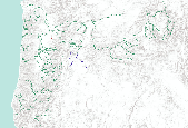
Oregon Fish Habitat Distribution These data describe areas of suitable habitat believed to be used currently by wild, natural, and/or hatchery fish populations. The term "currently" is defined as within the past five reproductive cycles. This information is based on sampling, the best professional opinion of Oregon Dept. of Fish and Wildlife or other natural resources agency staff biologists or modeling (see the fhdBasis field). Due to natural variations in run size, water conditions, or other environmental factors, some habitats identified may not be used annually. These data now comply with the Oregon Fish Habitat Distribution Data Standard that was adopted by the Oregon Geographic Information Council in...
Tags: anadromous fish,
anadromous fish distribution,
anadromous habitat,
fish,
habitat, All tags...
migration habitat,
rearing habitat,
resident fish,
resident fish distribution,
resident habitat,
spawning habitat, Fewer tags

This dataset depicts Marten (Martes americana) habitat in the Northern Appalachians predicted using the spatially explicit population model PATCH under the increased trapping Area scenario (B3; Carrol 2007). This dataset represents one of several scenarios testing the interacting effects of trapping, timber harvest, habitat restoration, and climate change on marten populations. Static habitat suitability models for marten were fed through PATCH to predict source and sink habitat areas across the landscape. The static models for marten were created based on annual snowfall and percentage of older conifer and mixed forest. Demographic parameters were obtained from the literature and from calibration of the model....

A medium resolution vector map of the Canadian and U.S. Great Lakes and St. Lawrence River shoreline is segmented into reaches and classified using a three tier scheme representing the geomorphic nature of the shoreline, the extent of shoreline protection, and the geomorphic nature of the nearshore subaqueous shoreline.

CBI's expert model for Palmer's jackass clover (Wislizenia refracta ssp. palmeri) includes areas with "North American warm desert dunes and sand flats" vegetation, sandy soils (porosity of < 0.4), and elevations under 150 meters, in ecoregion subsection 322Bc.
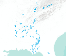
These data identify the areas where final critical habitat has been mapped by the USFWS for invertebrate species. These data were compiled by the Conservation Biology Institute (CBI) from a series of individual shapefiles published by the USFWS (http://criticalhabitat.fws.gov/). For more information on the process for mapping the critical habitat for each species, please see the metadata for each species listed on the USFWS web site. This particular dataset contains the invertebrate species critical habitat areas that are represented by lines. Critical habitat represented by polygons are contained in a separate dataset. Critical habitat designations have not been made for all listed endangered species. Where critical...

This dataset depicts Marten (Martes americana) habitat in the Northern Appalachians predicted using the spatially explicit population model PATCH under the increased trapping area plus timber harvest scenario (L3; Carrol 2007). This dataset represents one of several scenarios testing the interacting effects of trapping, timber harvest, habitat restoration, and climate change on marten populations. Static habitat suitability models for marten were fed through PATCH to predict source and sink habitat areas across the landscape. The static models for marten were created based on annual snowfall and percentage of older conifer and mixed forest. Demographic parameters were obtained from the literature and from calibration...

This dataset represents SAGE GROUSE (Greater Sage-Grouse and Gunnison Sage-Grouse) winter use areas in Utah as determined by UDWR field biologists in spring 1999. In May 2006 the dataset was converted from a Critical, High, Substantial and Limited value system to a Crucial/Substantial value system.

This dataset represents DESERT BIGHORN SHEEP use areas in Utah as determined by wildlife biologists during 2001, with supplemental additions motivated by the Richfield BLM Resource Management Planning process in the spring of 2004, in November 2004, and again in March 2005. In May 2006 the dataset was converted from a Critical, High, Substantial and Limited value system to a Crucial/Substantial value system. Additional updates for the layer were made in January 2008, in cooperation with the local BLM biologists.
|
|