Filters: Tags: Hamilton County (X)
916 results (14ms)|
Filters
Date Range
Extensions (Less) Types (Less)
Contacts (Less)
Categories (Less) Tag Types
|
Layers of geospatial data include contours, boundaries, land cover, hydrography, roads, transportation, geographic names, structures, and other selected map features.
stream South road, W. Punky Pond. Single Shanty Research Station. Hamilton county, NY
Layers of geospatial data include contours, boundaries, land cover, hydrography, roads, transportation, geographic names, structures, and other selected map features.
Layers of geospatial data include contours, boundaries, land cover, hydrography, roads, transportation, geographic names, structures, and other selected map features.
Layers of geospatial data include contours, boundaries, land cover, hydrography, roads, transportation, geographic names, structures, and other selected map features.
Types: Citation;
Tags: 7.5 x 7.5 minute,
7.5 x 7.5 minute,
Combined Vector,
Combined Vector,
Combined Vector,
Layers of geospatial data include contours, boundaries, land cover, hydrography, roads, transportation, geographic names, structures, and other selected map features.
Types: Citation;
Tags: 7.5 x 7.5 minute,
7.5 x 7.5 minute,
Combined Vector,
Combined Vector,
Combined Vector,
Layers of geospatial data include contours, boundaries, land cover, hydrography, roads, transportation, geographic names, structures, and other selected map features.
Types: Citation;
Tags: 7.5 x 7.5 minute,
7.5 x 7.5 minute,
Combined Vector,
Combined Vector,
Combined Vector,
These data are high-resolution bathymetry (lake bottom elevation) in a gridded XYZ format, generated from hydrographic surveys of Morse and Geist Reservoirs in April and May of 2016. Hydrographic data were collected using a multibeam echo-sounder (MBES) with integrated inertial navigation solution (INS) mounted on a marine survey vessel. Data were collected as the vessel traversed the lake along survey lines distributed throughout the area. Data collection software integrated and stored the depth data from the multibeam sonar and the horizontal and vertical position and attitude data of the vessel from the INS in real time. In the shallow areas, additional data were collected with an acoustic Doppler current profiler...
These data are high-resolution bathymetry (lake bottom elevation) in a gridded XYZ format, generated from hydrographic surveys of Morse Reservoir in May 2016. Hydrographic data were collected using a multibeam echo-sounder (MBES) with integrated inertial navigation solution (INS) mounted on a marine survey vessel. Data were collected as the vessel traversed the lake along survey lines distributed throughout the area. Data collection software integrated and stored the depth data from the multibeam sonar and the horizontal and vertical position and attitude data of the vessel from the INS in real time. In the shallow areas, additional data were collected with an acoustic Doppler current profiler (ADCP) and a real-time...
Categories: Data;
Tags: Hamilton County,
Indiana,
Morse Reservoir,
Noblesville,
United States of America,
Layered geospatial PDF 7.5 Minute Quadrangle Map. Layers of geospatial data include orthoimagery, roads, grids, geographic names, elevation contours, hydrography, and other selected map features. This map is derived from GIS (geospatial information system) data. It represents a repackaging of GIS data in traditional map form, not creation of new information. The geospatial data in this map are from selected National Map data holdings and other government sources.
Layered geospatial PDF 7.5 Minute Quadrangle Map. Layers of geospatial data include orthoimagery, roads, grids, geographic names, elevation contours, hydrography, and other selected map features. This map is derived from GIS (geospatial information system) data. It represents a repackaging of GIS data in traditional map form, not creation of new information. The geospatial data in this map are from selected National Map data holdings and other government sources.
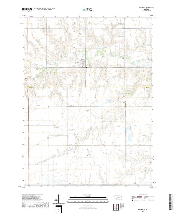
Layered geospatial PDF 7.5 Minute Quadrangle Map. Layers of geospatial data include orthoimagery, roads, grids, geographic names, elevation contours, hydrography, and other selected map features. This map is derived from GIS (geospatial information system) data. It represents a repackaging of GIS data in traditional map form, not creation of new information. The geospatial data in this map are from selected National Map data holdings and other government sources.
Layered geospatial PDF 7.5 Minute Quadrangle Map. Layers of geospatial data include orthoimagery, roads, grids, geographic names, elevation contours, hydrography, and other selected map features. This map is derived from GIS (geospatial information system) data. It represents a repackaging of GIS data in traditional map form, not creation of new information. The geospatial data in this map are from selected National Map data holdings and other government sources.
Layered geospatial PDF 7.5 Minute Quadrangle Map. Layers of geospatial data include orthoimagery, roads, grids, geographic names, elevation contours, hydrography, and other selected map features. This map is derived from GIS (geospatial information system) data. It represents a repackaging of GIS data in traditional map form, not creation of new information. The geospatial data in this map are from selected National Map data holdings and other government sources.
Layered geospatial PDF 7.5 Minute Quadrangle Map. Layers of geospatial data include orthoimagery, roads, grids, geographic names, elevation contours, hydrography, and other selected map features. This map is derived from GIS (geospatial information system) data. It represents a repackaging of GIS data in traditional map form, not creation of new information. The geospatial data in this map are from selected National Map data holdings and other government sources.
The U.S. Geological Survey, in cooperation with the Savannah Valley Utility District, evaluated the groundwater hydrology of the Valley and Ridge carbonate aquifer system of Cambrian-Ordovician age in the area of Savannah and Gunstocker Creeks in northeastern Hamilton, southern Meigs, and northwestern Bradley Counties, Tennessee, from 2007 through 2009. The evaluation included and built on: 1) the results of test drilling conducted in the area in 1974 to determine the potential for groundwater as a source of public supply for the utility, and 2) the results of an investigation conducted to define recharge areas for wells used by groundwater-source public-supply water systems throughout Hamilton County in the early...
Classified probability of suitable habitat for Black Tailed Prairie Dogs for each cell of raster. Classification is based on 4 probability cutoff levels with category 1 being low habitat suitability and category 4 being high habitat suitability. Categorized probability data is created from fitting a global third-order model to county level raster data. For details on model fitting and data used to produce categorized probability raster see report. https://www.fws.gov/science/catalog
Categories: Data;
Types: Downloadable,
GeoTIFF,
Map Service,
Raster;
Tags: Black Tailed Prairie Dogs,
Great Plains,
Habitat Suitability,
Hamilton County,
Kansas,

Layers of geospatial data include contours, boundaries, land cover, hydrography, roads, transportation, geographic names, structures, and other selected map features.
Layers of geospatial data include contours, boundaries, land cover, hydrography, roads, transportation, geographic names, structures, and other selected map features.
Layers of geospatial data include contours, boundaries, land cover, hydrography, roads, transportation, geographic names, structures, and other selected map features.
|

|
