Filters: Tags: Harris County (X) > Date Range: {"choice":"year"} (X)
11 results (42ms)|
Filters
Date Types (for Date Range)
Contacts
Categories Tag Types
|
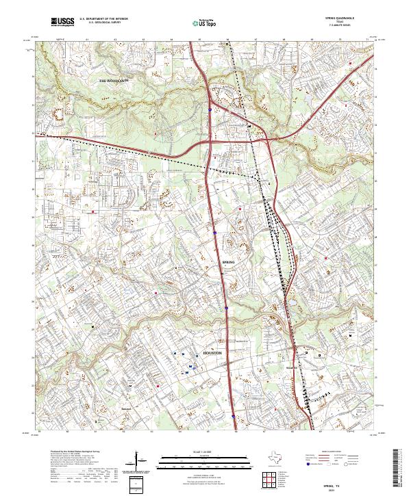
Layered geospatial PDF 7.5 Minute Quadrangle Map. Layers of geospatial data include orthoimagery, roads, grids, geographic names, elevation contours, hydrography, and other selected map features. This map is derived from GIS (geospatial information system) data. It represents a repackaging of GIS data in traditional map form, not creation of new information. The geospatial data in this map are from selected National Map data holdings and other government sources.
The U.S. Geological Survey (USGS), in cooperation with the Harris-Galveston Subsidence District and Fort Bend Subsidence District, constructed a finite-difference numerical groundwater-flow model of the northern Gulf Coast aquifer region for 1897 through 2018 using MODFLOW 6 with the Newton formulation solver to simulate groundwater flow and land-surface subsidence. Model parameter estimation and uncertainty analysis were conducted with PEST++ Iterative Ensemble Smoother software. The simulated results are described in the associated U.S. Geological Survey Professional Paper 1877. The model archive provided in this U.S. Geological Survey data release includes all the necessary files to run the MODFLOW 6 model and...
This dataset documents depth to groundwater measurements made from wells screened in the Chicot aquifer, Evangeline aquifer, Jasper aquifer, Burkeville confining unit, Catahoula confining unit, or a combination of these hydrogeologic units in the greater Houston area, Texas for 2023. The U.S. Geological Survey (USGS) prepared this dataset in cooperation with the Harris‐Galveston Subsidence District, City of Houston, Fort Bend Subsidence District, Lone Star Groundwater Conservation District, and Brazoria County Groundwater Conservation District. This dataset was created to provide resource managers, public officials, researchers, and the general public with ready access to information regarding depths to groundwater...
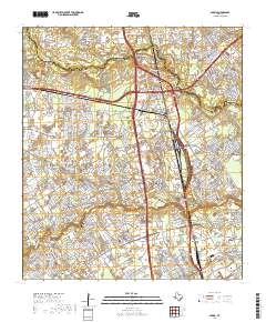
Layered geospatial PDF 7.5 Minute Quadrangle Map. Layers of geospatial data include orthoimagery, roads, grids, geographic names, elevation contours, hydrography, and other selected map features. This map is derived from GIS (geospatial information system) data. It represents a repackaging of GIS data in traditional map form, not creation of new information. The geospatial data in this map are from selected National Map data holdings and other government sources.
Florida - These data were taken from the Florida Boating Access Facilities Inventory and Economic Study including a pilot study for Lee County: A Report to the Florida Fish and Wildlife Conservation Commission on August 30, 2009. This GIS point data set is based on the data contained in the final databases that were provided to FWC on June 2, 2009 in Microsoft Access format.Mississippi - Boat ramps and marinas in the coastal counties of Mississippi are included in this data layer. These facilities were primarily derived from a document from the Mississippi Department of Marine Resources website. Due to changes after Hurricane Katrina, some marinas and boat ramps may have been abandoned or gone out-of-business. Some...
Categories: Data;
Tags: Academics & scientific researchers,
Alabama,
Aransas County,
Baldwin County,
Brazoria County,
The U.S. Geological Survey (USGS), in cooperation with the Harris‐Galveston Subsidence District, City of Houston, and the Fort Bend Subsidence District, produced a dataset through 2022 of compaction values in the Chicot and Evangeline aquifers in the greater Houston area, Texas. This dataset contains compaction values associated with subsurface sediments (mostly in the fine-grained silt and clay layers because little compaction occurs in sand layers) in the Chicot and Evangeline aquifers that were recorded continuously using analog technology at 14 extensometers at 12 locations (a pair of extensometers are installed at different depths at 2 of the 12 locations). Of the 14 extensometers, 13 were activated between...
Categories: Data Release - Revised;
Tags: Chicot aquifer,
Evangeline aquifer,
Galveston County,
Harris County,
Texas,
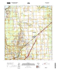
Layered geospatial PDF 7.5 Minute Quadrangle Map. Layers of geospatial data include orthoimagery, roads, grids, geographic names, elevation contours, hydrography, and other selected map features. This map is derived from GIS (geospatial information system) data. It represents a repackaging of GIS data in traditional map form, not creation of new information. The geospatial data in this map are from selected National Map data holdings and other government sources.
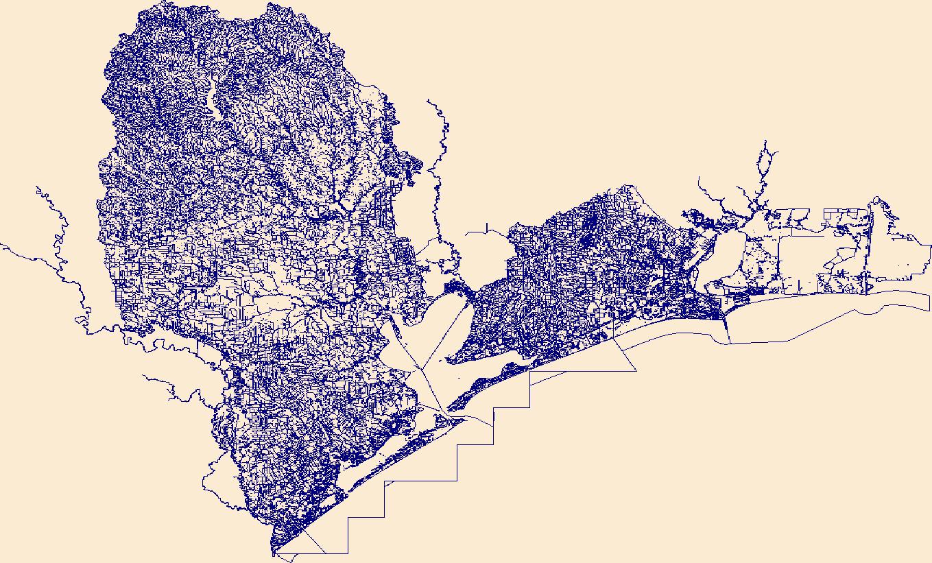
The High Resolution National Hydrography Dataset Plus (NHDPlus HR) is an integrated set of geospatial data layers, including the best available National Hydrography Dataset (NHD), the 10-meter 3D Elevation Program Digital Elevation Model (3DEP DEM), and the National Watershed Boundary Dataset (WBD). The NHDPlus HR combines the NHD, 3DEP DEMs, and WBD to create a stream network with linear referencing, feature naming, "value added attributes" (VAAs), elevation-derived catchments, and other features for hydrologic data analysis. The stream network with linear referencing is a system of data relationships applied to hydrographic systems so that one stream reach "flows" into another and "events" can be tied to and traced...
The Geneva Industries/Fuhrmann Energy Superfund Site in southeastern Houston, Texas was historically used as a site for petroleum exploration and petrochemical production and is currently (2023) inactive. Previous remedies to clean up the contaminated site included: excavation and off-site disposal of polychlorinated biphenyl-contaminated soils, capping of residual water on-site with a perimeter slurry wall, the recovery and treatment of trichloroethylene-contaminated groundwater, and institutional controls (Environmental Protection Agency, 2019). A conceptual site model (CSM) does not yet exist and is needed to (1) understand how site conditions have changed since earlier investigations; (2) reevaluate site contaminants...
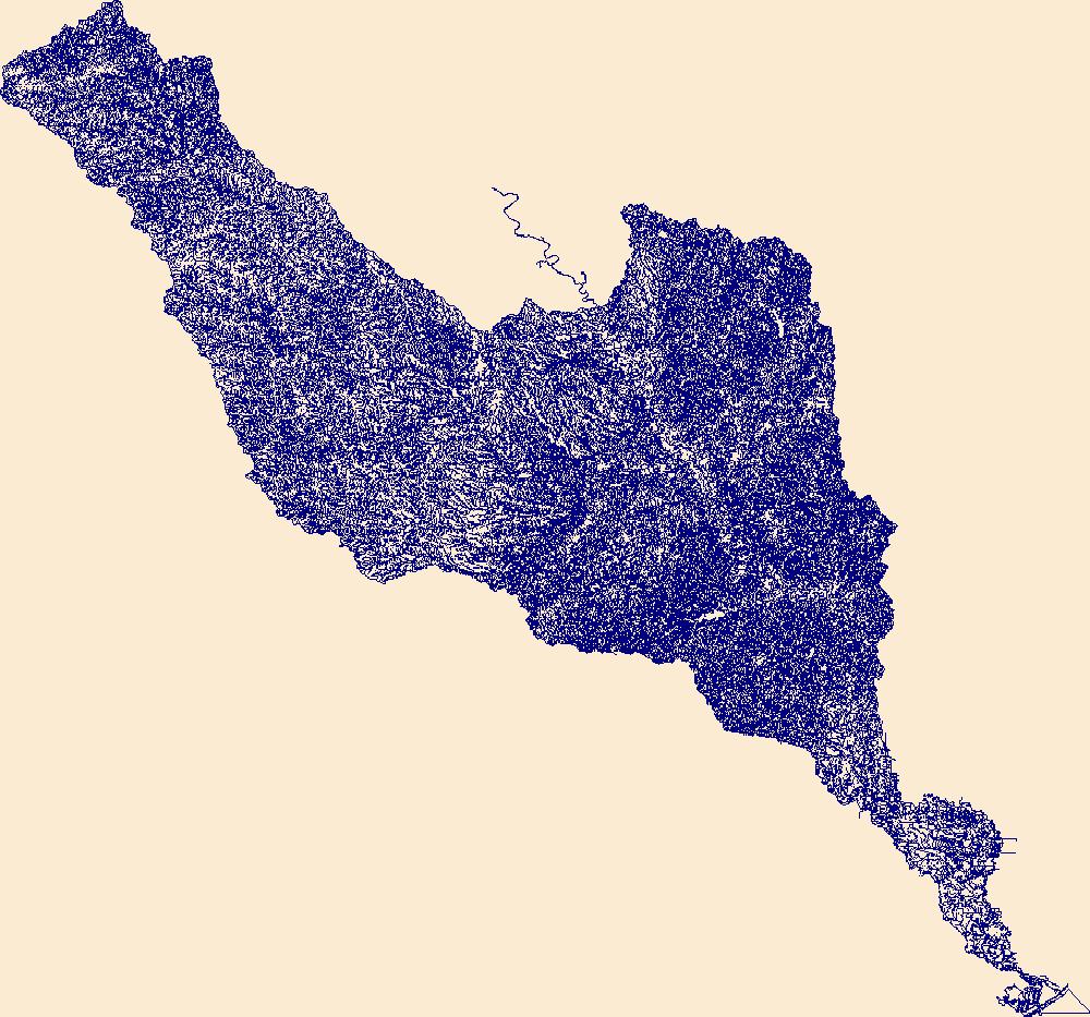
The High Resolution National Hydrography Dataset Plus (NHDPlus HR) is an integrated set of geospatial data layers, including the best available National Hydrography Dataset (NHD), the 10-meter 3D Elevation Program Digital Elevation Model (3DEP DEM), and the National Watershed Boundary Dataset (WBD). The NHDPlus HR combines the NHD, 3DEP DEMs, and WBD to create a stream network with linear referencing, feature naming, "value added attributes" (VAAs), elevation-derived catchments, and other features for hydrologic data analysis. The stream network with linear referencing is a system of data relationships applied to hydrographic systems so that one stream reach "flows" into another and "events" can be tied to and traced...
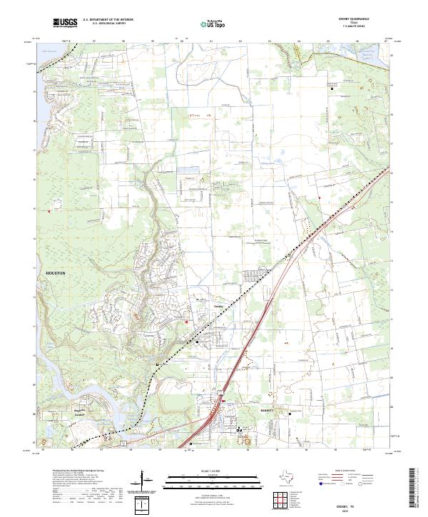
Layered geospatial PDF 7.5 Minute Quadrangle Map. Layers of geospatial data include orthoimagery, roads, grids, geographic names, elevation contours, hydrography, and other selected map features. This map is derived from GIS (geospatial information system) data. It represents a repackaging of GIS data in traditional map form, not creation of new information. The geospatial data in this map are from selected National Map data holdings and other government sources.
|

|
