Filters: Tags: Hawaii (X) > Date Range: {"choice":"year"} (X)
325 results (69ms)|
Filters
Date Types (for Date Range)
Types
Contacts
Categories
Tag Types
|
A sensitivity analysis of groundwater-recharge estimates from a water-budget model was completed for the islands of Oahu and Maui, Hawaii (Johnson and others, 2023). Results of the sensitivity analysis were used to quantify the relative importance of selected model parameters to recharge estimates for three moisture zones (dry, mesic, and wet) on Oahu and Maui. This shapefile contains the boundaries of the moisture zones and boundaries of the model subareas that were used in the model simulations for Oahu. The shapefile attribute information includes the names of the land-cover types assigned to model subareas and the mean annual recharge values determined for the model subareas for the baseline scenario of the...
Categories: Data;
Types: Downloadable,
Map Service,
OGC WFS Layer,
OGC WMS Layer,
OGC WMS Service,
Shapefile;
Tags: Hawaii,
Oahu,
Pacific Islands,
biota,
boundaries,
The U.S. Geological Survey (USGS), in cooperation with the State of Hawaiʻi Department of Transportation, estimated flood magnitudes for the 50-, 20-, 10-, 4-, 2-, 1-, 0.5-, and 0.2-percent annual exceedance probabilities (AEP) for unregulated streamgages in Kauaʻi, Oʻahu, Molokaʻi, Maui, and Hawaiʻi, State of Hawaiʻi, using data through water year 2020. Regression equations which can be used to estimate flood magnitude and associated frequency at ungaged streams were developed. The methods and results of the study are published in a separate report (https://doi.org/10.3133/sir20235014). This data release contains (1) a folder with the PeakFQ output files for each streamgage, ".PRT" and ".EXP" files, for use in...
Types: Map Service,
OGC WFS Layer,
OGC WMS Layer,
OGC WMS Service;
Tags: Hawaii,
Hawaii Island,
Kauai,
Maui,
Molokai,

The shapefile associated with this metadata file represents the spatial distribution of mean annual water-budget components, in inches, for Hawaii Island, Hawaii. The water-budget components in the shapefile were computed by a water-budget model for a scenario representative of predevelopment conditions (1916-83 rainfall and 1870 land cover), as described in USGS Scientific Investigations Report (SIR) 2015-5164. The model was developed for estimating groundwater recharge and other water-budget components for each subarea of the model. The model-subarea data set, consisting of 467,805 subareas (polygons), was generated using Esri ArcGIS software by intersecting (merging) multiple spatial data sets. Spatial datasets...

The Geographic Names Information System (GNIS) is the Federal standard for geographic nomenclature. The U.S. Geological Survey developed the GNIS for the U.S. Board on Geographic Names, a Federal inter-agency body chartered by public law to maintain uniform feature name usage throughout the Government and to promulgate standard names to the public. The GNIS is the official repository of domestic geographic names data; the official vehicle for geographic names use by all departments of the Federal Government; and the source for applying geographic names to Federal electronic and printed products of all types.
The National Park Service (NPS) requests burn severity assessments through an agreement with the U.S. Geological Survey (USGS) to be completed by analysts with the Monitoring Trends in Burn Severity (MTBS) Program. The MTBS Program assesses the frequency, extent, and magnitude (size and severity) of all large wildland fires (wildfires and prescribed fires) in the conterminous United States (CONUS), Alaska, Hawaii, and Puerto Rico for the period 1984 and beyond. All fires reported as greater than 1,000 acres in the western U.S. and greater than 500 acres in the eastern U.S. are mapped across all ownerships. MTBS produces a series of geospatial and tabular data for analysis at a range of spatial, temporal, and thematic...
Types: Map Service,
OGC WFS Layer,
OGC WMS Layer,
OGC WMS Service;
Tags: AK,
Alaska,
Burn severity,
Burned area,
CONUS,
This map layer is a vector polygon shapefile of the perimeters of all currently inventoried fires occurring between calendar year 2021 and 2021 that do not meet standard MTBS size criteria. These data are published to augment the data that are available from the MTBS program. This product was produced using the methods of the Monitoring Trends in Burn Severity Program (MTBS); however, these fires do not meet the size criteria for a standard MTBS assessment. The MTBS Program assesses the frequency, extent, and magnitude (size and severity) of all large wildland fires (wildfires and prescribed fires) in the conterminous United States (CONUS), Alaska, Hawaii, and Puerto Rico for the period 1984 and beyond. MTBS typically...
This data release includes data and metadata on 1) the coverage and composition of plants 2) species specific plant traits 3) sampling locations and 4) environmental data. All sites were within Hawaii Volcanoes National Park on Hawaii Island. Plant cover data were obtained from National Park Service Inventory and Monitoring Program. Plant trait data was collected for these plots in 2014. This study aims to evaluate how traits of native and exotic plant species change along environmental gradients and what this suggests for plant competition and invasion.
Categories: Data;
Tags: Ecology,
Hawaii,
Hawaii Volcanoes National Park,
USGS Science Data Catalog (SDC),
botany,
This data release includes metadata and tabular data that documents initial water conditions (temperature, pH, dissolved oxygen and salinity) during aquarium trials testing the efficacy of carbon dioxide (CO2) to manage invasive fish in anchialine pools.
This data release includes data and metadata on tree and shrub basal area as well as bird-mediated and passive seed rain for sites selected to have a range of understory cover under canopy trees (Metrosideros polymorpha and Acacia koa). It also includes seedling germination and survival data for a large-scale seed addition and grass removal experiment that varied both seed rain and grass cover. All sites were within Hakalau Forest National Wildlife Refuge on Hawaii Island. Broadly, this study asks what thresholds of seed rain and native and exotic plant cover are needed for passive forest regeneration.

The National Hydrography Dataset (NHD) is a feature-based database that interconnects and uniquely identifies the stream segments or reaches that make up the nation's surface water drainage system. NHD data was originally developed at 1:100,000-scale and exists at that scale for the whole country. This high-resolution NHD, generally developed at 1:24,000/1:12,000 scale, adds detail to the original 1:100,000-scale NHD. (Data for Alaska, Puerto Rico and the Virgin Islands was developed at high-resolution, not 1:100,000 scale.) Local resolution NHD is being developed where partners and data exist. The NHD contains reach codes for networked features, flow direction, names, and centerline representations for areal water...

The National Hydrography Dataset (NHD) is a feature-based database that interconnects and uniquely identifies the stream segments or reaches that make up the nation's surface water drainage system. NHD data was originally developed at 1:100,000-scale and exists at that scale for the whole country. This high-resolution NHD, generally developed at 1:24,000/1:12,000 scale, adds detail to the original 1:100,000-scale NHD. (Data for Alaska, Puerto Rico and the Virgin Islands was developed at high-resolution, not 1:100,000 scale.) Local resolution NHD is being developed where partners and data exist. The NHD contains reach codes for networked features, flow direction, names, and centerline representations for areal water...
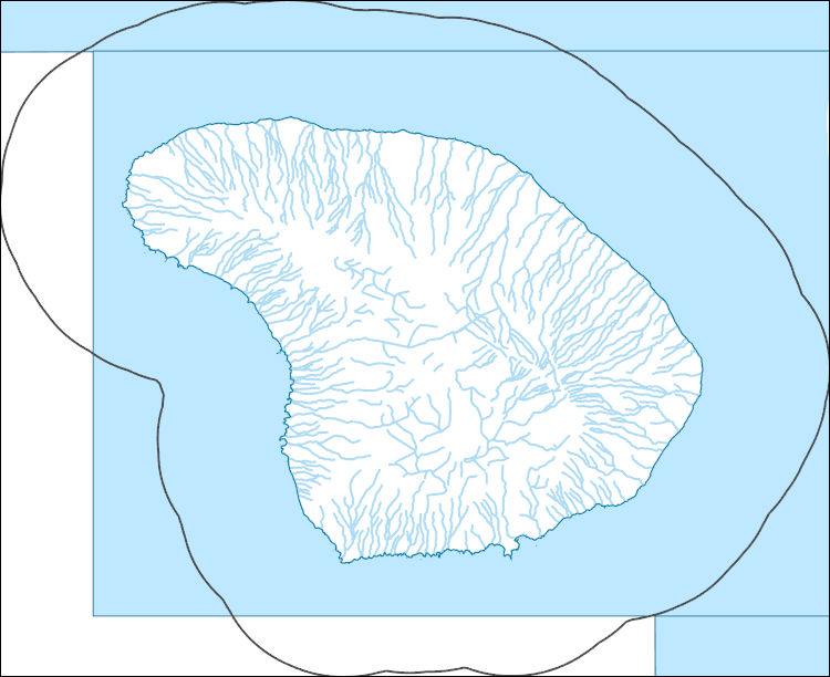
The National Hydrography Dataset (NHD) is a feature-based database that interconnects and uniquely identifies the stream segments or reaches that make up the nation's surface water drainage system. NHD data was originally developed at 1:100,000-scale and exists at that scale for the whole country. This high-resolution NHD, generally developed at 1:24,000/1:12,000 scale, adds detail to the original 1:100,000-scale NHD. (Data for Alaska, Puerto Rico and the Virgin Islands was developed at high-resolution, not 1:100,000 scale.) Local resolution NHD is being developed where partners and data exist. The NHD contains reach codes for networked features, flow direction, names, and centerline representations for areal water...
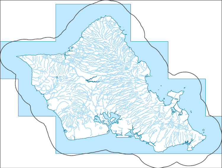
The National Hydrography Dataset (NHD) is a feature-based database that interconnects and uniquely identifies the stream segments or reaches that make up the nation's surface water drainage system. NHD data was originally developed at 1:100,000-scale and exists at that scale for the whole country. This high-resolution NHD, generally developed at 1:24,000/1:12,000 scale, adds detail to the original 1:100,000-scale NHD. (Data for Alaska, Puerto Rico and the Virgin Islands was developed at high-resolution, not 1:100,000 scale.) Local resolution NHD is being developed where partners and data exist. The NHD contains reach codes for networked features, flow direction, names, and centerline representations for areal water...
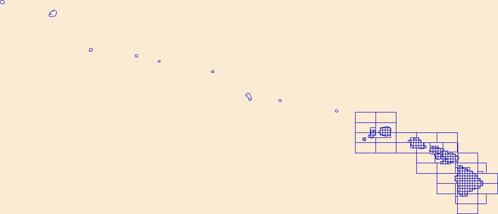
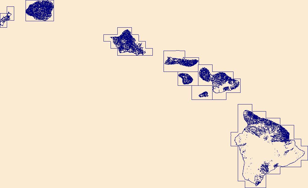
This data represents the map extent for current and historical USGS topographic maps for the United States and Territories, including 1 X 2 Degree, 1 X 1 Degree, 30 X 60 Minute, 15 X 15 Minute, 7.5 X 7.5 Minute, and 3.75 X 3.75 Minute. The grid was generated using ESRI ArcInfo GIS software.
The National Hydrography Dataset (NHD) is a feature-based database that interconnects and uniquely identifies the stream segments or reaches that make up the nation's surface water drainage system. NHD data was originally developed at 1:100,000-scale and exists at that scale for the whole country. This high-resolution NHD, generally developed at 1:24,000/1:12,000 scale, adds detail to the original 1:100,000-scale NHD. (Data for Alaska, Puerto Rico and the Virgin Islands was developed at high-resolution, not 1:100,000 scale.) Local resolution NHD is being developed where partners and data exist. The NHD contains reach codes for networked features, flow direction, names, and centerline representations for areal water...
This map layer shows major ports in the United States, Puerto Rico, and the U.S. Virgin Islands. A port is a city, town, or urban area with a harbor where ships load or unload. This is a revised version of the July 2012 map layer.
Categories: Data;
Types: Downloadable,
Map Service,
OGC WFS Layer,
OGC WMS Layer,
Shapefile;
Tags: Academics & scientific researchers,
Alabama,
Arizona,
Arkansas,
California,
|

|
