Filters: Tags: Hawaii (X)
2,854 results (100ms)|
Filters
Date Range
Extensions
Types
Contacts
Categories Tag Types
|
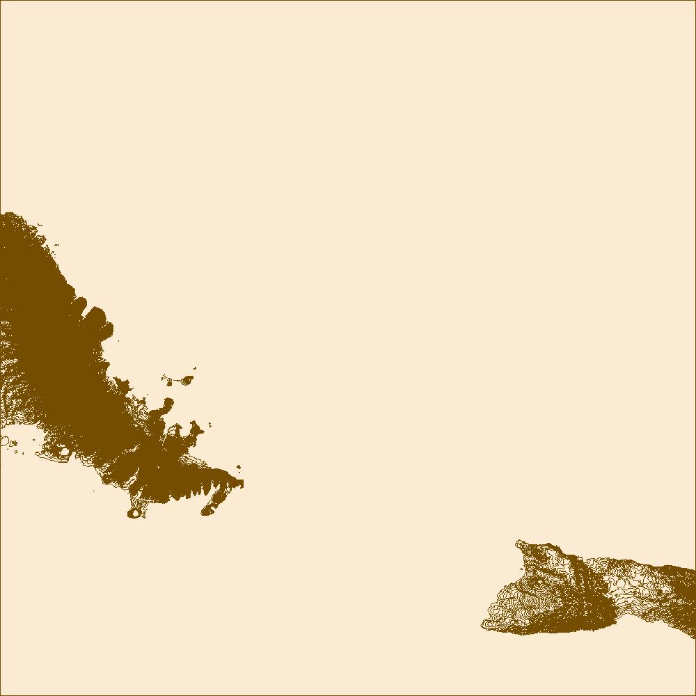
The 2018 lower East Rift Zone eruption of Kilauea Volcano began in the late afternoon of 3 May, with fissure 1 opening and erupting lava onto Mohala Street in the Leilani Estates subdivision, part of the lower Puna District of the Island of Hawai'i. For the first week of the eruption, relatively viscous lava flowed only within a kilometer (0.6 miles) of the fissures within Leilani Estates, before activity shifted downrift (east-northeast) and out of the subdivision during mid-May. Around 18 May, activity along the lower East Rift Zone intensified, and fluid lava erupting at higher effusion rates from the downrift fissures reached the ocean within two days. Near the end of May, this more vigorous activity shifted...
Categories: Data;
Types: Downloadable,
Map Service,
OGC WFS Layer,
OGC WMS Layer,
Shapefile;
Tags: East Rift Zone,
Fissure03Flow,
Green Lake,
Hawai'i,
Hawaii,
The 2018 lower East Rift Zone eruption of Kilauea Volcano began in the late afternoon of 3 May, with fissure 1 opening and erupting lava onto Mohala Street in the Leilani Estates subdivision, part of the lower Puna District of the Island of Hawai'i. For the first week of the eruption, relatively viscous lava flowed only within a kilometer (0.6 miles) of the fissures within Leilani Estates, before activity shifted downrift (east-northeast) and out of the subdivision during mid-May. Around 18 May, activity along the lower East Rift Zone intensified, and fluid lava erupting at higher effusion rates from the downrift fissures reached the ocean within two days. Near the end of May, this more vigorous activity shifted...
Categories: Data;
Types: Downloadable,
Map Service,
OGC WFS Layer,
OGC WMS Layer,
Shapefile;
Tags: East Rift Zone,
Fissure14Flow,
Green Lake,
Hawai'i,
Hawaii,
The 2018 lower East Rift Zone eruption of Kilauea Volcano began in the late afternoon of 3 May, with fissure 1 opening and erupting lava onto Mohala Street in the Leilani Estates subdivision, part of the lower Puna District of the Island of Hawai'i. For the first week of the eruption, relatively viscous lava flowed only within a kilometer (0.6 miles) of the fissures within Leilani Estates, before activity shifted downrift (east-northeast) and out of the subdivision during mid-May. Around 18 May, activity along the lower East Rift Zone intensified, and fluid lava erupting at higher effusion rates from the downrift fissures reached the ocean within two days. Near the end of May, this more vigorous activity shifted...
Categories: Data;
Types: Downloadable,
Map Service,
OGC WFS Layer,
OGC WMS Layer,
Shapefile;
Tags: East Rift Zone,
Fissure18Flow,
Green Lake,
Hawai'i,
Hawaii,
The 2018 lower East Rift Zone eruption of Kilauea Volcano began in the late afternoon of 3 May, with fissure 1 opening and erupting lava onto Mohala Street in the Leilani Estates subdivision, part of the lower Puna District of the Island of Hawai'i. For the first week of the eruption, relatively viscous lava flowed only within a kilometer (0.6 miles) of the fissures within Leilani Estates, before activity shifted downrift (east-northeast) and out of the subdivision during mid-May. Around 18 May, activity along the lower East Rift Zone intensified, and fluid lava erupting at higher effusion rates from the downrift fissures reached the ocean within two days. Near the end of May, this more vigorous activity shifted...

These vector contour lines are derived from the 3D Elevation Program using automated and semi-automated processes. They were created to support 1:24,000-scale topographic map products, but are also published in this GIS vector format. Contour intervals are assigned by 7.5-minute quadrangle, so this vector dataset is not visually seamless across quadrangle boundaries. The vector lines have elevation attributes (in feet above mean sea level on NAVD88), but this dataset does not carry line symbols or annotation.

These vector contour lines are derived from the 3D Elevation Program using automated and semi-automated processes. They were created to support 1:24,000-scale topographic map products, but are also published in this GIS vector format. Contour intervals are assigned by 7.5-minute quadrangle, so this vector dataset is not visually seamless across quadrangle boundaries. The vector lines have elevation attributes (in feet above mean sea level on NAVD88), but this dataset does not carry line symbols or annotation.
These vector contour lines are derived from the 3D Elevation Program using automated and semi-automated processes. They were created to support 1:24,000-scale topographic map products, but are also published in this GIS vector format. Contour intervals are assigned by 7.5-minute quadrangle, so this vector dataset is not visually seamless across quadrangle boundaries. The vector lines have elevation attributes (in feet above mean sea level on NAVD88), but this dataset does not carry line symbols or annotation.

"USDA has purchased a Enterprise Premium license for this Orthoimagery dataset from DigitalGlobe, Inc. Any government, education, not-for-profit agency and public/individuals not engaged in using the "Product for Commercial Exploitation or Commercial Purposes" can use this licensed data. Use of this product for Commercial Purposes by a person/company/organization for a profit or fee is strictly prohibited. Please refer to the separately attached license from DigitalGlobe, Inc. for additional information. Digital orthoimagery combines the image characteristics of a digital image with the geometric qualities of a map. The primary dynamic digital orthophoto is a 60 centimeter ground resolution, image cast to the customer...

"USDA has purchased a Enterprise Premium license for this Orthoimagery dataset from DigitalGlobe, Inc. Any government, education, not-for-profit agency and public/individuals not engaged in using the "Product for Commercial Exploitation or Commercial Purposes" can use this licensed data. Use of this product for Commercial Purposes by a person/company/organization for a profit or fee is strictly prohibited. Please refer to the separately attached license from DigitalGlobe, Inc. for additional information. Digital orthoimagery combines the image characteristics of a digital image with the geometric qualities of a map. The primary dynamic digital orthophoto is a 60 centimeter ground resolution, image cast to the customer...

"USDA has purchased a Enterprise Premium license for this Orthoimagery dataset from DigitalGlobe, Inc. Any government, education, not-for-profit agency and public/individuals not engaged in using the "Product for Commercial Exploitation or Commercial Purposes" can use this licensed data. Use of this product for Commercial Purposes by a person/company/organization for a profit or fee is strictly prohibited. Please refer to the separately attached license from DigitalGlobe, Inc. for additional information. Digital orthoimagery combines the image characteristics of a digital image with the geometric qualities of a map. The primary dynamic digital orthophoto is a 60 centimeter ground resolution, image cast to the customer...

"USDA has purchased a Enterprise Premium license for this Orthoimagery dataset from DigitalGlobe, Inc. Any government, education, not-for-profit agency and public/individuals not engaged in using the "Product for Commercial Exploitation or Commercial Purposes" can use this licensed data. Use of this product for Commercial Purposes by a person/company/organization for a profit or fee is strictly prohibited. Please refer to the separately attached license from DigitalGlobe, Inc. for additional information. Digital orthoimagery combines the image characteristics of a digital image with the geometric qualities of a map. The primary dynamic digital orthophoto is a 60 centimeter ground resolution, image cast to the customer...

"USDA has purchased a Enterprise Premium license for this Orthoimagery dataset from DigitalGlobe, Inc. Any government, education, not-for-profit agency and public/individuals not engaged in using the "Product for Commercial Exploitation or Commercial Purposes" can use this licensed data. Use of this product for Commercial Purposes by a person/company/organization for a profit or fee is strictly prohibited. Please refer to the separately attached license from DigitalGlobe, Inc. for additional information. Digital orthoimagery combines the image characteristics of a digital image with the geometric qualities of a map. The primary dynamic digital orthophoto is a 60 centimeter ground resolution, image cast to the customer...

"USDA has purchased a Enterprise Premium license for this Orthoimagery dataset from DigitalGlobe, Inc. Any government, education, not-for-profit agency and public/individuals not engaged in using the "Product for Commercial Exploitation or Commercial Purposes" can use this licensed data. Use of this product for Commercial Purposes by a person/company/organization for a profit or fee is strictly prohibited. Please refer to the separately attached license from DigitalGlobe, Inc. for additional information. Digital orthoimagery combines the image characteristics of a digital image with the geometric qualities of a map. The primary dynamic digital orthophoto is a 60 centimeter ground resolution, image cast to the customer...

"USDA has purchased a Enterprise Premium license for this Orthoimagery dataset from DigitalGlobe, Inc. Any government, education, not-for-profit agency and public/individuals not engaged in using the "Product for Commercial Exploitation or Commercial Purposes" can use this licensed data. Use of this product for Commercial Purposes by a person/company/organization for a profit or fee is strictly prohibited. Please refer to the separately attached license from DigitalGlobe, Inc. for additional information. Digital orthoimagery combines the image characteristics of a digital image with the geometric qualities of a map. The primary dynamic digital orthophoto is a 60 centimeter ground resolution, image cast to the customer...

"USDA has purchased a Enterprise Premium license for this Orthoimagery dataset from DigitalGlobe, Inc. Any government, education, not-for-profit agency and public/individuals not engaged in using the "Product for Commercial Exploitation or Commercial Purposes" can use this licensed data. Use of this product for Commercial Purposes by a person/company/organization for a profit or fee is strictly prohibited. Please refer to the separately attached license from DigitalGlobe, Inc. for additional information. Digital orthoimagery combines the image characteristics of a digital image with the geometric qualities of a map. The primary dynamic digital orthophoto is a 60 centimeter ground resolution, image cast to the customer...

"USDA has purchased a Enterprise Premium license for this Orthoimagery dataset from DigitalGlobe, Inc. Any government, education, not-for-profit agency and public/individuals not engaged in using the "Product for Commercial Exploitation or Commercial Purposes" can use this licensed data. Use of this product for Commercial Purposes by a person/company/organization for a profit or fee is strictly prohibited. Please refer to the separately attached license from DigitalGlobe, Inc. for additional information. Digital orthoimagery combines the image characteristics of a digital image with the geometric qualities of a map. The primary dynamic digital orthophoto is a 60 centimeter ground resolution, image cast to the customer...

"USDA has purchased a Enterprise Premium license for this Orthoimagery dataset from DigitalGlobe, Inc. Any government, education, not-for-profit agency and public/individuals not engaged in using the "Product for Commercial Exploitation or Commercial Purposes" can use this licensed data. Use of this product for Commercial Purposes by a person/company/organization for a profit or fee is strictly prohibited. Please refer to the separately attached license from DigitalGlobe, Inc. for additional information. Digital orthoimagery combines the image characteristics of a digital image with the geometric qualities of a map. The primary dynamic digital orthophoto is a 60 centimeter ground resolution, image cast to the customer...

"USDA has purchased a Enterprise Premium license for this Orthoimagery dataset from DigitalGlobe, Inc. Any government, education, not-for-profit agency and public/individuals not engaged in using the "Product for Commercial Exploitation or Commercial Purposes" can use this licensed data. Use of this product for Commercial Purposes by a person/company/organization for a profit or fee is strictly prohibited. Please refer to the separately attached license from DigitalGlobe, Inc. for additional information. Digital orthoimagery combines the image characteristics of a digital image with the geometric qualities of a map. The primary dynamic digital orthophoto is a 60 centimeter ground resolution, image cast to the customer...

"USDA has purchased a Enterprise Premium license for this Orthoimagery dataset from DigitalGlobe, Inc. Any government, education, not-for-profit agency and public/individuals not engaged in using the "Product for Commercial Exploitation or Commercial Purposes" can use this licensed data. Use of this product for Commercial Purposes by a person/company/organization for a profit or fee is strictly prohibited. Please refer to the separately attached license from DigitalGlobe, Inc. for additional information. Digital orthoimagery combines the image characteristics of a digital image with the geometric qualities of a map. The primary dynamic digital orthophoto is a 60 centimeter ground resolution, image cast to the customer...

"USDA has purchased a Enterprise Premium license for this Orthoimagery dataset from DigitalGlobe, Inc. Any government, education, not-for-profit agency and public/individuals not engaged in using the "Product for Commercial Exploitation or Commercial Purposes" can use this licensed data. Use of this product for Commercial Purposes by a person/company/organization for a profit or fee is strictly prohibited. Please refer to the separately attached license from DigitalGlobe, Inc. for additional information. Digital orthoimagery combines the image characteristics of a digital image with the geometric qualities of a map. The primary dynamic digital orthophoto is a 60 centimeter ground resolution, image cast to the customer...
|

|
