Filters
Date Range
Types
Contacts
Tag Types
Tag Schemes
|
This data set contains imagery from the National Agriculture Imagery Program (NAIP). The NAIP program is administered by USDA FSA and has been established to support two main FSA strategic goals centered on agricultural production. These are, increase stewardship of America's natural resources while enhancing the environment, and to ensure commodities are procured and distributed effectively and efficiently to increase food security. The NAIP program supports these goals by acquiring and providing ortho imagery that has been collected during the agricultural growing season in the U.S. The NAIP ortho imagery is tailored to meet FSA requirements and is a fundamental tool used to support FSA farm and conservation programs....
Types: Citation;
Tags: 3.75 x 3.75 minute,
3407859,
45051,
Aerial Compliance,
Compliance, All tags...
Digital Ortho rectified Image,
Downloadable Data,
HORRY CO SC FSA,
Horry,
JPEG2000,
NAIP,
Ortho Rectification,
Orthoimagery,
PIREWAY,
PIREWAY, SW,
Quarter Quadrangle,
SC,
SC051,
USDA National Agriculture Imagery Program (NAIP),
farming, Fewer tags
This data set contains imagery from the National Agriculture Imagery Program (NAIP). The NAIP program is administered by USDA FSA and has been established to support two main FSA strategic goals centered on agricultural production. These are, increase stewardship of America's natural resources while enhancing the environment, and to ensure commodities are procured and distributed effectively and efficiently to increase food security. The NAIP program supports these goals by acquiring and providing ortho imagery that has been collected during the agricultural growing season in the U.S. The NAIP ortho imagery is tailored to meet FSA requirements and is a fundamental tool used to support FSA farm and conservation programs....
Types: Citation;
Tags: 3.75 x 3.75 minute,
3307812,
45051,
Aerial Compliance,
Compliance, All tags...
Digital Ortho rectified Image,
Downloadable Data,
HORRY CO SC FSA,
Horry,
JPEG2000,
LITTLE RIVER,
LITTLE RIVER, NE,
NAIP,
Ortho Rectification,
Orthoimagery,
Quarter Quadrangle,
SC,
SC051,
USDA National Agriculture Imagery Program (NAIP),
farming, Fewer tags
This data set contains imagery from the National Agriculture Imagery Program (NAIP). The NAIP program is administered by USDA FSA and has been established to support two main FSA strategic goals centered on agricultural production. These are, increase stewardship of America's natural resources while enhancing the environment, and to ensure commodities are procured and distributed effectively and efficiently to increase food security. The NAIP program supports these goals by acquiring and providing ortho imagery that has been collected during the agricultural growing season in the U.S. The NAIP ortho imagery is tailored to meet FSA requirements and is a fundamental tool used to support FSA farm and conservation programs....
Types: Citation;
Tags: 3.75 x 3.75 minute,
3307916,
45051,
Aerial Compliance,
CONWAY, All tags...
CONWAY, NW,
Compliance,
Digital Ortho rectified Image,
Downloadable Data,
HORRY CO SC FSA,
Horry,
JPEG2000,
NAIP,
Ortho Rectification,
Orthoimagery,
Quarter Quadrangle,
SC,
SC051,
USDA National Agriculture Imagery Program (NAIP),
farming, Fewer tags
This data set contains imagery from the National Agriculture Imagery Program (NAIP). The NAIP program is administered by USDA FSA and has been established to support two main FSA strategic goals centered on agricultural production. These are, increase stewardship of America's natural resources while enhancing the environment, and to ensure commodities are procured and distributed effectively and efficiently to increase food security. The NAIP program supports these goals by acquiring and providing ortho imagery that has been collected during the agricultural growing season in the U.S. The NAIP ortho imagery is tailored to meet FSA requirements and is a fundamental tool used to support FSA farm and conservation programs....
Types: Citation;
Tags: 3.75 x 3.75 minute,
3307924,
45051,
Aerial Compliance,
BUCKSVILLE, All tags...
BUCKSVILLE, NE,
Compliance,
Digital Ortho rectified Image,
Downloadable Data,
HORRY CO SC FSA,
Horry,
JPEG2000,
NAIP,
Ortho Rectification,
Orthoimagery,
Quarter Quadrangle,
SC,
SC051,
USDA National Agriculture Imagery Program (NAIP),
farming, Fewer tags
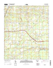
Layered geospatial PDF Map. Layers of geospatial data include orthoimagery, roads, grids, geographic names, elevation contours, hydrography, and other selected map features.
Tags: 7.5 x 7.5 minute,
Brunswick,
Columbus,
Downloadable Data,
EarthCover, All tags...
GeoPDF,
Horry,
Imagery and Base Maps,
Map,
North Carolina,
Pireway, NC-SC,
Public Land Survey System,
South Carolina,
U.S. National Grid,
US,
US Topo,
US Topo Historical,
United States,
boundary,
contour,
geographic names,
hydrography,
imageryBaseMapsEarthCover,
orthoimage,
structures,
topographic,
transportation,
woodland, Fewer tags
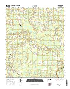
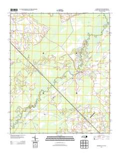
Layered GeoPDF 7.5 Minute Quadrangle Map. Layers of geospatial data include orthoimagery, roads, grids, geographic names, elevation contours, hydrography, and other selected map features.
Tags: 7.5 x 7.5 minute,
Dillon,
Downloadable Data,
EarthCover,
GeoPDF, All tags...
Horry,
Imagery and Base Maps,
Lake View, SC-NC,
Map,
Marion,
North Carolina,
Robeson,
South Carolina,
U.S. National Grid,
US,
US Topo,
US Topo Historical,
United States,
contour,
geographic names,
hydrography,
imageryBaseMapsEarthCover,
orthoimage,
structures,
topographic,
transportation, Fewer tags
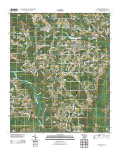
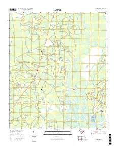
Layered GeoPDF 7.5 Minute Quadrangle Map. Layers of geospatial data include orthoimagery, roads, grids, geographic names, elevation contours, hydrography, and other selected map features.
Tags: 7.5 x 7.5 minute,
Downloadable Data,
EarthCover,
GeoPDF,
Horry, All tags...
Imagery and Base Maps,
Loris, SC,
Map,
South Carolina,
U.S. National Grid,
US,
US Topo,
US Topo Historical,
United States,
contour,
geographic names,
hydrography,
imageryBaseMapsEarthCover,
orthoimage,
structures,
topographic,
transportation, Fewer tags
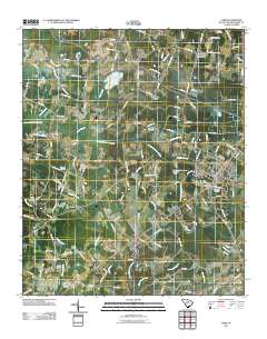
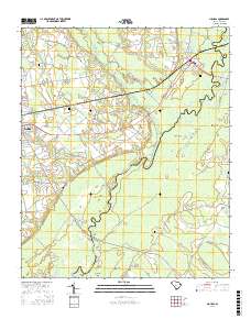
Layered GeoPDF 7.5 Minute Quadrangle Map. Layers of geospatial data include orthoimagery, roads, grids, geographic names, elevation contours, hydrography, and other selected map features.
Tags: 7.5 x 7.5 minute,
Downloadable Data,
EarthCover,
GeoPDF,
Horry, All tags...
Imagery and Base Maps,
Map,
Public Land Survey System,
Shell, SC,
South Carolina,
U.S. National Grid,
US,
US Topo,
US Topo Historical,
United States,
boundary,
contour,
geographic names,
hydrography,
imageryBaseMapsEarthCover,
orthoimage,
structures,
topographic,
transportation,
woodland, Fewer tags
Layered GeoPDF 7.5 Minute Quadrangle Map. Layers of geospatial data include orthoimagery, roads, grids, geographic names, elevation contours, hydrography, and other selected map features.
Tags: 7.5 x 7.5 minute,
Columbus,
Dillon,
Downloadable Data,
EarthCover, All tags...
Fair Bluff, NC-SC,
GeoPDF,
Horry,
Imagery and Base Maps,
Map,
North Carolina,
Public Land Survey System,
Robeson,
South Carolina,
U.S. National Grid,
US,
US Topo,
US Topo Historical,
United States,
boundary,
contour,
geographic names,
hydrography,
imageryBaseMapsEarthCover,
orthoimage,
structures,
topographic,
transportation,
woodland, Fewer tags
Layered geospatial PDF Map. Layers of geospatial data include orthoimagery, roads, grids, geographic names, elevation contours, hydrography, and other selected map features.
Tags: 7.5 x 7.5 minute,
Downloadable Data,
EarthCover,
GeoPDF,
Horry, All tags...
Imagery and Base Maps,
Map,
Marion,
Nichols, SC,
Public Land Survey System,
South Carolina,
U.S. National Grid,
US,
US Topo,
US Topo Historical,
United States,
boundary,
contour,
geographic names,
hydrography,
imageryBaseMapsEarthCover,
orthoimage,
structures,
topographic,
transportation,
woodland, Fewer tags
Layered geospatial PDF Map. Layers of geospatial data include orthoimagery, roads, grids, geographic names, elevation contours, hydrography, and other selected map features.
Tags: 7.5 x 7.5 minute,
Downloadable Data,
EarthCover,
GeoPDF,
Georgetown, All tags...
Horry,
Imagery and Base Maps,
Map,
Plantersville, SC,
Public Land Survey System,
South Carolina,
U.S. National Grid,
US,
US Topo,
US Topo Historical,
United States,
boundary,
contour,
geographic names,
hydrography,
imageryBaseMapsEarthCover,
orthoimage,
structures,
topographic,
transportation,
woodland, Fewer tags
The Geographic Names Information System (GNIS) is the Federal standard for geographic nomenclature. The U.S. Geological Survey developed the GNIS for the U.S. Board on Geographic Names, a Federal inter-agency body chartered by public law to maintain uniform feature name usage throughout the Government and to promulgate standard names to the public. The GNIS is the official repository of domestic geographic names data; the official vehicle for geographic names use by all departments of the Federal Government; and the source for applying geographic names to Federal electronic and printed products of all types.
Tags: Abbeville,
Aiken,
Allendale,
Anderson,
Antarctica, All tags...
Antarctica,
BGN,
Bamberg,
Barnwell,
Beaufort,
Berkeley,
Board on Geographic Names,
Borough,
Calhoun,
Census Area,
Charleston,
Cherokee,
Chester,
Chesterfield,
Clarendon,
Colleton,
Commonwealth,
County,
Darlington,
Dillon,
District,
Dorchester,
Downloadable Data,
Edgefield,
Fairfield,
Feature class,
Feature coordinates,
Feature county,
Feature description,
Feature designation,
Feature history,
Feature indentification,
Feature name,
Feature state,
Florence,
GNIS,
Geographic Names,
Geographic Names Domestic Names,
Geographic Names Information System,
Geographic feature,
Geographic name,
Geographical feature,
Geographical name,
Georgetown,
Greenville,
Greenwood,
Hampton,
Horry,
Jasper,
Kershaw,
Lancaster,
Laurens,
Lee,
Lexington,
Marion,
Marlboro,
McCormick,
Municipio,
National Geographic Names Information System (GNIS),
National Geographic Names Information System (GNIS),
Newberry,
Oconee,
Official feature name,
Orangeburg,
Outlying Area,
Parish,
Pickens,
Place name,
Populated Place,
Richland,
SC,
Saluda,
South Carolina,
Spartanburg,
State,
Sumter,
TXT (pipes),
Territories,
Territory,
Topographic Map,
U.S. Board on Geographic Names,
U.S. Geological Survey,
US,
USA,
USBGN,
USGS,
UTF-8 Pipe Delimited Text File nan,
Union,
United States,
United States,
United States,
Variant name,
Williamsburg,
York,
antarctic,
database,
economy,
environment,
feature,
gazetteer,
geographic,
geographic names,
geographical,
geography,
geospatial,
imageryBaseMapsEarthCover,
inlandWaters,
location,
map,
name,
place,
placename,
society,
structure,
topographic map,
toponymy, Fewer tags
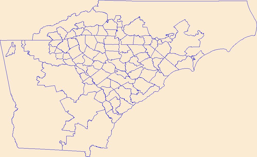
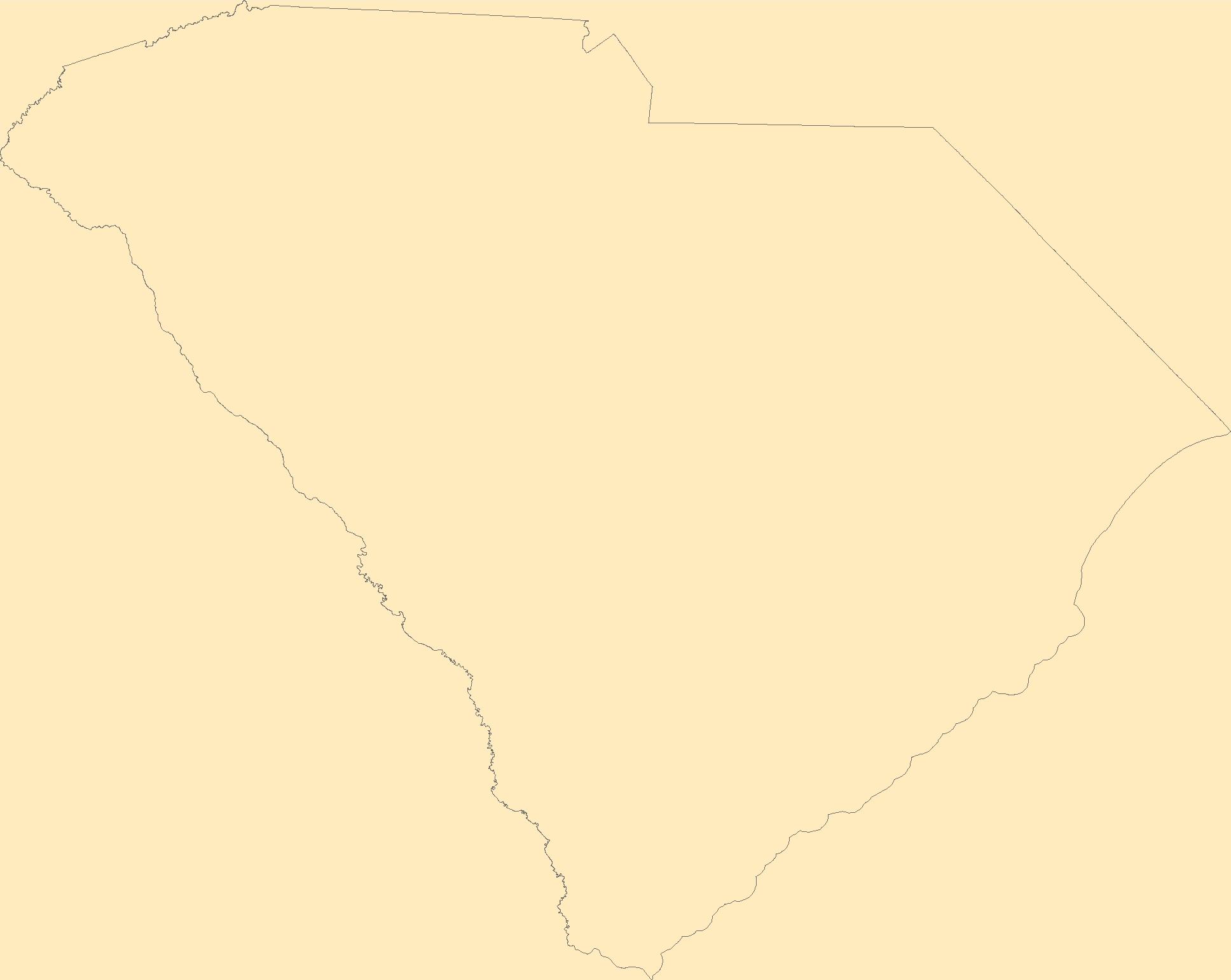
Geospatial data is comprised of government boundaries.
Types: Citation;
Tags: Abbeville,
Aiken,
Allendale,
Anderson,
Bamberg, All tags...
Barnwell,
Beaufort,
Berkeley,
Boundaries,
Calhoun,
Charleston,
Cherokee,
Chester,
Chesterfield,
Clarendon,
Colleton,
County or Equivalent,
Darlington,
Dillon,
Dorchester,
Downloadable Data,
Edgefield,
Esri File GeoDatabase 10,
Fairfield,
FileGDB,
Florence,
Georgetown,
Greenville,
Greenwood,
Hampton,
Horry,
Incorporated Place,
Jasper,
Jurisdictional,
Kershaw,
Lancaster,
Laurens,
Lee,
Lexington,
Marion,
Marlboro,
McCormick,
Minor Civil Division,
National Boundary Dataset (NBD),
National Boundary Dataset (NBD),
Native American Area,
Newberry,
Oconee,
Orangeburg,
PLSS First Division,
PLSS Special Survey,
PLSS Township,
Pickens,
Public Land Survey System,
Reserve,
Richland,
SC,
Saluda,
South Carolina,
Spartanburg,
State,
State,
State or Territory,
Sumter,
U.S. National Grid,
US,
Unincorporated Place,
Union,
United States,
Williamsburg,
York,
boundaries,
boundary,
cadastral surveys,
geographic names,
land ownership,
land use maps,
legal land descriptions,
political and administrative boundaries,
zoning maps, Fewer tags
This data set contains imagery from the National Agriculture Imagery Program (NAIP). The NAIP program is administered by USDA FSA and has been established to support two main FSA strategic goals centered on agricultural production. These are, increase stewardship of America's natural resources while enhancing the environment, and to ensure commodities are procured and distributed effectively and efficiently to increase food security. The NAIP program supports these goals by acquiring and providing ortho imagery that has been collected during the agricultural growing season in the U.S. The NAIP ortho imagery is tailored to meet FSA requirements and is a fundamental tool used to support FSA farm and conservation programs....
Types: Citation;
Tags: 3.75 x 3.75 minute,
3307817,
45051,
Aerial Compliance,
Compliance, All tags...
Digital Ortho rectified Image,
Downloadable Data,
HORRY CO SC FSA,
Horry,
JPEG2000,
MYRTLE BEACH,
MYRTLE BEACH, NE,
NAIP,
Ortho Rectification,
Orthoimagery,
Quarter Quadrangle,
SC,
SC051,
USDA National Agriculture Imagery Program (NAIP),
farming, Fewer tags
This data set contains imagery from the National Agriculture Imagery Program (NAIP). The NAIP program is administered by USDA FSA and has been established to support two main FSA strategic goals centered on agricultural production. These are, increase stewardship of America's natural resources while enhancing the environment, and to ensure commodities are procured and distributed effectively and efficiently to increase food security. The NAIP program supports these goals by acquiring and providing ortho imagery that has been collected during the agricultural growing season in the U.S. The NAIP ortho imagery is tailored to meet FSA requirements and is a fundamental tool used to support FSA farm and conservation programs....
Types: Citation;
Tags: 3.75 x 3.75 minute,
3307818,
45051,
Aerial Compliance,
Compliance, All tags...
Digital Ortho rectified Image,
Downloadable Data,
HORRY CO SC FSA,
Horry,
JPEG2000,
NAIP,
OCEAN FOREST,
OCEAN FOREST, NW,
Ortho Rectification,
Orthoimagery,
Quarter Quadrangle,
SC,
SC051,
USDA National Agriculture Imagery Program (NAIP),
farming, Fewer tags
This data set contains imagery from the National Agriculture Imagery Program (NAIP). The NAIP program is administered by USDA FSA and has been established to support two main FSA strategic goals centered on agricultural production. These are, increase stewardship of America's natural resources while enhancing the environment, and to ensure commodities are procured and distributed effectively and efficiently to increase food security. The NAIP program supports these goals by acquiring and providing ortho imagery that has been collected during the agricultural growing season in the U.S. The NAIP ortho imagery is tailored to meet FSA requirements and is a fundamental tool used to support FSA farm and conservation programs....
Types: Citation;
Tags: 3.75 x 3.75 minute,
3307915,
45051,
Aerial Compliance,
Compliance, All tags...
DONGOLA,
DONGOLA, SE,
Digital Ortho rectified Image,
Downloadable Data,
HORRY CO SC FSA,
Horry,
JPEG2000,
NAIP,
Ortho Rectification,
Orthoimagery,
Quarter Quadrangle,
SC,
SC051,
USDA National Agriculture Imagery Program (NAIP),
farming, Fewer tags
This data set contains imagery from the National Agriculture Imagery Program (NAIP). The NAIP program is administered by USDA FSA and has been established to support two main FSA strategic goals centered on agricultural production. These are, increase stewardship of America's natural resources while enhancing the environment, and to ensure commodities are procured and distributed effectively and efficiently to increase food security. The NAIP program supports these goals by acquiring and providing ortho imagery that has been collected during the agricultural growing season in the U.S. The NAIP ortho imagery is tailored to meet FSA requirements and is a fundamental tool used to support FSA farm and conservation programs....
Types: Citation;
Tags: 3.75 x 3.75 minute,
3407963,
45051,
Aerial Compliance,
Compliance, All tags...
Digital Ortho rectified Image,
Downloadable Data,
GALIVANTS FERRY,
GALIVANTS FERRY, SE,
HORRY CO SC FSA,
Horry,
JPEG2000,
NAIP,
Ortho Rectification,
Orthoimagery,
Quarter Quadrangle,
SC,
SC051,
USDA National Agriculture Imagery Program (NAIP),
farming, Fewer tags
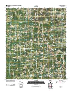
Layered GeoPDF 7.5 Minute Quadrangle Map. Layers of geospatial data include orthoimagery, roads, grids, geographic names, elevation contours, hydrography, and other selected map features.
Tags: 7.5 x 7.5 minute,
Downloadable Data,
EarthCover,
GeoPDF,
Horry, All tags...
Horry, SC,
Imagery and Base Maps,
Map,
South Carolina,
U.S. National Grid,
US,
US Topo,
US Topo Historical,
United States,
contour,
geographic names,
hydrography,
imageryBaseMapsEarthCover,
orthoimage,
structures,
topographic,
transportation, Fewer tags
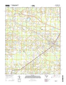
Layered GeoPDF 7.5 Minute Quadrangle Map. Layers of geospatial data include orthoimagery, roads, grids, geographic names, elevation contours, hydrography, and other selected map features.
Tags: 7.5 x 7.5 minute,
Downloadable Data,
EarthCover,
GeoPDF,
Horry, All tags...
Imagery and Base Maps,
Loris, SC,
Map,
Public Land Survey System,
South Carolina,
U.S. National Grid,
US,
US Topo,
US Topo Historical,
United States,
boundary,
contour,
geographic names,
hydrography,
imageryBaseMapsEarthCover,
orthoimage,
structures,
topographic,
transportation,
woodland, Fewer tags
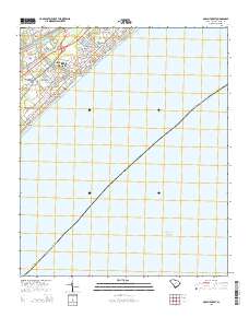
Layered GeoPDF 7.5 Minute Quadrangle Map. Layers of geospatial data include orthoimagery, roads, grids, geographic names, elevation contours, hydrography, and other selected map features.
Tags: 7.5 x 7.5 minute,
Downloadable Data,
EarthCover,
GeoPDF,
Horry, All tags...
Imagery and Base Maps,
Map,
Ocean Forest, SC,
Public Land Survey System,
South Carolina,
U.S. National Grid,
US,
US Topo,
US Topo Historical,
United States,
boundary,
contour,
geographic names,
hydrography,
imageryBaseMapsEarthCover,
orthoimage,
structures,
topographic,
transportation,
woodland, Fewer tags
|
|

