Filters
Date Range
Types
Contacts
Tag Types
Tag Schemes
|
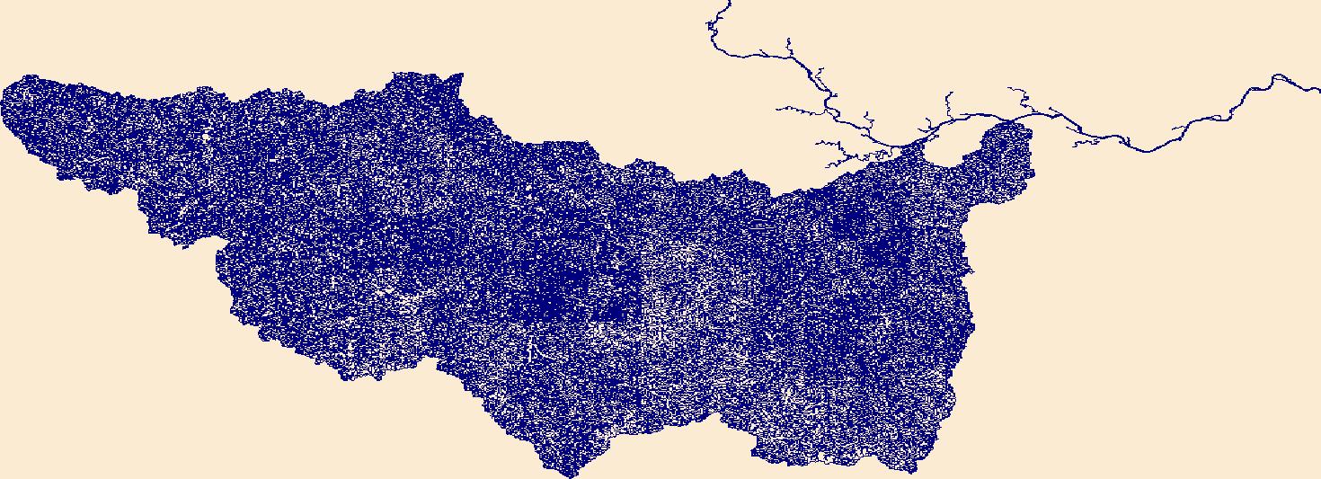
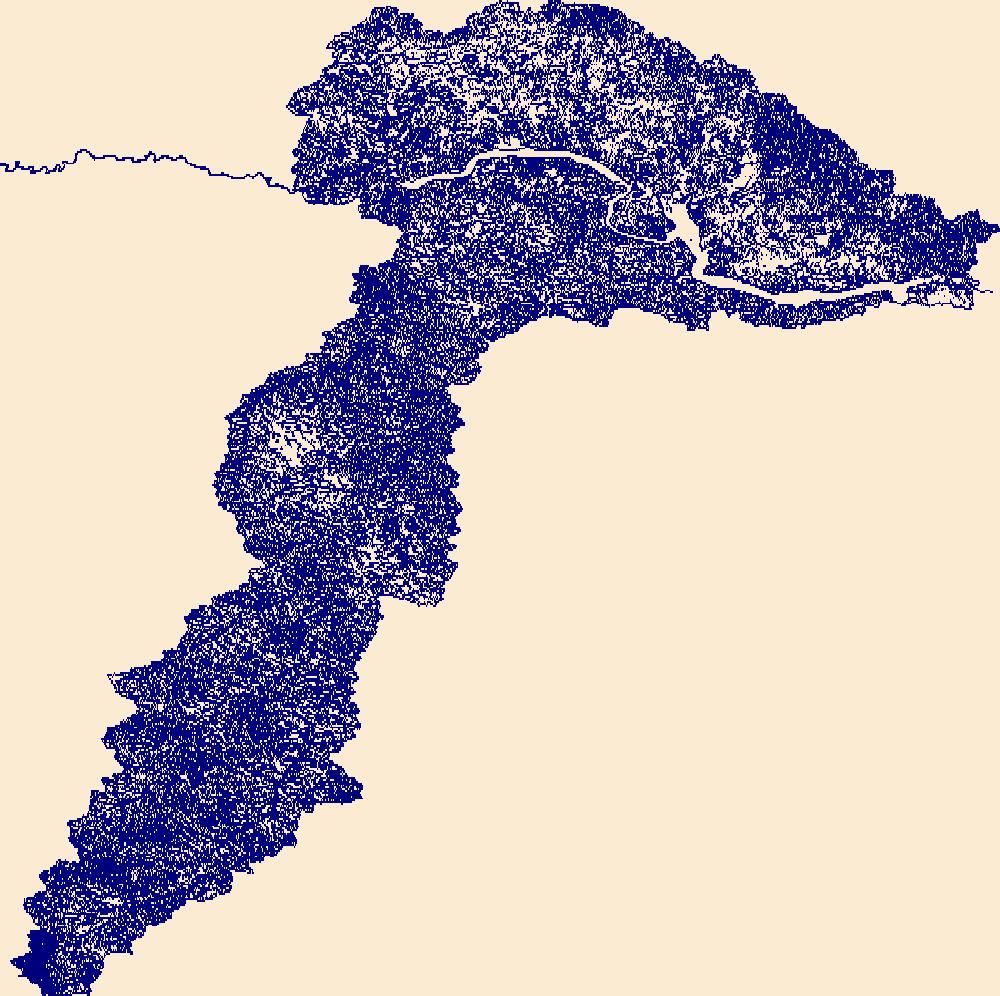
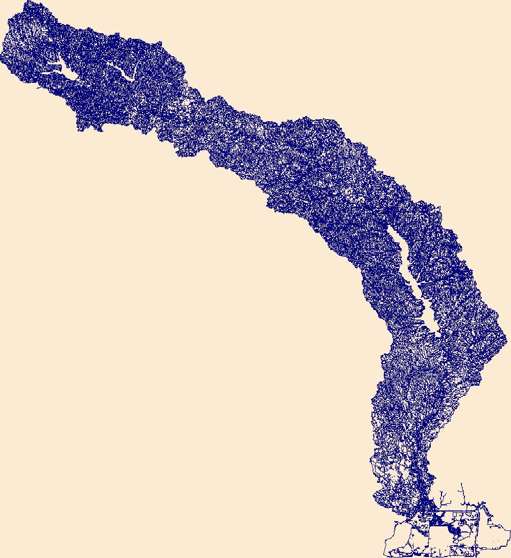
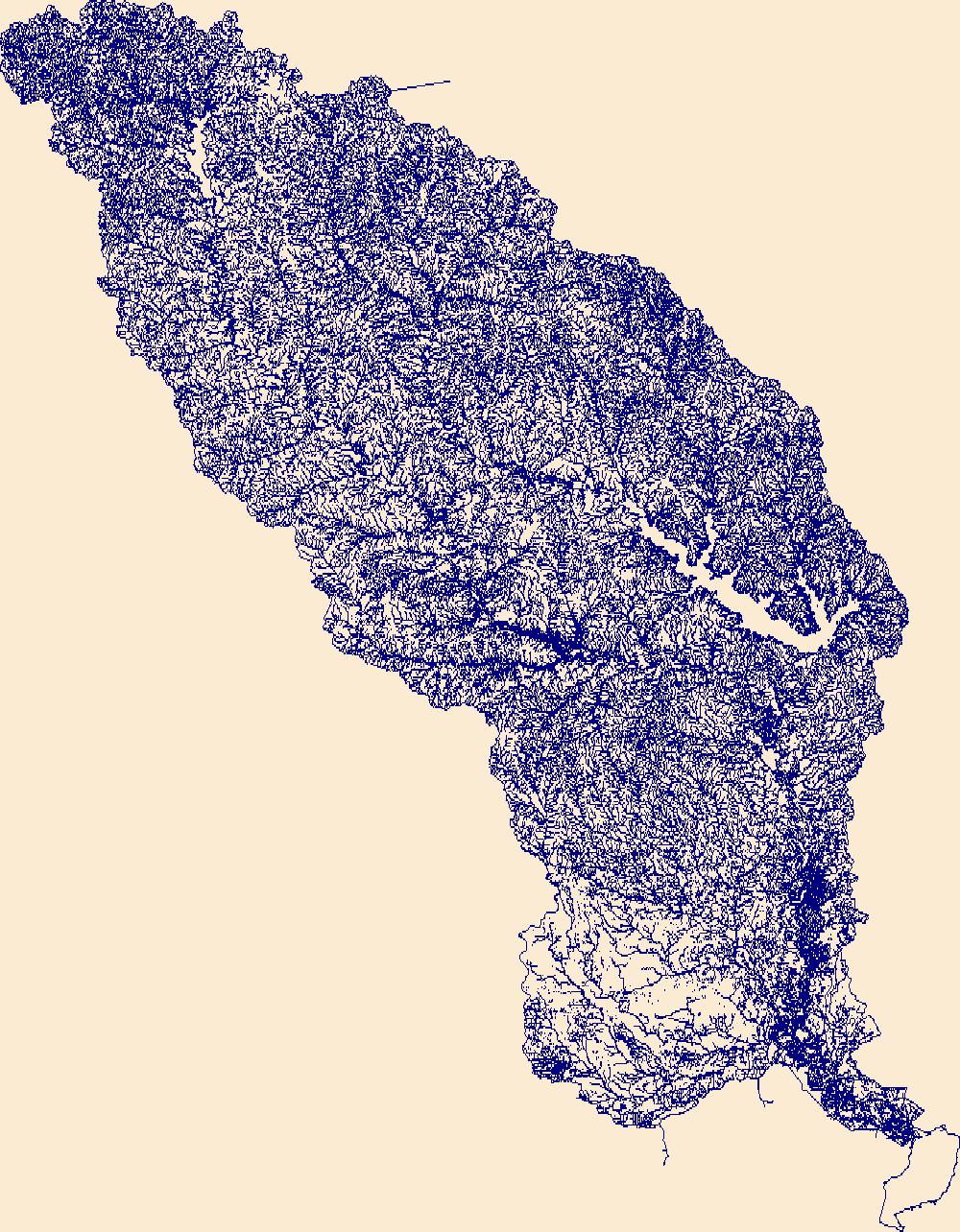
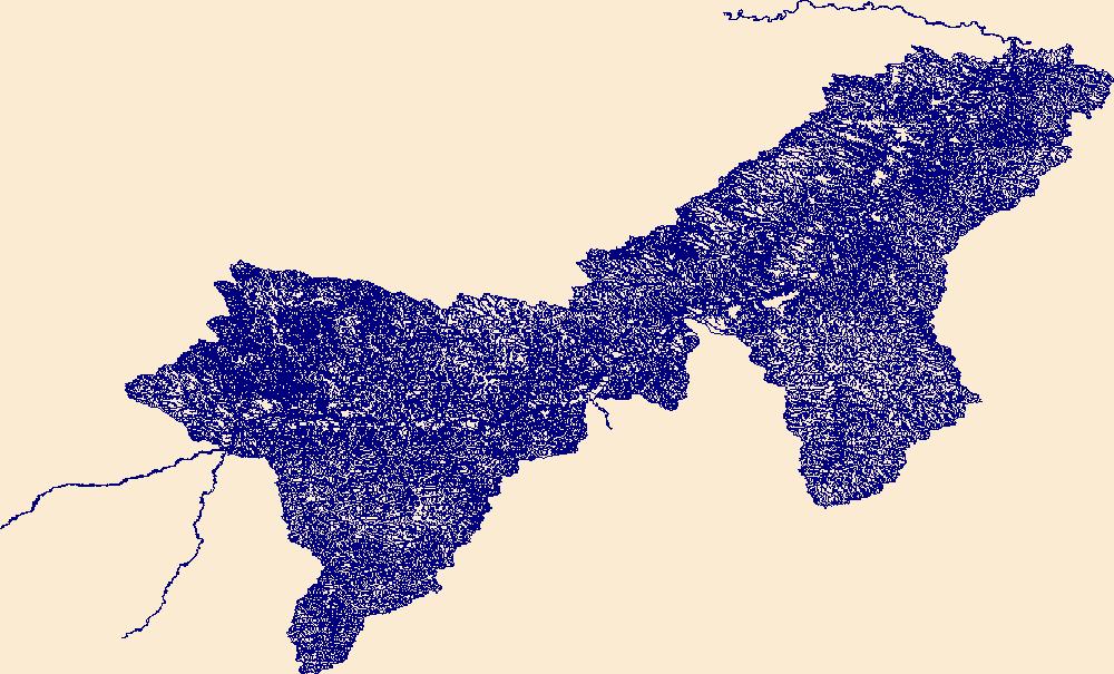
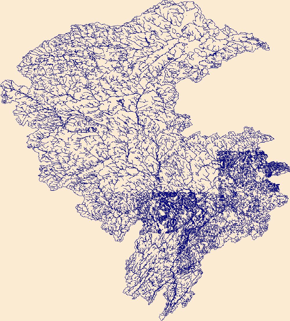
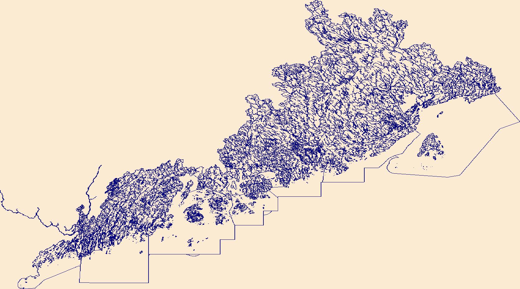
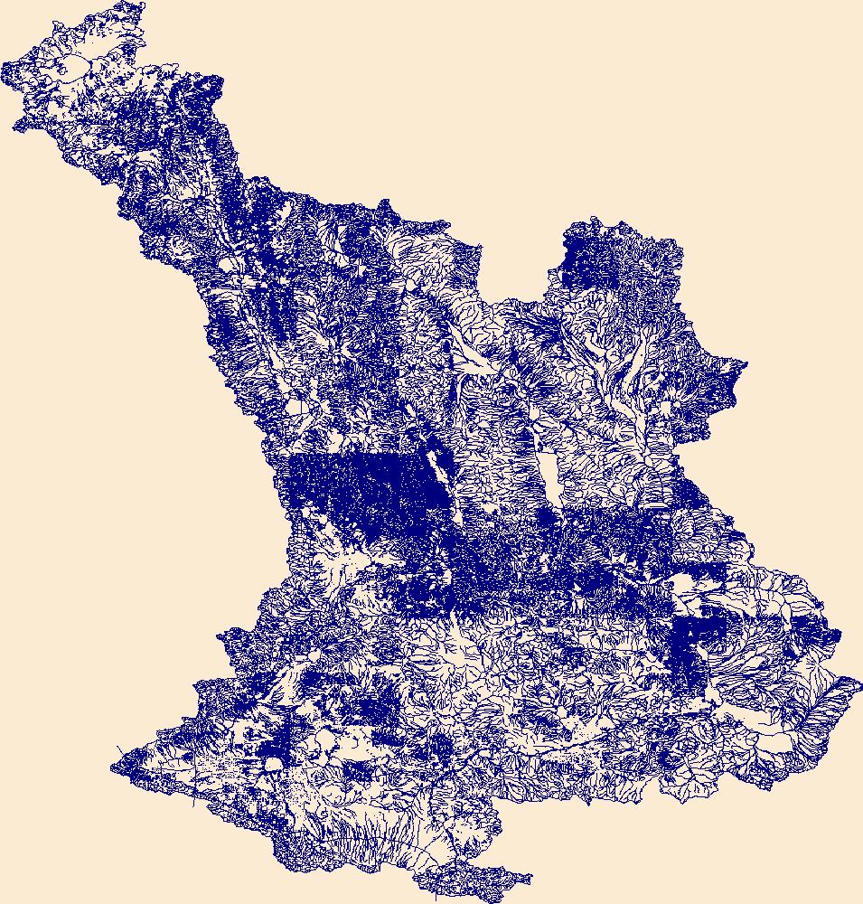
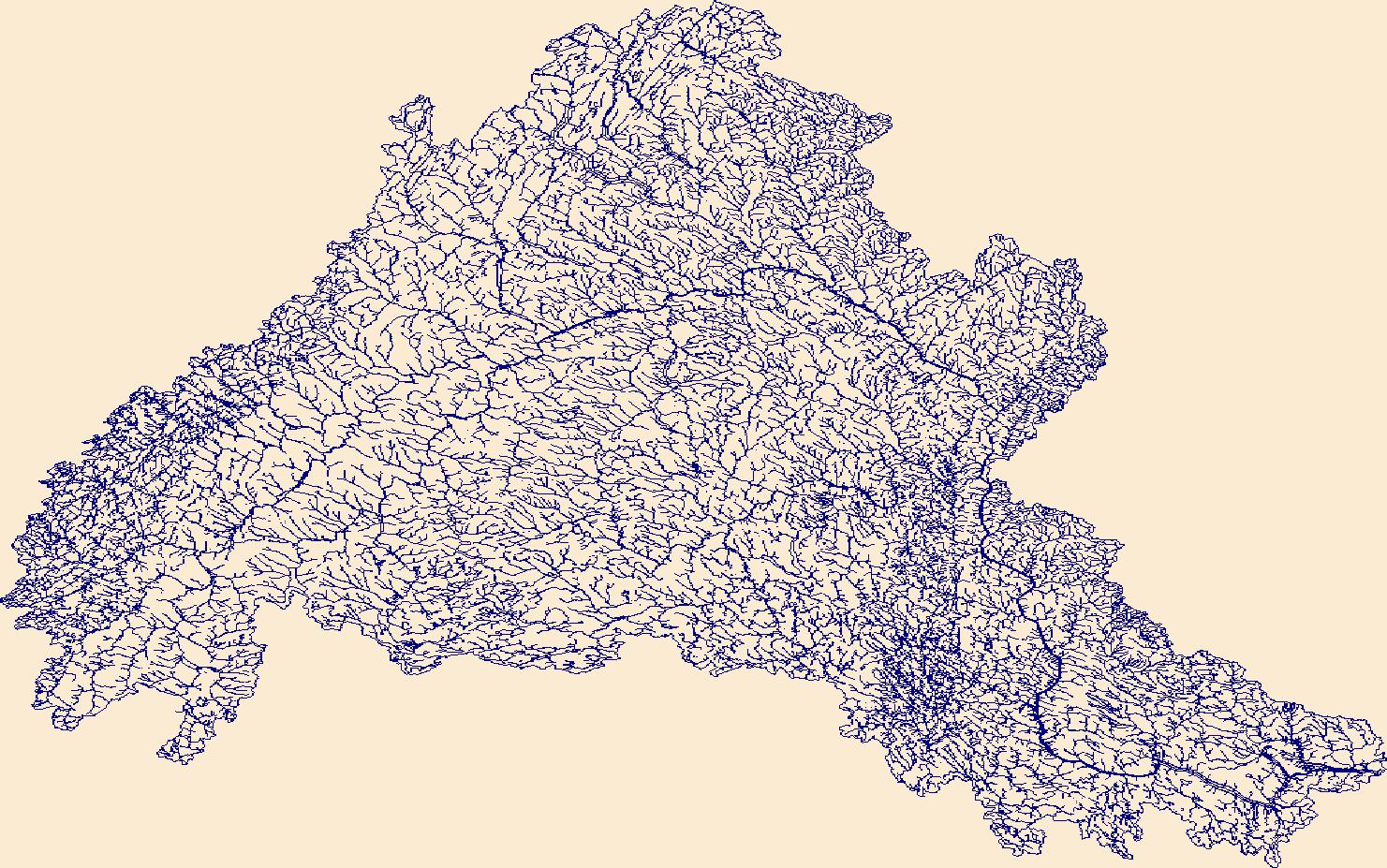
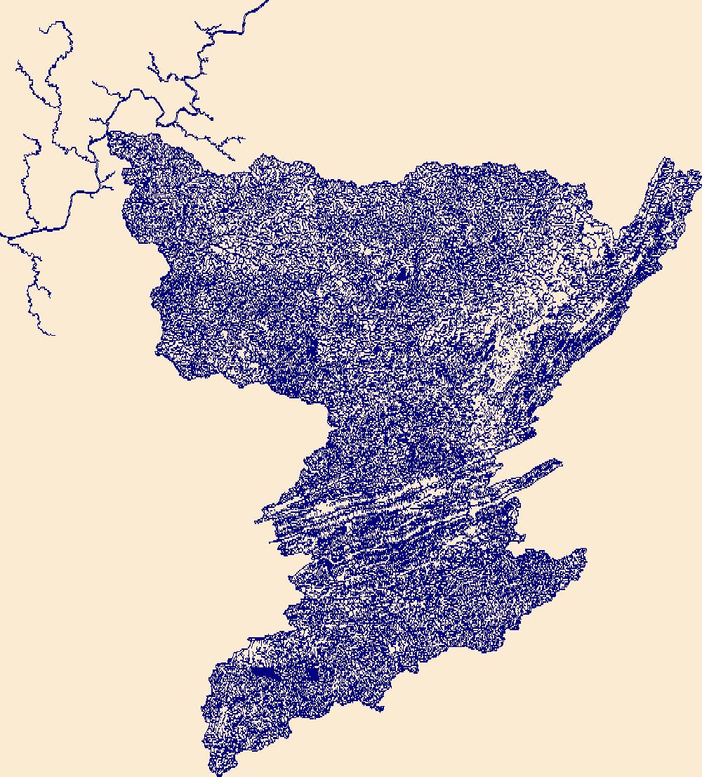
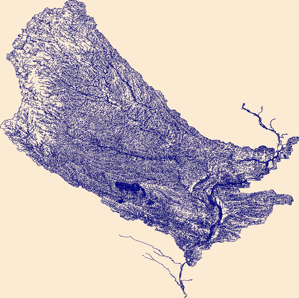
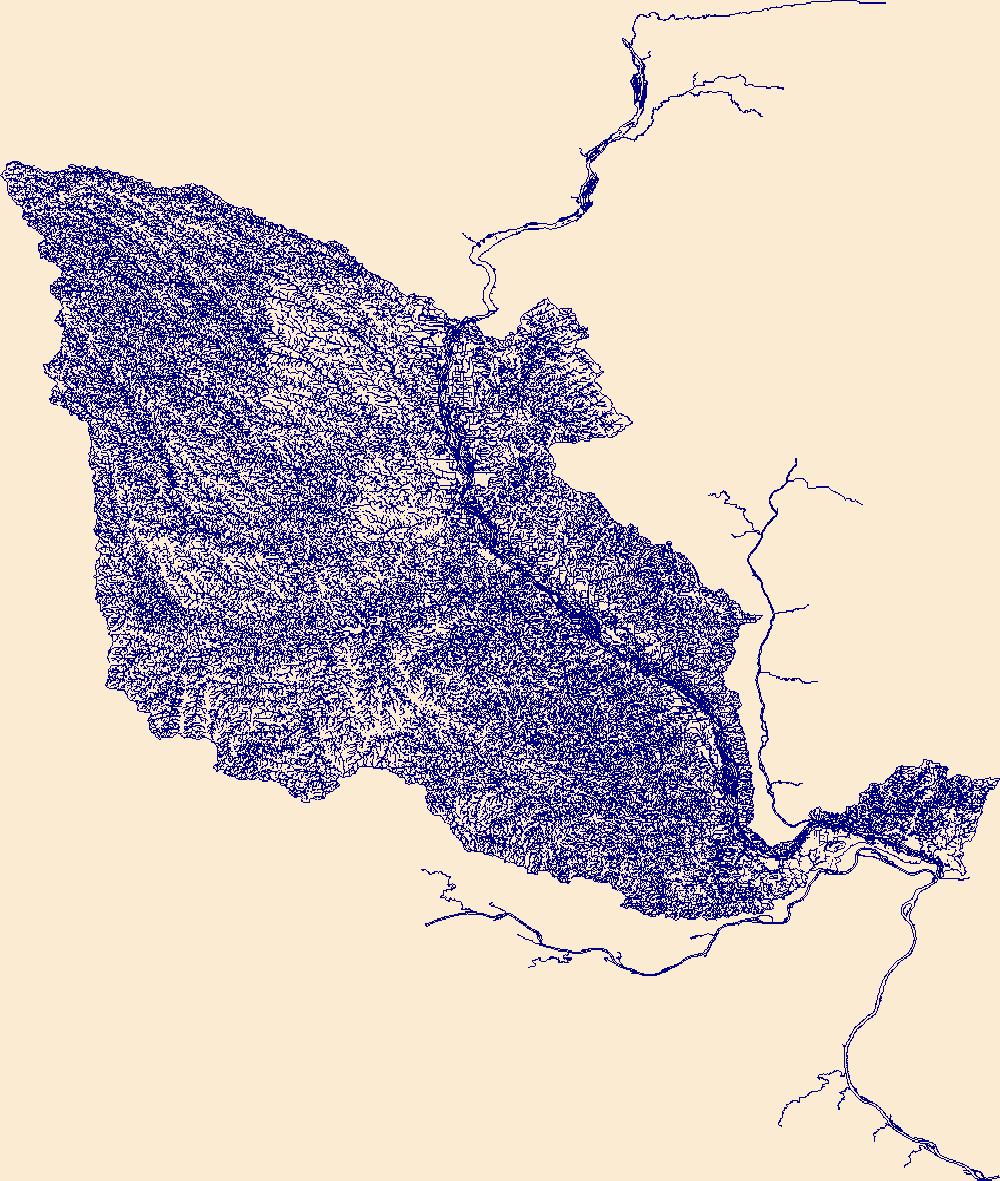
The High Resolution National Hydrography Dataset Plus (NHDPlus HR) is an integrated set of geospatial data layers, including the best available National Hydrography Dataset (NHD), the 10-meter 3D Elevation Program Digital Elevation Model (3DEP DEM), and the National Watershed Boundary Dataset (WBD). The NHDPlus HR combines the NHD, 3DEP DEMs, and WBD to create a stream network with linear referencing, feature naming, "value added attributes" (VAAs), elevation-derived catchments, and other features for hydrologic data analysis. The stream network with linear referencing is a system of data relationships applied to hydrographic systems so that one stream reach "flows" into another and "events" can be tied to and traced...
Tags: AllenCounty,
AndersonCounty,
BartonCounty,
BatesCounty,
BentonCounty, All tags...
BourbonCounty,
CamdenCounty,
CassCounty,
CedarCounty,
ChristianCounty,
CoffeyCounty,
ColeCounty,
CrawfordCounty,
DadeCounty,
DallasCounty,
DentCounty,
DouglasCounty,
Downloadable Data,
FileGDB,
FileGDB 10.1,
FranklinCounty,
GasconadeCounty,
GreeneCounty,
HU-4 Subregion,
HU-4 Subregion,
HenryCounty,
HickoryCounty,
HowellCounty,
Hydrography,
JacksonCounty,
JohnsonCounty,
JohnsonCounty,
KS,
Kansas,
LacledeCounty,
LawrenceCounty,
LinnCounty,
LyonCounty,
MariesCounty,
MiamiCounty,
MillerCounty,
MorganCounty,
NHDPlus HR Rasters,
NHDPlus High Resolution (NHDPlus HR),
National Hydrography Dataset (NHD),
National Hydrography Dataset Plus High Resolution (NHDPlus HR),
National Hydrography Dataset Plus High Resolution (NHDPlus HR) Current,
OsageCounty,
OsageCounty,
PettisCounty,
PhelpsCounty,
PolkCounty,
PulaskiCounty,
St. ClairCounty,
TexasCounty,
US,
United States,
VernonCounty,
WabaunseeCounty,
WebsterCounty,
WrightCounty,
base maps,
cartography,
catchments,
channels,
digital elevation models,
drainage basins,
earth sciences,
elevation,
environment,
geographic information systems,
geoscientific,
geospatial analysis,
hydrographic datasets,
hydrographic features,
hydrology,
imagery,
inland waters,
lakes,
land surface characteristics,
reservoirs,
river reaches,
rivers,
streamflow,
streamflow data,
streams,
topography,
water bodies,
water quality,
water resources,
watersheds, Fewer tags
The High Resolution National Hydrography Dataset Plus (NHDPlus HR) is an integrated set of geospatial data layers, including the best available National Hydrography Dataset (NHD), the 10-meter 3D Elevation Program Digital Elevation Model (3DEP DEM), and the National Watershed Boundary Dataset (WBD). The NHDPlus HR combines the NHD, 3DEP DEMs, and WBD to create a stream network with linear referencing, feature naming, "value added attributes" (VAAs), elevation-derived catchments, and other features for hydrologic data analysis. The stream network with linear referencing is a system of data relationships applied to hydrographic systems so that one stream reach "flows" into another and "events" can be tied to and traced...
Tags: BillingsCounty,
BowmanCounty,
BurkeCounty,
ButteCounty,
CampbellCounty, All tags...
CarterCounty,
CrookCounty,
DivideCounty,
Downloadable Data,
DunnCounty,
FallonCounty,
FileGDB,
FileGDB 10.1,
Golden ValleyCounty,
HU-4 Subregion,
HU-4 Subregion,
HardingCounty,
Hydrography,
MT,
McKenzieCounty,
McLeanCounty,
MercerCounty,
Montana,
MountrailCounty,
NHDPlus HR Rasters,
NHDPlus High Resolution (NHDPlus HR),
National Hydrography Dataset (NHD),
National Hydrography Dataset Plus High Resolution (NHDPlus HR),
National Hydrography Dataset Plus High Resolution (NHDPlus HR) Current,
Powder RiverCounty,
SlopeCounty,
US,
United States,
WardCounty,
WibauxCounty,
WilliamsCounty,
base maps,
cartography,
catchments,
channels,
digital elevation models,
drainage basins,
earth sciences,
elevation,
environment,
geographic information systems,
geoscientific,
geospatial analysis,
hydrographic datasets,
hydrographic features,
hydrology,
imagery,
inland waters,
lakes,
land surface characteristics,
reservoirs,
river reaches,
rivers,
streamflow,
streamflow data,
streams,
topography,
water bodies,
water quality,
water resources,
watersheds, Fewer tags
The High Resolution National Hydrography Dataset Plus (NHDPlus HR) is an integrated set of geospatial data layers, including the best available National Hydrography Dataset (NHD), the 10-meter 3D Elevation Program Digital Elevation Model (3DEP DEM), and the National Watershed Boundary Dataset (WBD). The NHDPlus HR combines the NHD, 3DEP DEMs, and WBD to create a stream network with linear referencing, feature naming, "value added attributes" (VAAs), elevation-derived catchments, and other features for hydrologic data analysis. The stream network with linear referencing is a system of data relationships applied to hydrographic systems so that one stream reach "flows" into another and "events" can be tied to and traced...
Tags: Beauregard County,
Caddo County,
Calcasieu County,
Cameron County,
Collin County, All tags...
De Soto County,
Downloadable Data,
FileGDB,
FileGDB 10.1,
Franklin County,
Gregg County,
HU-4 Subregion,
HU-4 Subregion,
HU4_1201,
Harrison County,
Hopkins County,
Hunt County,
Hydrography,
Jasper County,
Kaufman County,
LA,
Louisiana,
NHDPlus HR Rasters,
NHDPlus High Resolution (NHDPlus HR),
Natchitoches County,
National Hydrography Dataset (NHD),
National Hydrography Dataset Plus High Resolution (NHDPlus HR),
National Hydrography Dataset Plus High Resolution (NHDPlus HR) Current,
Newton County,
Orange County,
Panola County,
Rains County,
Rockwall County,
Rusk County,
Sabine County,
Sabine County,
San Augustine County,
Shelby County,
Smith County,
TX,
Texas,
US,
United States,
Upshur County,
Van Zandt County,
Vernon County,
Wood County,
base maps,
cartography,
catchments,
channels,
digital elevation models,
drainage basins,
earth sciences,
elevation,
environment,
geographic information systems,
geoscientific,
geospatial analysis,
hydrographic datasets,
hydrographic features,
hydrology,
imagery,
inland waters,
lakes,
land surface characteristics,
reservoirs,
river reaches,
rivers,
streamflow,
streamflow data,
streams,
topography,
water bodies,
water quality,
water resources,
watersheds, Fewer tags
The High Resolution National Hydrography Dataset Plus (NHDPlus HR) is an integrated set of geospatial data layers, including the best available National Hydrography Dataset (NHD), the 10-meter 3D Elevation Program Digital Elevation Model (3DEP DEM), and the National Watershed Boundary Dataset (WBD). The NHDPlus HR combines the NHD, 3DEP DEMs, and WBD to create a stream network with linear referencing, feature naming, "value added attributes" (VAAs), elevation-derived catchments, and other features for hydrologic data analysis. The stream network with linear referencing is a system of data relationships applied to hydrographic systems so that one stream reach "flows" into another and "events" can be tied to and traced...
Tags: Anderson County,
Angelina County,
Cherokee County,
Downloadable Data,
FileGDB, All tags...
FileGDB 10.1,
HU-4 Subregion,
HU-4 Subregion,
HU4_1202,
Hardin County,
Henderson County,
Houston County,
Hydrography,
Jasper County,
Jefferson County,
Liberty County,
NHDPlus HR Rasters,
NHDPlus High Resolution (NHDPlus HR),
Nacogdoches County,
National Hydrography Dataset (NHD),
National Hydrography Dataset Plus High Resolution (NHDPlus HR),
National Hydrography Dataset Plus High Resolution (NHDPlus HR) Current,
Newton County,
Orange County,
Polk County,
Rusk County,
Sabine County,
San Augustine County,
Shelby County,
Smith County,
TX,
Texas,
Trinity County,
Tyler County,
US,
United States,
Van Zandt County,
base maps,
cartography,
catchments,
channels,
digital elevation models,
drainage basins,
earth sciences,
elevation,
environment,
geographic information systems,
geoscientific,
geospatial analysis,
hydrographic datasets,
hydrographic features,
hydrology,
imagery,
inland waters,
lakes,
land surface characteristics,
reservoirs,
river reaches,
rivers,
streamflow,
streamflow data,
streams,
topography,
water bodies,
water quality,
water resources,
watersheds, Fewer tags
The High Resolution National Hydrography Dataset Plus (NHDPlus HR) is an integrated set of geospatial data layers, including the best available National Hydrography Dataset (NHD), the 10-meter 3D Elevation Program Digital Elevation Model (3DEP DEM), and the National Watershed Boundary Dataset (WBD). The NHDPlus HR combines the NHD, 3DEP DEMs, and WBD to create a stream network with linear referencing, feature naming, "value added attributes" (VAAs), elevation-derived catchments, and other features for hydrologic data analysis. The stream network with linear referencing is a system of data relationships applied to hydrographic systems so that one stream reach "flows" into another and "events" can be tied to and traced...
Tags: Big HornCounty,
CarterCounty,
CusterCounty,
DawsonCounty,
Downloadable Data, All tags...
FallonCounty,
FileGDB,
FileGDB 10.1,
GarfieldCounty,
Golden ValleyCounty,
HU-4 Subregion,
HU-4 Subregion,
Hydrography,
MT,
McConeCounty,
McKenzieCounty,
Montana,
MusselshellCounty,
NHDPlus HR Rasters,
NHDPlus High Resolution (NHDPlus HR),
National Hydrography Dataset (NHD),
National Hydrography Dataset Plus High Resolution (NHDPlus HR),
National Hydrography Dataset Plus High Resolution (NHDPlus HR) Current,
PrairieCounty,
RichlandCounty,
RosebudCounty,
TreasureCounty,
US,
United States,
WibauxCounty,
YellowstoneCounty,
base maps,
cartography,
catchments,
channels,
digital elevation models,
drainage basins,
earth sciences,
elevation,
environment,
geographic information systems,
geoscientific,
geospatial analysis,
hydrographic datasets,
hydrographic features,
hydrology,
imagery,
inland waters,
lakes,
land surface characteristics,
reservoirs,
river reaches,
rivers,
streamflow,
streamflow data,
streams,
topography,
water bodies,
water quality,
water resources,
watersheds, Fewer tags

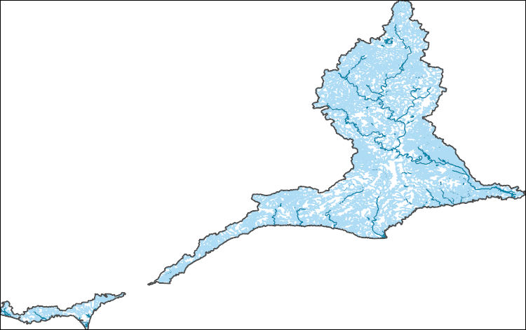
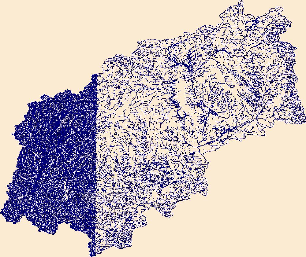
The High Resolution National Hydrography Dataset Plus (NHDPlus HR) is an integrated set of geospatial data layers, including the National Hydrography Dataset (NHD), National Watershed Boundary Dataset (WBD), and 3D Elevation Program Digital Elevation Model (3DEP DEM). The NHDPlus HR combines the NHD, 3DEP DEMs, and WBD to a data suite that includes the NHD stream network with linear referencing functionality, the WBD hydrologic units, elevation-derived catchment areas for each stream segment, "value added attributes" (VAAs), and other features that enhance hydrologic data analysis and routing.
Tags: CO,
Chaffee County,
Colorado,
Delta County,
Downloadable Data, All tags...
Esri File GeoDatabase 10,
FileGDB,
Gunnison County,
HU-4,
HU-4 Subregion,
HU4_1402,
Hinsdale County,
Hydrography,
Mesa County,
Mineral County,
Montrose County,
NHDPlus HR Rasters,
NHDPlus High Resolution (NHDPlus HR),
National Hydrography Dataset (NHD),
National Hydrography Dataset Plus High Resolution (NHDPlus HR),
National Hydrography Dataset Plus High Resolution (NHDPlus HR) Current,
Ouray County,
Pitkin County,
Saguache County,
San Juan County,
San Miguel County,
US,
United States,
base maps,
cartography,
catchments,
channels,
digital elevation models,
drainage basins,
earthsciences,
environment,
geographic information systems,
geoscientificInformation,
geospatial analysis,
hydrographic datasets,
hydrographic features,
hydrology,
inlandWaters,
lakes,
land surface characteristics,
reservoirs,
river reaches,
rivers,
streamflow,
streamflow data,
streams,
surface water quality,
topography,
water resources,
waterbodies,
watersheds, Fewer tags

The High Resolution National Hydrography Dataset Plus (NHDPlus HR) is an integrated set of geospatial data layers, including the National Hydrography Dataset (NHD), National Watershed Boundary Dataset (WBD), and 3D Elevation Program Digital Elevation Model (3DEP DEM). The NHDPlus HR combines the NHD, 3DEP DEMs, and WBD to a data suite that includes the NHD stream network with linear referencing functionality, the WBD hydrologic units, elevation-derived catchment areas for each stream segment, "value added attributes" (VAAs), and other features that enhance hydrologic data analysis and routing.
Tags: AZ,
Apache County,
Arizona,
Coconino County,
Downloadable Data, All tags...
Esri File GeoDatabase 10,
FileGDB,
Gila County,
Graham County,
Greenlee County,
HU-4,
HU-4 Subregion,
HU4_1506,
Hydrography,
Maricopa County,
NHDPlus HR Rasters,
NHDPlus High Resolution (NHDPlus HR),
National Hydrography Dataset (NHD),
National Hydrography Dataset Plus High Resolution (NHDPlus HR),
National Hydrography Dataset Plus High Resolution (NHDPlus HR) Current,
Navajo County,
Pinal County,
US,
United States,
Yavapai County,
base maps,
cartography,
catchments,
channels,
digital elevation models,
drainage basins,
earthsciences,
environment,
geographic information systems,
geoscientificInformation,
geospatial analysis,
hydrographic datasets,
hydrographic features,
hydrology,
inlandWaters,
lakes,
land surface characteristics,
reservoirs,
river reaches,
rivers,
streamflow,
streamflow data,
streams,
surface water quality,
topography,
water resources,
waterbodies,
watersheds, Fewer tags

The High Resolution National Hydrography Dataset Plus (NHDPlus HR) is an integrated set of geospatial data layers, including the National Hydrography Dataset (NHD), National Watershed Boundary Dataset (WBD), and 3D Elevation Program Digital Elevation Model (3DEP DEM). The NHDPlus HR combines the NHD, 3DEP DEMs, and WBD to a data suite that includes the NHD stream network with linear referencing functionality, the WBD hydrologic units, elevation-derived catchment areas for each stream segment, "value added attributes" (VAAs), and other features that enhance hydrologic data analysis and routing.
Tags: AZ,
Arizona,
Cochise County,
Downloadable Data,
Esri File GeoDatabase 10, All tags...
FileGDB,
Gila County,
Graham County,
HU-4,
HU-4 Subregion,
HU4_1505,
Hydrography,
Maricopa County,
NHDPlus HR Rasters,
NHDPlus High Resolution (NHDPlus HR),
National Hydrography Dataset (NHD),
National Hydrography Dataset Plus High Resolution (NHDPlus HR),
National Hydrography Dataset Plus High Resolution (NHDPlus HR) Current,
Pima County,
Pinal County,
Santa Cruz County,
US,
United States,
base maps,
cartography,
catchments,
channels,
digital elevation models,
drainage basins,
earthsciences,
environment,
geographic information systems,
geoscientificInformation,
geospatial analysis,
hydrographic datasets,
hydrographic features,
hydrology,
inlandWaters,
lakes,
land surface characteristics,
reservoirs,
river reaches,
rivers,
streamflow,
streamflow data,
streams,
surface water quality,
topography,
water resources,
waterbodies,
watersheds, Fewer tags
The High Resolution National Hydrography Dataset Plus (NHDPlus HR) is an integrated set of geospatial data layers, including the National Hydrography Dataset (NHD), National Watershed Boundary Dataset (WBD), and 3D Elevation Program Digital Elevation Model (3DEP DEM). The NHDPlus HR combines the NHD, 3DEP DEMs, and WBD to a data suite that includes the NHD stream network with linear referencing functionality, the WBD hydrologic units, elevation-derived catchment areas for each stream segment, "value added attributes" (VAAs), and other features that enhance hydrologic data analysis and routing.
Tags: Androscoggin,
Downloadable Data,
Esri File GeoDatabase 10,
FileGDB,
Franklin, All tags...
HU-4,
HU-4 Subregion,
HU4_0103,
Hydrography,
Kennebec,
Lincoln,
ME,
Maine,
NHDPlus HR Rasters,
NHDPlus High Resolution (NHDPlus HR),
National Hydrography Dataset (NHD),
National Hydrography Dataset Plus High Resolution (NHDPlus HR),
National Hydrography Dataset Plus High Resolution (NHDPlus HR) Current,
Penobscot,
Piscataquis,
Sagadahoc,
Somerset,
US,
United States,
Waldo,
base maps,
cartography,
catchments,
channels,
digital elevation models,
drainage basins,
earthsciences,
environment,
geographic information systems,
geoscientificInformation,
geospatial analysis,
hydrographic datasets,
hydrographic features,
hydrology,
inlandWaters,
lakes,
land surface characteristics,
reservoirs,
river reaches,
rivers,
streamflow,
streamflow data,
streams,
surface water quality,
topography,
water resources,
waterbodies,
watersheds, Fewer tags
The High Resolution National Hydrography Dataset Plus (NHDPlus HR) is an integrated set of geospatial data layers, including the National Hydrography Dataset (NHD), National Watershed Boundary Dataset (WBD), and 3D Elevation Program Digital Elevation Model (3DEP DEM). The NHDPlus HR combines the NHD, 3DEP DEMs, and WBD to a data suite that includes the NHD stream network with linear referencing functionality, the WBD hydrologic units, elevation-derived catchment areas for each stream segment, "value added attributes" (VAAs), and other features that enhance hydrologic data analysis and routing.
Tags: Aroostook,
Downloadable Data,
Esri File GeoDatabase 10,
FileGDB,
HU-4, All tags...
HU-4 Subregion,
HU4_0105,
Hancock,
Hydrography,
Kennebec,
Knox,
Lincoln,
ME,
Maine,
NHDPlus HR Rasters,
NHDPlus High Resolution (NHDPlus HR),
National Hydrography Dataset (NHD),
National Hydrography Dataset Plus High Resolution (NHDPlus HR),
National Hydrography Dataset Plus High Resolution (NHDPlus HR) Current,
Penobscot,
Sagadahoc,
US,
United States,
Waldo,
Washington,
base maps,
cartography,
catchments,
channels,
digital elevation models,
drainage basins,
earthsciences,
environment,
geographic information systems,
geoscientificInformation,
geospatial analysis,
hydrographic datasets,
hydrographic features,
hydrology,
inlandWaters,
lakes,
land surface characteristics,
reservoirs,
river reaches,
rivers,
streamflow,
streamflow data,
streams,
surface water quality,
topography,
water resources,
waterbodies,
watersheds, Fewer tags
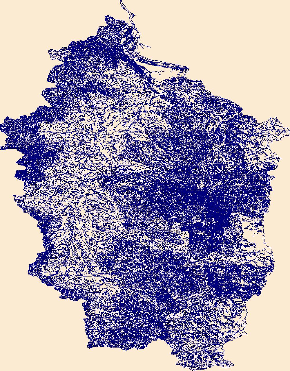
The High Resolution National Hydrography Dataset Plus (NHDPlus HR) is an integrated set of geospatial data layers, including the best available National Hydrography Dataset (NHD), the 10-meter 3D Elevation Program Digital Elevation Model (3DEP DEM), and the National Watershed Boundary Dataset (WBD). The NHDPlus HR combines the NHD, 3DEP DEMs, and WBD to create a stream network with linear referencing, feature naming, "value added attributes" (VAAs), elevation-derived catchments, and other features for hydrologic data analysis. The stream network with linear referencing is a system of data relationships applied to hydrographic systems so that one stream reach "flows" into another and "events" can be tied to and traced...
Tags: Downloadable Data,
FileGDB,
FileGDB 10.1,
HU-4 Subregion,
HU-4 Subregion, All tags...
HU4_0425,
Hydrography,
NHDPlus HR Rasters,
NHDPlus High Resolution (NHDPlus HR),
National Hydrography Dataset (NHD),
National Hydrography Dataset Plus High Resolution (NHDPlus HR),
National Hydrography Dataset Plus High Resolution (NHDPlus HR) Current,
US,
United States,
base maps,
cartography,
catchments,
channels,
digital elevation models,
drainage basins,
earth sciences,
elevation,
environment,
geographic information systems,
geoscientific,
geospatial analysis,
hydrographic datasets,
hydrographic features,
hydrology,
imagery,
inland waters,
lakes,
land surface characteristics,
reservoirs,
river reaches,
rivers,
streamflow,
streamflow data,
streams,
topography,
water bodies,
water quality,
water resources,
watersheds, Fewer tags
The High Resolution National Hydrography Dataset Plus (NHDPlus HR) is an integrated set of geospatial data layers, including the best available National Hydrography Dataset (NHD), the 10-meter 3D Elevation Program Digital Elevation Model (3DEP DEM), and the National Watershed Boundary Dataset (WBD). The NHDPlus HR combines the NHD, 3DEP DEMs, and WBD to create a stream network with linear referencing, feature naming, "value added attributes" (VAAs), elevation-derived catchments, and other features for hydrologic data analysis. The stream network with linear referencing is a system of data relationships applied to hydrographic systems so that one stream reach "flows" into another and "events" can be tied to and traced...
Tags: CA,
California,
Downloadable Data,
Esmeralda County,
FileGDB, All tags...
FileGDB 10.1,
Fresno County,
HU-4 Subregion,
HU-4 Subregion,
HU4_1809,
Hydrography,
Inyo County,
Kern County,
Los Angeles County,
Madera County,
Mineral County,
Mono County,
NHDPlus HR Rasters,
NHDPlus High Resolution (NHDPlus HR),
NV,
National Hydrography Dataset (NHD),
National Hydrography Dataset Plus High Resolution (NHDPlus HR),
National Hydrography Dataset Plus High Resolution (NHDPlus HR) Current,
Nevada,
Nye County,
San Bernardino County,
Tulare County,
Tuolumne County,
US,
United States,
base maps,
cartography,
catchments,
channels,
digital elevation models,
drainage basins,
earth sciences,
elevation,
environment,
geographic information systems,
geoscientific,
geospatial analysis,
hydrographic datasets,
hydrographic features,
hydrology,
imagery,
inland waters,
lakes,
land surface characteristics,
reservoirs,
river reaches,
rivers,
streamflow,
streamflow data,
streams,
topography,
water bodies,
water quality,
water resources,
watersheds, Fewer tags
The High Resolution National Hydrography Dataset Plus (NHDPlus HR) is an integrated set of geospatial data layers, including the best available National Hydrography Dataset (NHD), the 10-meter 3D Elevation Program Digital Elevation Model (3DEP DEM), and the National Watershed Boundary Dataset (WBD). The NHDPlus HR combines the NHD, 3DEP DEMs, and WBD to create a stream network with linear referencing, feature naming, "value added attributes" (VAAs), elevation-derived catchments, and other features for hydrologic data analysis. The stream network with linear referencing is a system of data relationships applied to hydrographic systems so that one stream reach "flows" into another and "events" can be tied to and traced...
Tags: Auglaize County,
Butler County,
Champaign County,
Clark County,
Darke County, All tags...
Dearborn County,
Decatur County,
Downloadable Data,
Fayette County,
FileGDB,
FileGDB 10.1,
Franklin County,
Greene County,
HU-4 Subregion,
HU-4 Subregion,
HU4_0508,
Hamilton County,
Hardin County,
Henry County,
Hydrography,
IN,
Indiana,
Logan County,
Mercer County,
Miami County,
Montgomery County,
NHDPlus HR Rasters,
NHDPlus High Resolution (NHDPlus HR),
National Hydrography Dataset (NHD),
National Hydrography Dataset Plus High Resolution (NHDPlus HR),
National Hydrography Dataset Plus High Resolution (NHDPlus HR) Current,
OH,
Ohio,
Preble County,
Randolph County,
Ripley County,
Rush County,
Shelby County,
US,
Union County,
United States,
Warren County,
Wayne County,
base maps,
cartography,
catchments,
channels,
digital elevation models,
drainage basins,
earth sciences,
elevation,
environment,
geographic information systems,
geoscientific,
geospatial analysis,
hydrographic datasets,
hydrographic features,
hydrology,
imagery,
inland waters,
lakes,
land surface characteristics,
reservoirs,
river reaches,
rivers,
streamflow,
streamflow data,
streams,
topography,
water bodies,
water quality,
water resources,
watersheds, Fewer tags
The High Resolution National Hydrography Dataset Plus (NHDPlus HR) is an integrated set of geospatial data layers, including the best available National Hydrography Dataset (NHD), the 10-meter 3D Elevation Program Digital Elevation Model (3DEP DEM), and the National Watershed Boundary Dataset (WBD). The NHDPlus HR combines the NHD, 3DEP DEMs, and WBD to create a stream network with linear referencing, feature naming, "value added attributes" (VAAs), elevation-derived catchments, and other features for hydrologic data analysis. The stream network with linear referencing is a system of data relationships applied to hydrographic systems so that one stream reach "flows" into another and "events" can be tied to and traced...
Tags: Benton County,
Clackamas County,
Columbia County,
Deschutes County,
Douglas County, All tags...
Downloadable Data,
FileGDB,
FileGDB 10.1,
HU-4 Subregion,
HU-4 Subregion,
HU4_1709,
Hydrography,
Jefferson County,
Klamath County,
Lane County,
Lincoln County,
Linn County,
Marion County,
Multnomah County,
NHDPlus HR Rasters,
NHDPlus High Resolution (NHDPlus HR),
National Hydrography Dataset (NHD),
National Hydrography Dataset Plus High Resolution (NHDPlus HR),
National Hydrography Dataset Plus High Resolution (NHDPlus HR) Current,
OR,
Oregon,
Polk County,
Tillamook County,
US,
United States,
Wasco County,
Washington County,
Yamhill County,
base maps,
cartography,
catchments,
channels,
digital elevation models,
drainage basins,
earth sciences,
elevation,
environment,
geographic information systems,
geoscientific,
geospatial analysis,
hydrographic datasets,
hydrographic features,
hydrology,
imagery,
inland waters,
lakes,
land surface characteristics,
reservoirs,
river reaches,
rivers,
streamflow,
streamflow data,
streams,
topography,
water bodies,
water quality,
water resources,
watersheds, Fewer tags
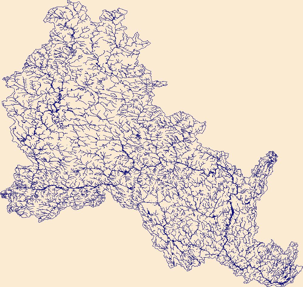
The High Resolution National Hydrography Dataset Plus (NHDPlus HR) is an integrated set of geospatial data layers, including the National Hydrography Dataset (NHD), National Watershed Boundary Dataset (WBD), and 3D Elevation Program Digital Elevation Model (3DEP DEM). The NHDPlus HR combines the NHD, 3DEP DEMs, and WBD to a data suite that includes the NHD stream network with linear referencing functionality, the WBD hydrologic units, elevation-derived catchment areas for each stream segment, "value added attributes" (VAAs), and other features that enhance hydrologic data analysis and routing.
Tags: Androscoggin,
Carroll,
Coos,
Cumberland,
Downloadable Data, All tags...
Esri File GeoDatabase 10,
FileGDB,
Franklin,
HU-4,
HU-4 Subregion,
HU4_0104,
Hydrography,
Kennebec,
ME,
Maine,
NH,
NHDPlus HR Rasters,
NHDPlus High Resolution (NHDPlus HR),
National Hydrography Dataset (NHD),
National Hydrography Dataset Plus High Resolution (NHDPlus HR),
National Hydrography Dataset Plus High Resolution (NHDPlus HR) Current,
New Hampshire,
Oxford,
Sagadahoc,
US,
United States,
base maps,
cartography,
catchments,
channels,
digital elevation models,
drainage basins,
earthsciences,
environment,
geographic information systems,
geoscientificInformation,
geospatial analysis,
hydrographic datasets,
hydrographic features,
hydrology,
inlandWaters,
lakes,
land surface characteristics,
reservoirs,
river reaches,
rivers,
streamflow,
streamflow data,
streams,
surface water quality,
topography,
water resources,
waterbodies,
watersheds, Fewer tags
The High Resolution National Hydrography Dataset Plus (NHDPlus HR) is an integrated set of geospatial data layers, including the National Hydrography Dataset (NHD), National Watershed Boundary Dataset (WBD), and 3D Elevation Program Digital Elevation Model (3DEP DEM). The NHDPlus HR combines the NHD, 3DEP DEMs, and WBD to a data suite that includes the NHD stream network with linear referencing functionality, the WBD hydrologic units, elevation-derived catchment areas for each stream segment, "value added attributes" (VAAs), and other features that enhance hydrologic data analysis and routing.
Tags: Aroostook County,
Downloadable Data,
Esri File GeoDatabase 10,
FileGDB,
HU-4, All tags...
HU-4 Subregion,
HU4_0101,
Hydrography,
ME,
Maine,
NHDPlus HR Rasters,
NHDPlus High Resolution (NHDPlus HR),
National Hydrography Dataset (NHD),
National Hydrography Dataset Plus High Resolution (NHDPlus HR),
National Hydrography Dataset Plus High Resolution (NHDPlus HR) Current,
Penobscot County,
Piscataquis County,
Somerset County,
US,
United States,
base maps,
cartography,
catchments,
channels,
digital elevation models,
drainage basins,
earthsciences,
environment,
geographic information systems,
geoscientificInformation,
geospatial analysis,
hydrographic datasets,
hydrographic features,
hydrology,
inlandWaters,
lakes,
land surface characteristics,
reservoirs,
river reaches,
rivers,
streamflow,
streamflow data,
streams,
surface water quality,
topography,
water resources,
waterbodies,
watersheds, Fewer tags
The High Resolution National Hydrography Dataset Plus (NHDPlus HR) is an integrated set of geospatial data layers, including the best available National Hydrography Dataset (NHD), the 10-meter 3D Elevation Program Digital Elevation Model (3DEP DEM), and the National Watershed Boundary Dataset (WBD). The NHDPlus HR combines the NHD, 3DEP DEMs, and WBD to create a stream network with linear referencing, feature naming, "value added attributes" (VAAs), elevation-derived catchments, and other features for hydrologic data analysis. The stream network with linear referencing is a system of data relationships applied to hydrographic systems so that one stream reach "flows" into another and "events" can be tied to and traced...
Tags: Alleghany County,
Alleghany County,
Ashe County,
Bath County,
Bland County, All tags...
Boone County,
Braxton County,
Cabell County,
Caldwell County,
Calhoun County,
Carroll County,
Clay County,
Craig County,
Downloadable Data,
Fayette County,
FileGDB,
FileGDB 10.1,
Floyd County,
Franklin County,
Galax County,
Giles County,
Grayson County,
Greenbrier County,
HU-4 Subregion,
HU-4 Subregion,
HU4_0505,
Highland County,
Hydrography,
Jackson County,
Johnson County,
Kanawha County,
Lincoln County,
Logan County,
Mason County,
McDowell County,
Mercer County,
Monroe County,
Montgomery County,
NC,
NHDPlus HR Rasters,
NHDPlus High Resolution (NHDPlus HR),
National Hydrography Dataset (NHD),
National Hydrography Dataset Plus High Resolution (NHDPlus HR),
National Hydrography Dataset Plus High Resolution (NHDPlus HR) Current,
Nicholas County,
North Carolina,
Patrick County,
Pendleton County,
Pocahontas County,
Pulaski County,
Putnam County,
Radford County,
Raleigh County,
Randolph County,
Roane County,
Smyth County,
Summers County,
Surry County,
TN,
Tazewell County,
Tennessee,
US,
United States,
VA,
Virginia,
WV,
Washington County,
Watauga County,
Webster County,
West Virginia,
Wilkes County,
Wyoming County,
Wythe County,
base maps,
cartography,
catchments,
channels,
digital elevation models,
drainage basins,
earth sciences,
elevation,
environment,
geographic information systems,
geoscientific,
geospatial analysis,
hydrographic datasets,
hydrographic features,
hydrology,
imagery,
inland waters,
lakes,
land surface characteristics,
reservoirs,
river reaches,
rivers,
streamflow,
streamflow data,
streams,
topography,
water bodies,
water quality,
water resources,
watersheds, Fewer tags
The High Resolution National Hydrography Dataset Plus (NHDPlus HR) is an integrated set of geospatial data layers, including the best available National Hydrography Dataset (NHD), the 10-meter 3D Elevation Program Digital Elevation Model (3DEP DEM), and the National Watershed Boundary Dataset (WBD). The NHDPlus HR combines the NHD, 3DEP DEMs, and WBD to create a stream network with linear referencing, feature naming, "value added attributes" (VAAs), elevation-derived catchments, and other features for hydrologic data analysis. The stream network with linear referencing is a system of data relationships applied to hydrographic systems so that one stream reach "flows" into another and "events" can be tied to and traced...
Tags: BentonCounty,
Black HawkCounty,
BooneCounty,
BremerCounty,
BuchananCounty, All tags...
ButlerCounty,
CarrollCounty,
CedarCounty,
Cerro GordoCounty,
ChickasawCounty,
ClarkCounty,
ClintonCounty,
DelawareCounty,
Des MoinesCounty,
DodgeCounty,
Downloadable Data,
FaribaultCounty,
FayetteCounty,
FileGDB,
FileGDB 10.1,
FloydCounty,
FranklinCounty,
FreebornCounty,
GrundyCounty,
HU-4 Subregion,
HU-4 Subregion,
HamiltonCounty,
HancockCounty,
HancockCounty,
HardinCounty,
HendersonCounty,
HenryCounty,
HenryCounty,
HowardCounty,
Hydrography,
IA,
Iowa,
IowaCounty,
JasperCounty,
JeffersonCounty,
JohnsonCounty,
JonesCounty,
KeokukCounty,
KnoxCounty,
LeeCounty,
LinnCounty,
LouisaCounty,
MahaskaCounty,
MarionCounty,
MarshallCounty,
MercerCounty,
MitchellCounty,
MowerCounty,
MuscatineCounty,
NHDPlus HR Rasters,
NHDPlus High Resolution (NHDPlus HR),
National Hydrography Dataset (NHD),
National Hydrography Dataset Plus High Resolution (NHDPlus HR),
National Hydrography Dataset Plus High Resolution (NHDPlus HR) Current,
PolkCounty,
PoweshiekCounty,
Rock IslandCounty,
ScottCounty,
SteeleCounty,
StoryCounty,
TamaCounty,
US,
United States,
Van BurenCounty,
WapelloCounty,
WarrenCounty,
WashingtonCounty,
WebsterCounty,
WhitesideCounty,
WinnebagoCounty,
WorthCounty,
WrightCounty,
base maps,
cartography,
catchments,
channels,
digital elevation models,
drainage basins,
earth sciences,
elevation,
environment,
geographic information systems,
geoscientific,
geospatial analysis,
hydrographic datasets,
hydrographic features,
hydrology,
imagery,
inland waters,
lakes,
land surface characteristics,
reservoirs,
river reaches,
rivers,
streamflow,
streamflow data,
streams,
topography,
water bodies,
water quality,
water resources,
watersheds, Fewer tags
The High Resolution National Hydrography Dataset Plus (NHDPlus HR) is an integrated set of geospatial data layers, including the best available National Hydrography Dataset (NHD), the 10-meter 3D Elevation Program Digital Elevation Model (3DEP DEM), and the National Watershed Boundary Dataset (WBD). The NHDPlus HR combines the NHD, 3DEP DEMs, and WBD to create a stream network with linear referencing, feature naming, "value added attributes" (VAAs), elevation-derived catchments, and other features for hydrologic data analysis. The stream network with linear referencing is a system of data relationships applied to hydrographic systems so that one stream reach "flows" into another and "events" can be tied to and traced...
Tags: AdairCounty,
AdamsCounty,
AppanooseCounty,
AudrainCounty,
BooneCounty, All tags...
CalhounCounty,
CallawayCounty,
ClarkCounty,
DavisCounty,
Downloadable Data,
FileGDB,
FileGDB 10.1,
HU-4 Subregion,
HU-4 Subregion,
HancockCounty,
Hydrography,
JerseyCounty,
KnoxCounty,
LeeCounty,
LewisCounty,
LincolnCounty,
MO,
MaconCounty,
MacoupinCounty,
MadisonCounty,
MarionCounty,
Missouri,
MonroeCounty,
MontgomeryCounty,
NHDPlus HR Rasters,
NHDPlus High Resolution (NHDPlus HR),
National Hydrography Dataset (NHD),
National Hydrography Dataset Plus High Resolution (NHDPlus HR),
National Hydrography Dataset Plus High Resolution (NHDPlus HR) Current,
PikeCounty,
PikeCounty,
RallsCounty,
RandolphCounty,
SchuylerCounty,
ScotlandCounty,
ShelbyCounty,
St. CharlesCounty,
St. LouisCounty,
US,
United States,
Van BurenCounty,
WarrenCounty,
base maps,
cartography,
catchments,
channels,
digital elevation models,
drainage basins,
earth sciences,
elevation,
environment,
geographic information systems,
geoscientific,
geospatial analysis,
hydrographic datasets,
hydrographic features,
hydrology,
imagery,
inland waters,
lakes,
land surface characteristics,
reservoirs,
river reaches,
rivers,
streamflow,
streamflow data,
streams,
topography,
water bodies,
water quality,
water resources,
watersheds, Fewer tags
The High Resolution National Hydrography Dataset Plus (NHDPlus HR) is an integrated set of geospatial data layers, including the best available National Hydrography Dataset (NHD), the 10-meter 3D Elevation Program Digital Elevation Model (3DEP DEM), and the National Watershed Boundary Dataset (WBD). The NHDPlus HR combines the NHD, 3DEP DEMs, and WBD to create a stream network with linear referencing, feature naming, "value added attributes" (VAAs), elevation-derived catchments, and other features for hydrologic data analysis. The stream network with linear referencing is a system of data relationships applied to hydrographic systems so that one stream reach "flows" into another and "events" can be tied to and traced...
Tags: Barnes County,
Becker County,
Beltrami County,
Benson County,
Big Stone County, All tags...
Cass County,
Cavalier County,
Clay County,
Clearwater County,
Dickey County,
Downloadable Data,
Eddy County,
FileGDB,
FileGDB 10.1,
Foster County,
Grand Forks County,
Grant County,
Griggs County,
HU-4 Subregion,
HU-4 Subregion,
HU4_0902,
Hydrography,
Itasca County,
Kittson County,
Koochiching County,
Lake of the Woods County,
MN,
Mahnomen County,
Marshall County,
Marshall County,
McHenry County,
McLean County,
Minnesota,
ND,
NHDPlus HR Rasters,
NHDPlus High Resolution (NHDPlus HR),
National Hydrography Dataset (NHD),
National Hydrography Dataset Plus High Resolution (NHDPlus HR),
National Hydrography Dataset Plus High Resolution (NHDPlus HR) Current,
Nelson County,
Norman County,
North Dakota,
Otter Tail County,
Pembina County,
Pennington County,
Pierce County,
Polk County,
Ramsey County,
Ransom County,
Red Lake County,
Richland County,
Roberts County,
Rolette County,
Roseau County,
SD,
Sargent County,
Sheridan County,
South Dakota,
Steele County,
Stevens County,
Stutsman County,
Towner County,
Traill County,
Traverse County,
US,
United States,
Walsh County,
Wells County,
Wilkin County,
base maps,
cartography,
catchments,
channels,
digital elevation models,
drainage basins,
earth sciences,
elevation,
environment,
geographic information systems,
geoscientific,
geospatial analysis,
hydrographic datasets,
hydrographic features,
hydrology,
imagery,
inland waters,
lakes,
land surface characteristics,
reservoirs,
river reaches,
rivers,
streamflow,
streamflow data,
streams,
topography,
water bodies,
water quality,
water resources,
watersheds, Fewer tags
|
|

