Filters: Tags: Information (X) > partyWithName: USGS - National Geospatial Technical Operations Center (NGTOC) (X)
2 results (70ms)|
Filters
Date Range
Types Contacts Tag Types Tag Schemes |
U.S. Geological Survey, Department of the Interior - The annual Geographic Names acquisition plan is to collect geographic name data over the United States and its territories through the Board on Geographic Names processes. The U.S. Board on Geographic Names is a Federal body created in 1890 and established in its present form by Public Law in 1947 to maintain uniform geographic name usage throughout the Federal Government. The Board comprises representatives of Federal agencies concerned with geographic information, population, ecology, and management of public lands. Sharing its responsibilities with the Secretary of the Interior, the Board promulgates official geographic feature names with locative attributes...
Types: Citation;
Tags: BGN,
Board on Geographic Names,
Cultural Resources Theme,
GNIS,
Geographic Names,
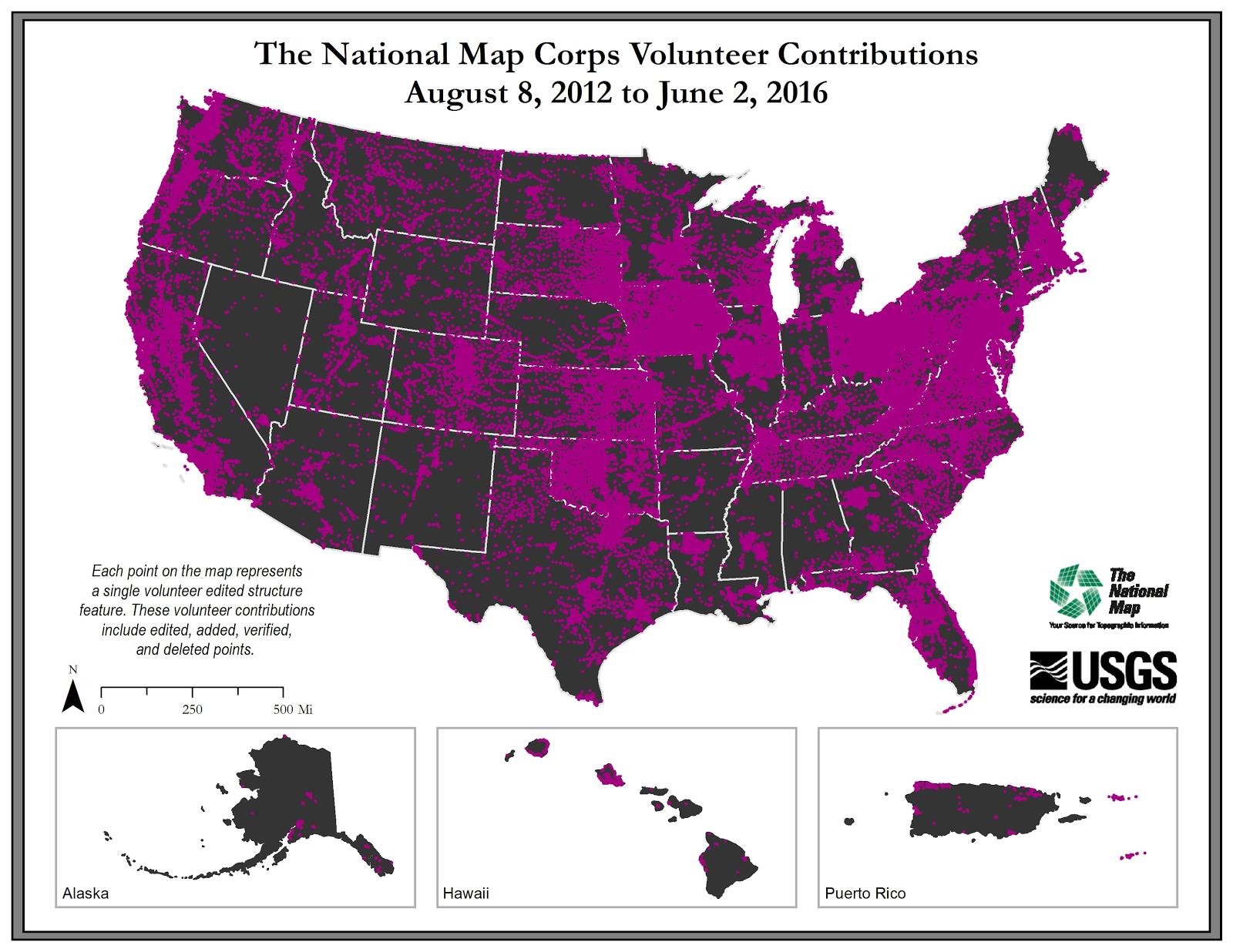
U.S. Geological Survey, Department of the Interior - The annual National Map Corps Volunteered Geographic Information (VGI) structures acquisition plan is to add new structures data and remove or edit obsolete structures data points over the United States. The FY17 acquisition plan allows data contributions by volunteers for all 50 states. Interested parties who wish to become a volunteer data acquisition partner with the USGS in FY17 or in future years should contact a USGS Geospatial Liaison - http://liaisons.usgs.gov/geospatial/documents/TNM_Partnership_User_ContactList.pdf. To find out more about the National Map Corps VGI structures program go to https://my.usgs.gov/confluence/display/nationalmapcorps/Home.
Types: Citation;
Tags: EMS station,
NGDA,
National Geospatial Data Asset,
Real Property Theme,
Structures,
|

|
