Filters: Tags: Kīlauea (X)
191 results (38ms)|
Filters
Date Range
Extensions Types
Contacts
Categories Tag Types Tag Schemes |
Samples of the crater lake water were filtered in the field with a 0.45 micron filter. Subsequently, additional precipitates formed in the solute-rich samples (secondary precipitates) which were subsequently filtered in the lab with a 0.45 micron filter. Resulting residues were analyzed both in situ on the filter and after scraping. Samples were sputter coated with 10 nm Au, then imaged in a Tescan VEGA3 scanning electron microscope (SEM) equipped with an Oxford 150 mm2 X-MaxN large area energy dispersive spectrometer at the U.S. Geological Survey, Menlo Park, CA. Elemental backscatter (BSE) images were collected with an accelerating voltage (HV) of 30 kV and a working distance (WD) of ~15 mm. Magnification is indicated...
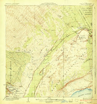
USGS Historical Quadrangle in GeoPDF.
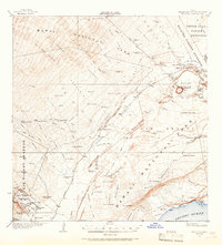
USGS Historical Quadrangle in GeoPDF.
An intrusion into Kīlauea’s upper East Rift Zone during June 17–19, 2007, during the 1983–2018 Pu‘u‘ō‘ō eruption, led to widespread ground cracking and a small (~1,525 m3) eruption on the northeast flank of the Kānenuiohamo cone, about 6 km upslope from the Pu‘u‘ō‘ō vent. Transmitted and induced very-low-frequency (VLF) magnetic fields were measured with a handheld VLF receiver along transects spanning the dike trace, and zones of ground cracking related to the intrusion were mapped. This dataset records the density and vesicularity of selected lava and tephra samples collected from the June 2007 Father's Day eruption site. The density of the basalt erupted was determined by measuring the weight of spatter and lava...
Categories: Data;
Tags: East Rift Zone,
Episode 56,
Father's Day event,
Hawaii,
Hawaii Volcanoes National Park,
This dataset contains shapefiles and associated metadata for Kīlauea volcano's Pu‘u ‘Ō‘ō episode 61g lava flow from May 24, 2016 through May 31, 2017. Episode 61g began with a breakout from the east flank of Pu‘u ‘Ō‘ō on May 24, 2016. Lava reached the Pacific Ocean at Kamokuna on July 26, 2017, and began building a lava delta that extended seaward from the original coastline. This lava delta collapsed into the ocean on December 31, 2016, as reflected in the data for January 12, 2017 and thereafter. The episode 61g lava flow continues as of May 31, 2017, the date of the last mapping to contribute to this dataset. One mapping date is included for each calendar month - usually late in the month - from May 2016 through...
Types: Map Service,
OGC WFS Layer,
OGC WMS Layer,
OGC WMS Service;
Tags: Episode 61g,
Hawai'i,
Hawai'i,
Hawaii,
Hawaii,
The 2018 lower East Rift Zone eruption of Kilauea Volcano began in the late afternoon of 3 May, with fissure 1 opening and erupting lava onto Mohala Street in the Leilani Estates subdivision, part of the lower Puna District of the Island of Hawai'i. For the first week of the eruption, relatively viscous lava flowed only within a kilometer (0.6 miles) of the fissures within Leilani Estates, before activity shifted downrift (east-northeast) and out of the subdivision during mid-May. Around 18 May, activity along the lower East Rift Zone intensified, and fluid lava erupting at higher effusion rates from the downrift fissures reached the ocean within two days. Near the end of May, this more vigorous activity shifted...
Categories: Data;
Types: Downloadable,
Map Service,
OGC WFS Layer,
OGC WMS Layer,
Shapefile;
Tags: East Rift Zone,
Fissure15FlowA,
Green Lake,
Hawai'i,
Hawaii,
The 2018 lower East Rift Zone eruption of Kilauea Volcano began in the late afternoon of 3 May, with fissure 1 opening and erupting lava onto Mohala Street in the Leilani Estates subdivision, part of the lower Puna District of the Island of Hawai'i. For the first week of the eruption, relatively viscous lava flowed only within a kilometer (0.6 miles) of the fissures within Leilani Estates, before activity shifted downrift (east-northeast) and out of the subdivision during mid-May. Around 18 May, activity along the lower East Rift Zone intensified, and fluid lava erupting at higher effusion rates from the downrift fissures reached the ocean within two days. Near the end of May, this more vigorous activity shifted...
Categories: Data;
Types: Downloadable,
Map Service,
OGC WFS Layer,
OGC WMS Layer,
Shapefile;
Tags: East Rift Zone,
Fissure19Flow,
Green Lake,
Hawai'i,
Hawaii,
These feature data are part of a larger dataset containing shapefiles and associated metadata for lava flows erupted at Kilauea volcano from ca. 1790 through 1982. The complete dataset includes all known subaerial eruptions in the volcano's Southwest Rift Zone and East Rift Zone, and selected flows erupted within the summit caldera, during this time period. Two attributed shapefiles are associated with each eruption: a polyline shapefile for the lava flow contacts and eruptive fissures, and a polygon shapefile showing the full extent of the lava flow after emplacement. In total, this dataset contains 100 shapefiles, each with an associated metadata .txt file, representing 50 separate eruptions. The lava flow contacts...
Categories: Data;
Types: Downloadable,
Map Service,
OGC WFS Layer,
OGC WMS Layer,
Shapefile;
Tags: Hawai`i,
Hawai`i,
Hawaii,
Hawaii,
Kilauea,
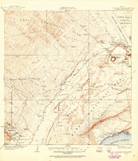
USGS Historical Quadrangle in GeoPDF.
We depict changing eruptive features within the summit caldera of Kīlauea volcano, Island of Hawaiʻi with rapid-response digital elevation models (DEMs) acquired since a series of caldera-filling effusive eruptions began on December 20, 2020. These eruptions follow the caldera collapse of 2018, with new lava progressively filling the approximately 1-cubic-kilometer pit that formed between May and August of that year. The majority of the provided DEMs were constructed via structure-from-motion (SfM) photogrammetry from either helicopter or uncrewed aircraft system (UAS) overflight images, with the remainder constructed via terrestrial laser scanning (TLS) from the Halemaʻumaʻu crater rim. These data were collected...
Types: Map Service,
OGC WFS Layer,
OGC WMS Layer,
OGC WMS Service;
Tags: Basalt,
Halemaʻumaʻu,
Hawaii,
Kaluapele,
Kīlauea,
These feature data are part of a larger dataset containing shapefiles and associated metadata for lava flows erupted at Kilauea volcano from ca. 1790 through 1982. The complete dataset includes all known subaerial eruptions in the volcano's Southwest Rift Zone and East Rift Zone, and selected flows erupted within the summit caldera, during this time period. Two attributed shapefiles are associated with each eruption: a polyline shapefile for the lava flow contacts and eruptive fissures, and a polygon shapefile showing the full extent of the lava flow after emplacement. In total, this dataset contains 100 shapefiles, each with an associated metadata .txt file, representing 50 separate eruptions. The lava flow contacts...
Categories: Data;
Types: Downloadable,
Map Service,
OGC WFS Layer,
OGC WMS Layer,
Shapefile;
Tags: Hawai`i,
Hawai`i,
Hawaii,
Hawaii,
Kilauea,
|

|
