Filters: Tags: Kīlauea (X)
191 results (46ms)|
Filters
Date Range
Extensions Types
Contacts
Categories Tag Types Tag Schemes |
These feature data are part of a larger dataset containing shapefiles and associated metadata for lava flows erupted at Kilauea volcano from ca. 1790 through 1982. The complete dataset includes all known subaerial eruptions in the volcano's Southwest Rift Zone and East Rift Zone, and selected flows erupted within the summit caldera, during this time period. Two attributed shapefiles are associated with each eruption: a polyline shapefile for the lava flow contacts and eruptive fissures, and a polygon shapefile showing the full extent of the lava flow after emplacement. In total, this dataset contains 100 shapefiles, each with an associated metadata .txt file, representing 50 separate eruptions. The lava flow contacts...
Categories: Data;
Types: Downloadable,
Map Service,
OGC WFS Layer,
OGC WMS Layer,
Shapefile;
Tags: Hawai`i,
Hawai`i,
Hawaii,
Hawaii,
Kilauea,
The 2018 Kīlauea eruption and caldera collapse generated intense cycles of seismicity tied to repeated large seismic (Mw ~5) collapse events associated with magma withdrawal from beneath the summit. To gain insight into the underlying dynamics and aid eruption response, we applied waveform-based earthquake detection and double-difference location as the eruption unfolded. Here, we augment these rapid results by grouping events based on patterns of correlation-derived phase polarities across the network. From April 29 to August 6, bracketing the eruption, we used ~2800 events cataloged by the Hawaiian Volcano Observatory to detect and precisely locate 44,000+ earthquakes. Resulting hypocentroids resolve complex,...
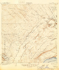
USGS Historical Quadrangle in GeoPDF.
We depict changing eruptive features within the summit caldera of Kīlauea volcano, Island of Hawaiʻi with rapid-response digital elevation models (DEMs) acquired since a series of caldera-filling effusive eruptions began on December 20, 2020. These eruptions follow the caldera collapse of 2018, with new lava progressively filling the approximately 1-cubic-kilometer pit that formed between May and August of that year. The majority of the provided DEMs were constructed via structure-from-motion (SfM) photogrammetry from either helicopter or uncrewed aircraft system (UAS) overflight images, with the remainder constructed via terrestrial laser scanning (TLS) from the Halemaʻumaʻu crater rim. These data were collected...
Types: Map Service,
OGC WFS Layer,
OGC WMS Layer,
OGC WMS Service;
Tags: Basalt,
Halemaʻumaʻu,
Hawaii,
Kaluapele,
Kīlauea,
These feature data are part of a larger dataset containing shapefiles and associated metadata for lava flows erupted at Kilauea volcano from ca. 1790 through 1982. The complete dataset includes all known subaerial eruptions in the volcano's Southwest Rift Zone and East Rift Zone, and selected flows erupted within the summit caldera, during this time period. Two attributed shapefiles are associated with each eruption: a polyline shapefile for the lava flow contacts and eruptive fissures, and a polygon shapefile showing the full extent of the lava flow after emplacement. In total, this dataset contains 100 shapefiles, each with an associated metadata .txt file, representing 50 separate eruptions. The lava flow contacts...
Categories: Data;
Types: Downloadable,
Map Service,
OGC WFS Layer,
OGC WMS Layer,
Shapefile;
Tags: Hawai`i,
Hawai`i,
Hawaii,
Hawaii,
Kilauea,
|

|
