Filters: Tags: La Paz County (X)
419 results (36ms)|
Filters
Date Range
Types Contacts
Categories Tag Types
|
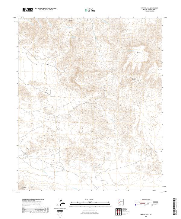
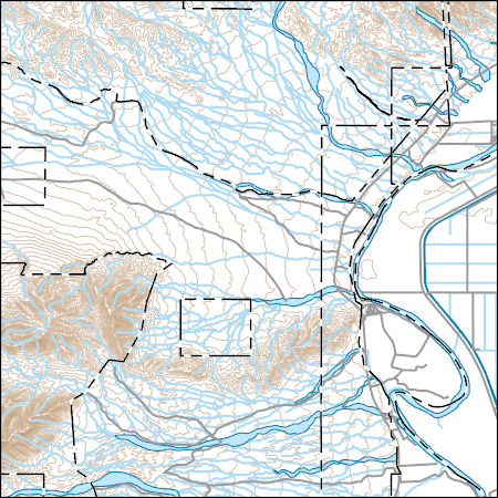
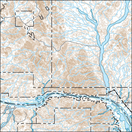
Layered geospatial PDF 7.5 Minute Quadrangle Map. Layers of geospatial data include orthoimagery, roads, grids, geographic names, elevation contours, hydrography, and other selected map features. This map is derived from GIS (geospatial information system) data. It represents a repackaging of GIS data in traditional map form, not creation of new information. The geospatial data in this map are from selected National Map data holdings and other government sources.
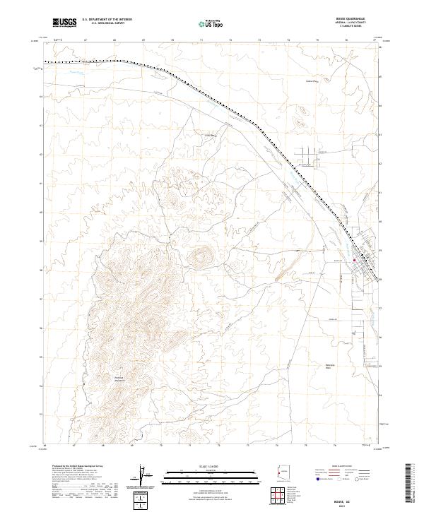
Layered geospatial PDF 7.5 Minute Quadrangle Map. Layers of geospatial data include orthoimagery, roads, grids, geographic names, elevation contours, hydrography, and other selected map features. This map is derived from GIS (geospatial information system) data. It represents a repackaging of GIS data in traditional map form, not creation of new information. The geospatial data in this map are from selected National Map data holdings and other government sources.
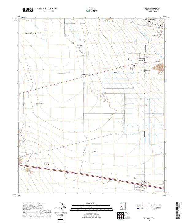
Layered geospatial PDF 7.5 Minute Quadrangle Map. Layers of geospatial data include orthoimagery, roads, grids, geographic names, elevation contours, hydrography, and other selected map features. This map is derived from GIS (geospatial information system) data. It represents a repackaging of GIS data in traditional map form, not creation of new information. The geospatial data in this map are from selected National Map data holdings and other government sources.
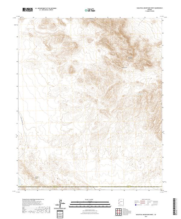
Layered geospatial PDF 7.5 Minute Quadrangle Map. Layers of geospatial data include orthoimagery, roads, grids, geographic names, elevation contours, hydrography, and other selected map features. This map is derived from GIS (geospatial information system) data. It represents a repackaging of GIS data in traditional map form, not creation of new information. The geospatial data in this map are from selected National Map data holdings and other government sources.
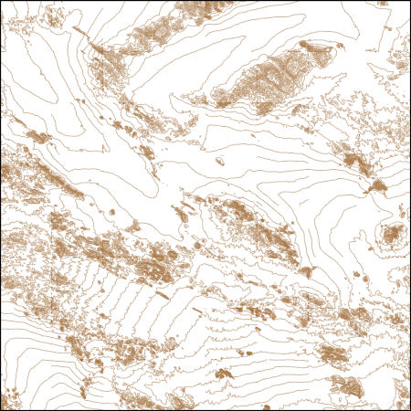
These vector contour lines are derived from the 3D Elevation Program using automated and semi-automated processes. They were created to support 1:24,000-scale CONUS and Hawaii, 1:25,000-scale Alaska, and 1:20,000-scale Puerto Rico / US Virgin Island topographic map products, but are also published in this GIS vector format. Contour intervals are assigned by 7.5-minute quadrangle, so this vector dataset is not visually seamless across quadrangle boundaries. The vector lines have elevation attributes (in feet above mean sea level on NAVD88), but this dataset does not carry line symbols or annotation.
Layers of geospatial data include contours, boundaries, land cover, hydrography, roads, transportation, geographic names, structures, and other selected map features.
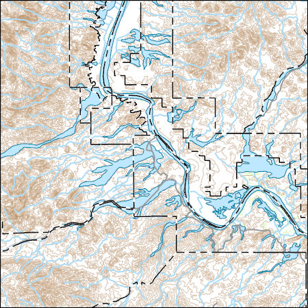
Layers of geospatial data include contours, boundaries, land cover, hydrography, roads, transportation, geographic names, structures, and other selected map features.
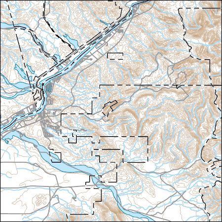
Layers of geospatial data include contours, boundaries, land cover, hydrography, roads, transportation, geographic names, structures, and other selected map features.
USGS Topo Map Vector Data (Vector) 35002 Picacho, California 20220510 for 7.5 x 7.5 minute Shapefile
Layers of geospatial data include contours, boundaries, land cover, hydrography, roads, transportation, geographic names, structures, and other selected map features.
ADMMR map collection: New Planet Iron Mine Assay Map; 1 in. to 50 feet; 29 x 22 in.
The 'Santa Fe Pacific Railroad Co. N. Yuma County, AZ' file is part of the Grover Heinrichs mining collection. Grover was the Vice President of Heinrichs GEOEXploration, located in Tucson, Arizona. The collection contains over 1,400 folders including economic geology reports, maps, photos, correspondence, drill logs and other related materials. The focus of much of the information is on the western United States, particularly Arizona, but the collection also includes files on mining activity throughout the United States, foreign countries, and 82 mineral commodities.
ADMMR map collection: Geologic Map of the Tough Nut, Southern Cross and Climax Mines in the Eastern Plomosa Mountains; 1 in. to 500 feet; 30 x 43 in.
ADMMR map collection: Double Eagle Tunnel; 1 in. to 20 feet; 11 x 8 in.
Categories: Data;
Tags: Arizona,
Dataset,
Double Eagle Claims,
Eagletail Mts. physiographic area,
Gold,
ADMMR map collection: New Planet Iron Mine Geologic Sections Map; 1 in. to 100 feet; 35 x 24 in.
Categories: Data;
Tags: Arizona,
Buckskin Mts. physiographic area,
Copper, Oxide,
Dataset,
Gold, Lode,
ADMMR map collection: Copperstone Gold Project, Plant Layout; 1 in. to 30 feet; 42 x 30 in.
Categories: Data;
Tags: 1980s,
Arizona,
Copperstone,
Copperstone metallic mineral dist.,
Cyprus Copperstone Gold,
Heinrichs Geoexploration Co. Maps: Area 2-Bouse, Aerial Magnetic Plan; 1:24000; 42 x 54 in.
Heinrichs Geoexploration Co. Maps: Area 2-Bouse, Aerial Magnetic Draft of Geox-0572; 1:24000; 37 x 48 in.
Heinrichs Geoexploration Co. Maps: Quartzite-Sugarloaf Project, Au Geochemical Dispersion; 1 in. to 1000 feet; 18 x 15 in.
Categories: Data;
Tags: 1980s,
Aluminum, Alunite,
Arizona,
Dataset,
Dome Rock Mts. physiographic area,
ADMMR map collection: Continental Mine 7th and 8th Levels; 1 in. to 50 feet; 24 x 20 in.
Categories: Data;
Tags: Arizona,
Black Peak - 15 Min,
Buckskin Mts. physiographic area,
Continental Mine,
Copper,
Heinrichs Geoexploration Co. Maps: Harquahala, I.P. Location and Interpretation Plan; 1 in. to 500 feet; 35 x 39 in.
|

|
