Filters
Date Range
Contacts
Tag Types
Tag Schemes
|

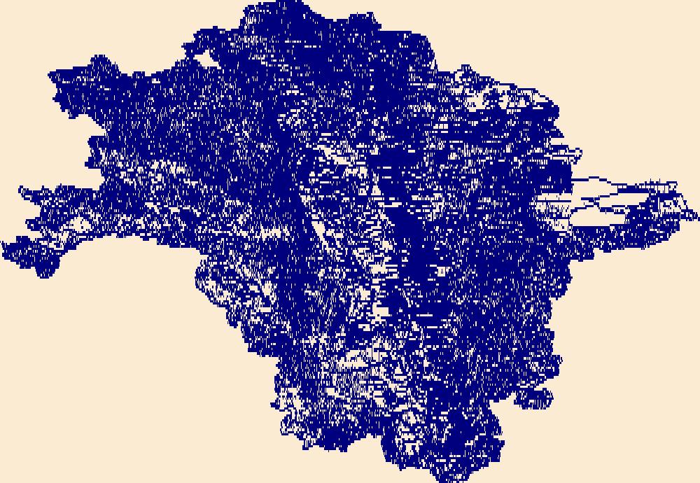
The High Resolution National Hydrography Dataset Plus (NHDPlus HR) is an integrated set of geospatial data layers, including the best available National Hydrography Dataset (NHD), the 10-meter 3D Elevation Program Digital Elevation Model (3DEP DEM), and the National Watershed Boundary Dataset (WBD). The NHDPlus HR combines the NHD, 3DEP DEMs, and WBD to create a stream network with linear referencing, feature naming, "value added attributes" (VAAs), elevation-derived catchments, and other features for hydrologic data analysis. The stream network with linear referencing is a system of data relationships applied to hydrographic systems so that one stream reach "flows" into another and "events" can be tied to and traced...
Tags: Archer County,
Baylor County,
Beckham County,
Briscoe County,
Bryan County, All tags...
Caddo County,
Canadian County,
Carter County,
Childress County,
Clay County,
Collingsworth County,
Comanche County,
Cooke County,
Cottle County,
Cotton County,
Crosby County,
Custer County,
Dewey County,
Dickens County,
Downloadable Data,
FileGDB,
FileGDB 10.1,
Floyd County,
Foard County,
Garvin County,
Grady County,
Gray County,
Grayson County,
HU-4 Subregion,
HU-4 Subregion,
HU4_1113,
Hale County,
Hall County,
Hardeman County,
Harmon County,
Hemphill County,
Hydrography,
Jackson County,
Jefferson County,
Johnston County,
King County,
Kiowa County,
Knox County,
Love County,
Marshall County,
McClain County,
Montague County,
Motley County,
Murray County,
NHDPlus HR Rasters,
NHDPlus High Resolution (NHDPlus HR),
National Hydrography Dataset (NHD),
National Hydrography Dataset Plus High Resolution (NHDPlus HR),
National Hydrography Dataset Plus High Resolution (NHDPlus HR) Current,
OK,
Oklahoma,
Pontotoc County,
Roberts County,
Roger Mills County,
Stephens County,
Swisher County,
TX,
Texas,
Tillman County,
US,
United States,
Washita County,
Wheeler County,
Wichita County,
Wilbarger County,
Young County,
base maps,
cartography,
catchments,
channels,
digital elevation models,
drainage basins,
earth sciences,
elevation,
environment,
geographic information systems,
geoscientific,
geospatial analysis,
hydrographic datasets,
hydrographic features,
hydrology,
imagery,
inland waters,
lakes,
land surface characteristics,
reservoirs,
river reaches,
rivers,
streamflow,
streamflow data,
streams,
topography,
water bodies,
water quality,
water resources,
watersheds, Fewer tags

The High Resolution National Hydrography Dataset Plus (NHDPlus HR) is an integrated set of geospatial data layers, including the National Hydrography Dataset (NHD), National Watershed Boundary Dataset (WBD), and 3D Elevation Program Digital Elevation Model (3DEP DEM). The NHDPlus HR combines the NHD, 3DEP DEMs, and WBD to a data suite that includes the NHD stream network with linear referencing functionality, the WBD hydrologic units, elevation-derived catchment areas for each stream segment, "value added attributes" (VAAs), and other features that enhance hydrologic data analysis and routing.
Tags: 4-digit hydrologic unit,
AL,
Alabama,
Alcorn County,
Bedford County, All tags...
Blount County,
Coffee County,
Colbert County,
Cullman County,
Dade County,
DeKalb County,
Downloadable Data,
Etowah County,
FileGDB,
Franklin County,
GA,
Georgia,
Giles County,
Grundy County,
HU-4 Subregion,
HU4,
HU4_0603,
Hardin County,
Hydrography,
Itawamba County,
Jackson County,
Lauderdale County,
Lawrence County,
Limestone County,
Lincoln County,
MS,
Madison County,
Marion County,
Marshall County,
Maury County,
Mississippi,
Moore County,
Morgan County,
NHDPlus HR Rasters,
NHDPlus High Resolution (NHDPlus HR),
National Hydrography Dataset (NHD),
National Hydrography Dataset Plus High Resolution (NHDPlus HR),
National Hydrography Dataset Plus High Resolution (NHDPlus HR) Current,
Prentiss County,
TN,
Tennessee,
Tishomingo County,
US,
United States,
Wayne County,
Winston County,
base maps,
cartography,
catchments,
channels,
digital elevation models,
drainage basins,
earthsciences,
environment,
geographic information systems,
geoscientificInformation,
geospatial analysis,
hydrographic datasets,
hydrographic features,
hydrology,
inlandWaters,
lakes,
land surface characteristics,
reservoirs,
river reaches,
rivers,
streamflow,
streamflow data,
streams,
surface water quality,
topography,
water resources,
waterbodies,
watersheds, Fewer tags

The High Resolution National Hydrography Dataset Plus (NHDPlus HR) is an integrated set of geospatial data layers, including the best available National Hydrography Dataset (NHD), the 10-meter 3D Elevation Program Digital Elevation Model (3DEP DEM), and the National Watershed Boundary Dataset (WBD). The NHDPlus HR combines the NHD, 3DEP DEMs, and WBD to create a stream network with linear referencing, feature naming, "value added attributes" (VAAs), elevation-derived catchments, and other features for hydrologic data analysis. The stream network with linear referencing is a system of data relationships applied to hydrographic systems so that one stream reach "flows" into another and "events" can be tied to and traced...
Tags: AL,
Alabama,
Baldwin County,
Bibb County,
Blount County, All tags...
Chickasaw County,
Choctaw County,
Choctaw County,
Clarke County,
Clarke County,
Clay County,
Cullman County,
Downloadable Data,
Etowah County,
Fayette County,
FileGDB,
FileGDB 10.1,
Franklin County,
Greene County,
HU-4 Subregion,
HU-4 Subregion,
HU4_0316,
Hale County,
Hydrography,
Itawamba County,
Jefferson County,
Kemper County,
Lamar County,
Lauderdale County,
Lawrence County,
Lee County,
Lowndes County,
MS,
Marengo County,
Marion County,
Marshall County,
Mississippi,
Mobile County,
Monroe County,
Morgan County,
NHDPlus HR Rasters,
NHDPlus High Resolution (NHDPlus HR),
National Hydrography Dataset (NHD),
National Hydrography Dataset Plus High Resolution (NHDPlus HR),
National Hydrography Dataset Plus High Resolution (NHDPlus HR) Current,
Noxubee County,
Oktibbeha County,
Perry County,
Pickens County,
Pontotoc County,
Prentiss County,
St. Clair County,
Sumter County,
Tippah County,
Tishomingo County,
Tuscaloosa County,
US,
Union County,
United States,
Walker County,
Washington County,
Wayne County,
Webster County,
Winston County,
Winston County,
base maps,
cartography,
catchments,
channels,
digital elevation models,
drainage basins,
earth sciences,
elevation,
environment,
geographic information systems,
geoscientific,
geospatial analysis,
hydrographic datasets,
hydrographic features,
hydrology,
imagery,
inland waters,
lakes,
land surface characteristics,
reservoirs,
river reaches,
rivers,
streamflow,
streamflow data,
streams,
topography,
water bodies,
water quality,
water resources,
watersheds, Fewer tags

The High Resolution National Hydrography Dataset Plus (NHDPlus HR) is an integrated set of geospatial data layers, including the National Hydrography Dataset (NHD), National Watershed Boundary Dataset (WBD), and 3D Elevation Program Digital Elevation Model (3DEP DEM). The NHDPlus HR combines the NHD, 3DEP DEMs, and WBD to a data suite that includes the NHD stream network with linear referencing functionality, the WBD hydrologic units, elevation-derived catchment areas for each stream segment, "value added attributes" (VAAs), and other features that enhance hydrologic data analysis and routing.
Tags: 4-digit hydrologic unit,
Alcorn County,
Bedford County,
Benton County,
Calloway County, All tags...
Cannon County,
Carroll County,
Chester County,
Coffee County,
Decatur County,
Dickson County,
Downloadable Data,
FileGDB,
Franklin County,
Giles County,
Graves County,
HU-4 Subregion,
HU4,
HU4_0604,
Hardin County,
Henderson County,
Henry County,
Hickman County,
Houston County,
Humphreys County,
Hydrography,
KY,
Kentucky,
Lawrence County,
Lewis County,
Lincoln County,
Livingston County,
Lyon County,
MS,
Marshall County,
Maury County,
McCracken County,
McNairy County,
Mississippi,
Moore County,
NHDPlus HR Rasters,
NHDPlus High Resolution (NHDPlus HR),
National Hydrography Dataset (NHD),
National Hydrography Dataset Plus High Resolution (NHDPlus HR),
National Hydrography Dataset Plus High Resolution (NHDPlus HR) Current,
Perry County,
Rutherford County,
Stewart County,
TN,
Tennessee,
Tishomingo County,
Trigg County,
US,
United States,
Wayne County,
Williamson County,
base maps,
cartography,
catchments,
channels,
digital elevation models,
drainage basins,
earthsciences,
environment,
geographic information systems,
geoscientificInformation,
geospatial analysis,
hydrographic datasets,
hydrographic features,
hydrology,
inlandWaters,
lakes,
land surface characteristics,
reservoirs,
river reaches,
rivers,
streamflow,
streamflow data,
streams,
surface water quality,
topography,
water resources,
waterbodies,
watersheds, Fewer tags

The High Resolution National Hydrography Dataset Plus (NHDPlus HR) is an integrated set of geospatial data layers, including the best available National Hydrography Dataset (NHD), the 10-meter 3D Elevation Program Digital Elevation Model (3DEP DEM), and the National Watershed Boundary Dataset (WBD). The NHDPlus HR combines the NHD, 3DEP DEMs, and WBD to create a stream network with linear referencing, feature naming, "value added attributes" (VAAs), elevation-derived catchments, and other features for hydrologic data analysis. The stream network with linear referencing is a system of data relationships applied to hydrographic systems so that one stream reach "flows" into another and "events" can be tied to and traced...
Tags: AR,
Arkansas,
Benton County,
Bolivar County,
Calhoun County, All tags...
Carroll County,
Chickasaw County,
Chicot County,
Coahoma County,
DeSoto County,
Desha County,
Downloadable Data,
East Carroll County,
FileGDB,
FileGDB 10.1,
Grenada County,
HU-4 Subregion,
HU-4 Subregion,
HU4_0803,
Holmes County,
Humphreys County,
Hydrography,
Issaquena County,
LA,
Lafayette County,
Leflore County,
Louisiana,
MS,
Madison County,
Marshall County,
Mississippi,
Montgomery County,
NHDPlus HR Rasters,
NHDPlus High Resolution (NHDPlus HR),
National Hydrography Dataset (NHD),
National Hydrography Dataset Plus High Resolution (NHDPlus HR),
National Hydrography Dataset Plus High Resolution (NHDPlus HR) Current,
Panola County,
Pontotoc County,
Quitman County,
Sharkey County,
Shelby County,
Sunflower County,
TN,
Tallahatchie County,
Tate County,
Tennessee,
Tippah County,
Tunica County,
US,
Union County,
United States,
Warren County,
Washington County,
Webster County,
Yalobusha County,
Yazoo County,
base maps,
cartography,
catchments,
channels,
digital elevation models,
drainage basins,
earth sciences,
elevation,
environment,
geographic information systems,
geoscientific,
geospatial analysis,
hydrographic datasets,
hydrographic features,
hydrology,
imagery,
inland waters,
lakes,
land surface characteristics,
reservoirs,
river reaches,
rivers,
streamflow,
streamflow data,
streams,
topography,
water bodies,
water quality,
water resources,
watersheds, Fewer tags
The High Resolution National Hydrography Dataset Plus (NHDPlus HR) is an integrated set of geospatial data layers, including the best available National Hydrography Dataset (NHD), the 10-meter 3D Elevation Program Digital Elevation Model (3DEP DEM), and the National Watershed Boundary Dataset (WBD). The NHDPlus HR combines the NHD, 3DEP DEMs, and WBD to create a stream network with linear referencing, feature naming, "value added attributes" (VAAs), elevation-derived catchments, and other features for hydrologic data analysis. The stream network with linear referencing is a system of data relationships applied to hydrographic systems so that one stream reach "flows" into another and "events" can be tied to and traced...
Tags: Barnes County,
Becker County,
Beltrami County,
Benson County,
Big Stone County, All tags...
Cass County,
Cavalier County,
Clay County,
Clearwater County,
Dickey County,
Downloadable Data,
Eddy County,
FileGDB,
FileGDB 10.1,
Foster County,
Grand Forks County,
Grant County,
Griggs County,
HU-4 Subregion,
HU-4 Subregion,
HU4_0902,
Hydrography,
Itasca County,
Kittson County,
Koochiching County,
Lake of the Woods County,
MN,
Mahnomen County,
Marshall County,
Marshall County,
McHenry County,
McLean County,
Minnesota,
ND,
NHDPlus HR Rasters,
NHDPlus High Resolution (NHDPlus HR),
National Hydrography Dataset (NHD),
National Hydrography Dataset Plus High Resolution (NHDPlus HR),
National Hydrography Dataset Plus High Resolution (NHDPlus HR) Current,
Nelson County,
Norman County,
North Dakota,
Otter Tail County,
Pembina County,
Pennington County,
Pierce County,
Polk County,
Ramsey County,
Ransom County,
Red Lake County,
Richland County,
Roberts County,
Rolette County,
Roseau County,
SD,
Sargent County,
Sheridan County,
South Dakota,
Steele County,
Stevens County,
Stutsman County,
Towner County,
Traill County,
Traverse County,
US,
United States,
Walsh County,
Wells County,
Wilkin County,
base maps,
cartography,
catchments,
channels,
digital elevation models,
drainage basins,
earth sciences,
elevation,
environment,
geographic information systems,
geoscientific,
geospatial analysis,
hydrographic datasets,
hydrographic features,
hydrology,
imagery,
inland waters,
lakes,
land surface characteristics,
reservoirs,
river reaches,
rivers,
streamflow,
streamflow data,
streams,
topography,
water bodies,
water quality,
water resources,
watersheds, Fewer tags

The High Resolution National Hydrography Dataset Plus (NHDPlus HR) is an integrated set of geospatial data layers, including the best available National Hydrography Dataset (NHD), the 10-meter 3D Elevation Program Digital Elevation Model (3DEP DEM), and the National Watershed Boundary Dataset (WBD). The NHDPlus HR combines the NHD, 3DEP DEMs, and WBD to create a stream network with linear referencing, feature naming, "value added attributes" (VAAs), elevation-derived catchments, and other features for hydrologic data analysis. The stream network with linear referencing is a system of data relationships applied to hydrographic systems so that one stream reach "flows" into another and "events" can be tied to and traced...
Tags: Allegheny County,
Ashtabula County,
Athens County,
Beaver County,
Belmont County, All tags...
Braxton County,
Brooke County,
Butler County,
Calhoun County,
Carroll County,
Clay County,
Columbiana County,
Crawford County,
Doddridge County,
Downloadable Data,
Fairfield County,
FileGDB,
FileGDB 10.1,
Gallia County,
Geauga County,
Gilmer County,
Greene County,
Guernsey County,
HU-4 Subregion,
HU-4 Subregion,
HU4_0503,
Hancock County,
Harrison County,
Harrison County,
Hocking County,
Hydrography,
Jackson County,
Jefferson County,
Lawrence County,
Lewis County,
Mahoning County,
Marion County,
Marshall County,
Mason County,
Meigs County,
Mercer County,
Monongalia County,
Monroe County,
Morgan County,
NHDPlus HR Rasters,
NHDPlus High Resolution (NHDPlus HR),
National Hydrography Dataset (NHD),
National Hydrography Dataset Plus High Resolution (NHDPlus HR),
National Hydrography Dataset Plus High Resolution (NHDPlus HR) Current,
Noble County,
OH,
Ohio,
Ohio County,
PA,
Pennsylvania,
Perry County,
Pleasants County,
Portage County,
Ritchie County,
Roane County,
Stark County,
Trumbull County,
Tyler County,
US,
United States,
Upshur County,
Venango County,
WV,
Washington County,
Washington County,
Webster County,
West Virginia,
Wetzel County,
Wirt County,
Wood County,
base maps,
cartography,
catchments,
channels,
digital elevation models,
drainage basins,
earth sciences,
elevation,
environment,
geographic information systems,
geoscientific,
geospatial analysis,
hydrographic datasets,
hydrographic features,
hydrology,
imagery,
inland waters,
lakes,
land surface characteristics,
reservoirs,
river reaches,
rivers,
streamflow,
streamflow data,
streams,
topography,
water bodies,
water quality,
water resources,
watersheds, Fewer tags

The High Resolution National Hydrography Dataset Plus (NHDPlus HR) is an integrated set of geospatial data layers, including the best available National Hydrography Dataset (NHD), the 10-meter 3D Elevation Program Digital Elevation Model (3DEP DEM), and the National Watershed Boundary Dataset (WBD). The NHDPlus HR combines the NHD, 3DEP DEMs, and WBD to create a stream network with linear referencing, feature naming, "value added attributes" (VAAs), elevation-derived catchments, and other features for hydrologic data analysis. The stream network with linear referencing is a system of data relationships applied to hydrographic systems so that one stream reach "flows" into another and "events" can be tied to and traced...
Tags: AR,
Alcorn County,
Alexander County,
Arkansas,
Ballard County, All tags...
Benton County,
Calloway County,
Carlisle County,
Carroll County,
Chester County,
Crittenden County,
Crockett County,
DeSoto County,
Downloadable Data,
Dyer County,
Fayette County,
FileGDB,
FileGDB 10.1,
Fulton County,
Gibson County,
Graves County,
HU-4 Subregion,
HU-4 Subregion,
HU4_0801,
Hardeman County,
Haywood County,
Henderson County,
Henry County,
Hickman County,
Hydrography,
IL,
Illinois,
KY,
Kentucky,
Lake County,
Lauderdale County,
MO,
MS,
Madison County,
Marshall County,
McCracken County,
McNairy County,
Mississippi,
Mississippi County,
Mississippi County,
Missouri,
NHDPlus HR Rasters,
NHDPlus High Resolution (NHDPlus HR),
National Hydrography Dataset (NHD),
National Hydrography Dataset Plus High Resolution (NHDPlus HR),
National Hydrography Dataset Plus High Resolution (NHDPlus HR) Current,
New Madrid County,
Obion County,
Pemiscot County,
Prentiss County,
Scott County,
Shelby County,
TN,
Tennessee,
Tippah County,
Tipton County,
US,
Union County,
United States,
Weakley County,
base maps,
cartography,
catchments,
channels,
digital elevation models,
drainage basins,
earth sciences,
elevation,
environment,
geographic information systems,
geoscientific,
geospatial analysis,
hydrographic datasets,
hydrographic features,
hydrology,
imagery,
inland waters,
lakes,
land surface characteristics,
reservoirs,
river reaches,
rivers,
streamflow,
streamflow data,
streams,
topography,
water bodies,
water quality,
water resources,
watersheds, Fewer tags

The High Resolution National Hydrography Dataset Plus (NHDPlus HR) is an integrated set of geospatial data layers, including the best available National Hydrography Dataset (NHD), the 10-meter 3D Elevation Program Digital Elevation Model (3DEP DEM), and the National Watershed Boundary Dataset (WBD). The NHDPlus HR combines the NHD, 3DEP DEMs, and WBD to create a stream network with linear referencing, feature naming, "value added attributes" (VAAs), elevation-derived catchments, and other features for hydrologic data analysis. The stream network with linear referencing is a system of data relationships applied to hydrographic systems so that one stream reach "flows" into another and "events" can be tied to and traced...
Tags: Adams County,
Brown County,
Bureau County,
Calhoun County,
Cass County, All tags...
Champaign County,
Christian County,
De Witt County,
Downloadable Data,
FileGDB,
FileGDB 10.1,
Ford County,
Fulton County,
Greene County,
HU-4 Subregion,
HU-4 Subregion,
HU4_0713,
Hancock County,
Henderson County,
Henry County,
Hydrography,
IL,
Illinois,
Iroquois County,
Jersey County,
Knox County,
LaSalle County,
Lee County,
Livingston County,
Logan County,
Macon County,
Macoupin County,
Marshall County,
Mason County,
McDonough County,
McLean County,
Menard County,
Montgomery County,
Morgan County,
Moultrie County,
NHDPlus HR Rasters,
NHDPlus High Resolution (NHDPlus HR),
National Hydrography Dataset (NHD),
National Hydrography Dataset Plus High Resolution (NHDPlus HR),
National Hydrography Dataset Plus High Resolution (NHDPlus HR) Current,
Peoria County,
Piatt County,
Pike County,
Putnam County,
Sangamon County,
Schuyler County,
Scott County,
Shelby County,
Stark County,
Tazewell County,
US,
United States,
Warren County,
Woodford County,
base maps,
cartography,
catchments,
channels,
digital elevation models,
drainage basins,
earth sciences,
elevation,
environment,
geographic information systems,
geoscientific,
geospatial analysis,
hydrographic datasets,
hydrographic features,
hydrology,
imagery,
inland waters,
lakes,
land surface characteristics,
reservoirs,
river reaches,
rivers,
streamflow,
streamflow data,
streams,
topography,
water bodies,
water quality,
water resources,
watersheds, Fewer tags

The High Resolution National Hydrography Dataset Plus (NHDPlus HR) is an integrated set of geospatial data layers, including the best available National Hydrography Dataset (NHD), the 10-meter 3D Elevation Program Digital Elevation Model (3DEP DEM), and the National Watershed Boundary Dataset (WBD). The NHDPlus HR combines the NHD, 3DEP DEMs, and WBD to create a stream network with linear referencing, feature naming, "value added attributes" (VAAs), elevation-derived catchments, and other features for hydrologic data analysis. The stream network with linear referencing is a system of data relationships applied to hydrographic systems so that one stream reach "flows" into another and "events" can be tied to and traced...
Tags: Adams County,
Allen County,
Auglaize County,
Bartholomew County,
Benton County, All tags...
Blackford County,
Boone County,
Brown County,
Carroll County,
Cass County,
Champaign County,
Clark County,
Clark County,
Clay County,
Clay County,
Clinton County,
Coles County,
Crawford County,
Crawford County,
Cumberland County,
Darke County,
Daviess County,
Decatur County,
Delaware County,
Douglas County,
Downloadable Data,
Dubois County,
Edgar County,
Edwards County,
Effingham County,
Fayette County,
Fayette County,
FileGDB,
FileGDB 10.1,
Ford County,
Fountain County,
Fulton County,
Gallatin County,
Gibson County,
Grant County,
Greene County,
HU-4 Subregion,
HU-4 Subregion,
HU4_0512,
Hamilton County,
Hamilton County,
Hancock County,
Hendricks County,
Henry County,
Howard County,
Huntington County,
Hydrography,
IL,
IN,
Illinois,
Indiana,
Iroquois County,
Jackson County,
Jasper County,
Jasper County,
Jay County,
Jefferson County,
Jefferson County,
Jennings County,
Johnson County,
Knox County,
Kosciusko County,
Lawrence County,
Lawrence County,
Livingston County,
Madison County,
Marion County,
Marion County,
Marshall County,
Martin County,
Mercer County,
Miami County,
Monroe County,
Montgomery County,
Morgan County,
Moultrie County,
NHDPlus HR Rasters,
NHDPlus High Resolution (NHDPlus HR),
National Hydrography Dataset (NHD),
National Hydrography Dataset Plus High Resolution (NHDPlus HR),
National Hydrography Dataset Plus High Resolution (NHDPlus HR) Current,
Noble County,
OH,
Ohio,
Orange County,
Owen County,
Parke County,
Pike County,
Posey County,
Pulaski County,
Putnam County,
Randolph County,
Richland County,
Ripley County,
Rush County,
Scott County,
Shelby County,
Shelby County,
Spencer County,
Starke County,
Sullivan County,
Tippecanoe County,
Tipton County,
US,
United States,
Vanderburgh County,
Vermilion County,
Vermillion County,
Vigo County,
Wabash County,
Wabash County,
Warren County,
Warrick County,
Washington County,
Wayne County,
Wells County,
White County,
White County,
Whitley County,
base maps,
cartography,
catchments,
channels,
digital elevation models,
drainage basins,
earth sciences,
elevation,
environment,
geographic information systems,
geoscientific,
geospatial analysis,
hydrographic datasets,
hydrographic features,
hydrology,
imagery,
inland waters,
lakes,
land surface characteristics,
reservoirs,
river reaches,
rivers,
streamflow,
streamflow data,
streams,
topography,
water bodies,
water quality,
water resources,
watersheds, Fewer tags
|
|

