Filters: Tags: Michigan (X) > Date Range: {"choice":"month"} (X)
21 results (21ms)|
Filters
Date Types (for Date Range)
Types Contacts
Categories Tag Types Tag Schemes |
This dataset is part of the U.S. Geological Survey (USGS) Great Lakes Coastal Wetland Restoration Assessment (GLCWRA) initiative. These data represent the flowline network in the Green Bay Restoration Assessment (GBRA). It is attributed with the number of disconnections (e.g., road crossings) between the reach and Lake Ontario. The more road crossings on a flowline the more disconnected that area is from the lake and the less suitable it will be for restoration. These data help identify the condition of hydrologic separation between potential restoration areas and Lake Ontario. Low numbers represent fewer disconnections, such as culverts, between the reach and the water body requiring no flow network modification...
The Maumee River transports huge loads of nitrogen (N) and phosphorus (P) to Lake Erie. The increased concentrations of N and P are causing eutrophication of the lake, creating hypoxic zones, and contributing to phytoplankton blooms. It is hypothesized that the P loads are a major contributor to harmful algal blooms that occur in the western basin of Lake Erie, particularly in summer. The Maumee River has been identified by the United States Environmental Protection Agency as a priority watershed where action needs to be taken to reduce nutrient loads. This study quantified rates of biogeochemical processes affecting downstream flux of N and P by 1) measuring indices of potential sediment P retention and 2) measuring...

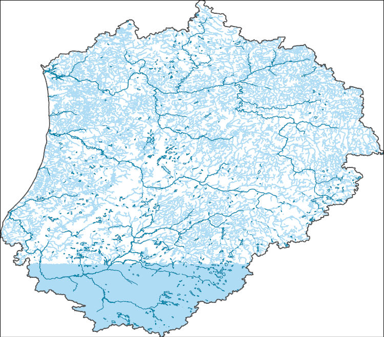
The High Resolution National Hydrography Dataset Plus (NHDPlus HR) is an integrated set of geospatial data layers, including the best available National Hydrography Dataset (NHD), the 10-meter 3D Elevation Program Digital Elevation Model (3DEP DEM), and the National Watershed Boundary Dataset (WBD). The NHDPlus HR combines the NHD, 3DEP DEMs, and WBD to create a stream network with linear referencing, feature naming, "value added attributes" (VAAs), elevation-derived catchments, and other features for hydrologic data analysis. The stream network with linear referencing is a system of data relationships applied to hydrographic systems so that one stream reach "flows" into another and "events" can be tied to and traced...
This dataset is part of the U.S. Geological Survey (USGS) Great Lakes Coastal Wetland Restoration Assessment (GLCWRA) initiative. These data represent the flowline network in the Upper Peninsula Restoration Assessment (UPRA). It is attributed with the number of disconnections (e.g., road crossings) between the reach and Lake Ontario. The more road crossings on a flowline the more disconnected that area is from the lake and the less suitable it will be for restoration. These data help identify the condition of hydrologic separation between potential restoration areas and Lake Ontario. Low numbers represent fewer disconnections, such as culverts, between the reach and the water body requiring no flow network modification...
Types: GeoTIFF,
Map Service,
OGC WFS Layer,
OGC WMS Layer,
OGC WMS Service;
Tags: Chippewa,
Ecology,
Great Lakes,
Holocene,
Hydrology,
Peak-flow frequency analysis is crucial in various water-resources management applications, including floodplain management and critical structure design. Federal guidelines for peak-flow frequency analyses, provided in Bulletin 17C, assume that the statistical properties of the hydrologic processes driving variability in peak flows do not change over time and so the frequency distribution of annual peak flows is stationary. Better understanding of long-term climatic persistence and further consideration of potential climate and land-use changes have caused the assumption of stationarity to be reexamined. This data release contains input data and results of a study investigating hydroclimatic trends in peak streamflow...
Fisheries monitoring data detailing the lengths and or ages of fish caught during state agency fisheries surveys. These data were collected and shared with our team from: Iowa Department of Natural Resources, Illinois Department of Natural Resources, Indiana Department of Natural Resources, Michigan Department of Natural Resources, Minnesota Department of Natural Resources, South Dakota Game, Fish and Parks, and Wisconsin Department of Natural Resources. Data include length and age data for seven sport fish species: black crappie (Pomoxis nigromaculatus), bluegill (Lepomis macrochirus), largemouth bass (Micropterus salmoides), northern pike (Esox lucius), smallmouth bass (Micropterus dolomieu), walleye (Sander vitreus),...

The High Resolution National Hydrography Dataset Plus (NHDPlus HR) is an integrated set of geospatial data layers, including the best available National Hydrography Dataset (NHD), the 10-meter 3D Elevation Program Digital Elevation Model (3DEP DEM), and the National Watershed Boundary Dataset (WBD). The NHDPlus HR combines the NHD, 3DEP DEMs, and WBD to create a stream network with linear referencing, feature naming, "value added attributes" (VAAs), elevation-derived catchments, and other features for hydrologic data analysis. The stream network with linear referencing is a system of data relationships applied to hydrographic systems so that one stream reach "flows" into another and "events" can be tied to and traced...
The U.S. Geological Survey (USGS), in cooperation with the Illinois Center for Transportation and the Illinois Department of Transportation, prepared hydro-conditioned geographic information systems (GIS) layers for use in the Illinois StreamStats application. These data were used to delineate drainage basins and compute basin characteristics for updated peak flow and flow duration regression equations for Illinois. This dataset consists of raster grid files for elevation (dem), flow accumulation (fac), flow direction (fdr), and stream definition (str900) for each 8-digit Hydrologic Unit Code (HUC) area in Illinois merged into a single dataset. There are 51 full or partial HUC 8s represented by this data set: 04040002,...
Note: this data release is currently being revised and is temporarily unavailable. This data release is a compilation of the locations of airborne geophysical surveys in the United States. The inventory documents public airborne geophysical surveys primarily flown by or contracted by the USGS from 1943 to present. In addition, surveys from the State of Alaska, Department of Natural Resources, Division of Geological and Geophysical Surveys (DGGS): Airborne GeophysWeb, the Bureau of Land Management, the Department of Energy and other state agencies have also been included. The surveys have contributed to studies under USGS programs including Water, Geologic Mapping, Minerals, Energy, Environmental Health, Ecosystems,...
Categories: Data,
Data Release - Under Revision;
Types: ArcGIS REST Map Service,
ArcGIS Service Definition,
Downloadable,
Map Service;
Tags: Alabama,
Alaska,
Arizona,
Arkansas,
California,
Chronic Wasting Disease distribution in the United States by state and county (ver. 2.0, April 2024)
Chronic Wasting Disease (CWD) is a fatal, contagious, neuro-degenerative disease affecting multiple members of the Family Cervidae. First detected in 1967, the disease has, as of April 2024, been documented in free-ranging and/or captive cervid populations in 33 states, five Canadian provinces, the Republic of South Korea, Norway, Sweden, and Finland. The data provided here contains information on the known, available, documented distribution of CWD in the United States that is current as of the publication date. The USGS National Wildlife Health Center (NWHC) tracks changes to the known distribution of CWD in the form of a map (available on the NWHC website at https://www.usgs.gov/centers/nwhc/science/expanding-distribution-chronic-wasting-disease....
Categories: Data,
Data Release - Revised;
Types: Citation;
Tags: Alabama,
Alaska,
American Samoa,
Arizona,
Arkansas,

The High Resolution National Hydrography Dataset Plus (NHDPlus HR) is an integrated set of geospatial data layers, including the best available National Hydrography Dataset (NHD), the 10-meter 3D Elevation Program Digital Elevation Model (3DEP DEM), and the National Watershed Boundary Dataset (WBD). The NHDPlus HR combines the NHD, 3DEP DEMs, and WBD to create a stream network with linear referencing, feature naming, "value added attributes" (VAAs), elevation-derived catchments, and other features for hydrologic data analysis. The stream network with linear referencing is a system of data relationships applied to hydrographic systems so that one stream reach "flows" into another and "events" can be tied to and traced...
Phosphorus, nitrogen, and suspended-sediment loads, in 24 U.S. tributaries of the Great Lakes, were calculated using U.S. Geological Survey (USGS) data from the Great Lakes Restoration Initiative (GLRI) monitoring program for the period Oct 2010 through Sept 2020 (USGS water years 2011–2020). Total phosphorus, orthophosphate, particulate phosphorus, total nitrogen, nitrate plus nitrite, ammonium plus ammonia, and suspended-sediment loads and changes in loads were determined by applying a weighted regression approach called WRTDS (Weighted Regression on Time, Discharge, and Season). The load results represent the total mass of nitrogen, phosphorus, and suspended sediment exported downstream at each tributary site....
Categories: Data;
Types: Map Service,
OGC WFS Layer,
OGC WMS Layer,
OGC WMS Service;
Tags: Great Lakes Watershed,
Indiana,
Kalman filtering,
Michigan,
Minnesota,

The High Resolution National Hydrography Dataset Plus (NHDPlus HR) is an integrated set of geospatial data layers, including the best available National Hydrography Dataset (NHD), the 10-meter 3D Elevation Program Digital Elevation Model (3DEP DEM), and the National Watershed Boundary Dataset (WBD). The NHDPlus HR combines the NHD, 3DEP DEMs, and WBD to create a stream network with linear referencing, feature naming, "value added attributes" (VAAs), elevation-derived catchments, and other features for hydrologic data analysis. The stream network with linear referencing is a system of data relationships applied to hydrographic systems so that one stream reach "flows" into another and "events" can be tied to and traced...
The geochemical data included here were generated as part of the Earth Mapping Resources Initiative (Earth MRI), which was developed by the U.S. Geological Survey (USGS) in response to a Federal directive calling on various Federal agencies to address potential vulnerabilities in the Nation’s supply of critical mineral resources. Earth MRI is a partnership between the USGS, State Geological Surveys, and industry coordinating with other federal agencies to accomplish the mission. The primary purpose of this initiative is to identify potentially mineralized areas containing critical minerals by gathering new basic geologic data about the United States and its territories and to make these data publicly available through...
Categories: Data,
Data Release - Revised;
Types: Downloadable,
Map Service,
OGC WFS Layer,
OGC WMS Layer,
OGC WMS Service,
Shapefile;
Tags: Alabama,
Alaska,
Alaska Division of Geological & Geophysical Surveys,
Arizona,
Arizona Geological Survey,
These data were collected by a SonTek Argonaut-XR 3000-MHz 3D acoustic Doppler current meter (ADCM) that was mounted on an approximately 75-pound mounting plate. The ADCM was deployed on the bottom of River Raisin at approximately 41.899978°N, -83.353548°E and took measurements from August 17-September 13, 2023. These data were collected in cooperation with U.S. Environmental Protection Agency (USEPA), to provide them with data that may help them better understand water velocities caused by river currents, ship traffic, or anything else that could cause the erosion of a 'cap' installed on the river bed that was designed to prevent the dispersion of contaminated soil. In reviewing the data it was noticed that on...
The Maumee River transports huge loads of nitrogen (N) and phosphorus (P) to Lake Erie. The increased concentrations of N and P are causing eutrophication of the lake, creating hypoxic zones, and contributing to phytoplankton blooms. It is hypothesized that the P loads are a major contributor to harmful algal blooms that occur in the western basin of Lake Erie, particularly in summer. The Maumee River has been identified by the United States Environmental Protection Agency as a priority watershed where action needs to be taken to reduce nutrient loads. This study quantified rates of biogeochemical processes affecting downstream flux of N and P by 1) measuring indices of potential sediment P retention and 2) measuring...
Categories: Data,
Data Release - Revised;
Tags: Fort Wayne,
Indiana,
Maumee River,
Maumee River Basin,
Michigan,

The High Resolution National Hydrography Dataset Plus (NHDPlus HR) is an integrated set of geospatial data layers, including the best available National Hydrography Dataset (NHD), the 10-meter 3D Elevation Program Digital Elevation Model (3DEP DEM), and the National Watershed Boundary Dataset (WBD). The NHDPlus HR combines the NHD, 3DEP DEMs, and WBD to create a stream network with linear referencing, feature naming, "value added attributes" (VAAs), elevation-derived catchments, and other features for hydrologic data analysis. The stream network with linear referencing is a system of data relationships applied to hydrographic systems so that one stream reach "flows" into another and "events" can be tied to and traced...

The High Resolution National Hydrography Dataset Plus (NHDPlus HR) is an integrated set of geospatial data layers, including the best available National Hydrography Dataset (NHD), the 10-meter 3D Elevation Program Digital Elevation Model (3DEP DEM), and the National Watershed Boundary Dataset (WBD). The NHDPlus HR combines the NHD, 3DEP DEMs, and WBD to create a stream network with linear referencing, feature naming, "value added attributes" (VAAs), elevation-derived catchments, and other features for hydrologic data analysis. The stream network with linear referencing is a system of data relationships applied to hydrographic systems so that one stream reach "flows" into another and "events" can be tied to and traced...
The Maumee River transports huge loads of nitrogen (N) and phosphorus (P) to Lake Erie. The increased concentrations of N and P are causing eutrophication of the lake, creating hypoxic zones, and contributing to phytoplankton blooms. It is hypothesized that the P loads are a major contributor to harmful algal blooms that occur in the western basin of Lake Erie, particularly in summer. The Maumee River has been identified by the United States Environmental Protection Agency as a priority watershed where action needs to be taken to reduce nutrient loads. This study quantified rates of biogeochemical processes affecting downstream flux of N and P by 1) measuring indices of potential sediment P retention and 2) measuring...
The High Resolution National Hydrography Dataset Plus (NHDPlus HR) is an integrated set of geospatial data layers, including the best available National Hydrography Dataset (NHD), the 10-meter 3D Elevation Program Digital Elevation Model (3DEP DEM), and the National Watershed Boundary Dataset (WBD). The NHDPlus HR combines the NHD, 3DEP DEMs, and WBD to create a stream network with linear referencing, feature naming, "value added attributes" (VAAs), elevation-derived catchments, and other features for hydrologic data analysis. The stream network with linear referencing is a system of data relationships applied to hydrographic systems so that one stream reach "flows" into another and "events" can be tied to and traced...
|

|
