Filters: Tags: Mojave (X)
224 results (69ms)|
Filters
Date Range
Extensions (Less) Types (Less)
Contacts (Less)
Categories (Less) Tag Types
|
This dataset consists of 65 magnetotelluric (MT) stations collected in 2015 near Mountain Pass, California. The U.S. Geological Survey acquired these data to create a regional conductivity model near the Mountain Pass mine. This work is in support of characterizing mineral deposits.
This dataset consists of 65 magnetotelluric (MT) stations collected in 2015 near Mountain Pass, California. The U.S. Geological Survey acquired these data to create a regional conductivity model near the Mountain Pass mine. This work is in support of characterizing mineral deposits.
This dataset consists of 65 magnetotelluric (MT) stations collected in 2015 near Mountain Pass, California. The U.S. Geological Survey acquired these data to create a regional conductivity model near the Mountain Pass mine. This work is in support of characterizing mineral deposits.
This dataset consists of 65 magnetotelluric (MT) stations collected in 2015 near Mountain Pass, California. The U.S. Geological Survey acquired these data to create a regional conductivity model near the Mountain Pass mine. This work is in support of characterizing mineral deposits.
This dataset consists of 65 magnetotelluric (MT) stations collected in 2015 near Mountain Pass, California. The U.S. Geological Survey acquired these data to create a regional conductivity model near the Mountain Pass mine. This work is in support of characterizing mineral deposits.
The RCMAP (Rangeland Condition Monitoring Assessment and Projection) dataset quantifies the percent cover of rangeland components across the western U.S. using Landsat imagery from 1985-2021. The RCMAP product suite consists of nine fractional components: annual herbaceous, bare ground, herbaceous, litter, non-sagebrush shrub, perennial herbaceous, sagebrush, shrub, and tree, in addition to the temporal trends of each component. Several enhancements were made to the RCMAP process relative to prior generations. First, we have trained time-series predictions directly from 331 high-resolution sites collected from 2013-2018 from Assessment, Inventory, and Monitoring (AIM) instead of using the 2016 “base” map as an intermediary....
As part of a research study in cooperation with the U.S. Environmental Protection Agency (EPA) and the U.S. Army at Fort Irwin National Training Center, the U.S. Geological Survey (USGS) evaluated unsaturated zone soil property data of cores from a borehole for a newly drilled monitoring well near a dry well and Four-plex baseball field. Cores were continuous from land surface down to 240 feet below land surface and were drilled by consultants to EPA using sonic rotary–a fluidless drilling technique. Data on this page consist of: 1) field drilling notes from USGS and consultants to EPA (GeoSystems Analysis, Inc., Tucson, Arizona); 2) field descriptions of core lithology–including grain size, sorting, color, mineralogy,...
Categories: Data;
Types: Map Service,
OGC WFS Layer,
OGC WMS Layer,
OGC WMS Service;
Tags: Fort Irwin,
Mojave,
San Bernardino,
environment,
geoscientificInformation,
As part of a larger groundwater research study conducted at the U.S. Army Fort Irwin National Training Center (NTC), located approximately 35 miles north-northeast of Barstow, California, the U.S. Environmental Protection Agency (EPA), the U.S. Army, and the U.S. Geological Survey (USGS) have cooperated to evaluate unsaturated zone soil property data of cores from the borehole for a newly drilled monitoring well (ESW2B). Specific horizons of interest were identified and selected for detailed grain-size distribution analysis using the Fritsch Analysette A28 Image Sizer (particle analyzer) located at the USGS California Water Science Center (CAWSC) in San Diego, CA. The particle analyzer identified circularity and...
Categories: Data;
Types: Map Service,
OGC WFS Layer,
OGC WMS Layer,
OGC WMS Service;
Tags: Fort Irwin,
Mojave,
San Bernardino,
environment,
geoscientificInformation,
These datasets were developed to represent the geographic distribution of Plantago ovata in the Mojave Desert. This data release consists of two raster spatial layers (GeoTIFF) reflecting predicted habitat for the species within the Mojave Desert and the standard error in predictions. The habitat layer (raster dataset) is a continuous probability distribution of suitable habitat where values range from 0 (very low probability of species occurrence) to 1 (very high probability of species occurrence). An additional raster dataset provides the standard error in habitat predictions calculated among alternative habitat models: users should evaluate both the habitat and standard error datasets and exercise prudence when...
Preserving native species diversity is fundamental to ecosystem conservation. Selecting appropriate native species for use in restoration is a critical component of project design and may emphasize species attributes such as life history, functional type, pollinator services, and nutritional value for wildlife. Determining which species are likely to establish and persist in a particular environment is a key consideration. Species distribution models (SDMs) characterize relationships between species occurrences and the physical environment (e.g., climate, soil, topographic relief) and provide a mechanism for assessing which species may successfully propagate at a restoration site. In conjunction with information...
Categories: Data;
Types: Downloadable,
GeoTIFF,
Map Service,
Raster;
Tags: Arizona,
California,
Mojave,
Nevada,
Utah,
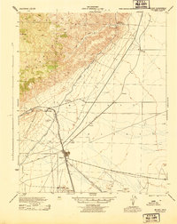
USGS Historical Quadrangle in GeoPDF.
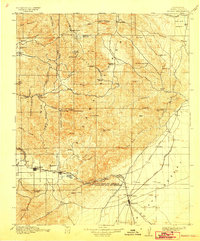
USGS Historical Quadrangle in GeoPDF.
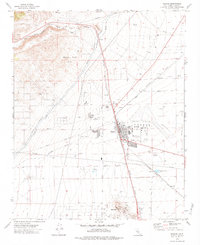
USGS Historical Quadrangle in GeoPDF.
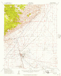
USGS Historical Quadrangle in GeoPDF.
This dataset consists of 65 magnetotelluric (MT) stations collected in 2015 near Mountain Pass, California. The U.S. Geological Survey acquired these data to create a regional conductivity model near the Mountain Pass mine. This work is in support of characterizing mineral deposits.
This dataset consists of 65 magnetotelluric (MT) stations collected in 2015 near Mountain Pass, California. The U.S. Geological Survey acquired these data to create a regional conductivity model near the Mountain Pass mine. This work is in support of characterizing mineral deposits.
This dataset consists of 65 magnetotelluric (MT) stations collected in 2015 near Mountain Pass, California. The U.S. Geological Survey acquired these data to create a regional conductivity model near the Mountain Pass mine. This work is in support of characterizing mineral deposits.
This dataset consists of 65 magnetotelluric (MT) stations collected in 2015 near Mountain Pass, California. The U.S. Geological Survey acquired these data to create a regional conductivity model near the Mountain Pass mine. This work is in support of characterizing mineral deposits.
|

|
