Filters: Tags: Monterey County (X) > Date Range: {"choice":"year"} (X)
49 results (26ms)|
Filters
Date Types (for Date Range)
Types
Contacts
Categories Tag Types Tag Schemes
|

These data were released prior to the October 1, 2016 effective date for the USGS’s policy dictating the review, approval, and release of scientific data as referenced in USGS Survey Manual Chapter 502.8 Fundamental Science Practices: Review and Approval of Scientific Data for Release. This digital dataset defines the spring 1961 water-table altitude for the California's Central Valley. It was used to initiate the water-level altitudes for the upper zones of the transient hydrologic model of the Central Valley flow system. The Central Valley encompasses an approximate 50,000 square-kilometer region of California. The complex hydrologic system of the Central Valley is simulated using the USGS numerical modeling...

These data were released prior to the October 1, 2016 effective date for the USGS’s policy dictating the review, approval, and release of scientific data as referenced in USGS Survey Manual Chapter 502.8 Fundamental Science Practices: Review and Approval of Scientific Data for Release. This digital dataset defines the model grid and altitudes of the top of the 10 model layers and base of the model simulated in the transient hydrologic model of the Central Valley flow system. The Central Valley encompasses an approximate 50,000 square-kilometer region of California. The complex hydrologic system of the Central Valley is simulated using the USGS numerical modeling code MODFLOW-FMP (Schmid and others, 2006), which...

These data were released prior to the October 1, 2016 effective date for the USGS’s policy dictating the review, approval, and release of scientific data as referenced in USGS Survey Manual Chapter 502.8 Fundamental Science Practices: Review and Approval of Scientific Data for Release. This digital dataset contains the surface-water network for the Central Valley Hydrologic Model (CVHM). The Central Valley encompasses an approximate 50,000-square-kilometer region of California. The complex hydrologic system of the Central Valley is simulated using the USGS numerical modeling code MODFLOW-FMP (Schmid and others, 2006). This simulation is referred to here as the CVHM (Faunt, 2009). Utilizing MODFLOW-FMP, the CVHM...
This data release presents beach topography and nearshore bathymetry data from repeated surveys in northern Monterey Bay, California to document changes in shoreline position and coastal morphology as they relate to episodic (storms), seasonal, and interannual and longer (e.g. El Niño) processes. The ongoing monitoring program was initiated in October 2014 with semi-annual surveys performed in late summer (September or October) and Spring (March). Nearshore bathymetry and topography data were collected along a series of shore-perpendicular transects spaced primarily at 50-250 m intervals between Santa Cruz and Moss Landing, California (fig. 1). The transects were located along sandy stretches of the coastline...
Categories: Data;
Types: Map Service,
OGC WFS Layer,
OGC WMS Layer,
OGC WMS Service;
Tags: Bathymetry and Elevation,
CMGP,
Coastal and Marine Geology Program,
Echo Sounders,
GPS (Global Positioning System),

The High Resolution National Hydrography Dataset Plus (NHDPlus HR) is an integrated set of geospatial data layers, including the best available National Hydrography Dataset (NHD), the 10-meter 3D Elevation Program Digital Elevation Model (3DEP DEM), and the National Watershed Boundary Dataset (WBD). The NHDPlus HR combines the NHD, 3DEP DEMs, and WBD to create a stream network with linear referencing, feature naming, "value added attributes" (VAAs), elevation-derived catchments, and other features for hydrologic data analysis. The stream network with linear referencing is a system of data relationships applied to hydrographic systems so that one stream reach "flows" into another and "events" can be tied to and traced...

These data were released prior to the October 1, 2016 effective date for the USGS’s policy dictating the review, approval, and release of scientific data as referenced in USGS Survey Manual Chapter 502.8 Fundamental Science Practices: Review and Approval of Scientific Data for Release. This digital dataset contains the virtual wells used for urban (municipal and industrial use) pumpage for the Central Valley Hydrologic Model (CVHM). The Central Valley encompasses an approximate 50,000 square-kilometer region of California. The complex hydrologic system of the Central Valley is simulated using the U.S. Geological Survey (USGS) numerical modeling code MODFLOW-FMP (Schmid and others, 2006). This application is referred...
Rainfall measurements were collected in and near the Dolan Fire burn area, Los Padres National Forest, California. The CZU Fire ignited in Los Padres National Forest, California, on August 18, 2020. By the time of full containment on December 31, 2020, the fire had burned 518 km2 (128,050 acres) in Monterey County. The U.S. Geological Survey (USGS) installed seven rain gages in and near the Dolan Fire burn area in October 2021 to measure rainfall during two post-fire wet seasons. This data release contains rain records from the Mill Creek and upper Nacimiento River watersheds collected during water year 2023 (October 1, 2022, through spring 2023). Previous datasets from this region included an additional rain gage...
Categories: Data;
Tags: CMHRP,
Climatology,
Coastal and Marine Hazards and Resources Program,
Monterey County,
PCMSC,
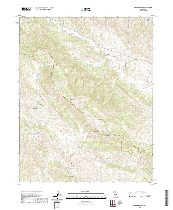
Layered geospatial PDF 7.5 Minute Quadrangle Map. Layers of geospatial data include orthoimagery, roads, grids, geographic names, elevation contours, hydrography, and other selected map features. This map is derived from GIS (geospatial information system) data. It represents a repackaging of GIS data in traditional map form, not creation of new information. The geospatial data in this map are from selected National Map data holdings and other government sources.

These data were released prior to the October 1, 2016 effective date for the USGS’s policy dictating the review, approval, and release of scientific data as referenced in USGS Survey Manual Chapter 502.8 Fundamental Science Practices: Review and Approval of Scientific Data for Release. This digital dataset defines the model grid, active cells in model layers 2 and 3, and geologic province arrays of the ZONE package used in the transient hydrologic model of the Central Valley flow system. The Central Valley encompasses an approximate 50,000 square-kilometer region of California. The complex hydrologic system of the Central Valley is simulated using the USGS numerical modeling code MODFLOW-FMP (Schmid and others,...

These data were released prior to the October 1, 2016 effective date for the USGS’s policy dictating the review, approval, and release of scientific data as referenced in USGS Survey Manual Chapter 502.8 Fundamental Science Practices: Review and Approval of Scientific Data for Release. This digital dataset contains the monthly precipitation for the Central Valley Hydrologic Model (CVHM). The Central Valley encompasses an approximate 50,000 square-kilometer region of California. The complex hydrologic system of the Central Valley is simulated using the U.S. Geological Survey (USGS) numerical modeling code MODFLOW-FMP (Schmid and others, 2006). This simulation is referred to here as the CVHM (Faunt, 2009). Utilizing...

These data were released prior to the October 1, 2016 effective date for the USGS’s policy dictating the review, approval, and release of scientific data as referenced in USGS Survey Manual Chapter 502.8 Fundamental Science Practices: Review and Approval of Scientific Data for Release. This digital dataset contains the monthly urban (municipal and industrial use) pumpage for the Central Valley Hydrologic Model (CVHM) by Water Balance Subregion (WBS). The Central Valley encompasses an approximate 50,000 square-kilometer region of California. The complex hydrologic system of the Central Valley is simulated using the U.S. Geological Survey(USGS) numerical modeling code MODFLOW-FMP (Schmid and others, 2006). This application...

These data were released prior to the October 1, 2016 effective date for the USGS’s policy dictating the review, approval, and release of scientific data as referenced in USGS Survey Manual Chapter 502.8 Fundamental Science Practices: Review and Approval of Scientific Data for Release. This digital dataset contains the locations of, and links to USGS gages on the surface-water network for the Central Valley Hydrologic Model (CVHM). The Central Valley encompasses an approximate 50,000 square-kilometer region of California. The complex hydrologic system of the Central Valley is simulated using the USGS numerical modeling code MODFLOW-FMP (Schmidt and others, 2006b). This simulation is referred to here as the CVHM...

These data were released prior to the October 1, 2016 effective date for the USGS’s policy dictating the review, approval, and release of scientific data as referenced in USGS Survey Manual Chapter 502.8 Fundamental Science Practices: Review and Approval of Scientific Data for Release. This digital dataset contains the name and location for the diversions from the surface-water network for the Central Valley Hydrologic Model (CVHM). The Central Valley encompasses an approximate 50,000 square-kilometer region of California. The complex hydrologic system of the Central Valley is simulated using the USGS numerical modeling code MODFLOW-FMP (Schmid and others, 2006). This simulation is referred to here as the CVHM...
This digital dataset contains the surface water operational data used for the Salinas Valley Operational Model (SVOM) including the time series data and the operational rules. While much of the input data is shared between the Salinas Valley Operational Model (SVOM) and the Salinas Valley Integrated Hydrologic Model (SVIHM), the SVOM has additional input data specific to the purpose and function of the model. This digital dataset contains the datasets related to agricultural and municipal water supply and groundwater in the Lower Salinas Valley Hydrologic Models, including the Salinas Valley Operational Model (SVOM) and the Salinas Valley Integrated Hydrologic Model (SVIHM). Groundwater inflow and outflow data include...
Categories: Data,
Data Release - Revised;
Tags: California,
Monterey County,
Salinas,
San Luis Obispo County,
USGS Science Data Catalog (SDC),
Tabular data output from a series of groundwater modeling simulations for five counties along the Central Coast of California, USA. We used a spatially explicit state-and-transition simulation model with stocks and flows that integrates climate, land-use change, human water use, and groundwater gain-loss to examine the impact of future climate and land use change on groundwater balance and water demand at 270-m resolution from 2010 to 2060. The model incorporated downscaled groundwater recharge projections based on a Warm/Wet and a Hot/Dry climate future using output from the Basin Characterization Model, a spatially explicit hydrological process-based model. Two urbanization projections from a parcel-based, regional...
The California Groundwater Ambient Monitoring and Assessment Program Priority Basin Project (GAMA-PBP) analyzed for per-and polyfluoroalkyl substances (PFAS) in groundwater samples collected from domestic and public drinking water supply wells in California. GAMA-PBP is a cooperative program between the U.S. Geological Survey and the California State Water Resources Control Board. This data release contains data for samples collected from May 2019 through December 2022 and includes revisions to earlier data (Kent, 2021) that were either screened or removed after analysis of quality-control data. Please see the quality-control and other descriptions of the data in the processing steps in the xml file. Subsequent...
This digital dataset contains the monthly inflows and diversions to the surface-water network in the updated Central Valley Hydrologic Model (CVHM2) for water years 1922-2019. The surface-water network simulates the Central Valley’s complex conveyance network through the Streamflow Routing Package (SFR2) and the Farm-Process (FMP4) at 65 inflow locations with 271 stream segments and 13 bifurcations, and 571 diversion locations providing 564 of semi-routed diversions and 7 non-routed diversions. The semi-routed deliveries are routed through the simulated surface-water network, while the non-routed delivery is simulated through linkages between the SFR2 and FMP4 packages in MODFLOW-OWHM. Surface water data for CVHM2...

These data were released prior to the October 1, 2016 effective date for the USGS’s policy dictating the review, approval, and release of scientific data as referenced in USGS Survey Manual Chapter 502.8 Fundamental Science Practices: Review and Approval of Scientific Data for Release. This digital dataset contains the categories used to classify the basin-fill deposits in the Central Valley as either coarse-grained or fine-grained deposits. This classification was used to develop the texture model which was used as input data for the hydraulic properties portion of the Central Valley Hydrologic Model (CVHM). The Central Valley encompasses an approximate 50,000 square-kilometer region of California. The complex...

These data were released prior to the October 1, 2016 effective date for the USGS’s policy dictating the review, approval, and release of scientific data as referenced in USGS Survey Manual Chapter 502.8 Fundamental Science Practices: Review and Approval of Scientific Data for Release. This digital dataset contains the percentage of coarse-grained deposits in wells in 15 meter increments and the percentage of coarse-grained deposits in texture model lattice points interpolated from the well data for the Central Valley. The texture model was used as input data for the hydraulic properties portion of the Central Valley Hydrologic Model (CVHM). The Central Valley encompasses an approximate 50,000 square-kilometer...

These data were released prior to the October 1, 2016 effective date for the USGS’s policy dictating the review, approval, and release of scientific data as referenced in USGS Survey Manual Chapter 502.8 Fundamental Science Practices: Review and Approval of Scientific Data for Release. This digital dataset contains the compaction data for 24 extensometers used for observations in the Central Valley Hydrologic Model (CVHM). The Central Valley encompasses an approximate 50,000 square-kilometer region of California. The complex hydrologic system of the Central Valley is simulated using the USGS numerical modeling code MODFLOW-FMP (Schmid and others, 2006). This simulation is referred to here as the CVHM (Faunt, 2009)....
|

|
