Filters
Date Range
Extensions
Types
Contacts
Categories
Tag Types
Tag Schemes
|
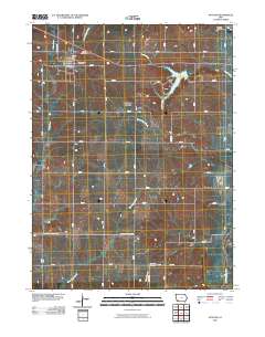
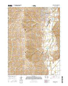
Layered GeoPDF 7.5 Minute Quadrangle Map. Layers of geospatial data include orthoimagery, roads, grids, geographic names, elevation contours, hydrography, and other selected map features.
Tags: 7.5 x 7.5 minute,
Downloadable Data,
EarthCover,
GeoPDF,
Imagery and Base Maps, All tags...
Iowa,
Map,
Montgomery,
Page,
Stanton, IA,
U.S. National Grid,
US,
US Topo,
US Topo Historical,
United States,
contour,
geographic names,
hydrography,
orthoimage,
topographic,
transportation, Fewer tags
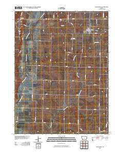
Layered GeoPDF 7.5 Minute Quadrangle Map. Layers of geospatial data include orthoimagery, roads, grids, geographic names, elevation contours, hydrography, and other selected map features.
Tags: 7.5 x 7.5 minute,
Downloadable Data,
EarthCover,
GeoPDF,
Imagery and Base Maps, All tags...
Iowa,
Map,
New Market, IA,
Page,
Taylor,
U.S. National Grid,
US,
US Topo,
US Topo Historical,
United States,
contour,
geographic names,
hydrography,
orthoimage,
topographic,
transportation, Fewer tags
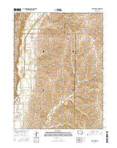
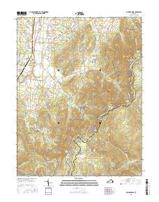
Layered GeoPDF 7.5 Minute Quadrangle Map. Layers of geospatial data include orthoimagery, roads, grids, geographic names, elevation contours, hydrography, and other selected map features.
Tags: 7.5 x 7.5 minute,
Downloadable Data,
EarthCover,
GeoPDF,
Imagery and Base Maps, All tags...
Iowa,
Map,
New Market, IA,
Page,
Public Land Survey System,
Taylor,
U.S. National Grid,
US,
US Topo,
US Topo Historical,
United States,
boundary,
contour,
geographic names,
hydrography,
imageryBaseMapsEarthCover,
orthoimage,
structures,
topographic,
transportation,
woodland, Fewer tags
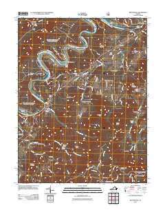
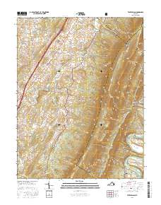
Layered GeoPDF 7.5 Minute Quadrangle Map. Layers of geospatial data include orthoimagery, roads, grids, geographic names, elevation contours, hydrography, and other selected map features.
Tags: 7.5 x 7.5 minute,
Bentonville, VA,
Downloadable Data,
EarthCover,
GeoPDF, All tags...
Imagery and Base Maps,
Map,
Page,
Rappahannock,
Shenandoah,
U.S. National Grid,
US,
US Topo,
US Topo Historical,
United States,
Virginia,
Warren,
contour,
geographic names,
hydrography,
imageryBaseMapsEarthCover,
orthoimage,
structures,
topographic,
transportation, Fewer tags
Layered GeoPDF 7.5 Minute Quadrangle Map. Layers of geospatial data include orthoimagery, roads, grids, geographic names, elevation contours, hydrography, and other selected map features.
Tags: 7.5 x 7.5 minute,
Clarinda South, IA,
Downloadable Data,
EarthCover,
GeoPDF, All tags...
Imagery and Base Maps,
Iowa,
Map,
Page,
Public Land Survey System,
U.S. National Grid,
US,
US Topo,
US Topo Historical,
United States,
boundary,
contour,
geographic names,
hydrography,
imageryBaseMapsEarthCover,
orthoimage,
structures,
topographic,
transportation,
woodland, Fewer tags
Layered geospatial PDF Map. Layers of geospatial data include orthoimagery, roads, grids, geographic names, elevation contours, hydrography, and other selected map features.
Tags: 7.5 x 7.5 minute,
Big Meadows, VA,
Downloadable Data,
EarthCover,
GeoPDF, All tags...
Imagery and Base Maps,
Madison,
Map,
Page,
Public Land Survey System,
U.S. National Grid,
US,
US Topo,
US Topo Historical,
United States,
Virginia,
boundary,
contour,
geographic names,
hydrography,
imageryBaseMapsEarthCover,
orthoimage,
structures,
topographic,
transportation,
woodland, Fewer tags
Layered geospatial PDF Map. Layers of geospatial data include orthoimagery, roads, grids, geographic names, elevation contours, hydrography, and other selected map features.
Tags: 7.5 x 7.5 minute,
Downloadable Data,
EarthCover,
GeoPDF,
Imagery and Base Maps, All tags...
Map,
Page,
Public Land Survey System,
Rockingham,
Shenandoah,
Tenth Legion, VA,
U.S. National Grid,
US,
US Topo,
US Topo Historical,
United States,
Virginia,
boundary,
contour,
geographic names,
hydrography,
imageryBaseMapsEarthCover,
orthoimage,
structures,
topographic,
transportation,
woodland, Fewer tags
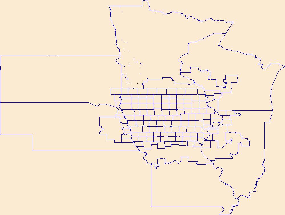
Geospatial data is comprised of government boundaries.
Tags: Adair,
Adams,
Allamakee,
Appanoose,
Audubon, All tags...
Benton,
Black Hawk,
Boone,
Boundaries,
Bremer,
Buchanan,
Buena Vista,
Butler,
Calhoun,
Carroll,
Cass,
Cedar,
Cerro Gordo,
Cherokee,
Chickasaw,
Clarke,
Clay,
Clayton,
Clinton,
County or Equivalent,
Crawford,
Dallas,
Davis,
Decatur,
Delaware,
Des Moines,
Dickinson,
Downloadable Data,
Dubuque,
Emmet,
Esri Shapefile nan,
Fayette,
Floyd,
Franklin,
Fremont,
Greene,
Grundy,
Guthrie,
Hamilton,
Hancock,
Hardin,
Harrison,
Henry,
Howard,
Humboldt,
IA,
Ida,
Incorporated Place,
Iowa,
Iowa,
Jackson,
Jasper,
Jefferson,
Johnson,
Jones,
Jurisdictional,
Keokuk,
Kossuth,
Lee,
Linn,
Louisa,
Lucas,
Lyon,
Madison,
Mahaska,
Marion,
Marshall,
Mills,
Minor Civil Division,
Mitchell,
Monona,
Monroe,
Montgomery,
Muscatine,
National Boundary Dataset (NBD),
National Boundary Dataset (NBD),
Native American Area,
O'Brien,
Osceola,
PLSS First Division,
PLSS Special Survey,
PLSS Township,
Page,
Palo Alto,
Plymouth,
Pocahontas,
Polk,
Pottawattamie,
Poweshiek,
Public Land Survey System,
Reserve,
Ringgold,
Sac,
Scott,
Shapefile,
Shelby,
Sioux,
State,
State,
State or Territory,
Story,
Tama,
Taylor,
U.S. National Grid,
US,
Unincorporated Place,
Union,
United States,
Van Buren,
Wapello,
Warren,
Washington,
Wayne,
Webster,
Winnebago,
Winneshiek,
Woodbury,
Worth,
Wright,
boundaries,
boundary,
cadastral surveys,
geographic names,
land ownership,
land use maps,
legal land descriptions,
political and administrative boundaries,
zoning maps, Fewer tags
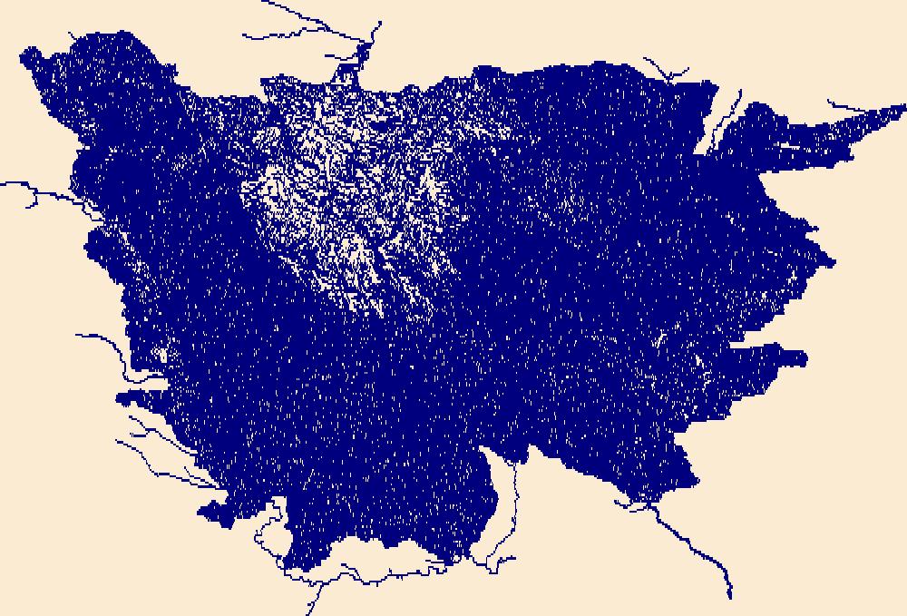
Geospatial data includes structures and other selected map features.
Tags: Adair,
Adams,
Allamakee,
Appanoose,
Audubon, All tags...
Benton,
Black Hawk,
Boone,
Bremer,
Buchanan,
Buena Vista,
Butler,
Calhoun,
Campground,
Carroll,
Cass,
Cedar,
Cerro Gordo,
Cherokee,
Chickasaw,
Clarke,
Clay,
Clayton,
Clinton,
College / University,
Courthouse,
Crawford,
Dallas,
Davis,
Decatur,
Delaware,
Des Moines,
Dickinson,
Downloadable Data,
Dubuque,
Emmet,
Fayette,
Fire Station/ EMS Station,
Floyd,
Franklin,
Fremont,
GeoPackage,
Greene,
Grundy,
Guthrie,
Hamilton,
Hancock,
Hardin,
Harrison,
Henry,
Hospital/Medical Center,
Howard,
Humboldt,
IA,
Ida,
Information Center,
Iowa,
Iowa,
Jackson,
Jasper,
Jefferson,
Johnson,
Jones,
Keokuk,
Kossuth,
Law Enforcement,
Lee,
Linn,
Louisa,
Lucas,
Lyon,
Madison,
Mahaska,
Marion,
Marshall,
Mills,
Mitchell,
Monona,
Monroe,
Montgomery,
Muscatine,
National Structures Dataset (NSD),
National Structures Dataset (NSD),
O'Brien,
Open Geospatial Consortium GeoPackage 1.2,
Osceola,
Page,
Palo Alto,
Plymouth,
Pocahontas,
Polk,
Post Office,
Pottawattamie,
Poweshiek,
Prison/ Correctional Facility,
Ringgold,
Sac,
School,
School:Elementary,
School:High School,
School:Middle School,
Scott,
Shelby,
Sioux,
State,
State,
State Capitol,
Story,
Structures,
Tama,
Taylor,
Technical School,
Town Hall,
Trade School,
Trailhead,
US,
Union,
United States,
Van Buren,
Visitor Center,
Wapello,
Warren,
Washington,
Wayne,
Webster,
Winnebago,
Winneshiek,
Woodbury,
Worth,
Wright,
structure, Fewer tags
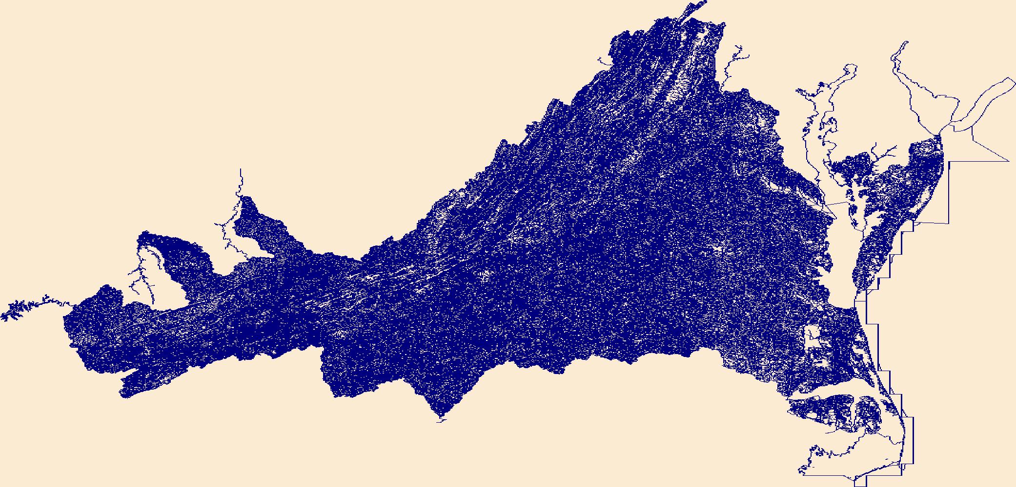
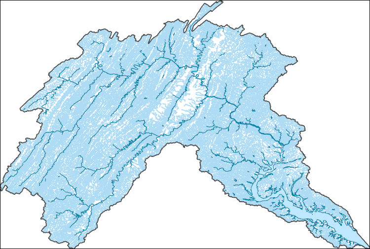
The National Hydrography Dataset (NHD) is a feature-based database that interconnects and uniquely identifies the stream segments or reaches that make up the nation's surface water drainage system. NHD data was originally developed at 1:100,000-scale and exists at that scale for the whole country. This high-resolution NHD, generally developed at 1:24,000/1:12,000 scale, adds detail to the original 1:100,000-scale NHD. (Data for Alaska, Puerto Rico and the Virgin Islands was developed at high-resolution, not 1:100,000 scale.) Local resolution NHD is being developed where partners and data exist. The NHD contains reach codes for networked features, flow direction, names, and centerline representations for areal water...
Tags: Adair,
Adams,
Administrative watershed units,
Administrative watershed units,
Allamakee, All tags...
Appanoose,
Area of Complex Channels,
Area to be submerged,
Audubon,
Basin,
Basin,
Bay/Inlet,
Benton,
Black Hawk,
Boone,
Boundaries,
Boundary,
Bremer,
Bridge,
Buchanan,
Buena Vista,
Butler,
Calhoun,
Canal/Ditch,
Carroll,
Cass,
Cedar,
Cerro Gordo,
Cherokee,
Chickasaw,
Clarke,
Clay,
Clayton,
Clinton,
Coastline,
Connector,
Crawford,
Dallas,
Dam/Weir,
Davis,
Decatur,
Delaware,
Des Moines,
Dickinson,
Downloadable Data,
Drainage areas for surface water,
Drainageway,
Dubuque,
Emmet,
Esri Shapefile nan,
Estuary,
Fayette,
Flow direction network,
Floyd,
Flume,
ForeShore,
Franklin,
Fremont,
Gaging Station,
Gate,
Greene,
Grundy,
Guthrie,
HU10,
HU12,
HU14,
HU16,
HU2,
HU4,
HU6,
HU8,
HUC,
Hamilton,
Hancock,
Hardin,
Harrison,
Hazard Zone,
Henry,
Howard,
Humboldt,
Hydrographic,
Hydrography,
Hydrography,
Hydrography,
Hydrologic Unit Code,
Hydrologic Units,
IA,
Ice mass,
Ida,
Inundation Area,
Iowa,
Iowa,
Jackson,
Jasper,
Jefferson,
Johnson,
Jones,
Keokuk,
Kossuth,
Lee,
Levee,
Line,
Linn,
Lock Chamber,
Louisa,
Lucas,
Lyon,
Madison,
Mahaska,
Marion,
Marsh,
Marshall,
Mills,
Mitchell,
Monona,
Monroe,
Montgomery,
Muscatine,
National Hydrography Dataset (NHD),
National Hydrography Dataset (NHD) Best Resolution,
National Hydrography Dataset (NHD) Best Resolution,
Nonearthen Shore,
O'Brien,
Orthoimage,
Osceola,
Page,
Palo Alto,
Playa,
Plymouth,
Pocahontas,
Point,
PointEvent,
Polk,
Pond,
Pottawattamie,
Poweshiek,
Rapids,
Rapids,
Reach,
Reach code,
Reef,
Region,
Reservoir,
Ringgold,
Rock,
Sac,
Scott,
Sea/Ocean,
Shapefile,
Shelby,
Sink/Rise,
Sioux,
Sounding Datum Line,
Special Use Zone,
Special Use Zone Limit,
Spillway,
State,
State,
State_Iowa,
Story,
Stream,
Stream/River,
Sub-basin,
Sub-region,
Subbasin,
Submerged Stream,
Subregion,
Subwatershed,
Surface water systems,
Swamp,
Tama,
Taylor,
Topographic,
Tunnel,
US,
Underground Conduit,
Union,
United States,
Van Buren,
WBD,
WBD,
Wall,
Wapello,
Warren,
Wash,
Washington,
Water Intake Outflow,
Waterfall,
Watershed,
Watershed Boundaries,
Watershed Boundary Dataset,
Watershed Boundary Dataset,
Wayne,
Webster,
Well,
Winnebago,
Winneshiek,
Woodbury,
Worth,
Wright,
artificial path,
boundaries,
dams,
drainage systems and characteristics,
inlandWaters,
lakes,
ngda,
rivers, Fewer tags
The National Hydrography Dataset (NHD) is a feature-based database that interconnects and uniquely identifies the stream segments or reaches that make up the nation's surface water drainage system. NHD data was originally developed at 1:100,000-scale and exists at that scale for the whole country. This high-resolution NHD, generally developed at 1:24,000/1:12,000 scale, adds detail to the original 1:100,000-scale NHD. (Data for Alaska, Puerto Rico and the Virgin Islands was developed at high-resolution, not 1:100,000 scale.) Local resolution NHD is being developed where partners and data exist. The NHD contains reach codes for networked features, flow direction, names, and centerline representations for areal water...
Tags: Accomack,
Administrative watershed units,
Administrative watershed units,
Albemarle,
Alexandria, All tags...
Alleghany,
Amelia,
Amherst,
Appomattox,
Area of Complex Channels,
Area to be submerged,
Arlington,
Augusta,
Basin,
Basin,
Bath,
Bay/Inlet,
Bedford,
Bland,
Botetourt,
Boundaries,
Boundary,
Bridge,
Bristol,
Brunswick,
Buchanan,
Buckingham,
Buena Vista,
Campbell,
Canal/Ditch,
Caroline,
Carroll,
Charles City,
Charlotte,
Charlottesville,
Chesapeake,
Chesterfield,
Clarke,
Coastline,
Colonial Heights,
Connector,
Covington,
Craig,
Culpeper,
Cumberland,
Dam/Weir,
Danville,
Dickenson,
Dinwiddie,
Downloadable Data,
Drainage areas for surface water,
Drainageway,
Emporia,
Esri File GeoDatabase 10,
Essex,
Estuary,
Fairfax,
Falls Church,
Fauquier,
FileGDB,
Flow direction network,
Floyd,
Flume,
Fluvanna,
ForeShore,
Franklin,
Frederick,
Fredericksburg,
Gaging Station,
Galax,
Gate,
Giles,
Gloucester,
Goochland,
Grayson,
Greene,
Greensville,
HU10,
HU12,
HU14,
HU16,
HU2,
HU4,
HU6,
HU8,
HUC,
Halifax,
Hampton,
Hanover,
Harrisonburg,
Hazard Zone,
Henrico,
Henry,
Highland,
Hopewell,
Hydrographic,
Hydrography,
Hydrography,
Hydrography,
Hydrologic Unit Code,
Hydrologic Units,
Ice mass,
Inundation Area,
Isle of Wight,
James City,
King George,
King William,
King and Queen,
Lancaster,
Lee,
Levee,
Lexington,
Line,
Lock Chamber,
Loudoun,
Louisa,
Lunenburg,
Lynchburg,
Madison,
Manassas,
Manassas Park,
Marsh,
Martinsville,
Mathews,
Mecklenburg,
Middlesex,
Montgomery,
National Hydrography Dataset (NHD),
National Hydrography Dataset (NHD) Best Resolution,
National Hydrography Dataset (NHD) Best Resolution,
Nelson,
New Kent,
Newport News,
Nonearthen Shore,
Norfolk,
Northampton,
Northumberland,
Norton,
Nottoway,
Orange,
Orthoimage,
Page,
Patrick,
Petersburg,
Pittsylvania,
Playa,
Point,
PointEvent,
Pond,
Poquoson,
Portsmouth,
Powhatan,
Prince Edward,
Prince George,
Prince William,
Pulaski,
Radford,
Rapids,
Rapids,
Rappahannock,
Reach,
Reach code,
Reef,
Region,
Reservoir,
Richmond,
Roanoke,
Rock,
Rockbridge,
Rockingham,
Russell,
Salem,
Scott,
Sea/Ocean,
Shenandoah,
Sink/Rise,
Smyth,
Sounding Datum Line,
Southampton,
Special Use Zone,
Special Use Zone Limit,
Spillway,
Spotsylvania,
Stafford,
State,
State,
State_Virginia,
Staunton,
Stream,
Stream/River,
Sub-basin,
Sub-region,
Subbasin,
Submerged Stream,
Subregion,
Subwatershed,
Suffolk,
Surface water systems,
Surry,
Sussex,
Swamp,
Tazewell,
Topographic,
Tunnel,
US,
Underground Conduit,
United States,
VA,
Virginia,
Virginia Beach,
WBD,
WBD,
Wall,
Warren,
Wash,
Washington,
Water Intake Outflow,
Waterfall,
Watershed,
Watershed Boundaries,
Watershed Boundary Dataset,
Watershed Boundary Dataset,
Waynesboro,
Well,
Westmoreland,
Williamsburg,
Winchester,
Wise,
Wythe,
York,
artificial path,
boundaries,
dams,
drainage systems and characteristics,
inlandWaters,
lakes,
ngda,
rivers, Fewer tags
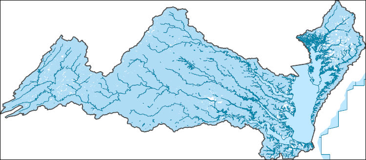
The National Hydrography Dataset (NHD) is a feature-based database that interconnects and uniquely identifies the stream segments or reaches that make up the nation's surface water drainage system. NHD data was originally developed at 1:100,000-scale and exists at that scale for the whole country. This high-resolution NHD, generally developed at 1:24,000/1:12,000 scale, adds detail to the original 1:100,000-scale NHD. (Data for Alaska, Puerto Rico and the Virgin Islands was developed at high-resolution, not 1:100,000 scale.) Local resolution NHD is being developed where partners and data exist. The NHD contains reach codes for networked features, flow direction, names, and centerline representations for areal water...
Tags: Accomack,
Adams,
Administrative watershed units,
Administrative watershed units,
Albemarle, All tags...
Alexandria,
Allegany,
Area of Complex Channels,
Area to be submerged,
Arlington,
Augusta,
Basin,
Basin,
Bay/Inlet,
Bedford,
Berkeley,
Boundaries,
Boundary,
Bridge,
Canal/Ditch,
Carroll,
Charles,
Clarke,
Coastline,
Connector,
Cumberland,
DC,
Dam/Weir,
District of Columbia,
District of Columbia,
Downloadable Data,
Drainage areas for surface water,
Drainageway,
Estuary,
Fairfax,
Falls Church,
Fauquier,
Flow direction network,
Flume,
ForeShore,
Franklin,
Frederick,
Fulton,
Gaging Station,
Garrett,
Gate,
GeoPackage,
Grant,
Greene,
HU-4,
HU-4 Subregion,
HU10,
HU12,
HU14,
HU16,
HU2,
HU4,
HU4_0207,
HU6,
HU8,
HUC,
Hampshire,
Hardy,
Harrisonburg,
Hazard Zone,
Highland,
Huntingdon,
Hydrographic,
Hydrography,
Hydrography,
Hydrography,
Hydrologic Unit Code,
Hydrologic Units,
Ice mass,
Inundation Area,
Jefferson,
King George,
Levee,
Line,
Lock Chamber,
Loudoun,
MD,
Madison,
Manassas,
Manassas Park,
Marsh,
Maryland,
Mineral,
Montgomery,
Morgan,
National Hydrography Dataset (NHD),
National Hydrography Dataset (NHD) Best Resolution,
National Hydrography Dataset (NHD) Best Resolution,
Nelson,
Nonearthen Shore,
Northumberland,
Open Geospatial Consortium GeoPackage 1.2,
Orthoimage,
PA,
Page,
Pendleton,
Pennsylvania,
Perry,
Playa,
Pocahontas,
Point,
PointEvent,
Pond,
Preston,
Prince George's,
Prince William,
Randolph,
Rapids,
Rapids,
Rappahannock,
Reach,
Reach code,
Reef,
Region,
Reservoir,
Richmond,
Rock,
Rockingham,
Sea/Ocean,
Shenandoah,
Sink/Rise,
Somerset,
Sounding Datum Line,
Special Use Zone,
Special Use Zone Limit,
Spillway,
St. Mary's,
Stafford,
Staunton,
Stream,
Stream/River,
Sub-basin,
Sub-region,
Subbasin,
Submerged Stream,
Subregion,
Subwatershed,
Surface water systems,
Swamp,
Topographic,
Tucker,
Tunnel,
US,
Underground Conduit,
United States,
VA,
Virginia,
WBD,
WBD,
WV,
Wall,
Warren,
Wash,
Washington,
Water Intake Outflow,
Waterfall,
Watershed,
Watershed Boundaries,
Watershed Boundary Dataset,
Watershed Boundary Dataset,
Waynesboro,
Well,
West Virginia,
Westmoreland,
Winchester,
artificial path,
boundaries,
dams,
drainage systems and characteristics,
inlandWaters,
lakes,
ngda,
rivers, Fewer tags
The National Hydrography Dataset (NHD) is a feature-based database that interconnects and uniquely identifies the stream segments or reaches that make up the nation's surface water drainage system. NHD data was originally developed at 1:100,000-scale and exists at that scale for the whole country. This high-resolution NHD, generally developed at 1:24,000/1:12,000 scale, adds detail to the original 1:100,000-scale NHD. (Data for Alaska, Puerto Rico and the Virgin Islands was developed at high-resolution, not 1:100,000 scale.) Local resolution NHD is being developed where partners and data exist. The NHD contains reach codes for networked features, flow direction, names, and centerline representations for areal water...
Tags: Accomack,
Administrative watershed units,
Administrative watershed units,
Albemarle,
Alleghany, All tags...
Amelia,
Amherst,
Appomattox,
Area of Complex Channels,
Area to be submerged,
Augusta,
Basin,
Basin,
Bath,
Bay/Inlet,
Bedford,
Botetourt,
Boundaries,
Boundary,
Bridge,
Buckingham,
Buena Vista,
Campbell,
Canal/Ditch,
Caroline,
Charles City,
Charlotte,
Charlottesville,
Chesapeake,
Chesterfield,
Coastline,
Colonial Heights,
Connector,
Covington,
Craig,
Culpeper,
Cumberland,
DE,
Dam/Weir,
Delaware,
Dinwiddie,
Dorchester,
Downloadable Data,
Drainage areas for surface water,
Drainageway,
Esri Shapefile nan,
Essex,
Estuary,
Fauquier,
Flow direction network,
Flume,
Fluvanna,
ForeShore,
Fredericksburg,
Gaging Station,
Gate,
Giles,
Gloucester,
Goochland,
Greenbrier,
Greene,
HU-4,
HU-4 Subregion,
HU10,
HU12,
HU14,
HU16,
HU2,
HU4,
HU4_0208,
HU6,
HU8,
HUC,
Hampton,
Hanover,
Hazard Zone,
Henrico,
Highland,
Hopewell,
Hydrographic,
Hydrography,
Hydrography,
Hydrography,
Hydrologic Unit Code,
Hydrologic Units,
Ice mass,
Inundation Area,
Isle of Wight,
James City,
Kent,
King George,
King William,
King and Queen,
Lancaster,
Levee,
Lexington,
Line,
Lock Chamber,
Louisa,
Lunenburg,
Lynchburg,
MD,
Madison,
Marsh,
Maryland,
Mathews,
Middlesex,
Monroe,
Montgomery,
National Hydrography Dataset (NHD),
National Hydrography Dataset (NHD) Best Resolution,
National Hydrography Dataset (NHD) Best Resolution,
Nelson,
New Kent,
Newport News,
Nonearthen Shore,
Norfolk,
Northampton,
Northumberland,
Nottoway,
Orange,
Orthoimage,
Page,
Pendleton,
Petersburg,
Playa,
Pocahontas,
Point,
PointEvent,
Pond,
Poquoson,
Portsmouth,
Powhatan,
Prince Edward,
Prince George,
Rapids,
Rapids,
Rappahannock,
Reach,
Reach code,
Reef,
Region,
Reservoir,
Richmond,
Roanoke,
Rock,
Rockbridge,
Rockingham,
Sea/Ocean,
Shapefile,
Sink/Rise,
Somerset,
Sounding Datum Line,
Special Use Zone,
Special Use Zone Limit,
Spillway,
Spotsylvania,
St. Mary's,
Stafford,
Stream,
Stream/River,
Sub-basin,
Sub-region,
Subbasin,
Submerged Stream,
Subregion,
Subwatershed,
Suffolk,
Surface water systems,
Surry,
Sussex,
Swamp,
Topographic,
Tunnel,
US,
Underground Conduit,
United States,
VA,
Virginia,
Virginia Beach,
WBD,
WBD,
WV,
Wall,
Warren,
Wash,
Water Intake Outflow,
Waterfall,
Watershed,
Watershed Boundaries,
Watershed Boundary Dataset,
Watershed Boundary Dataset,
Well,
West Virginia,
Westmoreland,
Wicomico,
Williamsburg,
Worcester,
York,
artificial path,
boundaries,
dams,
drainage systems and characteristics,
inlandWaters,
lakes,
ngda,
rivers, Fewer tags

In May 2021, the Grand Canyon Monitoring and Research Center (GCMRC) of the U.S. Geological Survey’s (USGS), Southwest Biological Science Center (SBSC) acquired airborne multispectral high resolution data for the Colorado River in Grand Canyon in Arizona, USA. The imagery data consist of four bands (Band 1 – red, Band 2 – green, Band 3 – blue, and Band 4 – near infrared) with a ground resolution of 20 centimeters (cm). These image data are available to the public as 16-bit GeoTIFF files, which can be read and used by most geographic information system (GIS) and image-processing software. The spatial reference of the image data are in the State Plane (SP) map projection using the central Arizona zone (FIPS 0202)...
Categories: Data;
Types: Downloadable,
Map Service,
OGC WFS Layer,
OGC WMS Layer,
Shapefile;
Tags: Arizona,
Bright Angel Creek,
Colorado River,
Diamond Creek,
ESRI shapefile, All tags...
Glen Canyon Dam,
Grand Canyon,
Havasu Creek,
Kanab Creek,
Lake Mead,
Lake Powell,
Lees Ferry,
Little Colorado River,
Marble Canyon,
Page,
Paria River,
Peach Springs,
Pearce Ferry,
Shinumo Creek,
Tapeats Creek,
United States,
data release,
geographic information systems,
geospatial datasets,
image mosaics,
imageryBaseMapsEarthCover,
study areas, Fewer tags
The Geographic Names Information System (GNIS) is the Federal standard for geographic nomenclature. The U.S. Geological Survey developed the GNIS for the U.S. Board on Geographic Names, a Federal inter-agency body chartered by public law to maintain uniform feature name usage throughout the Government and to promulgate standard names to the public. The GNIS is the official repository of domestic geographic names data; the official vehicle for geographic names use by all departments of the Federal Government; and the source for applying geographic names to Federal electronic and printed products of all types.
Tags: Accomack,
Albemarle,
Alexandria,
Alleghany,
Amelia, All tags...
Amherst,
Antarctica,
Antarctica,
Appomattox,
Arlington,
Augusta,
BGN,
Bath,
Bedford,
Bland,
Board on Geographic Names,
Borough,
Botetourt,
Bristol,
Brunswick,
Buchanan,
Buckingham,
Buena Vista,
Campbell,
Caroline,
Carroll,
Census Area,
Charles City,
Charlotte,
Charlottesville,
Chesapeake,
Chesterfield,
Clarke,
Colonial Heights,
Commonwealth,
County,
Covington,
Craig,
Culpeper,
Cumberland,
Danville,
Dickenson,
Dinwiddie,
District,
Downloadable Data,
Emporia,
Essex,
Fairfax,
Falls Church,
Fauquier,
Feature class,
Feature coordinates,
Feature county,
Feature description,
Feature designation,
Feature history,
Feature indentification,
Feature name,
Feature state,
Floyd,
Fluvanna,
Franklin,
Frederick,
Fredericksburg,
GNIS,
Galax,
Geographic Names,
Geographic Names Federal Codes,
Geographic Names Information System,
Geographic feature,
Geographic name,
Geographical feature,
Geographical name,
Giles,
Gloucester,
Goochland,
Grayson,
Greene,
Greensville,
Halifax,
Hampton,
Hanover,
Harrisonburg,
Henrico,
Henry,
Highland,
Hopewell,
Isle of Wight,
James City,
King George,
King William,
King and Queen,
Lancaster,
Lee,
Lexington,
Loudoun,
Louisa,
Lunenburg,
Lynchburg,
Madison,
Manassas,
Manassas Park,
Martinsville,
Mathews,
Mecklenburg,
Middlesex,
Montgomery,
Municipio,
National Geographic Names Information System (GNIS),
National Geographic Names Information System (GNIS),
Nelson,
New Kent,
Newport News,
Norfolk,
Northampton,
Northumberland,
Norton,
Nottoway,
Official feature name,
Orange,
Outlying Area,
Page,
Parish,
Patrick,
Petersburg,
Pittsylvania,
Place name,
Populated Place,
Poquoson,
Portsmouth,
Powhatan,
Prince Edward,
Prince George,
Prince William,
Pulaski,
Radford,
Rappahannock,
Richmond,
Roanoke,
Rockbridge,
Rockingham,
Russell,
Salem,
Scott,
Shenandoah,
Smyth,
Southampton,
Spotsylvania,
Stafford,
State,
Staunton,
Suffolk,
Surry,
Sussex,
TXT (pipes),
Tazewell,
Territories,
Territory,
Topographic Map,
U.S. Board on Geographic Names,
U.S. Geological Survey,
US,
USA,
USBGN,
USGS,
UTF-8 Pipe Delimited Text File nan,
United States,
United States,
United States,
VA,
Variant name,
Virginia,
Virginia Beach,
Warren,
Washington,
Waynesboro,
Westmoreland,
Williamsburg,
Winchester,
Wise,
Wythe,
York,
antarctic,
database,
economy,
environment,
feature,
gazetteer,
geographic,
geographic names,
geographical,
geography,
geospatial,
imageryBaseMapsEarthCover,
inlandWaters,
location,
map,
name,
place,
placename,
society,
structure,
topographic map,
toponymy, Fewer tags

USGS Historical Quadrangle in GeoPDF.
Tags: 7.5 x 7.5 minute,
Downloadable Data,
GeoPDF,
GeoTIFF,
Historical Topographic Maps, All tags...
Historical Topographic Maps 7.5 x 7.5 Minute Map Series,
Map,
Page,
WA,
imageryBaseMapsEarthCover, Fewer tags

This data set contains imagery from the National Agriculture Imagery Program (NAIP). The NAIP program is administered by USDA FSA and has been established to support two main FSA strategic goals centered on agricultural production. These are, increase stewardship of America's natural resources while enhancing the environment, and to ensure commodities are procured and distributed effectively and efficiently to increase food security. The NAIP program supports these goals by acquiring and providing ortho imagery that has been collected during the agricultural growing season in the U.S. The NAIP ortho imagery is tailored to meet FSA requirements and is a fundamental tool used to support FSA farm and conservation programs....
Types: Citation;
Tags: 3.75 x 3.75 minute,
31089,
4209837,
Aerial Compliance,
Compliance, All tags...
Digital Ortho rectified Image,
Downloadable Data,
HOLT CO NE FSA,
Holt,
JPEG2000,
NAIP,
NE,
NE089,
Ortho Rectification,
Orthoimagery,
PAGE,
PAGE, NW,
Quarter Quadrangle,
USDA National Agriculture Imagery Program (NAIP),
farming, Fewer tags

This data set contains imagery from the National Agriculture Imagery Program (NAIP). The NAIP program is administered by USDA FSA and has been established to support two main FSA strategic goals centered on agricultural production. These are, increase stewardship of America's natural resources while enhancing the environment, and to ensure commodities are procured and distributed effectively and efficiently to increase food security. The NAIP program supports these goals by acquiring and providing ortho imagery that has been collected during the agricultural growing season in the U.S. The NAIP ortho imagery is tailored to meet FSA requirements and is a fundamental tool used to support FSA farm and conservation programs....
Types: Citation;
Tags: 3.75 x 3.75 minute,
3807828,
51139,
Aerial Compliance,
Compliance, All tags...
Digital Ortho rectified Image,
Downloadable Data,
JPEG2000,
NAIP,
Ortho Rectification,
Orthoimagery,
PAGE CO VA FSA,
Page,
Quarter Quadrangle,
STANLEY,
STANLEY, SE,
USDA National Agriculture Imagery Program (NAIP),
VA,
VA139,
farming, Fewer tags

This data set contains imagery from the National Agriculture Imagery Program (NAIP). The NAIP program is administered by USDA FSA and has been established to support two main FSA strategic goals centered on agricultural production. These are, increase stewardship of America's natural resources while enhancing the environment, and to ensure commodities are procured and distributed effectively and efficiently to increase food security. The NAIP program supports these goals by acquiring and providing ortho imagery that has been collected during the agricultural growing season in the U.S. The NAIP ortho imagery is tailored to meet FSA requirements and is a fundamental tool used to support FSA farm and conservation programs....
Types: Citation;
Tags: 3.75 x 3.75 minute,
3807829,
51139,
Aerial Compliance,
BIG MEADOWS, All tags...
BIG MEADOWS, NW,
Compliance,
Digital Ortho rectified Image,
Downloadable Data,
JPEG2000,
NAIP,
Ortho Rectification,
Orthoimagery,
PAGE CO VA FSA,
Page,
Quarter Quadrangle,
USDA National Agriculture Imagery Program (NAIP),
VA,
VA139,
farming, Fewer tags

This data set contains imagery from the National Agriculture Imagery Program (NAIP). The NAIP program is administered by USDA FSA and has been established to support two main FSA strategic goals centered on agricultural production. These are, increase stewardship of America's natural resources while enhancing the environment, and to ensure commodities are procured and distributed effectively and efficiently to increase food security. The NAIP program supports these goals by acquiring and providing ortho imagery that has been collected during the agricultural growing season in the U.S. The NAIP ortho imagery is tailored to meet FSA requirements and is a fundamental tool used to support FSA farm and conservation programs....
Types: Citation;
Tags: 3.75 x 3.75 minute,
3807829,
51139,
Aerial Compliance,
BIG MEADOWS, All tags...
BIG MEADOWS, SW,
Compliance,
Digital Ortho rectified Image,
Downloadable Data,
JPEG2000,
NAIP,
Ortho Rectification,
Orthoimagery,
PAGE CO VA FSA,
Page,
Quarter Quadrangle,
USDA National Agriculture Imagery Program (NAIP),
VA,
VA139,
farming, Fewer tags
|
|

