Filters
Date Range
Extensions
Types
Contacts
Categories
Tag Types
Tag Schemes
|

This data release contains the boundaries of assessment units and input data for the assessment of undiscovered gas hydrate resources on the north slope of Alaska. The Assessment Unit is the fundamental unit used in the National Assessment Project for the assessment of undiscovered oil and gas resources. The Assessment Unit is defined within the context of the higher-level Total Petroleum System. The Assessment Unit is shown herein as a geographic boundary interpreted, defined, and mapped by the geologist responsible for the province and incorporates a set of known or postulated oil and (or) gas accumulations sharing similar geologic, geographic, and temporal properties within the Total Petroleum System, such as...
Categories: Data;
Types: Downloadable,
Map Service,
OGC WFS Layer,
OGC WMS Layer,
Shapefile;
Tags: Assessment Unit,
Continuous Assessment Unit,
Earth Science,
Economic geology,
Energy Resources, All tags...
Energy Resources,
Geology,
NOGA2000,
Nanushuk Formation Gas Hydrate,
National Assessment of Oil and Gas,
Natural Gas,
Natural Resources,
Natural gas resources,
Northern Alaska Province,
Oil,
Oil resources,
OilGas,
Resource Assessment,
Sagavanirktok Formation Gas Hydrate,
State of Alaska,
Tuluvak-Schrader Bluff-Prince Creek Formation Gas Hydrate,
U.S. Geological Survey,
U.S.A.,
USGS,
USGS Science Data Catalog (SDC),
USGS World Energy Region 5,
USGS World Energy Region 5,
Unconventional Assessment Unit,
United States,
United States of America,
energy resources,
geoscientificInformation,
natural gas resources,
oil resources,
petroleum, Fewer tags

This data release contains the boundaries of assessment of undiscovered continuous tight-gas resources in the Mesaverde Group and Wasatch Formation, Uinta-Piceance Province, Utah and Colorado. The Assessment Unit is the fundamental unit used in the National Assessment Project for the assessment of undiscovered oil and gas resources. The Assessment Unit is defined within the context of the higher-level Total Petroleum System. The Assessment Unit is shown herein as a geographic boundary interpreted, defined, and mapped by the geologist responsible for the province and incorporates a set of known or postulated oil and (or) gas accumulations sharing similar geologic, geographic, and temporal properties within the Total...
Categories: Data;
Types: Downloadable,
Map Service,
OGC WFS Layer,
OGC WMS Layer,
Shapefile;
Tags: Assessment Unit,
Continuous Assessment Unit,
Earth Science,
Energy Resources,
Energy Resources, All tags...
Geology,
NOGA2000,
National Assessment of Oil and Gas,
Natural Gas,
Natural Resources,
Oil,
OilGas,
Piceance Mesaverde Tight Gas,
Resource Assessment,
State of Colorado,
State of Utah,
U.S. Geological Survey,
U.S.A.,
USGS,
USGS Science Data Catalog (SDC),
USGS World Energy Region 5,
USGS World Energy Region 5,
Uinta Mesaverde Tight Gas,
Uinta-Piceance Basin Province,
Unconventional Assessment Unit,
United States,
United States of America,
energy resources,
geoscientificInformation,
natural gas resources,
oil resources,
petroleum, Fewer tags
Layered GeoPDF 7.5 Minute Quadrangle Map. Layers of geospatial data include orthoimagery, roads, grids, geographic names, elevation contours, hydrography, and other selected map features.
Tags: 7.5 x 7.5 minute,
Bear Creek Reservoir, MT,
Downloadable Data,
EarthCover,
Fergus, All tags...
GeoPDF,
Imagery and Base Maps,
Map,
Montana,
Petroleum,
Public Land Survey System,
U.S. National Grid,
US,
US Topo,
US Topo Historical,
United States,
boundary,
contour,
geographic names,
hydrography,
imageryBaseMapsEarthCover,
orthoimage,
structures,
topographic,
transportation,
woodland, Fewer tags
Layered GeoPDF 7.5 Minute Quadrangle Map. Layers of geospatial data include orthoimagery, roads, grids, geographic names, elevation contours, hydrography, and other selected map features.
Tags: 7.5 x 7.5 minute,
Downloadable Data,
EarthCover,
GeoPDF,
Imagery and Base Maps, All tags...
Kirkendal Flat, MT,
Map,
Montana,
Petroleum,
Public Land Survey System,
U.S. National Grid,
US,
US Topo,
US Topo Historical,
United States,
boundary,
contour,
geographic names,
hydrography,
imageryBaseMapsEarthCover,
orthoimage,
structures,
topographic,
transportation,
woodland, Fewer tags
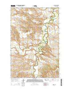
Layered geospatial PDF Map. Layers of geospatial data include orthoimagery, roads, grids, geographic names, elevation contours, hydrography, and other selected map features.
Tags: 7.5 x 7.5 minute,
Big Wall NW, MT,
Downloadable Data,
EarthCover,
GeoPDF, All tags...
Imagery and Base Maps,
Map,
Montana,
Musselshell,
Petroleum,
Public Land Survey System,
U.S. National Grid,
US,
US Topo,
US Topo Historical,
United States,
boundary,
contour,
geographic names,
hydrography,
imageryBaseMapsEarthCover,
orthoimage,
structures,
topographic,
transportation,
woodland, Fewer tags
Layered GeoPDF 7.5 Minute Quadrangle Map. Layers of geospatial data include orthoimagery, roads, grids, geographic names, elevation contours, hydrography, and other selected map features.
Tags: 7.5 x 7.5 minute,
Downloadable Data,
EarthCover,
GeoPDF,
Imagery and Base Maps, All tags...
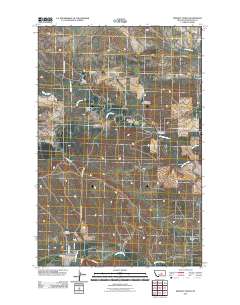
Little Bear Lake, MT,
Map,
Montana,
Petroleum,
Public Land Survey System,
U.S. National Grid,
US,
US Topo,
US Topo Historical,
United States,
boundary,
contour,
geographic names,
hydrography,
imageryBaseMapsEarthCover,
orthoimage,
structures,
topographic,
transportation,
woodland, Fewer tags
Layered GeoPDF 7.5 Minute Quadrangle Map. Layers of geospatial data include orthoimagery, roads, grids, geographic names, elevation contours, hydrography, and other selected map features.
Tags: 7.5 x 7.5 minute,
Downloadable Data,
EarthCover,
Garfield,
GeoPDF, All tags...
Imagery and Base Maps,
Map,
Montana,
Mosby, MT,
Petroleum,
Public Land Survey System,
U.S. National Grid,
US,
US Topo,
US Topo Historical,
United States,
boundary,
contour,
geographic names,
hydrography,
imageryBaseMapsEarthCover,
orthoimage,
structures,
topographic,
transportation,
woodland, Fewer tags
Layered GeoPDF 7.5 Minute Quadrangle Map. Layers of geospatial data include orthoimagery, roads, grids, geographic names, elevation contours, hydrography, and other selected map features.
Tags: 7.5 x 7.5 minute,
Downloadable Data,
EarthCover,
GeoPDF,
Imagery and Base Maps, All tags...
Map,
Montana,
Petroleum,
U.S. National Grid,
US,
US Topo,
US Topo Historical,
United States,
Winnett North, MT,
contour,
geographic names,
hydrography,
imageryBaseMapsEarthCover,
orthoimage,
structures,
topographic,
transportation, Fewer tags
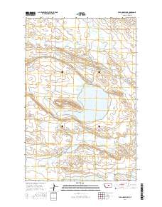
Layered geospatial PDF Map. Layers of geospatial data include orthoimagery, roads, grids, geographic names, elevation contours, hydrography, and other selected map features.
Tags: 7.5 x 7.5 minute,
Downloadable Data,
EarthCover,
GeoPDF,
Imagery and Base Maps, All tags...
Map,
Montana,
Petroleum,
Public Land Survey System,
U.S. National Grid,
US,
US Topo,
US Topo Historical,
United States,
Winnett North, MT,
boundary,
contour,
geographic names,
hydrography,
imageryBaseMapsEarthCover,
orthoimage,
structures,
topographic,
transportation,
woodland, Fewer tags
Layered geospatial PDF Map. Layers of geospatial data include orthoimagery, roads, grids, geographic names, elevation contours, hydrography, and other selected map features.
Tags: 7.5 x 7.5 minute,
Downloadable Data,
EarthCover,
GeoPDF,
Imagery and Base Maps, All tags...
Map,
Montana,
Petroleum,
Public Land Survey System,
U.S. National Grid,
US,
US Topo,
US Topo Historical,
United States,
Wild Horse Lake, MT,
boundary,
contour,
geographic names,
hydrography,
imageryBaseMapsEarthCover,
orthoimage,
structures,
topographic,
transportation,
woodland, Fewer tags
Layered GeoPDF 7.5 Minute Quadrangle Map. Layers of geospatial data include orthoimagery, roads, grids, geographic names, elevation contours, hydrography, and other selected map features.
Tags: 7.5 x 7.5 minute,
Downloadable Data,
EarthCover,
GeoPDF,
Imagery and Base Maps, All tags...
Kelley, MT,
Map,
Montana,
Musselshell,
Petroleum,
U.S. National Grid,
US,
US Topo,
US Topo Historical,
United States,
contour,
geographic names,
hydrography,
imageryBaseMapsEarthCover,
orthoimage,
structures,
topographic,
transportation, Fewer tags
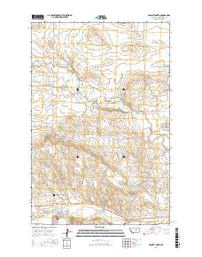
Layered GeoPDF 7.5 Minute Quadrangle Map. Layers of geospatial data include orthoimagery, roads, grids, geographic names, elevation contours, hydrography, and other selected map features.
Tags: 7.5 x 7.5 minute,
Dovetail Butte, MT,
Downloadable Data,
EarthCover,
Fergus, All tags...
GeoPDF,
Imagery and Base Maps,
Map,
Montana,
Petroleum,
U.S. National Grid,
US,
US Topo,
US Topo Historical,
United States,
contour,
geographic names,
hydrography,
imageryBaseMapsEarthCover,
orthoimage,
structures,
topographic,
transportation, Fewer tags
Layered geospatial PDF Map. Layers of geospatial data include orthoimagery, roads, grids, geographic names, elevation contours, hydrography, and other selected map features.
Tags: 7.5 x 7.5 minute,
Davis Spring, MT,
Downloadable Data,
EarthCover,
GeoPDF, All tags...
Imagery and Base Maps,
Map,
Montana,
Petroleum,
Public Land Survey System,
U.S. National Grid,
US,
US Topo,
US Topo Historical,
United States,
boundary,
contour,
geographic names,
hydrography,
imageryBaseMapsEarthCover,
orthoimage,
structures,
topographic,
transportation,
woodland, Fewer tags
Layered geospatial PDF Map. Layers of geospatial data include orthoimagery, roads, grids, geographic names, elevation contours, hydrography, and other selected map features.
Tags: 7.5 x 7.5 minute,
Downloadable Data,
EarthCover,
GeoPDF,
Imagery and Base Maps, All tags...
Map,
Montana,
Petroleum,
Public Land Survey System,
U.S. National Grid,
US,
US Topo,
US Topo Historical,
United States,
Yellow Water Reservoir, MT,
boundary,
contour,
geographic names,
hydrography,
imageryBaseMapsEarthCover,
orthoimage,
structures,
topographic,
transportation,
woodland, Fewer tags
Layered GeoPDF 7.5 Minute Quadrangle Map. Layers of geospatial data include orthoimagery, roads, grids, geographic names, elevation contours, hydrography, and other selected map features.
Tags: 7.5 x 7.5 minute,
Downloadable Data,
EarthCover,
Fergus,
GeoPDF, All tags...
Hanson Flat, MT,
Imagery and Base Maps,
Map,
Montana,
Petroleum,
Phillips,
Public Land Survey System,
U.S. National Grid,
US,
US Topo,
US Topo Historical,
United States,
boundary,
contour,
geographic names,
hydrography,
imageryBaseMapsEarthCover,
orthoimage,
structures,
topographic,
transportation,
woodland, Fewer tags

This coverage includes arcs, polygons and polygon labels that describe U.S. Geological Survey defined geologic provinces of Europe including Turkey. (Albania, Andorra, Austria, Belgium, Bosnia and Herzegovina, Bulgaria, Croatia, Cyprus, Czech Republic, Denmark, Finland, France, Germany, Greece, Hungary, Iceland, Ireland, Italy, Liechtenstein, Luxembourg, The Former Yugoslav Republic of Macedonia, Malta, Monaco, Netherlands, Norway, Poland, Portugal, Romania, San Marino, Serbia and Montenegro, Slovakia, Slovenia, Spain, Sweden, Switzerland, Turkey, United Kingdom and Vatican City.) Each province has a set of geologic characteristics distinguishing it from surrounding provinces. These characteristics may include the...
Categories: Data,
pre-SM502.8;
Types: Downloadable,
Map Service,
OGC WFS Layer,
OGC WMS Layer,
Shapefile;
Tags: AL,
AN,
AU,
Adana/Sivas, Province 2079,
Adriatic Basin, Province 4058, All tags...
Aegean, Province 4075,
Albania,
Alentejo-Guadalquivir Basin, Province 4077,
Alps, Province 4051,
Andalucia, Province 4088,
Andorra,
Anglo-Dutch Basin, Province 4036,
Anglo-Paris Basin, Province 4040,
Apulia Platform, Province 4059,
Aquitaine Basin, Province 4045,
Araks, Province 2080,
Armoricia, Province 4041,
Austria,
BE,
BK,
BU,
Baltic Depression, Province 4021,
Baltic Shield-Norwegian Caledonides, Province 4016,
Barents Continental Slope, Province 4013,
Belgium,
Belorussian-Voronezh High, Province 1004,
Betic Zone, Province 4078,
Black Sea Continental Slope, Province 1107,
Bohemia, Province 4046,
Bosnia and Herzegovina,
Bresse Depression, Province 4054,
Bulgaria,
CY,
Carpathian-Balkanian Basin, Province 4061,
Corsican-Sardinian Basins, Province 4067,
Crete, Province 4076,
Croatia,
Cyprus,
Czech Republic,
DA,
Denmark,
Dinaric Alps, Province 4071,
Dobrogea Foreland, Province 1103,
Dobrogean Orogen, Province 4063,
EI,
EZ,
Earth Science,
Economic geology,
Euphrates/Mardin, Province 2075,
Europe,
FI,
FO,
FR,
Faeroes-Shetland-Orkney Basin, Province 4019,
Faroe Islands,
Fennoscandian Border-Danish-Polish Margin, Province 4022,
Finland,
France,
GI,
GK,
GM,
GR,
Galician Basin, Province 4073,
Gas,
Geologic province,
Geology,
German-Polish Basin, Province 4033,
Germany,
Gibraltar,
Greece,
Guernsey,
HR,
HU,
Haleb, Province 2076,
Hammerfest-Varanger Basin, Province 4015,
Hatton-Rockall Basin, Province 4020,
Horda-Norwegian-Danish Basin, Province 4023,
Hungary,
IC,
IM,
IT,
Iberian Massif, Province 4072,
Iberic Cordillera, Province 4083,
Iceland,
Ireland,
Ireland-Scotland Platform, Province 4026,
Irish Sea, Province 4030,
Isle of Man,
Italy,
JE,
Jersey,
Jura, Province 4052,
Kardiff/Menders Massif, Province 2084,
Kola Monocline-Finnmark Platform, Province 1051,
LO,
LS,
LU,
Lesser Caucasus, Province 2081,
Liechtenstein,
Lion-Camargue, Province 4056,
London-Brabant Platform, Province 4037,
Lusitanian Basin, Province 4074,
Luxembourg,
MK,
MN,
MW,
Malta,
Massif Central, Province 4043,
Mediterranean Basin, Province 2070,
Mid-North Sea High, Province 4028,
Midland Valley-Forth Approaches Basin, Province 4027,
Molasse Basin, Province 4049,
Monaco,
Munsterland Basin, Province 4038,
NL,
NO,
Natural Gas,
Natural Resources,
Natural gas resources,
Netherlands,
North Carpathian Basin, Province 4047,
North Sea Graben, Province 4025,
Northwest German Basin, Province 4035,
Norway,
Oil,
Oil,
Oil sand resources,
Oil shale resources,
PL,
PO,
Pannonian Basin, Province 4048,
Pelagian Basin, Province 2048,
Petroleum,
Po Basin, Province 4060,
Poland,
Portugal,
Provence Basin, Province 4068,
Pyrenean Foothills-Ebro Basin, Province 4044,
RO,
Resource Assessment,
Rhine Graben, Province 4055,
Rif Basin, Province 2072,
Romania,
Russian Craton Margin, Province 1011,
SI,
SM,
SP,
SR,
SV,
SW,
SZ,
San Marino,
Serbia and Montenegro,
Sicily, Province 4066,
Slovakia,
Slovenia,
Southwest German Basin, Province 4039,
Spain,
Spanish Trough-Cantabrian Zone, Province 4070,
Svalbard,
Sweden,
Switzerland,
TU,
Tajo-Duero Basin, Province 4082,
The Former Yugoslav Republic of Macedonia,
Thrace/Samsun, Province 2085,
Trans-Graben, Province 4053,
Transylvanian Basin, Province 4057,
Troms-Bjornoya, Province 4014,
Turkey,
Tuscany-Latium-Paola, Province 4062,
Tuz/Corum, Province 2083,
Tyrrhenian Basin, Province 4069,
U.S. Geological Survey,
UK,
USGS,
USGS Science Data Catalog (SDC),
Ukrainian Shield, Province 1013,
United Kingdom,
VT,
Vatican City,
Vestford-Helgeland, Province 4017,
West Black Sea Basin, Province 4064,
Zagros Fold Belt, Province 2030,
Zagros Thrust Zone, Province 2031,
environment,
europe,
geoscientificInformation,
oilgas,
wep,
worldgeologicmaps, Fewer tags

The Watershed Boundary Dataset (WBD) is a comprehensive aggregated collection of hydrologic unit data consistent with the national criteria for delineation and resolution. It defines the areal extent of surface water drainage to a point except in coastal or lake front areas where there could be multiple outlets as stated by the "Federal Standards and Procedures for the National Watershed Boundary Dataset (WBD)" "Standard" (https://pubs.usgs.gov/tm/11/a3/). Watershed boundaries are determined solely upon science-based hydrologic principles, not favoring any administrative boundaries or special projects, nor particular program or agency. This dataset represents the hydrologic unit boundaries to the 12-digit (6th level)...
Tags: 10-digit,
12-digit,
14-digit,
16-digit,
2-digit, All tags...
4-digit,
6-digit,
8-digit,
Adair,
Adams,
Albany,
Allen,
Anderson,
Andrew,
Antelope,
Appanoose,
Arapahoe,
Arthur,
Atchison,
Audrain,
Audubon,
Aurora,
Banner,
Barnes,
Barton,
Basin,
Bates,
Beadle,
Beaverhead,
Bennett,
Benton,
Big Horn,
Billings,
Blaine,
Bon Homme,
Boone,
Boulder,
Bourbon,
Bowman,
Box Butte,
Boyd,
Broadwater,
Brookings,
Broomfield,
Brown,
Brule,
Buchanan,
Buena Vista,
Buffalo,
Burke,
Burleigh,
Burt,
Butler,
Butte,
CO,
Caldwell,
Callaway,
Camden,
Campbell,
Carbon,
Carroll,
Carter,
Cascade,
Cass,
Cedar,
Chaffee,
Chariton,
Charles Mix,
Chase,
Cherokee,
Cherry,
Cheyenne,
Chouteau,
Christian,
Clark,
Clarke,
Clay,
Clear Creek,
Clinton,
Cloud,
Codington,
Coffey,
Cole,
Colfax,
Colorado,
Converse,
Cooper,
Corson,
Crawford,
Crook,
Cuming,
Custer,
Dade,
Dakota,
Dallas,
Daniels,
Daviess,
Davis,
Davison,
Dawes,
Dawson,
Day,
DeKalb,
Decatur,
Deer Lodge,
Dent,
Denver,
Deuel,
Dewey,
Dickey,
Dickinson,
Divide,
Dixon,
Dodge,
Doniphan,
Douglas,
Downloadable Data,
Dundy,
Dunn,
Eddy,
Edmunds,
El Paso,
Elbert,
Ellis,
Ellsworth,
Emmet,
Emmons,
Fall River,
Fallon,
Faulk,
Fergus,
Fillmore,
Flathead,
Foster,
Franklin,
Fremont,
Frontier,
Furnas,
Gage,
Gallatin,
Garden,
Garfield,
Gasconade,
Geary,
Gentry,
GeoPackage,
Gilpin,
Glacier,
Golden Valley,
Goshen,
Gosper,
Gove,
Graham,
Grand,
Granite,
Grant,
Greeley,
Greene,
Gregory,
Grundy,
Guthrie,
HU-2,
HU-2 Region,
HU2_10,
HUC,
Haakon,
Hall,
Hamilton,
Hamlin,
Hand,
Hanson,
Harding,
Harlan,
Harrison,
Hayes,
Henry,
Hettinger,
Hickory,
Hill,
Hitchcock,
Holt,
Hooker,
Hot Springs,
Howard,
Howell,
Hughes,
Hutchinson,
Hyde,
Hydrography,
Hydrologic Unit Code,
Hydrologic Units,
IA,
ID,
Ida,
Idaho,
Iowa,
Jackson,
Jefferson,
Jerauld,
Jewell,
Johnson,
Jones,
Judith Basin,
KS,
Kansas,
Kearney,
Keith,
Keya Paha,
Kidder,
Kimball,
Kingsbury,
Kit Carson,
Knox,
LaMoure,
Laclede,
Lafayette,
Lake,
Lancaster,
Lane,
Laramie,
Larimer,
Lawrence,
Leavenworth,
Lemhi,
Lewis and Clark,
Liberty,
Lincoln,
Linn,
Livingston,
Logan,
Loup,
Lucas,
Lyman,
Lyon,
MN,
MO,
MT,
Macon,
Madison,
Maries,
Marion,
Marshall,
McCone,
McCook,
McHenry,
McIntosh,
McKenzie,
McLean,
McPherson,
Meade,
Meagher,
Mellette,
Mercer,
Merrick,
Miami,
Miller,
Mills,
Miner,
Minnehaha,
Minnesota,
Missouri,
Mitchell,
Moniteau,
Monona,
Monroe,
Montana,
Montgomery,
Moody,
Morgan,
Morrill,
Morris,
Morton,
Mountrail,
Murray,
Musselshell,
ND,
NE,
Nance,
National Watershed Boundary Dataset (WBD),
National Watershed Boundary Dataset (WBD),
Natrona,
Nebraska,
Nemaha,
Ness,
Niobrara,
Nobles,
Nodaway,
North Dakota,
Norton,
Nuckolls,
O'Brien,
Oglala Lakota,
Oliver,
Open Geospatial Consortium GeoPackage 1.2,
Osage,
Osborne,
Osceola,
Otoe,
Ottawa,
Page,
Palo Alto,
Park,
Pawnee,
Pennington,
Perkins,
Petroleum,
Pettis,
Phelps,
Phillips,
Pierce,
Pipestone,
Platte,
Plymouth,
Polk,
Pondera,
Pottawatomie,
Pottawattamie,
Potter,
Powder River,
Powell,
Prairie,
Pulaski,
Putnam,
Randolph,
Ransom,
Ravalli,
Rawlins,
Ray,
Red Willow,
Region,
Republic,
Rice,
Richardson,
Richland,
Riley,
Ringgold,
Roberts,
Rock,
Rooks,
Roosevelt,
Rosebud,
Routt,
Rush,
Russell,
SD,
Sac,
Saline,
Sanborn,
Sargent,
Sarpy,
Saunders,
Schuyler,
Scott,
Scotts Bluff,
Sedgwick,
Seward,
Shawnee,
Shelby,
Sheridan,
Sherman,
Silver Bow,
Sioux,
Slope,
Smith,
South Dakota,
Spink,
St. Charles,
St. Clair,
St. Louis,
Stanley,
Stanton,
Stark,
Stillwater,
Stutsman,
Sub-basin,
Sub-region,
Sublette,
Subwatershed,
Sullivan,
Sully,
Summit,
Sweet Grass,
Sweetwater,
Taylor,
Teller,
Teton,
Texas,
Thayer,
Thomas,
Thurston,
Todd,
Toole,
Treasure,
Trego,
Tripp,
Turner,
US,
Union,
United States,
Valley,
Vernon,
WBD,
WY,
Wabaunsee,
Wallace,
Walworth,
Ward,
Warren,
Washakie,
Washington,
Watershed,
Watershed Boundary Dataset,
Wayne,
Webster,
Weld,
Wells,
Weston,
Wheatland,
Wheeler,
Wibaux,
Wichita,
Williams,
Woodbury,
Worth,
Wright,
Wyandotte,
Wyoming,
Yankton,
Yellowstone,
York,
Yuma,
Ziebach,
inlandWaters, Fewer tags

This data represents the relative subsurface hydrocarbon exploration potential of sedimentary basins along the British Columbia coast.
Tags: BC,
BCMCA,
British Columbia Marine Conservation Analysis,
Marine,
NPLCC, All tags...
North Pacific Landscape Conservation Cooperative,
Pacific Ocean,
Petroleum,
hydrocarbon potential,
offshore oil and gas,
prospectivity,
sedimentary basin, Fewer tags

Surficial geology (geo7_2ag).
Categories: Data,
pre-SM502.8;
Types: Downloadable,
Map Service,
OGC WFS Layer,
OGC WMS Layer,
Shapefile;
Tags: Aaiun-Tarfaya Basin, Province 2066,
Abu Gharadiq Basin, Province 2038,
Africa,
Age,
Amhara Plateau, Province 7161, All tags...
Atlas Basin, Province 2062,
Atlas Uplift, Province 2053,
Baffa, Province 7105,
Benue, Province 7136,
Canary Islands, Province 2065,
Chad, Province 7066,
Cyrenacia Basin, Province 2041,
Cyrenaica Uplift, Province 2040,
Damer Belt, Province 7311,
Digital geologic map,
Earth Science,
East African Rift, Province 7246,
East Kalahari Precambrian Belt, Province 7331,
East Zaire Precambrian Belt, Province 7231,
Economic geology,
Erdis Kufra, Province 7075,
Essaouni Basin, Province 2064,
Etosha, Province 7285,
Fezzan Uplift, Province 2046,
Gas,
Geologic age,
Geology,
Geology,
Grand Erg/Ahnet Basin, Province 2058,
Guercif Basin, Province 2069,
Gulf of Guinea, Province 7183,
Hamra Basin, Province 2047,
Hauts Basin, Province 2051,
Hoggar, Province 7041,
Illizi Basin, Province 2056,
Iullemmeden, Province 7055,
Kalahari, Province 7325,
Karoo, Province 7355,
Khartoum, Province 7087,
Lithology,
Luffillian Arc, Province 7291,
Madagascar Offshore, Province 7403,
Madagascar, Province 7381,
Mediterranean Basin, Province 2070,
Morondava, Province 7373,
Mozambique Coastal, Province 7343,
Murzuk Basin, Province 2045,
Natural Gas,
Natural Resources,
Natural gas resources,
Nefusa Uplift, Province 2049,
Niger Delta, Province 7192,
Nigerian Massive, Province 7121,
Nile Delta Basin, Province 2035,
North Egypt Basin, Province 2039,
North Red Sea Shield, Province 2073,
Nubian Uplift, Province 2044,
Oil,
Oil,
Oil sand resources,
Oil shale resources,
Orange River Coastal, Province 7303,
Ougarta Uplift, Province 2061,
Pelagian Basin, Province 2048,
Petroleum,
Rabat Basin, Province 2063,
Red Sea Basin, Province 2071,
Reggane Basin, Province 2060,
Reguibate Uplift, Province 2068,
Resource Assessment,
Rif Basin, Province 2072,
Senegal, Province 7013,
Seychelles, Province 7417,
Sirte Basin, Province 2043,
Somali Deep Sea, Province 7263,
Somali, Province 7255,
South African Coastal, Province 7363,
South Red Sea Shield, Province 7091,
Sud, Province 7146,
Surface Geology,
Syrian Arch, Province 2036,
Tamatave, Province 7396,
Tanzania Coastal, Province 7273,
Taoudeni Basin, Province 7035,
Tellian Foredeep, Province 2052,
Tellian Uplift, Province 2050,
Thiemboka Uplift, Province 2057,
Tindouf Basin, Province 2067,
Trias/Ghadames Basin, Province 2054,
U.S. Geological Survey,
USGS,
USGS Science Data Catalog (SDC),
Upper Egypt Basin, Province 2037,
Volta, Province 7114,
West African Coastal, Province 7173,
West African Shield, Province 7021,
West Zaire Precambrian Belt, Province 7211,
West-Central Coastal, Province 7203,
Western Nubian Shield, Province 7151,
Zaire, Province 7225,
africa,
environment,
geoscientificInformation,
oilgas,
wep,
worldgeologicmaps, Fewer tags

This feature class was created to assemble oil and gas well information for a comprehensive inventory of energy data pertinent to the Wyoming Landscape Conservation Initiative decision-making process. These data are available as online resources for scientists, resource managers engaged in the Initiative, and other researchers. The GIS data and map services created for this study are available for interactive analysis and/or download at the Energy Geoscience Center WLCI website.
Categories: Data,
pre-SM502.8;
Types: Downloadable,
Map Service,
OGC WFS Layer,
OGC WMS Layer,
Shapefile;
Tags: 503702 = Mowry Composite Total Petroleum System,
50370261 = Mowry Continuous Gas,
503704 = Hilliard-Baxter-Mancos Total Petroleum System,
50370461 = Hilliard-Baxter-Mancos Continuous Gas,
503705 = Mesaverde Total Petroleum System, All tags...
50370561 = Almond Continuous Gas,
50370562 = Rock Springs-Ericson Continuous Gas,
503706 = Mesaverde-Lance-Fort Union Composite Total Petroleum System,
50370661 = Mesaverde-Lance-Fort Union Continuous Gas,
503707 = Lewis Total Petroleum System,
50370761 = Lewis Continuous Gas,
503708 = Lance-Fort Union Composite Total Petroleum System,
50370861 = Lance-Fort Union Continuous Gas,
Assessment Unit,
Coalbed Methane,
Coalbed methane resources,
Earth Science,
Economic geology,
Energy Resources,
Gas,
Geology,
Greater Green River Basin,
Impacts of Energy Production,
National Assessment of Oil and Gas,
Natural Gas,
Natural Resources,
Natural gas resources,
North America,
Oil,
Oil and Gas Exploration,
Oil and Natural Gas,
Oil sand resources,
Oil shale resources,
Petroleum,
Resource Assessment,
Sedimentary Basin,
Southwestern Wyoming,
Southwestern Wyoming,
U.S.,
U.S. Geological Survey,
US56 = Wyoming,
USA,
USGS,
USGS Science Data Catalog (SDC),
USGS World Energy Region 5,
USGS World Energy Region 5,
United States,
United States of America,
WLCI,
WOGCC,
WY,
Wyoming,
Wyoming Landscape Conservation Initiative,
Wyoming Oil and Gas Conservation Commission,
economy,
environment,
geoscientificInformation,
oilgas,
wlci, Fewer tags
|
|

