Filters
Date Range
Extensions
Types
Contacts
Categories
Tag Types
Tag Schemes
|
Layered GeoPDF 7.5 Minute Quadrangle Map. Layers of geospatial data include orthoimagery, roads, grids, geographic names, elevation contours, hydrography, and other selected map features.
Tags: 7.5 x 7.5 minute,
Downloadable Data,
EarthCover,
Fergus,
GeoPDF, All tags...
Imagery and Base Maps,
Map,
Montana,
Petroleum,
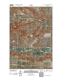
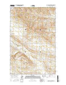
Pike Creek Hills East, MT,
U.S. National Grid,
US,
US Topo,
US Topo Historical,
United States,
contour,
geographic names,
hydrography,
imageryBaseMapsEarthCover,
orthoimage,
structures,
topographic,
transportation, Fewer tags
Layered GeoPDF 7.5 Minute Quadrangle Map. Layers of geospatial data include orthoimagery, roads, grids, geographic names, elevation contours, hydrography, and other selected map features.
Tags: 7.5 x 7.5 minute,
Downloadable Data,
EarthCover,
Garfield,
GeoPDF, All tags...
Imagery and Base Maps,
Map,
Montana,
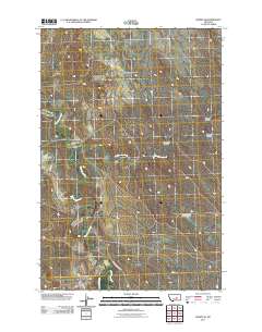
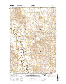
Mosby SE, MT,
Musselshell,
Petroleum,
Rosebud,
U.S. National Grid,
US,
US Topo,
US Topo Historical,
United States,
contour,
geographic names,
hydrography,
imageryBaseMapsEarthCover,
orthoimage,
structures,
topographic,
transportation, Fewer tags

Overview This directory was developed to provide discovery information for anyone looking for publicly accessible repositories that house geological materials in the U.S. and Canada. In addition, this resource is intended to be a tool to facilitate a community of practice. The need for the directory was identified during planning for and follow-up from a drill core repository webinar series in Spring 2020 for public repository curators and staff in the U.S. and Canada hosted by the Minnesota Geological Survey and the Minnesota Department of Natural Resources. Additional supporting sponsors included the U.S. Geological Survey National Geological and Geophysical Data Preservation Program and the Association of American...
Categories: Data;
Types: Downloadable,
Map Service,
OGC WFS Layer,
OGC WMS Layer,
Shapefile;
Tags: Alabama,
Alaska,
Alberta,
Arkansas,
British Columbia, All tags...
Canada,
Colorado,
Connecticut,
Delaware,
Economic Geology,
Energy Resources,
Florida,
Illinois,
Indiana,
Iowa,
Kansas,
Kentucky,
Maine,
Marine Geology,
Maryland,
Massachusetts,
Michigan,
Mineral Resources,
Minnesota,
Missouri,
Nebraska,
Nevada,
New Jersey,
New York,
Newfoundland,
North Carolina,
North Dakota,
Northwest Territories,
Nova Scotia,
Ohio,
Oklahoma,
Ontario,
Pennsylvania,
Saskatchewan,
South Carolina,
South Dakota,
Texas,
USGS Science Data Catalog (SDC),
United States,
Utah,
Virginia,
Washington,
West Virginia,
Wisconsin,
Wyoming,
Yukon,
directories,
drilling and coring,
fossils,
geoscientificInformation,
igneous rocks,
metamorphic rocks,
mineral deposits,
petroleum,
sample repositories,
sedimentary rocks,
specimen collecting,
unconsolidated deposits, Fewer tags

Airborne electromagnetic (AEM) and magnetic survey data were collected during October 2014 in a 553-square-kilometer area that includes the East Poplar oil field on the Fort Peck Indian Reservation in northeastern Montana, USA. Data surround the city of Poplar and extend south into the Missouri River floodplain. Data were acquired with the SkyTEM301 transient electromagnetic helicopter-borne system together with a Geometrics G-822 magnetometer. The AEM average depth of investigation is about 80 m. The survey was flown at a nominal flight height of 30 m above terrain along north-south oriented flight lines; the majority of lines had a nominal spacing of 200 m with a sub-block area in the central portion of the oil...
Categories: Data;
Types: Downloadable,
Map Service,
OGC WFS Layer,
OGC WMS Layer,
Shapefile;
Tags: CGGSC,
City of Poplar,
Crustal Geophysics and Geochemistry Science Center,
East Poplar Oil Field,
Energy Resources Program, All tags...
Fort Peck Indian Reservation,
Fort Peck Office of Environmental Protection,
Missouri River,
Montana,
Poplar River,
Roosevelt County,
STEPPE,
Science Team about Energy and Plains and Potholes Environments,
USGS Science Data Catalog (SDC),
WY-MTWSC,
Williston Basin,
Wyoming-Montana Water Science Center,
aeromagnetic surveying,
electromagnetic surveying,
environment,
geophysics,
geoscientificInformation,
geospatial datasets,
magnetic surveying,
natural gas resources,
oil and gas production,
oil resources,
petroleum,
produced waters,
resistivity,
salinity, Fewer tags
Layered geospatial PDF Map. Layers of geospatial data include orthoimagery, roads, grids, geographic names, elevation contours, hydrography, and other selected map features.
Tags: 7.5 x 7.5 minute,
Downloadable Data,
EarthCover,
Fergus,
GeoPDF, All tags...
Imagery and Base Maps,
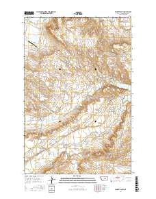
Lake Mason NW, MT,
Map,
Montana,
Musselshell,
Petroleum,
Public Land Survey System,
U.S. National Grid,
US,
US Topo,
US Topo Historical,
United States,
boundary,
contour,
geographic names,
hydrography,
imageryBaseMapsEarthCover,
orthoimage,
structures,
topographic,
transportation,
woodland, Fewer tags
Layered geospatial PDF Map. Layers of geospatial data include orthoimagery, roads, grids, geographic names, elevation contours, hydrography, and other selected map features.
Tags: 7.5 x 7.5 minute,
Downloadable Data,
EarthCover,
GeoPDF,
Imagery and Base Maps, All tags...
Map,
Montana,
Petroleum,
Public Land Survey System,
U.S. National Grid,
US,
US Topo,
US Topo Historical,
United States,
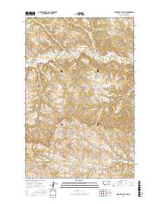
Weingart Place, MT,
boundary,
contour,
geographic names,
hydrography,
imageryBaseMapsEarthCover,
orthoimage,
structures,
topographic,
transportation,
woodland, Fewer tags
Layered geospatial PDF Map. Layers of geospatial data include orthoimagery, roads, grids, geographic names, elevation contours, hydrography, and other selected map features.
Tags: 7.5 x 7.5 minute,
Downloadable Data,
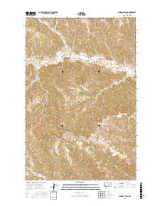
Dry Blood Creek West, MT,
EarthCover,
GeoPDF, All tags...
Imagery and Base Maps,
Map,
Montana,
Petroleum,
Public Land Survey System,
U.S. National Grid,
US,
US Topo,
US Topo Historical,
United States,
boundary,
contour,
geographic names,
hydrography,
imageryBaseMapsEarthCover,
orthoimage,
structures,
topographic,
transportation,
woodland, Fewer tags
Layered geospatial PDF Map. Layers of geospatial data include orthoimagery, roads, grids, geographic names, elevation contours, hydrography, and other selected map features.
Tags: 7.5 x 7.5 minute,
Downloadable Data,
EarthCover,
Garfield,
GeoPDF, All tags...
Imagery and Base Maps,
Map,
Montana,
Mosby SE, MT,
Musselshell,
Petroleum,
Public Land Survey System,
Rosebud,
U.S. National Grid,
US,
US Topo,
US Topo Historical,
United States,
boundary,
contour,
geographic names,
hydrography,
imageryBaseMapsEarthCover,
orthoimage,
structures,
topographic,
transportation,
woodland, Fewer tags
Layered geospatial PDF Map. Layers of geospatial data include orthoimagery, roads, grids, geographic names, elevation contours, hydrography, and other selected map features.
Tags: 7.5 x 7.5 minute,
Downloadable Data,
EarthCover,
GeoPDF,
Imagery and Base Maps, All tags...
Map,
Montana,
Petroleum,
Public Land Survey System,
U.S. National Grid,
US,
US Topo,
US Topo Historical,
United States,
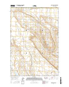
Winnett South, MT,
boundary,
contour,
geographic names,
hydrography,
imageryBaseMapsEarthCover,
orthoimage,
structures,
topographic,
transportation,
woodland, Fewer tags
Layered geospatial PDF Map. Layers of geospatial data include orthoimagery, roads, grids, geographic names, elevation contours, hydrography, and other selected map features.
Tags: 7.5 x 7.5 minute,
Downloadable Data,
EarthCover,
GeoPDF,
Imagery and Base Maps, All tags...
Map,
Montana,
Petroleum,
Public Land Survey System,
U.S. National Grid,
US,
US Topo,
US Topo Historical,
United States,
Weingart Place NW, MT,
boundary,
contour,
geographic names,
hydrography,
imageryBaseMapsEarthCover,
orthoimage,
structures,
topographic,
transportation,
woodland, Fewer tags

During 2014-2016, the depth to top of perforated intervals and depth to base of freshwater for oil and gas production wells in California were extracted from well records maintained by the California Division of Oil, Gas, and Geothermal Resources (DOGGR). Well records including geophysical logs, well history, well completion reports, and correspondences were viewed on DOGGR's Well Finder website at https://maps.conservation.ca.gov/doggr/wellfinder/. This digital dataset contains 3,505 records for production wells, of which 2,964 wells have a recorded depth to top of perforated intervals and 1,494 wells have a recorded depth to base of freshwater. Wells were attributed with American Petroleum Institute (API) numbers,...

This data release contains the boundaries of assessment units and input data for the assessment of undiscovered continuous oil and gas resources in the Bakken formation of Northwest Montana. The Assessment Unit is the fundamental unit used in the National Assessment Project for the assessment of undiscovered oil and gas resources. The Assessment Unit is defined within the context of the higher-level Total Petroleum System. The Assessment Unit is shown herein as a geographic boundary interpreted, defined, and mapped by the geologist responsible for the province and incorporates a set of known or postulated oil and (or) gas accumulations sharing similar geologic, geographic, and temporal properties within the Total...
Categories: Data;
Types: Downloadable,
Map Service,
OGC WFS Layer,
OGC WMS Layer,
Shapefile;
Tags: Assessment Unit,
Continuous Assessment Unit,
Energy Resources,
Energy Resources,
Geology, All tags...
NOGA2000,
NW Montana Bakken Formation Continuous Gas,
NW Montana Bakken Formation Continuous Oil,
National Assessment of Oil and Gas,
Natural Gas,
Oil,
OilGas,
Resource Assessment,
State of Montana,
USGS Science Data Catalog (SDC),
Unconventional Assessment Unit,
United States of America,
energy resources,
geoscientificInformation,
natural gas resources,
oil resources,
petroleum, Fewer tags

This data release contains the boundaries of assessment units, assessment input data and resulting fact sheet data tables for the assessment of undiscovered oil and gas resources in the Barents Sea Area. The Assessment Unit is the fundamental unit used in the National and Global Oil and Gas Assessment Project for the assessment of undiscovered oil and gas resources. The Assessment Unit is defined within the context of the higher-level Total Petroleum System. The Assessment Unit is shown herein as a geographic boundary interpreted, defined, and mapped by the geologist responsible for the province and incorporates a set of known or postulated oil and (or) gas accumulations sharing similar geologic, geographic, and...
Categories: Data;
Types: Downloadable,
Map Service,
OGC WFS Layer,
OGC WMS Layer,
Shapefile;
Tags: Assessment Unit,
Barents Platform North Reservoirs,
Barents Platform South Reservoirs,
Conventional Assessment Unit,
Energy Resources, All tags...
Energy Resources,
Geology,
Kolguyev Terrace Reservoirs,
NOGA2000,
National Assessment of Oil and Gas,
Natural Gas,
North Barents Reservoirs,
Oil,
OilGas,
Resource Assessment,
Russia,
South Barents-Ludlov Saddle Reservoirs,
Svalbard,
USGS Science Data Catalog (SDC),
energy resources,
geoscientificInformation,
natural gas resources,
oil resources,
petroleum, Fewer tags

Proppants used during hydraulic fracturing of oil and gas wells are manufactured to maximize petroleum yield by controlling the size, shape, density, and strength of the proppant material. The most common types of proppants are mined silica sand and manufactured ceramics, some of which are further modified with organic resin coatings to improve performance. Much of the work on the environmental and human health effects of proppant releases into the environment has focused on occupational silicosis, with little attention given to the potential effects from the organic coatings on these materials. This oversight is especially relevant in the context of dumping of unwanted proppant on the land surface, which has been...
Categories: Data;
Types: Map Service,
OGC WFS Layer,
OGC WMS Layer,
OGC WMS Service;
Tags: Energy Resources,
Environmental Health,
Geochemistry,
New Mexico,
USGS Science Data Catalog (SDC), All tags...
chemical analysis,
environment,
geochemistry,
geoscientificInformation,
hydraulic fracturing,
petroleum, Fewer tags

This shapefile contains polylines that describe isopachs of the Hauterivian Qezeltash formation in northern Afghanistan. Hauterivian sandstones are a reservoir rock of the Jurassic subsalt petroleum systems of the Afghan-Tajik and Amu Darya basins.
Categories: Data,
pre-SM502.8;
Types: Downloadable,
Map Service,
OGC WFS Layer,
OGC WMS Layer,
Shapefile;
Tags: AF,
Afghan-Tajik basin, Province 1156,
Afghanistan Ministry of Mines and Industry,
Amu Darya basin, Province 1154,
Earth Science, All tags...
Geology,
Islamic State of Afghanistan,
Joint Oil and Gas Resource Assessment Team,
Natural Gas,
Natural Resources,
Northern Afghanistan,
Oil,
Petroleum,
Qezeltash formation,
Qezeltash isopachs,
Resource Assessment,
Thickness of Hauterivian red beds,
Thickness of Hauterivian reservoir,
Thickness of Hauterivian sandstones,
Thickness of Lower Cretaceous reservoir,
Thickness of Lower Cretaceous sandstones,
U.S. Geological Survey,
USGS,
USGS Science Data Catalog (SDC),
afghan,
geoscientificInformation,
oilgas,
wep,
worldgeologicmaps, Fewer tags

The USGS Central Region Energy Team assesses oil and gas resources of the United States. The onshore and State water areas of the United States comprise 71 provinces. Within these provinces, Total Petroleum Systems are defined and Assessment Units are defined and assessed. Each of these provinces is defined geologically, and most province boundaries are defined by major geologic changes. The Uinta-Piceance Province is located in eastern Utah and western Colorado, encompassing all or parts of Delta, Garfield, Gunnison, Mesa, Moffat, Montrose, Ouray, Rio Blanco, and Routt Counties in Colorado and all or parts of Carbon, Duchesne, Emery, Grand, Sanpete, Sevier, Uintah, Utah, and Wasatch Counties in Utah. The main population...
Categories: Data,
pre-SM502.8;
Types: Downloadable,
Map Service,
OGC WFS Layer,
OGC WMS Layer,
Shapefile;
Tags: 502001 = Ferron Coal/Wasatch Plateau,
50200101 = Conventional Ferron Sandstone Gas,
50200161 = Deep (6,000 feet plus) Coal and Sandstone Gas,
50200181 = Northern Coal Fairway/Drunkards Wash,
50200182 = Central Coal Fairway/Buzzards Bench, All tags...
50200183 = Southern Coal Fairway,
50200184 = Joes Valley and Messina Grabens,
50200185 = Southern Coal Outcrop,
502002 = Mesaverde,
50200201 = Uinta-Piceance Basin Conventional Gas,
50200261 = Uinta Basin Continuous Gas,
50200262 = Uinta Basin Transitional Gas,
50200263 = Piceance Basin Continuous Gas,
50200264 = Piceance Basin Transitional Gas,
50200281 = Uinta Basin Blackhawk Coalbed Gas,
50200282 = Mesaverde Group Coalbed Gas,
502003 = Mancos/Mowry,
50200361 = Piceance Basin Continuous Gas,
50200362 = Uinta Basin Continuous Gas,
50200363 = Uinta-Piceance Transitional and Migrated Gas,
502004 = Phosphoria,
50200401 = Hanging Wall,
50200402 = Paleozoic/Mesozoic,
502005 = Green River,
50200501 = Uinta Green River Conventional Oil and Gas,
50200502 = Piceance Green River Conventional Oil,
50200561 = Deep Uinta Overpressured Continuous Oil,
CO,
Coalbed methane resources,
Colorado Plateau,
Colorado Plateau and Basin and Range,
Earth Science,
Economic geology,
Energy Resources,
Gas hydrate resources,
Geology,
Kirschbaum, M.A.,
National Assessment of Oil and Gas,
Natural Gas,
Natural Resources,
Natural gas resources,
Oil,
Oil sand resources,
Oil shale resources,
Petroleum,
Province,
Resource Assessment,
Sedimentary Basin,
U.S. Geological Survey,
US08 = Colorado,
US49 = Utah,
USGS,
USGS Science Data Catalog (SDC),
USGS World Energy Region 5,
USGS World Energy Region 5,
UT,
Uinta-Piceance,
Uinta-Piceance,
United States,
geoscientificInformation,
noga2000,
nogaupiceance,
oilgas, Fewer tags

Locations and shapes of salt diapirs were modified after the New Orleans Geological Society map, Salt tectonism of the U.S. Gulf Coast Basin (compiled by J.A. Lopez, 1995); Plate 2, Principal structural features, Gulf of Mexico Basin (compiled by T.E. Ewing and R.F. Lopez) in Volume J, The Geology of North America (1991); and U.S. Geological Survey Miscellaneous Field Studies Map MF-1213, Distribution of salt structures, Gulf of Mexico, by R.G. Martin (1980). This dataset contains basic data and interpretations developed and compiled by the U.S. Geological Survey's Framework Studies and Assessment of the Gulf Coast Project. Other major sources of data include publicly available information from state agencies as...
Categories: Data,
pre-SM502.8;
Types: Downloadable,
Map Service,
OGC WFS Layer,
OGC WMS Layer,
Shapefile;
Tags: AL,
AR,
Anticlines,
Coal,
Coalbed Methane, All tags...
Coalbed methane resources,
Earth Science,
Economic geology,
Energy Resources,
FL,
Geology,
Geology,
Gulf Coast,
Gulf Coast Framework Studies,
Gulf of Mexico,
LA,
MS,
Miocene,
Natural Gas,
Natural Resources,
Natural gas resources,
Oil,
Oil sand resources,
Petroleum,
Resource Assessment,
TX,
Tertiary Systems,
U.S. Geological Survey,
USGS,
USGS Science Data Catalog (SDC),
United States,
economy,
geoscientificInformation,
gulfcoastframework,
gulfroom,
oilgas, Fewer tags

The USGS Central Region Energy Team assesses oil and gas resources of the United States. The onshore and State water areas of the United States comprise 71 provinces. Within these provinces, Total Petroleum Systems are defined and Assessment Units are defined and assessed. Each of these provinces is defined geologically, and most province boundaries are defined by major geologic changes. The Appalachian Basin Province is located in the eastern United States, encompassing all or parts of the counties in Alabama, Georgia, Kentucky, Maryland, New Jersey, New York, North Carolina, Ohio, Pennsylvania, Tennessee, Virginia, and West Virginia. The main population centers within the study area are Birmingham, Alabama; Buffalo,...
Categories: Data,
pre-SM502.8;
Types: Downloadable,
Map Service,
OGC WFS Layer,
OGC WMS Layer,
Shapefile;
Tags: 506701 = Conasauga-Rome/Conasauga,
50670101 = Rome Trough,
506702 = Sevier-Knox Trenton,
50670201 = Lower Paleozoic Carbonates,
506703 = Utica-Lower Paleozoic, All tags...
50670301 = Lower Paleozoic Carbonates in Thrust Belt,
50670302 = Knox Unconformity,
50670303 = Black River-Trenton Hydrothermal Dolomite,
50670304 = Lockport Dolomite,
50670361 = Clinton-Medina Basin Center,
50670362 = Clinton-Medina Transitional Northeast,
50670363 = Clinton-Medina Transitional,
50670364 = Tuscarora Basin Center,
506704 = Devonian Shale-Middle and Upper Paleozoic,
50670401 = Oriskany Sandstone-Structural,
50670402 = Oriskany Sandstone-Stratigraphic,
50670403 = Greenbrier Limestone,
50670404 = Mississippian Sandstones,
50670461 = Greater Big Sandy,
50670462 = Northwestern Ohio Shale,
50670463 = Devonian Siltstone and Shale,
50670464 = Marcellus Shale,
50670465 = Catskill Sandstones and Siltstone,
50670466 = Berea Sandstone,
506705 = Carboniferous Coal-Bed Gas,
50670581 = Pocahontas Basin,
50670582 = East Dunkard (Folded),
50670583 = West Dunkard (Unfolded),
50670584 = Central Appalachian Shelf,
50670585 = Appalachain Anthracite and Semi-Anthracite,
506706 = Pottsville Coal-Bed Gas,
50670681 = Cahaba Basin,
67 = Appalachian Basin,
AL,
Appalachian Basin,
Coalbed methane resources,
Earth Science,
Economic geology,
Energy Resources,
GA,
Gas hydrate resources,
Geology,
KY,
MD,
Milici, Robert C.,
NC,
NJ,
NY,
National Assessment of Oil and Gas,
Natural Gas,
Natural Resources,
Natural gas resources,
OH,
Oil,
Oil sand resources,
Oil shale resources,
PA,
Petroleum,
Province,
Resource Assessment,
Sedimentary Basin,
TN,
U.S. Geological Survey,
US01 = Alabama,
US13 = Georgia,
US21 = Kentucky,
US24 = Maryland,
US34 = New Jersey,
US36 = New York,
US37 = North Carolina,
US39 = Ohio,
US42 = Pennsylvania,
US47 = Tennessee,
US51 = Virginia,
US54 = West Virginia,
USGS,
USGS Science Data Catalog (SDC),
USGS World Energy Region 5,
USGS World Energy Region 5,
United States,
VA,
WV,
geoscientificInformation,
noga2000,
nogaappalachian,
oilgas, Fewer tags

The volcanic provinces are modified after Plate 2, Principal structural features, Gulf of Mexico Basin (compiled by T.E. Ewing and R.F. Lopez) in Volume J, The Geology of North America (1991). This dataset contains basic data and interpretations developed and compiled by the U.S. Geological Survey's Framework Studies and Assessment of the Gulf Coast Project. Other major sources of data include publicly available information from state agencies as well as publications of the U.S. Geological Survey and other scientific organizations. In cases where company proprietary data were used to produce various derivatives such as contour surfaces, the source is cited but the data are not displayed.
Categories: Data,
pre-SM502.8;
Types: Downloadable,
Map Service,
OGC WFS Layer,
OGC WMS Layer,
Shapefile;
Tags: AL,
AR,
Anticlines,
Coal,
Coalbed Methane, All tags...
Coalbed methane resources,
Earth Science,
Economic geology,
Energy Resources,
FL,
Geology,
Geology,
Gulf Coast,
Gulf Coast Framework Studies,
Gulf of Mexico,
LA,
MS,
Miocene,
Natural Gas,
Natural Resources,
Natural gas resources,
Oil,
Oil sand resources,
Petroleum,
Resource Assessment,
TX,
Tertiary Systems,
U.S. Geological Survey,
USGS,
USGS Science Data Catalog (SDC),
United States,
economy,
geoscientificInformation,
gulfcoastframework,
gulfroom,
oilgas, Fewer tags

This coverage includes arcs, polygons and polygon labels that describe U.S. Geological Survey defined geologic provinces of the Australia and New Zealand area (Australia, Fiji, New Zealand, Tonga and Vanuatu; and parts of Indonesia, Papua New Guinea and Solomon Islands). Each province has a set of geologic characteristics distinguishing it from surrounding provinces. These characteristics may include the dominant lithologies, the age of the strata, and the structural style. Some provinces include multiple genetically-related basins. Offshore province boundaries are defined by the 2000 meter bathymetric contour.
Categories: Data,
pre-SM502.8;
Types: Downloadable,
Map Service,
OGC WFS Layer,
OGC WMS Layer,
Shapefile;
Tags: AS,
Adelaide and Kanmantoo Fold Belts, Province 3901,
Akita Basin, Province 3301,
Alakol Basin, Province 1169,
Alashan Yinshan Fold Belt, Province 3101, All tags...
Albany-Fraser Province 3904,
Altay-Sayan Folded Region, Province 1219,
Altunshan Fold Belt, Province 3102,
Amadeus Basin, Province 3903,
Arafura Basin-Irian Jaya, Province 3801,
Arunta Block, Province 3904,
Australia,
Australian Arafura Basin, Province 3905,
BP,
Baikal-Patom Folded Region, Province 1230,
Bali Basin, Province 3802,
Banda Arc, Province 3803,
Bangemall and Nabberu Basins, Province 3906,
Baram Delta/Brunei-Sabah Basin, Province 3701,
Barito Basin, Province 3804,
Bass Basin, Province 3907,
Bassian Rise, Province 3908,
Bau Waters Basin, Province 3001,
Beibuwan Basin, Province 3103,
Bellona Plateau, Province 3002,
Bicol Shelf Basin, Province 3601,
Bijianan Basin, Province 3180,
Bintuni/Sulawati Province 3805,
Birrindudu Basin and Tanami Block, Province 3909,
Bligh Water Basin, Province 3003,
Bogdashan Fold Belt, Province 3105,
Bohaiwan Basin, Province 3127,
Bonaparte Gulf Basin, Province 3910,
Bone Basin, Province 3806,
Bose Basin, Province 3106,
Bowen Basin, Province 3911,
Bremer Basin, Province 3912,
Browse Basin, Province 3913,
Cagayan Basin, Province 3602,
Canning Basin, Province 3914,
Cape Vogel Basin, Province 3964,
Capricorn Basin, Province 3915,
Carnarvon Basin, Province 3916,
Carpentaria Basin, Province 3917,
Celebes Sea, Province 3807,
Central Sumatra Basin, Province 3808,
Central Vietnam Basin, Province 3501,
Challenger Plateau, Province 3918,
Chatham Rise, Province 3972,
Choybalsan Basin, Province 3203,
Chuxiong Basin, Province 3107,
Clarence-Moreton Basin, Province 3919,
Coen-Yambo Block, Province 3920,
Commonwealth of Australia,
Cotabato Basin, Province 3603,
Cuoqing Lupola Basin, Province 3108,
Daly River Basin, Province 3921,
Darling Basin, Province 3922,
Drummond Fold Belt and Anakie High, Province 3923,
Earth Science,
East China Sea Basin, Province 3109,
East Ili Basin, Province 1164,
East Java Basin, Province 3809,
East Natuna Basin, Province 3810,
East Ontong Java Rise, Province 3014,
Economic geology,
Erlian Basin, Province 3110,
Erlian Uplift, Province 3166,
Eromanga Basin, Province 3924,
Eucla Basin, Province 3925,
FF,
Fiji,
Fiji Islands, Province 3973,
Fiji Ridge, Province 3006,
Flores Basin, Province 3811,
Galilee Basin, Province 3926,
Gas,
Gascoyne Block, Province 3927,
Gawler Block, Province 3928,
Gensan Basin, Province 3401,
Geologic Provinces,
Geologic map,
Geology,
Georgina Basin, Province 3929,
Gippsland Basin, Province 3930,
Gobi Basin, Province 3204,
Gorontalo Basin, Province 3812,
Great Australian Bight Basin, Province 3931,
Great Lake Basin, Province 3208,
Great Lake Uplift, Province 3209,
Great South Basin, Province 3007,
Greater Sarawak Basin, Province 3702,
Gyeongsang Basin, Province 3402,
Halifax Basin, Province 3932,
Halls Creek Province 3933,
Halmahera Basin, Province 3813,
Halmahera Platform, Province 3814,
Heilongjiang Basin, Province 3165,
Hikurani Trough, Province 3008,
Himalayan, Province 8002,
Hodgkinson/Lachlan Fold Belt, Province 3934,
Honshu Ridge, Province 3302,
Huskan Platform, Province 3403,
ID,
Independent State of Papua New Guinea,
Independent State of Samoa,
Indispensable Reef, Province 3015,
Indonesia,
Ishikari Hidaka Basin, Province 3303,
Japan Volcanic Arc/Accreted Terrane, Province 3304,
Java/Banda Sea, Province 3815,
Jianghan Basin, Province 3112,
Jiangnan South Jiangsu Fold Belt, Province 3113,
Jiuquan Minle Wuwei Basin, Province 3114,
Joban Basin, Province 3305,
Junggar Basin, Province 3115,
Kanto Basin, Province 3306,
Karamay Thrust Belt, Province 3116,
Kermadec Ridge, Province 3010,
Ketuneau/Sintang Terrane, Province 3816,
Khanka Basin, Province 1226,
Khorat Platform, Province 3502,
Kimberley Basin, Province 3935,
Kingdom of Tonga,
Korba Bay Basin, Province 3404,
Korean Continental Shelf, Province 3406,
Korean Craton, Province 3405,
Kumukulig Basin, Province 3117,
Kunlunshan Fold Belt, Province 3118,
Kutei Basin, Province 3817,
Lacklan Fold Belt, Province 3936,
Lanping Simao Basin, Province 3119,
Laura Basin, Province 3937,
Leidong Basin, Province 3120,
Lhasa Basin, Province 3121,
Lhasa Terrane, Province 3122,
Longmenshan Dabashan Fold Belt, Province 3168,
Lord Howe Rise, Province 3011,
Loyalty Island Ridge, Province 3012,
Luxi Jiaoliao Uplift, Province 3124,
Malakula/Aoba/Banks Basin, Province 3938,
Malay Basin, Province 3703,
Malay Peninsula, Province 3704,
Marion Terrain, Province 3939,
Maryborough Basin, Province 3940,
McArthur Basin, Province 3945,
Mekong/Cuulong/Vung Tau Basin, Province 3503,
Melanesia,
Melanesia Border Plateau, Province 3013,
Melawi Basin, Province 3818,
Mellish Reef, Province 3017,
Meratus High, Province 3819,
Merauke Platform, Province 3820,
Middle Amur Basin, Province 1227,
Miyazaki Basin, Province 3307,
Mohe Basin, Province 3164,
Money Shoal Basin, Province 3941,
Mongol-Okhotsk Folded Region, Province 3202,
Mt. Isa Block, Province 3942,
Murray Basin, Province 3943,
Musgrave Block, Province 3944,
NC,
NH,
NZ,
Nanpanjiang Depression, Province 3125,
Nanyang Basin, Province 3126,
Natural Gas,
Natural Resources,
Natural gas resources,
New Caledonia,
New Caledonia, Province 3018,
New England Fold Belt, Province 3946,
New Guinea Foreland Basin-Fold Belt, Province 3966,
New Guinea Mobile Belt, Province 3967,
New Hebrides Arc, Province 3019,
New Ireland Basin, Province 3968,
New Zealand,
New Zealand East Coast Basin, Province 3020,
New Zealand Orogenic Belt, Province 3021,
Ngalia Basin, Province 3947,
Niigata Basin, Province 3308,
Norfolk Island Ridge, Province 3022,
North Banda Basin, Province 3821,
North Sumatra Basin, Province 3822,
Northern Irian Jaya Waropen Basin, Province 3823,
Northland Basin, Province 3023,
Northwest Java Basin, Province 3824,
Northwest Shelf, Province 3948,
Nyalga Basin, Province 3205,
Oceania,
Officer Basin, Province 3949,
Oil,
Oil,
Oil sand resources,
Oil shale resources,
Okinawa Trough, Province 3309,
Ordos Basin, Province 3128,
Otway Basin, Province 3950,
PP,
Palawan Shelf, Province 3605,
Pamusian Tarakan Basin, Province 3606,
Panjang/Cardomomes Basin, Province 3504,
Papua New Guinea,
Papuan Basin-Shelf Platform, Province 3969,
Paterson Province 3951,
Pearl River Mouth Basin, Province 3130,
Penyu/West Natuna Basin, Province 3825,
Perth Basin, Province 3952,
Petroleum,
Philippine Accretionary Prism, Province 3607,
Philippine Magmatic Arc, Province 3608,
Pilbara Block, Province 3953,
Pine Creek Geosyncline, Province 3954,
Qabdu Basin, Province 3137,
Qaidam Basin, Province 3131,
Qiangtang Tanggula Basin, Province 3132,
Qiangtang Terrane, Province 3133,
Qilianshan Fold Belt, Province 3134,
Qinling Dabieshan Fold Belt, Province 3135,
Qiongdongnan Basin, Province 3136,
Queensland Plateau, Province 3955,
Rajang-Crocker Accretionary Prism, Province 3705,
Reed Bank Basin, Province 3609,
Republic of Indonesia,
Republic of Vanuatu,
Republic of the Fiji Islands,
Resource Assessment,
Rocky Cape Block/Dundas Trough, Province 3956,
Russell Basin, Province 3016,
Ryukyu Volcanic Arc, Province 3310,
Sagara Basin, Province 3311,
Saigon Basin, Province 3505,
Samoa,
Samoa Basin, Province 3024,
Sanshui Basin, Province 3139,
Sea Of Japan Backarc Basin, Province 3312,
Sepik-Ramu Basin, Province 3970,
Shanxi Plateau, Province 3140,
Shiwan Dashan Basin, Province 3141,
Shorland Basin, Province 3004,
Sichuan Basin, Province 3142,
Sikhote-Alin Folded Region, Province 1224,
Sinzi Uplift, Province 3313,
Solander-Waiau Basin, Province 3025,
Solomon Islands, Province 3005,
Songliao Basin, Province 3144,
Songpan Ganzi Fold Belt, Province 3143,
South Banda Basin, Province 3826,
South Bismarck Volcanic Arc, Province 3971,
South China Continental Shelf Slope, Province 3181,
South China Fold Belt, Province 3146,
South China Ocean Basin, Province 3167,
South China Sea Platform, Province 3506,
South Makassar Basin, Province 3827,
South Sumatra Basin, Province 3828,
Stuart Shelf, Province 3957,
Subei Yellow Sea Basin, Province 3147,
Sulawesi Accretionary Prism, Province 3829,
Sulawesi Magmatic Arc, Province 3830,
Sulongshan Fold Belt, Province 3148,
Sulu Arch, Province 3610,
Sulu Sea Basin, Province 3611,
Sumatra/Java Accretionary Prism, Province 3831,
Sumatra/Java Fore-Arc Basins, Province 3832,
Sumatra/Java Magmatic Arc, Province 3833,
Sumba Province 3834,
Sunda Platform, Province 3835,
Surat Basin, Province 3958,
Sydney Basin, Province 3959,
TN,
TV,
Tagaung Myitkyina Fold Belt, Province 3520,
Taihangshan Yanshan Fold Belt, Province 3149,
Taikang Hefei Basin, Province 3150,
Taiwan Melange Belt, Province 3152,
Taiwan Thrust and Fold Belt, Province 3151,
Taixinan Basin, Province 3153,
Taranaki Basin, Province 3031,
Tarim Basin, Province 3154,
Tasmania,
Tasmania Basin, Province 3960,
Temtsag Hailar Basin, Province 3207,
Tenasserim-Shan, Province 8006,
Tennant Creek Block, Province 3961,
Thai Basin, Province 3507,
Thailand Mesozoic Basin Belt, Province 3508,
Three Kings Rise, Province 3026,
Tian Shan Foldbelt, Province 1158,
Tokachi Basin, Province 3314,
Tonga,
Tonga Ridge, Province 3027,
Tonle Sap-Phnom Penh Basin, Province 3509,
Tottori Basin, Province 3315,
Truong Son Fold Belt, Province 3510,
Tsushima Basin, Province 3316,
Turpan Basin, Province 3156,
U.S. Geological Survey,
USGS,
USGS Science Data Catalog (SDC),
Ulan Bator Basin, Province 3210,
Ushumun Basin, Province 3138,
Vanikoro Basin, Province 3028,
Vanuatu,
Victoria River Basin, Province 3962,
Visayan, Province 3612,
WS,
Waikato Basin, Province 3029,
Wanganui Basin, Province 3030,
Weber Basin, Province 3836,
Wiso Basin, Province 3963,
Xichang Yunnan Fold Belt, Province 3157,
Xisha Trough, Province 3158,
Yilgarn Block, Province 3974,
Yingehai Basin, Province 3159,
Yinshan Da and Xiao Hingganling Uplift, Province 3160,
Yitong Graben, Province 3169,
Yunnan Guizhou Hubei Fold Belt, Province 3161,
Zambalez/Central Luzon Basin, Province 3837,
Zaysan Basin, Province 1170,
Zhangguangcailing Uplift, Province 3162,
asiapacific,
environment,
geoscientificInformation,
oilgas,
wep,
worldgeologicmaps, Fewer tags
|
|

