Filters: Tags: Quartz (X)
27 results (10ms)|
Filters
Date Range
Extensions (Less) Types (Less)
Contacts (Less)
Categories (Less) Tag Types
|
Temporal and spatial sources of silica for chert remain poorly constrained. Modern sources to the worlds oceans include silica in rivers > aeolian (dust) deposition > sea floor vents and submarine weathering. However, changes in aridity and dust flux during the Phanerozoic may explain variations in the ocean silica cycle and times and places of chert formation. The chemistry of fine quartz dust (FQD) provides a chemical mechanism for the transformation of FQD to polymorphs of silica in chert; FQD is readily dissolved, then reprecipitated as Opal-A by either biotic or abiotic processes. An unequivocal relation between increases in dust flux and biogenic opal-A in the western Pacific Ocean during the past 200 kyr...
Thin section showing replacement of arsenopyrite fragments by quartz and sercicite. Western Utah Mine. Toole County, Utah. ca. 1926. Plate 11-D, U.S.Geological Survey Professional paper 177. 1935.
Categories: Image;
Tags: Mills, Mines, Quarries,
Nolan, T.B. Collection,
Photographers,
Quartz,
Sercicite,
Photomicrograph of vein rock shown in photo 37, with plain light, showing orthoclase, or, fractured and veined by quartz q. Bartow County, Georgia. Circa 1944. Plate 12-C, in U.S.Geological Survey Professional paper 224. 1950.
Enlargement from just left of center of photo 5, graphic pattern of gold in quartz; photomicrograph by K.E. Lohman. Battle Branch mine. Lumpkin County, Georgia. 1935. Plate 11-B, U.S.Geological Survey Professional paper 213. 1948.
Categories: Image;
Tags: Lumpkin County, Georgia,
Mills, Mines, Quarries,
Park, C.F., Jr. Collection,
Photographers,
Photomicrographs,
Twenty-five ore and gangue mineral separates from the Miocene-age Goldfield and Tonopah epithermal Au-Ag deposits in southwestern Nevada were analyzed to determine the helium, neon, and argon (He, Ne, and Ar) isotopic compositions contained in fluid inclusions. Four mineral separates from the Butte Main Stage vein deposit and two from the Bingham pyrite-enargite vein deposits were also analyzed. Fifteen separates are from hand samples collected from underground mine workings and the remaining 16 are from mine tailings piles and pits excavated within the past 100 years. The separates consist dominantly of pyrite, enargite, and quartz, with lesser amounts of sphalerite, galena, potassium feldspar, bismuthinite, marcasite,...
Categories: Data;
Tags: 3He/4He,
Ar,
Bingham Copper Mine,
Bingham pyrite-enargite vein deposit,
Butte Main Stage vein deposit,
Vugs and comb quartz: Polished slab from vug, euhedral quartz crystals are coated with white ankerite. The vug is filled with a dark-green mixture of chlorite and mechanically ground quartz in a matrix of carbonates. Nevada County, California. 1931. Plate 15-B, U.S.Geological Survey Professional paper 194. 1940.
Categories: Image;
Types: Map Service,
OGC WFS Layer,
OGC WMS Layer,
OGC WMS Service;
Tags: Johnston, W. D., Jr. Collection,
Mills, Mines, Quarries,
Nevada County, California,
Photographers,
Quartz,
The U.S. Geological Survey (USGS) has compiled a geodatabase containing mineral-related geospatial data for the People's Republic of China. The data can be used in analyses of the extractive fuel and nonfuel mineral industries and related economic and physical infrastructure integral for the successful operation of the mineral industries within the area of study as well as the movement of mineral products across domestic and global markets. This geodatabase reflects the USGS ongoing commitment to its mission of understanding the nature and distribution of global mineral commodity supply chains by updating and publishing the georeferenced locations of mineral commodity production and processing facilities, mineral...
This DGGS Raw Data File presents 40Ar/39Ar age dating results for selected igneous rocks encountered in the Styx River area of the western Alaska Range. Crystallization ages on biotite and hornblende from plutonic rocks range from about ~60 to ~63 Ma, while a sericite alteration age in plutonic rocks altered by a dike swarm also is around ~63 Ma. Sericite alteration associated with a copper-molybdenum porphyry ranges from ~10 to ~11 Ma. Analyses were performed by the University of Alaska Fairbanks Geochronology Laboratory, and results were reported by Paul Layer and Jeff Benowitz. This data release includes the following products: a summary of sample collection methods, the laboratory report, analytical data tables...
This location is part of the Arizona Mineral Industry Location System (AzMILS), an inventory of mineral occurences, prospects and mine locations in Arizona. Yavapai1200 is located in T11N R1E Sec 28 NW in the Battle Flat - 7.5 Min quad. This collection consists of various reports, maps, records and related materials acquired by the Arizona Department of Mines and Mineral Resources regarding mining properties in Arizona. Information was obtained by various means, including the property owners, exploration companies, consultants, verbal interviews, field visits, newspapers and publications. Some sections may be redacted for copyright. Please see the access statement.
Categories: Data;
Tags: 1980s,
Arizona,
Battle Flat - 7.5 Min,
Bradshaw Mts. physiographic area,
Corral Pegmatite,
This report provides detailed (1:63,360-scale) mapping of portions of U.S. Geological Survey Circle B-2 (1955), B-3 (1955), B-4 (1952), C-2 (1955), C-3 (1955), and C-4 (1952) quadrangles. The area is part of the Circle mining district and adjacent to the Fairbanks mining district. This report includes detailed geologic, structural, stratigraphic, and geochronologic data. Based on the resulting geologic maps, field investigations, and laboratory materials analyses, the project has also generated derivative maps of geologic construction materials and geologic hazards.
The U.S. Geological Survey (USGS) has compiled a geodatabase containing mineral-related geospatial data for 10 countries of interest in Southwest Asia (area of study): Afghanistan, Cambodia, Laos, India, Indonesia, Iran, Nepal, North Korea, Pakistan, and Thailand. The data can be used in analyses of the extractive fuel and nonfuel mineral industries and related economic and physical infrastructure integral for the successful operation of the mineral industries within the area of study as well as the movement of mineral products across domestic and global markets. This geodatabase reflects the USGS ongoing commitment to its mission of understanding the nature and distribution of global mineral commodity supply chains...
This data release is a geochemical data set from the reanalysis of 23 rock and 85 sediment samples collected between 1966 and 1970 by the U.S. Geological Survey (USGS) for a series of studies investigating the mineral resources of the Idaho Primitive Area (Cater et al., 1973). The samples are from the upper Middle Fork Salmon River and the South Fork Salmon River, including the tributaries of East Fork of the South Fork and Porphyry Creek. The overall objective of this study is to characterize the regional impact of legacy mining for the Frank Church - River of No Return Wilderness Area. In 1980 the U. S. Congress passed the Central Idaho Wilderness Act which combined the Idaho Primitive Area, the Salmon Rivers...
Categories: Data;
Types: Downloadable,
Map Service,
OGC WFS Layer,
OGC WMS Layer,
Shapefile;
Tags: Automatic Creek,
Beansnapper Creek,
Bear Creek,
Big Chief Creek,
Big Cottonwood Creek,
This data release contains the U.S. salient statistics and world production data extracted from the GEMSTONES data sheet of the USGS Mineral Commodity Summaries 2022.
Types: Map Service,
OGC WFS Layer,
OGC WMS Layer,
OGC WMS Service;
Tags: Lemhi County, Idaho,
Quartz
The State of Alaska Division of Geological & Geophysical Surveys (DGGS) and Division of Oil & Gas (DOG) are currently engaged in a multi-year study of the hydrocarbon potential of the Tertiary and Mesozoic strata in Cook Inlet basin. Modal analyses and routine core analyses were performed on Tertiary and Mesozoic siltstones and sandstones collected during the 2007-2010 field seasons from six geographic areas in upper and lower Cook Inlet. The reservoir quality of Cook Inlet sandstones varies widely depending on their mineralogy, geologic age, burial depth, and depositional environment. Tuxedni and Naknek sandstones have poor reservoir quality and are likely to be of equally poor quality down dip. West Foreland sandstones...
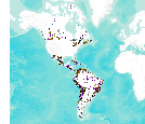
This data set consists of records for over 900 mineral facilities in Latin America and Canada. The mineral facilities include mines, plants, smelters, or refineries of aluminum, cement, coal, copper, diamond, gold, iron and steel, nickel, platinum-group metals, salt, and silver, among others. Records include attributes such as commodity, country, location, company name, facility type and capacity if applicable, and generalized coordinates. The data were compiled from multiple sources, including the 2003 and 2004 USGS Minerals Yearbooks (Latin America and Candada volume), data to be published in the 2005 Minerals Yearbook Latin America and Canada Volume, minerals statistics and information from the USGS minerals...
A U.S. Geological Survey (USGS) provisional geochemical and mineralogical database for hydrocarbon-rich shale in the Appalachian region has been compiled by Catherine Enomoto, Frank Dulong and Robert Milici for online distribution. USGS staff collaborated with geologists in State geological agencies to obtain samples that were analyzed for organic properties, including Rock Eval analyses, total organic carbon (TOC), thermal maturity, and semi-quantitative mineralogy. However, the database also contains previously published data, with appropriate citations included. Previously unpublished data are from samples collected and analyzed between 2007 and 2012 from wells drilled between 1931 and 2009, and from exposures...
This data release contains programmed pyrolysis, organic petrographic (reflectance), and semiquantitative X-ray diffraction mineralogy data for subsurface coal and shale samples from around the world. Samples were subjected to hydrous or anhydrous pyrolysis experiments at varying temperatures and the resulting residues were analyzed via programmed pyrolysis and reflectance to document changes in thermal maturity.
The U.S. Geological Survey assessed undiscovered petroleum resources in the downdip Paleogene formations of the U.S. Gulf Coast in 2018. During the assessment new data and information were collected to evaluate thermal maturity, source rock character, and unconventional reservoir rock prospectivity for the Cenozoic-aged section in south Louisiana. Samples were analyzed using multiple analytical approaches, including programmed pyrolysis (Rock-Eval), Leco TOC, organic petrographic analysis including vitrinite reflectance (Ro, %), and X-ray diffraction mineralogy. Associated abstract publication: Valentine, B.J., Elizalde, C., Enomoto, C.B., Hackley, P.C., 2015, Organic petrology and geochemistry of Tertiary and...
Upheaval Dome is a unique circular structure on the Colorado Plateau in SE Utah, the origin of which has been controversially discussed for decades. It has been interpreted as a crypto volcanic feature, a salt diapir, a pinched-off salt diapir, and an eroded impact crater. While recent structural mapping, modeling, and analyses of deformation mechanisms strongly support an impact origin, ultimate proof, namely the documentation of unambiguous shock features, has yet to be successfully provided. In this study, we document, for the first time, shocked quartz grains from this crater in sandstones of the Jurassic Kayenta Formation. The investigated grains contain multiple sets of decorated planar deformation features....
Categories: Publication;
Types: Citation,
Journal Citation;
Tags: Geology,
TEM data,
impact craters,
quartz,
shock metamorphism
|

|
