Filters: Tags: Reservoir (X) > Types: Citation (X)
22 results (58ms)|
Filters
Date Range
Extensions Types Contacts
Categories Tag Types
|
Distribution, movements, and habitat use of 10 wild adult razorback suckers (Xyrauchen texanus) were examined in Lake Mohave, Arizona-Nevada, from November 1994 through July 1997. Movement rates (0.00?17.35 km d?1) and ranges (x?= 39 km) were similar to those for riverine populations. All study fish returned to spawning sites used in previous years, but they also visited other spawning areas. Spawning females were significantly (P = 0.031) more active than males (480 vs. 87 m d?1) and moved substantial distances between spawning sites during peak reproduction (1?28 February). Fish became most active (m d?1, km month?1) after spawning and moved to areas known to support higher algal production. Fish were typically...
Categories: Publication;
Types: Citation,
Journal Citation;
Tags: Western North American Naturalist,
Xyrauchen texanus,
habitat,
movements,
razorback sucker,

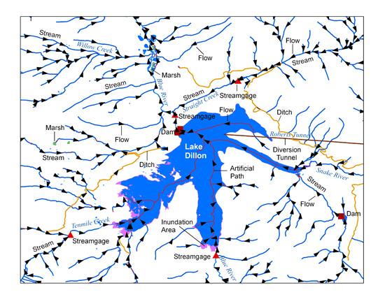
The USGS National Hydrography Dataset (NHD) service from The National Map (TNM) is a comprehensive set of digital spatial data that encodes information about naturally occurring and constructed bodies of surface water (lakes, ponds, and reservoirs), paths through which water flows (canals, ditches, streams, and rivers), and related entities such as point features (springs, wells, stream gages, and dams). The information encoded about these features includes classification and other characteristics, delineation, geographic name, position and related measures, a "reach code" through which other information can be related to the NHD, and the direction of water flow. The network of reach codes delineating water and...
Web Soil Survey (WSS) provides soil data and information produced by the National Cooperative Soil Survey. It is operated by the USDA Natural Resources Conservation Service (NRCS) and provides access to the largest natural resource information system in the world. NRCS has soil maps and data available online for more than 95 percent of the nation’s counties and anticipates having 100 percent in the near future. The site is updated and maintained online as the single authoritative source of soil survey information. Soil surveys can be used for general farm, local, and wider area planning. Onsite investigation is needed in some cases, such as soil quality assessments and certain conservation and engineering applications....
Categories: Data,
Publication;
Types: Citation,
Map Service,
OGC WFS Layer,
OGC WMS Layer,
OGC WMS Service;
Tags: English,
GIS,
US,
agriculture,
development,
A major objective of the energy transition is to reduce dependence on oil imports through structural change in energy systems leading to lower and sustained oil use. This paper outlines possible directions which can be followed under conditions of healthy economic growth to achieve a smooth transition. It also provides a framework to identify and analyse potential energy problem areas. An important conclusion is that although IEA net oil imports in 2000 could be reduced to about 15 million bbl/day, this will not be easy. To supplement market forces, effective energy policies will be necessary to bring on non-oil supplies in time, promote the replacement of oil by other fuels and restrain oil demand.
Categories: Publication;
Types: Citation;
Tags: Management,
approach,
hydro-energy,
policy,
reservoir
Dam removal is a potentially powerful tool for restoring riverine habitats and communities. However, the effectiveness of this tool is unknown because published data on the effects of dam removal on in-stream biota are lacking. We investigated the effects of a small dam removal on unionid mussels in Koshkonong Creek, Wisconsin (USA). Removal of the dam led to mortality both within the former impoundment and in downstream reaches. Within the former reservoir, mortality rates were extremely high (95%) due to des- iccation and exposure. Mussel densities in a bed 0.5 km downstream from the dam declined from 3.80 ± 0.56 mussels m)2 in fall 2000 immediately after dam removal to 2.60 ± 0.48 mussels m)2 by summer 2003....
Categories: Publication;
Types: Citation;
Tags: mussels,
reservoir,
restoration,
sediments,
siltation,
Saylorville Reservoir is a 24.1 km2 impoundment of the Des Moines River located approximately 10 km north of the City of Des Moines, Iowa, USA. Surface water from the Des Moines River used for drinking water supply is impaired for nitrate–nitrogen. Monthly mean nitrate concentration data collected upstream and downstream of the reservoir for a 30-year period (1977–2006) were selected for time-series analysis. Our objectives were to (1) develop a model describing nitrate concentrations downstream of the reservoir as a function of the concentrations entering the reservoir and (2) use the model to provide a 1-month ahead forecast for downstream water quality. Results indicated that downstream nitrate can be effectively...
Categories: Publication;
Types: Citation;
Tags: ARMA,
Data Visualization & Tools,
Landscapes,
Nitrate,
Northeast CASC,

The National Hydrography Dataset (NHD) is a feature-based database that interconnects and uniquely identifies the stream segments or reaches that make up the nation's surface water drainage system. NHD data was originally developed at 1:100,000-scale and exists at that scale for the whole country. This high-resolution NHD, generally developed at 1:24,000/1:12,000 scale, adds detail to the original 1:100,000-scale NHD. (Data for Alaska, Puerto Rico and the Virgin Islands was developed at high-resolution, not 1:100,000 scale.) Local resolution NHD is being developed where partners and data exist. The NHD contains reach codes for networked features, flow direction, names, and centerline representations for areal water...
Categories: Data;
Types: Citation;
Tags: Administrative watershed units,
Area of Complex Channels,
Area to be submerged,
Basin,
Bay/Inlet,
In the spring of 1996, a nine-day test flood from Glen Canyon Dam involved the deepest and largest hypolimnetic withdrawals from the penstocks and the river outlet works (ROW) since 1986, interacting with ongoing hydrodynamic and stratification patterns to enhance freshening of the hypolimnion of Lake Powell reservoir and its tailwaters. Prior to the test flood, a six-year drought had produced a pronounced meromictic hypolimnion that was weakening from high inflow events in 1993 and 1995. Hypoxia, however, had continued to increase in the deepest portions of the reservoir. Over the course of the test flood, 0.893 km3 were released from the ports located at and below the hypolimnetic chemocline. The increased discharge...
Categories: Publication;
Types: Citation,
Journal Citation;
Tags: Colorado River,
Ecological Applications,
Glen Canyon Dam,
Lake Powell,
dam operations,
Geologic sequestration of CO2 in depleted oil reservoirs, while a complex issue, is thought to be a safe and effective carbon management strategy. This paper provides an overview of a NETLsponsored R&D project to predict and monitor the migration and ultimate fate of CO2 after being injected into a depleted oil reservoir as part of a micropilot scale field experiment. The Queen Formation sandstone, located in the West Pearl Queen field in SE NM, was identified as the CO2 injection site for this project. Core samples of this formation were obtained for lithologic analysis and laboratory experimentation. Preliminary flow simulations were run using this data and suggest that at least 2000 tons of CO2 can be injected...
This represents the flowline network in Western Lale Erie Restoration Assessment (WLERA). It is attributed with the number of disconnections between the reach and the connecting river system. These data will help identify the condition of hydrologic separation between potential restoration areas and the connecting river system. Low numbers represent fewer disconnections such as culverts between the reach and the rivers requiring no flow network modification to restore the area.
Categories: Data;
Types: Citation,
Downloadable,
Map Service,
OGC WFS Layer,
OGC WMS Layer,
Shapefile;
Tags: Artificial Path,
Canal / Ditch,
FWHydrography,
Great Lakes,
Hydrography,

The High Resolution National Hydrography Dataset Plus (NHDPlus HR) is an integrated datset of geospatial data layers, including the most current National Hydrography Dataset (NHD), the 10-meter 3D Elevation Program Digital Elevation Model (3DEP DEM), and the National Watershed Boundary Dataset (WBD). The NHDPlus HR combines the NHD, 3DEP DEMs, and WBD to create a stream network with linear referencing, feature naming, "value added attributes" (VAAs), elevation-derived catchments, and other features for hydrologic data analysis. The stream network with linear referencing is a system of data relationships applied to hydrographic systems so that one stream reach "flows" into another and "events" can be tied to and...
Types: Citation;
Tags: Administrative watershed units,
Area of Complex Channels,
Area to be submerged,
Basin,
Bay/Inlet,
The National Hydrography Dataset (NHD) is a feature-based database that interconnects and uniquely identifies the stream segments or reaches that make up the nation's surface water drainage system. NHD data was originally developed at 1:100,000-scale and exists at that scale for the whole country. This high-resolution NHD, generally developed at 1:24,000/1:12,000 scale, adds detail to the original 1:100,000-scale NHD. (Data for Alaska, Puerto Rico and the Virgin Islands was developed at high-resolution, not 1:100,000 scale.) Local resolution NHD is being developed where partners and data exist. The NHD contains reach codes for networked features, flow direction, names, and centerline representations for areal water...
Categories: Data;
Types: ArcGIS REST Map Service,
ArcGIS Service Definition,
Citation,
Downloadable,
Map Service,
OGC WFS Layer,
OGC WMS Layer,
Shapefile;
Tags: Artificial Path,
California (CA),
Canal / Ditch,
FWHydrography,
Hydrography,
This represents the flowline network in Connecting River Systems Restoration Assessment (CRSRA). It is attributed with the number of disconnections between the reach and the connecting river system. These data will help identify the condition of hydrologic separation between potential restoration areas and the connecting river system. Low numbers represent fewer disconnections such as culverts between the reach and the rivers requiring no flow network modification to restore the area.
Categories: Data;
Types: Citation,
Downloadable,
Map Service,
OGC WFS Layer,
OGC WMS Layer,
Shapefile;
Tags: Artificial Path,
Canal / Ditch,
Detroit River,
FWHydrography,
Great Lakes,
This data release includes GIS shapefiles and metadata for location of the study area and phytoplankton taxonomy counts determined by Dr. Russel Rhodes, Faculty Emeritus, Department of Biology, Missouri State University, in three north Louisiana reservoirs: Cross Lake, Bayou D'Arbonne Lake, and Poverty Point Reservoir, June 2009-February 2011. These data and GIS coverages complement and support the findings in the companion report by Tollett and others (in review).
Types: Citation;
Tags: Cross Lake,
algae,
cyanobacteria ["blue-green algae"],
phytoplankton,
reservoir
Categories: Publication;
Types: Citation;
Tags: Artificial Path,
Canal / Ditch,
Colorado,
FWHydrography,
GPLCC,
This represents the flowline network in Sagina Bay Restoration Assessment (SBRA). It is attributed with the number of disconnections between the reach and the connecting river system. These data will help identify the condition of hydrologic separation between potential restoration areas and the connecting river system. Low numbers represent fewer disconnections such as culverts between the reach and the rivers requiring no flow network modification to restore the area.
Categories: Data;
Types: Citation,
Downloadable,
Map Service,
OGC WFS Layer,
OGC WMS Layer,
Shapefile;
Tags: Artificial Path,
Canal / Ditch,
FWHydrography,
Great Lakes,
Hydrography,
This data release includes GIS shapefiles and metadata for location of the study area and phytoplankton taxonomy counts determined by Dr. Russel Rhodes, Faculty Emeritus, Department of Biology, Missouri State University, in three north Louisiana reservoirs: Cross Lake, Bayou D'Arbonne Lake, and Poverty Point Reservoir, June 2009-February 2011. These data and GIS coverages complement and support the findings in the companion report by Tollett and others (in review).
Types: Citation;
Tags: Poverty Point,
Reservoir,
algae,
cyanobacteria ["blue-green algae"],
phytoplankton,
Growth of smallmouth bass (Micropterus dolomieu) was described for three widely spaced areas progressing downstream in Flaming Gorge Reservoir, Wyoming-Utah. Significant differences among areas were detected only for age-1 fish. Growth in the reservoir was compared with that of populations in other lentic habitats of varying growing season lengths in North America; slow growth in the reservoir was related to the relatively short growing season (less than 90 days). Published in Western North American Naturalist, volume 53, issue 2, on pages 180 - 185, in 1993.
Categories: Publication;
Types: Citation,
Journal Citation;
Tags: Micropterus dolomieu,
Western North American Naturalist,
growth,
population structure,
reservoir,
There is currently an international drive to build new nuclear power plants, bringing about what is being termed a “nuclear renaissance”. However, the public perception of nuclear energy has historically been, and continues to be, a key issue, particularly in light of the Fukushima nuclear incident. This paper discusses the disparity between perceived and calculated risks based on the last four decades of research into risk perception. The leading psychological and sociological theories, Psychometric Paradigm and Cultural Theory, respectively, are critically reviewed. The authors then argue that a new nuclear-build policy that promotes a broader approach to design incorporating a wider range of stakeholder inputs,...
Categories: Publication;
Types: Citation;
Tags: clogging,
geothermal,
pore space,
precipitation,
reservoir,
|

|