Filters: Tags: Rhode Island (X) > Date Range: {"choice":"year"} (X)
213 results (51ms)|
Filters
Date Types (for Date Range)
Types
Contacts
Categories
Tag Types
|
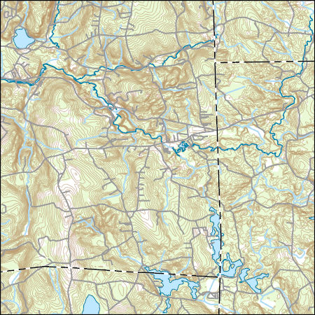
Layers of geospatial data include contours, boundaries, land cover, hydrography, roads, transportation, geographic names, structures, and other selected map features.
Air view, looking southwest, west-central portion of the Hope Valley quadrangle. Intersection of Plain Road and a north-south road at the lower right. Reflection from water, lower center, is the Wood River. Rhode Island. November 1957.
Categories: Image;
Types: Map Service,
OGC WFS Layer,
OGC WMS Layer,
OGC WMS Service;
Tags: Feininger, T.G. Collection,
Photographers,
Rhode Island,
photo print

A series of three-dimensional, hypothetical, groundwater models (MODFLOW-NWT) were developed to investigate the effects of a variety of factors on the flow of arsenic-containing water into a well. The well is of novel design with a constructed aquifer providing storage. The models simulate a hillslope with till overlying a fractured bedrock aquifer as is common in New England. Backwards particle tracking using MODPATH was used to track the particles from the constructed aquifer to the recharge location. A new program, EndPoint Analyzer, was used to determine the fraction of the flow that passed through the bedrock. The bedrock is assumed to be the source of arsenic contamination so the fraction of the flow passing...
This service definition contains landscape factors representing human disturbances summarized to local and network catchments of river reaches for the state of Alabama. This dataset is the result of clipping the feature class 'NFHAP 2010 HCI Scores and Human Disturbance Data for the Conterminous United States linked to NHDPLUSV1.gdb' to the state boundary of Alabama. Landscape factors include land uses, population density, roads, dams, mines, and point-source pollution sites. The source datasets that were compiled and attributed to catchments were identified as being: (1) meaningful for assessing fish habitat; (2) consistent across the entire study area in the way that they were assembled; (3) representative of...
Categories: Data;
Types: ArcGIS REST Map Service,
ArcGIS Service Definition,
Downloadable,
Map Service;
Tags: Anthropogenic factors,
Anthropogenic factors,
Aquatic habitats,
Aquatic habitats,
Atlantic Coast FHP,
The data are from the Sediment Placement Projects on Sandy Beaches in the U.S. Atlantic Coast Breeding Range of the Piping Plover (Charadrius melodus) prior to Hurricane Sandy.This dataset represents the approximate locations of sediment placement projects along the U.S. North Atlantic coast from Maine through Virginia prior to the time that Hurricane Sandy made landfall in October 2012.The sediment placement projects were identified as part of an inventory of habitat modifications to sandy beach habitat within the U.S. Atlantic Coast breeding range of the federally-threatened piping plover. Sediment placement projects included in the inventory were beach nourishment projects, storm damage reduction projects, beneficial...
Categories: Data;
Types: ArcGIS REST Map Service,
ArcGIS Service Definition,
Downloadable,
Map Service;
Tags: Data,
LCC Network Science Catalog,
North Atlantic Landscape Conservation Cooperative Data.gov,
beach,
beach,
Water primrose (Ludwigia hexapetala) is an invasive aquatic plant that has rapidly increased in coverage throughout the Sacramento-San Joaquin Delta. Water primrose has invaded wetlands and may contribute towards mortality of tules (Schoenoplectus spp.) and cattails (Typha spp.). Little research has been completed on the mechanisms responsible for marsh loss, but previous studies have suggested that water primrose contains allelopathic chemicals that could cause plant mortality. Three major allelopathic polyphenols (myricitrin, prunin, and quercitrin) previously identified in L. hexapetala leaves were measured in leaf, water, and soil samples from Delta marshes infested with water primrose. Samples were collected...
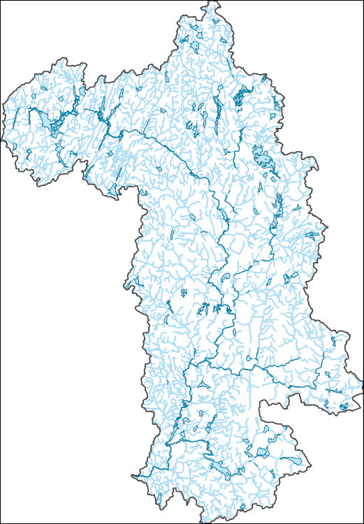
The National Hydrography Dataset (NHD) is a feature-based database that interconnects and uniquely identifies the stream segments or reaches that make up the nation's surface water drainage system. NHD data was originally developed at 1:100,000-scale and exists at that scale for the whole country. This high-resolution NHD, generally developed at 1:24,000/1:12,000 scale, adds detail to the original 1:100,000-scale NHD. (Data for Alaska, Puerto Rico and the Virgin Islands was developed at high-resolution, not 1:100,000 scale.) Local resolution NHD is being developed where partners and data exist. The NHD contains reach codes for networked features, flow direction, names, and centerline representations for areal water...

The National Hydrography Dataset (NHD) is a feature-based database that interconnects and uniquely identifies the stream segments or reaches that make up the nation's surface water drainage system. NHD data was originally developed at 1:100,000-scale and exists at that scale for the whole country. This high-resolution NHD, generally developed at 1:24,000/1:12,000 scale, adds detail to the original 1:100,000-scale NHD. (Data for Alaska, Puerto Rico and the Virgin Islands was developed at high-resolution, not 1:100,000 scale.) Local resolution NHD is being developed where partners and data exist. The NHD contains reach codes for networked features, flow direction, names, and centerline representations for areal water...
Physical and chemical data were collected to characterize water-quality conditions in the Sakonnet River, a tidal strait located on the east side of Narragansett Bay in Rhode Island, from April 28 to November 11, 2018 and from June 19 to November 26, 2019. Specifically, the 2018 information in this data release includes: vertical profiles of water quality from 16 to 18 locations and data collected from three surface spatial surveys (moving boat surveys) designed to characterize near-surface water-quality conditions in the river. Temperature, pH, specific conductance, salinity, dissolved oxygen concentration and saturation, turbidity, and chlorophyll a data were collected with calibrated water-quality sensors. Water-quality...
This data release includes estimates of potassium (K), equivalent uranium (eU), and equivalent thorium (eTh) for the conterminous United States derived from the U.S. Geological Survey's national airborne radiometric data compilation (Duval and others, 2005). Airborne gamma ray spectrometry (AGRS) measures the gamma-rays that are emitted from naturally occurring radioactive isotopes found in rocks and soil, the most abundant of which are potassium (K40), uranium (U238), and thorium (Th232). Radiometric data can aid in exploration of critical mineral resources, including deposits of barium, fluorine, titanium, beryllium, niobium, rare-earth elements, and uranium. There is also growing interest in using radiometric...
Categories: Data;
Types: Downloadable,
GeoTIFF,
Map Service,
Raster;
Tags: Alabama,
Arizona,
Arkansas,
California,
Colorado,
This service definition contains landscape factors representing human disturbances summarized to local and network catchments of river reaches for the state of Washington. This dataset is the result of clipping the feature class 'NFHAP 2010 HCI Scores and Human Disturbance Data for the Conterminous United States linked to NHDPLUSV1.gdb' to the state boundary of Washington. Landscape factors include land uses, population density, roads, dams, mines, and point-source pollution sites. The source datasets that were compiled and attributed to catchments were identified as being: (1) meaningful for assessing fish habitat; (2) consistent across the entire study area in the way that they were assembled; (3) representative...
Categories: Data;
Types: ArcGIS REST Map Service,
ArcGIS Service Definition,
Downloadable,
Map Service;
Tags: Anthropogenic factors,
Aquatic habitats,
Atlantic Coast FHP,
Catchment areas,
Connecticut,
This service definition contains landscape factors representing human disturbances summarized to local and network catchments of river reaches for the state of Georgia. This dataset is the result of clipping the feature class 'NFHAP 2010 HCI Scores and Human Disturbance Data for the Conterminous United States linked to NHDPLUSV1.gdb' to the state boundary of Georgia. Landscape factors include land uses, population density, roads, dams, mines, and point-source pollution sites. The source datasets that were compiled and attributed to catchments were identified as being: (1) meaningful for assessing fish habitat; (2) consistent across the entire study area in the way that they were assembled; (3) representative of...
Categories: Data;
Types: ArcGIS REST Map Service,
ArcGIS Service Definition,
Downloadable,
Map Service;
Tags: Anthropogenic factors,
Aquatic habitats,
Atlantic Coast FHP,
Catchment areas,
Connecticut,
This service definition contains landscape factors representing human disturbances summarized to local and network catchments of river reaches for the state of Indiana. This dataset is the result of clipping the feature class 'NFHAP 2010 HCI Scores and Human Disturbance Data for the Conterminous United States linked to NHDPLUSV1.gdb' to the state boundary of Indiana. Landscape factors include land uses, population density, roads, dams, mines, and point-source pollution sites. The source datasets that were compiled and attributed to catchments were identified as being: (1) meaningful for assessing fish habitat; (2) consistent across the entire study area in the way that they were assembled; (3) representative of...
Categories: Data;
Types: ArcGIS REST Map Service,
ArcGIS Service Definition,
Downloadable,
Map Service;
Tags: Anthropogenic factors,
Aquatic habitats,
Atlantic Coast FHP,
Catchment areas,
Connecticut,
This service definition contains landscape factors representing human disturbances summarized to local and network catchments of river reaches for the state of Missouri. This dataset is the result of clipping the feature class 'NFHAP 2010 HCI Scores and Human Disturbance Data for the Conterminous United States linked to NHDPLUSV1.gdb' to the state boundary of Missouri. Landscape factors include land uses, population density, roads, dams, mines, and point-source pollution sites. The source datasets that were compiled and attributed to catchments were identified as being: (1) meaningful for assessing fish habitat; (2) consistent across the entire study area in the way that they were assembled; (3) representative of...
Categories: Data;
Types: ArcGIS REST Map Service,
ArcGIS Service Definition,
Downloadable,
Map Service;
Tags: Anthropogenic factors,
Aquatic habitats,
Atlantic Coast FHP,
Catchment areas,
Connecticut,
This service definition contains landscape factors representing human disturbances summarized to local and network catchments of river reaches for the state of Mississippi. This dataset is the result of clipping the feature class 'NFHAP 2010 HCI Scores and Human Disturbance Data for the Conterminous United States linked to NHDPLUSV1.gdb' to the state boundary of Mississippi. Landscape factors include land uses, population density, roads, dams, mines, and point-source pollution sites. The source datasets that were compiled and attributed to catchments were identified as being: (1) meaningful for assessing fish habitat; (2) consistent across the entire study area in the way that they were assembled; (3) representative...
Categories: Data;
Types: ArcGIS REST Map Service,
ArcGIS Service Definition,
Downloadable,
Map Service;
Tags: Anthropogenic factors,
Aquatic habitats,
Atlantic Coast FHP,
Catchment areas,
Connecticut,
This service definition contains landscape factors representing human disturbances summarized to local and network catchments of river reaches for the state of Wisconsin. This dataset is the result of clipping the feature class 'NFHAP 2010 HCI Scores and Human Disturbance Data for the Conterminous United States linked to NHDPLUSV1.gdb' to the state boundary of Wisconsin. Landscape factors include land uses, population density, roads, dams, mines, and point-source pollution sites. The source datasets that were compiled and attributed to catchments were identified as being: (1) meaningful for assessing fish habitat; (2) consistent across the entire study area in the way that they were assembled; (3) representative...
Categories: Data;
Types: ArcGIS REST Map Service,
ArcGIS Service Definition,
Downloadable,
Map Service;
Tags: Anthropogenic factors,
Aquatic habitats,
Atlantic Coast FHP,
Catchment areas,
Connecticut,
This service definition contains landscape factors representing human disturbances summarized to local and network catchments of river reaches for the state of Vermont. This dataset is the result of clipping the feature class 'NFHAP 2010 HCI Scores and Human Disturbance Data for the Conterminous United States linked to NHDPLUSV1.gdb' to the state boundary of Vermont. Landscape factors include land uses, population density, roads, dams, mines, and point-source pollution sites. The source datasets that were compiled and attributed to catchments were identified as being: (1) meaningful for assessing fish habitat; (2) consistent across the entire study area in the way that they were assembled; (3) representative of...
Categories: Data;
Types: ArcGIS REST Map Service,
ArcGIS Service Definition,
Downloadable,
Map Service;
Tags: Anthropogenic factors,
Aquatic habitats,
Atlantic Coast FHP,
Catchment areas,
Connecticut,
This service definition contains landscape factors representing human disturbances summarized to local and network catchments of river reaches for the state of Virginia. This dataset is the result of clipping the feature class 'NFHAP 2010 HCI Scores and Human Disturbance Data for the Conterminous United States linked to NHDPLUSV1.gdb' to the state boundary of Virginia. Landscape factors include land uses, population density, roads, dams, mines, and point-source pollution sites. The source datasets that were compiled and attributed to catchments were identified as being: (1) meaningful for assessing fish habitat; (2) consistent across the entire study area in the way that they were assembled; (3) representative of...
Categories: Data;
Types: ArcGIS REST Map Service,
ArcGIS Service Definition,
Downloadable,
Map Service;
Tags: Anthropogenic factors,
Aquatic habitats,
Atlantic Coast FHP,
Catchment areas,
Connecticut,
This service definition contains landscape factors representing human disturbances summarized to local and network catchments of river reaches for the state of North Carolina. This dataset is the result of clipping the feature class 'NFHAP 2010 HCI Scores and Human Disturbance Data for the Conterminous United States linked to NHDPLUSV1.gdb' to the state boundary of North Carolina. Landscape factors include land uses, population density, roads, dams, mines, and point-source pollution sites. The source datasets that were compiled and attributed to catchments were identified as being: (1) meaningful for assessing fish habitat; (2) consistent across the entire study area in the way that they were assembled; (3) representative...
Categories: Data;
Types: ArcGIS REST Map Service,
ArcGIS Service Definition,
Downloadable,
Map Service;
Tags: Anthropogenic factors,
Aquatic habitats,
Atlantic Coast FHP,
Catchment areas,
Connecticut,
The potential introduction of SARS-CoV-2, the virus responsible for the COVID-19 pandemic, into North American bat populations is of interest to wildlife managers due to recent declines of several species. Populations of little brown bats (Myotis lucifugus) have collapsed due to white-nose syndrome (WNS), a disease caused by the introduction and spread of the fungal pathogen Pseudogymnoascus destructans (Pd). Throughout much of the United States and southern Canada, large colonies of the species routinely established diurnal roosts in anthropogenic structures creating the potential for direct human contact and cross-species disease transmission. Given recent declines and the potential for further disease impacts,...
|

|
