Filters: Tags: Rio Grande (X)
404 results (14ms)|
Filters
Date Range
Extensions
Types Contacts
Categories Tag Types
|
Burn probability (BP) for Fireline Intensity Class 4 (FIL4) with flame lengths in the range of 1.8-2.4 m predicted for the 2050-2070 period in the Rio Grande area. This raster dataset was generated using: 1) data developed from the 2014 Fire Program Analysis (FPA) system; 2) geospatial Fire Simulation (FSim) system developed by the US Forest Service Missoula Fire Sciences Laboratory to estimate probabilistic components of wildfire risk (Finney et al. 2011); and 3) climate predictions developed using the Multivariate Adaptive Constructed Analogs (MACA) method (Abatzoglou and Brown 2011) which downscaled model output from the GFDL-ESM-2m global climate model of the Coupled Model Inter-Comparison Project 5 for the...
Categories: Data;
Types: ArcGIS REST Map Service,
ArcGIS Service Definition,
Downloadable,
Map Service;
Tags: burn probability,
fire,
fireline intensity,
future climate,
gis,
This line vector dataset represents the faults and dikes used as input data for the Rio Grande transboundary integrated hydrologic model and water-availability analysis, New Mexico and Texas, United States, and Northern Chihuahua, Mexico.

Rocky Mountain Region GIS Data Library Our geographic area of responsibility covers Colorado, Kansas, Nebraska, South Dakota, and Wyoming.
The transboundary Mesilla Basin/Conejos-Médanos aquifer system was identified as one of the priority transboundary aquifer systems for additional study by the United States and Mexico U.S.-Mexico Transboundary Aquifer Assessment Act of 2006 (United States-Mexico Transboundary Aquifer Act, Public Law 109-448). As one of the largest rechargeable groundwater systems by total available volume in the Rio Grande/Rio Bravo del Norte Basin region of the United States and Mexico, the Mesilla Basin/Conejos-Médanos aquifer system supplies water for irrigation as well as municipal use in El Paso, Texas; Las Cruces, New Mexico; and Ciudad Juárez, Chihuahua, Mexico (Alley, 2013). The U.S. Geological Survey in cooperation with...
This data set contains imagery from the National Agriculture Imagery Program (NAIP). The NAIP program is administered by USDA FSA and has been established to support two main FSA strategic goals centered on agricultural production. These are, increase stewardship of America's natural resources while enhancing the environment, and to ensure commodities are procured and distributed effectively and efficiently to increase food security. The NAIP program supports these goals by acquiring and providing ortho imagery that has been collected during the agricultural growing season in the U.S. The NAIP ortho imagery is tailored to meet FSA requirements and is a fundamental tool used to support FSA farm and conservation programs....
This data set contains imagery from the National Agriculture Imagery Program (NAIP). The NAIP program is administered by USDA FSA and has been established to support two main FSA strategic goals centered on agricultural production. These are, increase stewardship of America's natural resources while enhancing the environment, and to ensure commodities are procured and distributed effectively and efficiently to increase food security. The NAIP program supports these goals by acquiring and providing ortho imagery that has been collected during the agricultural growing season in the U.S. The NAIP ortho imagery is tailored to meet FSA requirements and is a fundamental tool used to support FSA farm and conservation programs....
This data set contains imagery from the National Agriculture Imagery Program (NAIP). The NAIP program is administered by USDA FSA and has been established to support two main FSA strategic goals centered on agricultural production. These are, increase stewardship of America's natural resources while enhancing the environment, and to ensure commodities are procured and distributed effectively and efficiently to increase food security. The NAIP program supports these goals by acquiring and providing ortho imagery that has been collected during the agricultural growing season in the U.S. The NAIP ortho imagery is tailored to meet FSA requirements and is a fundamental tool used to support FSA farm and conservation programs....
Types: Citation;
Tags: 08105,
3.75 x 3.75 minute,
3710627,
Aerial Compliance,
BEAVER CREEK RESERVOIR,
This data set contains imagery from the National Agriculture Imagery Program (NAIP). The NAIP program is administered by USDA FSA and has been established to support two main FSA strategic goals centered on agricultural production. These are, increase stewardship of America's natural resources while enhancing the environment, and to ensure commodities are procured and distributed effectively and efficiently to increase food security. The NAIP program supports these goals by acquiring and providing ortho imagery that has been collected during the agricultural growing season in the U.S. The NAIP ortho imagery is tailored to meet FSA requirements and is a fundamental tool used to support FSA farm and conservation programs....
This data set contains imagery from the National Agriculture Imagery Program (NAIP). The NAIP program is administered by USDA FSA and has been established to support two main FSA strategic goals centered on agricultural production. These are, increase stewardship of America's natural resources while enhancing the environment, and to ensure commodities are procured and distributed effectively and efficiently to increase food security. The NAIP program supports these goals by acquiring and providing ortho imagery that has been collected during the agricultural growing season in the U.S. The NAIP ortho imagery is tailored to meet FSA requirements and is a fundamental tool used to support FSA farm and conservation programs....
This data set contains imagery from the National Agriculture Imagery Program (NAIP). The NAIP program is administered by USDA FSA and has been established to support two main FSA strategic goals centered on agricultural production. These are, increase stewardship of America's natural resources while enhancing the environment, and to ensure commodities are procured and distributed effectively and efficiently to increase food security. The NAIP program supports these goals by acquiring and providing ortho imagery that has been collected during the agricultural growing season in the U.S. The NAIP ortho imagery is tailored to meet FSA requirements and is a fundamental tool used to support FSA farm and conservation programs....
This data set contains imagery from the National Agriculture Imagery Program (NAIP). The NAIP program is administered by USDA FSA and has been established to support two main FSA strategic goals centered on agricultural production. These are, increase stewardship of America's natural resources while enhancing the environment, and to ensure commodities are procured and distributed effectively and efficiently to increase food security. The NAIP program supports these goals by acquiring and providing ortho imagery that has been collected during the agricultural growing season in the U.S. The NAIP ortho imagery is tailored to meet FSA requirements and is a fundamental tool used to support FSA farm and conservation programs....
Sandy ocean beaches in the United States are popular tourist and recreational destinations and constitute some of the most valuable real estate in the country. The boundary between land and water along the coastline is often the location of concentrated residential and commercial development and is frequently exposed to a range of natural hazards, which include flooding, storm effects, and coastal erosion. In response, the U.S. Geological Survey (USGS) is conducting a national assessment of coastal change hazards. One component of this research effort, the National Assessment of Shoreline Change Project, documents changes in shoreline position as a proxy for coastal change. Shoreline position is an easily understood...
This dataset contains monthly crop irrigation requirement (CIR) values from 1938 through 2014 for six canal service units used in the Lower Rio Grande Basin groundwater flow model (SSPA, 2007). CIR values from 1938 through 2010 were extracted from the New Mexico Office of the State Engineer’s (NMOSE’s) Canal spreadsheet, version 11.2 (Barroll, P., NMOSE, written commun., 2011). CIR values from 2011 through 2014 were copied from a year within the 1938 through 2010 dataset with a similar total annual precipitation as recorded at the State University, NM US station, part of the National Oceanic and Atmospheric Administration (NOAA) National Climatic Data Center (NCDC) Global Historical Climatology Network (GHCND) (NCDC,...
Categories: Data;
Tags: Caballo Reservoir,
Chihuahua,
El Paso,
Elephant Butte Reservoir,
Las Cruces,
This dataset contains the source information for pumping rates for municipal and industrial (MnI) wells in Texas within the Rio Grande Transboundary Integrated Hydrologic Model (RGTIHM). In RGTIHM, these wells are considered the Other Texas (OTX) group.
Categories: Data;
Tags: Caballo Reservoir,
Chihuahua,
El Paso,
Elephant Butte Reservoir,
Las Cruces,
This data set contains imagery from the National Agriculture Imagery Program (NAIP). The NAIP program is administered by USDA FSA and has been established to support two main FSA strategic goals centered on agricultural production. These are, increase stewardship of America's natural resources while enhancing the environment, and to ensure commodities are procured and distributed effectively and efficiently to increase food security. The NAIP program supports these goals by acquiring and providing ortho imagery that has been collected during the agricultural growing season in the U.S. The NAIP ortho imagery is tailored to meet FSA requirements and is a fundamental tool used to support FSA farm and conservation programs....
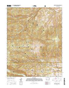
Layered geospatial PDF Map. Layers of geospatial data include orthoimagery, roads, grids, geographic names, elevation contours, hydrography, and other selected map features.
Layered geospatial PDF Map. Layers of geospatial data include orthoimagery, roads, grids, geographic names, elevation contours, hydrography, and other selected map features.
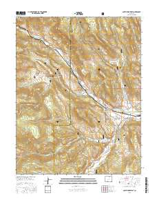
Layered GeoPDF 7.5 Minute Quadrangle Map. Layers of geospatial data include orthoimagery, roads, grids, geographic names, elevation contours, hydrography, and other selected map features.
Layered GeoPDF 7.5 Minute Quadrangle Map. Layers of geospatial data include orthoimagery, roads, grids, geographic names, elevation contours, hydrography, and other selected map features.
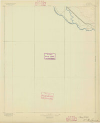
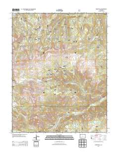
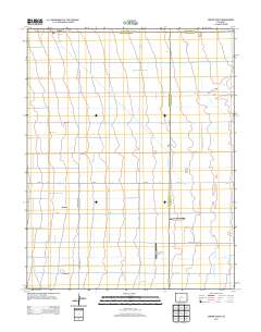
USGS Historical Quadrangle in GeoPDF.
|