Filters: Tags: River (X) > partyWithName: U.S. Geological Survey, National Geospatial Technical Operations Center (X)
11 results (42ms)|
Filters
Date Range
Extensions Types Contacts
Categories Tag Types Tag Schemes
|

The Watershed Boundary Dataset (WBD) from The National Map (TNM) defines the perimeter of drainage areas formed by the terrain and other landscape characteristics. The drainage areas are nested within each other so that a large drainage area, such as the Upper Mississippi River, will be composed of multiple smaller drainage areas, such as the Wisconsin River. Each of these smaller areas can further be subdivided into smaller and smaller drainage areas. The WBD uses six different levels in this hierarchy, with the smallest averaging about 30,000 acres. The WBD is made up of polygons nested into six levels of data respectively defined by Regions, Subregions, Basins, Subbasins, Watersheds, and Subwatersheds. For additional...

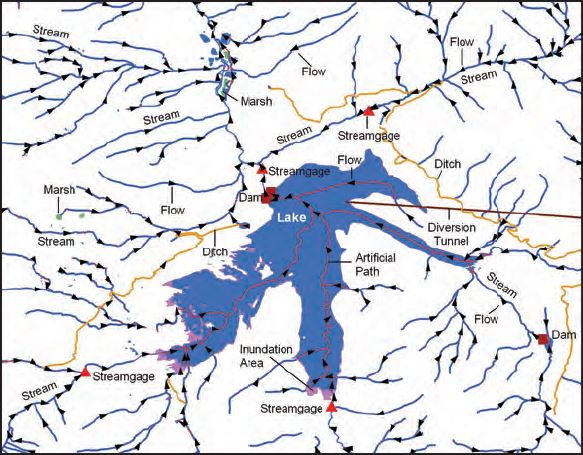
The USGS National Hydrography Dataset (NHD) service from The National Map (TNM) is a comprehensive set of digital spatial data that encodes information about naturally occurring and constructed bodies of surface water (lakes, ponds, and reservoirs), paths through which water flows (canals, ditches, streams, and rivers), and related entities such as point features (springs, wells, stream gages, and dams). The information encoded about these features includes classification and other characteristics, delineation, geographic name, position and related measures, a "reach code" through which other information can be related to the NHD, and the direction of water flow. The network of reach codes delineating water and...

The National Hydrography Dataset (NHD) is a feature-based database that interconnects and uniquely identifies the stream segments or reaches that make up the nation's surface water drainage system. NHD data was originally developed at 1:100,000-scale and exists at that scale for the whole country. This high-resolution NHD, generally developed at 1:24,000/1:12,000 scale, adds detail to the original 1:100,000-scale NHD. (Data for Alaska, Puerto Rico and the Virgin Islands was developed at high-resolution, not 1:100,000 scale.) Local resolution NHD is being developed where partners and data exist. The NHD contains reach codes for networked features, flow direction, names, and centerline representations for areal water...
Categories: Data;
Types: Citation;
Tags: Administrative watershed units,
Area of Complex Channels,
Area to be submerged,
Basin,
Bay/Inlet,

This geodatabase contains streams, waterbodies and wetlands, streamflow gaging stations, and coastlines for the United States, Puerto Rico, and the U.S. Virgin Islands. The streams are incorporated into a geometric network. All feature classes are vertically integrated with each other and with 1:1,000,000-scale transportation and boundary data sets.
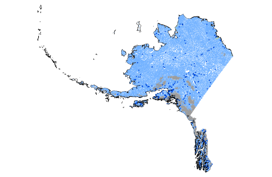
This geodatabase contains streams, waterbodies and wetlands, streamflow gaging stations, and coastlines for Alaska. The streams are incorporated into a geometric network. All feature classes are vertically integrated with each other and with 1:1,000,000-scale transportation and boundary data sets.
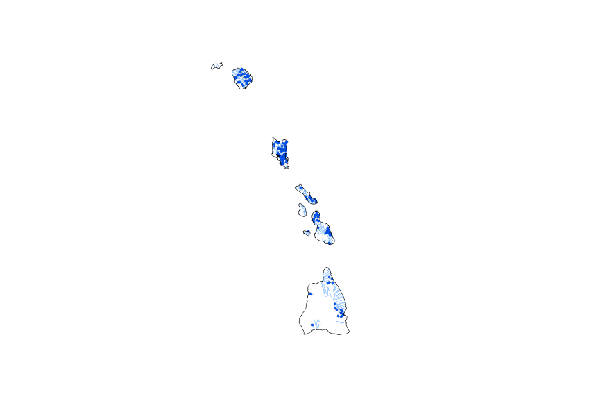
This geodatabase contains streams, waterbodies and wetlands, streamflow gaging stations, and coastlines for Hawaii. The streams are incorporated into a geometric network. All feature classes are vertically integrated with each other and with 1:1,000,000-scale transportation and boundary data sets.
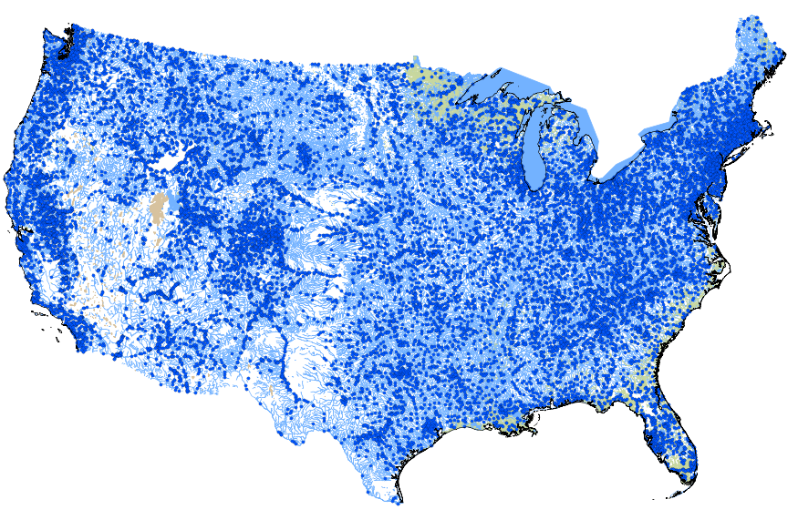
This geodatabase contains streams, waterbodies and wetlands, streamflow gaging stations, and coastlines for the conterminous United States. The streams are incorporated into a geometric network. All feature classes are vertically integrated with each other and with 1:1,000,000-scale transportation and boundary data sets.
U.S. Geological Survey, Department of the Interior - The annual National Hydrography Dataset (NHD) stewardship plan is to maintain hydrography data in the NHD over the United States and its territories. NHD for the nation has been collected and is now in maintenance mode. Interested parties who wish to become a NHD stewardship partner with the USGS in FY15 or in future years should contact a USGS Geospatial Liaison - http://liaisons.usgs.gov/geospatial/documents/TNM_Partnership_User_ContactList.pdf. To find out more about hydrography stewardship go to http://nhd.usgs.gov/stewardship.html or for exact project status information on areas currently in work go to http://nhd.usgs.gov/project_status.html
The USGS National Hydrography Dataset (NHD) service from The National Map (TNM) is a comprehensive set of digital spatial data that encodes information about naturally occurring and constructed bodies of surface water (lakes, ponds, and reservoirs), paths through which water flows (canals, ditches, streams, and rivers), and related entities such as point features (springs, wells, stream gages, and dams). The information encoded about these features includes classification and other characteristics, delineation, geographic name, position and related measures, a "reach code" through which other information can be related to the NHD, and the direction of water flow. The network of reach codes delineating water and...
Categories: Data;
Types: ArcGIS REST Map Service,
Map Service;
Tags: HU,
Hydrography,
NGP-TNM,
NHD,
Overlay Map Service,
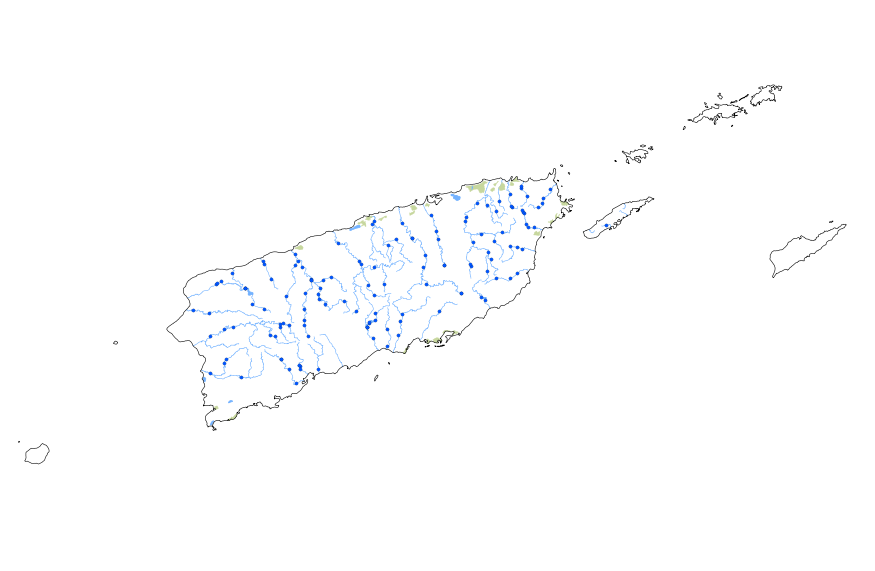
This geodatabase contains streams, waterbodies and wetlands, streamflow gaging stations, and coastlines for Puerto Rico and the U.S. Virgin Islands. The streams are incorporated into a geometric network. All feature classes are vertically integrated with each other and with 1:1,000,000-scale transportation and boundary data sets.
U.S. Geological Survey, Department of the Interior - The annual National Hydrography Dataset (NHD) stewardship plan is to maintain hydrography data in the NHD over the United States and its territories. NHD for the nation has been collected and is now in maintenance mode. Interested parties who wish to become a NHD stewardship partner with the USGS in FY17 or in future years should contact a USGS Geospatial Liaison - http://liaisons.usgs.gov/geospatial/documents/TNM_Partnership_User_ContactList.pdf. To find out more about hydrography stewardship go to http://nhd.usgs.gov/stewardship.html or for exact project status information on areas currently in work go to http://nhd.usgs.gov/project_status.html
Types: Citation;
Tags: Hydrography,
NGDA,
NHD,
National Geospatial Data Asset,
National Hydrography Dataset,
|

|
