Filters: Tags: Salt Lake City (X)
17 results (59ms)|
Filters
Date Range
Extensions (Less) Types (Less)
Contacts (Less)
Categories (Less) Tag Types Tag Schemes
|
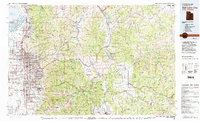
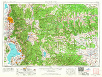
USGS Historical Quadrangle in GeoPDF.

USGS Historical Quadrangle in GeoPDF.
This section of the data release includes the spatial metadata geospatial polygon feature dataset (.shp file) that contains spatial footprints for each input source dataset used to develop the topobathymetric dataset of Great Salt Lake. The attributes for each footprint polygon describe the characteristics of each input dataset used to generate the topobathymetric dataset.
Categories: Data;
Types: Downloadable,
Map Service,
OGC WFS Layer,
OGC WMS Layer,
Shapefile;
Tags: 3D Elevation Program,
3DEP,
Acoustic Sonar,
Antelope Island,
Bear River,

USGS Historical Quadrangle in GeoPDF.
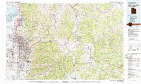
USGS Historical Quadrangle in GeoPDF.
This section of the data release includes the topobathymetric elevation dataset of Great Salt Lake as an assimilated raster comprising interpolated bathymetry from 2005 and 2006 (Baskin, 2005; Baskin, 2006) and QL1 and QL2 lidar from 2016 (Utah Geospatial Resource Center, 2016). The bathymetric dataset was originally published as contour maps. The contours were interpolated to develop a digital elevation model that is readable by a geographic information system and compatible with topographic lidar data generated in 2016. Because the water elevation of Great Salt Lake has declined since 2005, regions of the bathymetric and lidar datasets overlap to provide a reasonable estimate of error. The topobathymetric dataset...
Real-time, high frequency (1-second sample interval), georeferenced water quality data was collected in Utah Lake, Utah. Utah Lake is located approximately 45 miles south of Salt Lake City, Utah, and approximately 5 miles west of Provo, Utah. Data was collected on 8/10/16 over an approximate 6.5-hour period (8:00 – 14:30 h PST) while underway. Sample water was continuously pumped through a pickup tube mounted at the stern of the vessel. Sample was pre-filtered using a 178 um in-line strainer, passed through a de-bubbler, and diverted through a 0.2 micron filter to various water quality instrumentation. Data was handled by a Campbell Scientific CR-6 data logger and recorded continuously to a Microsoft Excel file....
Categories: Data;
Types: Citation;
Tags: Provo,
Salt Lake City,
USGS Science Data Catalog (SDC),
United States,
Utah,
This data release includes geochronological data for the Airport East trench site (40.795359°, -111.950438°) on the Taylorsville fault of the West Valley fault zone (WVFZ). The WVFZ comprises intrabasin faults in the hanging wall of the Wasatch fault zone in the northern part of Salt Lake Valley, Utah. Samples for radiocarbon and luminescence dating were collected from two paleoseismic trenches in August–September 2015. Laboratory data include four optically stimulated luminescence ages and 14 radiocarbon ages for charcoal extracted from bulk sediment samples. This database has been approved for release by the U.S. Geological Survey (USGS). Although this database has been subjected to rigorous review and is substantially...
Categories: Data;
Types: Map Service,
OGC WFS Layer,
OGC WMS Layer,
OGC WMS Service;
Tags: Geomorphology,
Salt Lake City,
Salt Lake Valley,
Sedimentology,
Seismology,

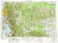
USGS Historical Quadrangle in GeoPDF.
These are physical and geochemical (elemental, strontium isotope) data from dust and sediments collected from the Salt Lake Valley, Utah between 2018 and 2019. Data were collected by the U.S. Geological Survey Utah Water Science Center (West Valley City, Utah) to examine contributions of dust from the dry lakebed of Great Salt Lake, other regional playas, and anthropogenic sources to passive dust samplers deployed throughout the rapidly growing cities at the foot of the central Wasatch Mountains, referred to as the Wasatch Front. The samples were processed at the Utah Water Science Center and geochemical analysis was performed at the University of Utah's ICP-MS Metals and Strontium Isotope Facility (Salt Lake City,...
Categories: Data;
Tags: Ecology,
Environmental Health,
Geochemistry,
Great Salt Lake,
Salt Lake City,
This section of the data release includes tables in the format of comma-separated value (CSV) files with elevation-area-volume relationships for Great Salt Lake. The volume and area of Great Salt Lake were calculated from the topobathymetric raster dataset, which was resampled from 0.5-meter to 5.0-meter resolution, at elevation increments of 0.01 feet between 4,170.00–4,215.00 ft above the North American Vertical Datum of 1988. Data are provided as total values for Great Salt Lake as well as regional values for the north arm, south arm, Bear River Bay, and Farmington Bay.
This data release presents data used for analyzing spatial and temporal differences in soil surface roughness within selected biocrust communities. These records were collected by ground-based lidar for 121, 1m x 3m soil plots with biological soil crusts (biocrusts). Roughness was estimated from 5 mm resolution data (CloudCompare v. 2.10.2, 2019) for two Great Basin Desert sites (UTTR-1; UTTR-2) in December 2015 and one Chihuahuan Desert site (JER) in February 2016. Data were again collected in June 2018 for UTTR-1 and UTTR-2. Additional field and laboratory data were included within this study to understand differences in soil surface roughness between UTTR and JER as well as between the 2016 and 2018 surveys at...
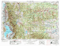
USGS Historical Quadrangle in GeoPDF.
This topobathymetric elevation dataset of Great Salt Lake includes an assimilated topobathymetric raster comprising interpolated bathymetry from 2005 and 2006 (Baskin, 2005; Baskin, 2006) and QL1 and QL2 lidar from 2016 (Utah Geospatial Resource Center, 2016). The bathymetric dataset was originally published as contour maps. The contours were interpolated to develop a digital elevation model that is readable by a geographic information system and compatible with topographic lidar data generated in 2016. Because the water elevation of Great Salt Lake has declined since 2005, regions of the bathymetric and lidar datasets overlap to provide a reasonable estimate of error. The topobathymetric dataset was generated with...

USGS Historical Quadrangle in GeoPDF.
USGS Historical Quadrangle in GeoPDF.
USGS Historical Quadrangle in GeoPDF.
|

|
