Filters: Tags: Sierra Nevada (X)
234 results (52ms)|
Filters
Date Range
Extensions Types Contacts
Categories Tag Types
|

The Nature Conservancy (TNC) has derived climate suitability forecasts for most species of trees and shrubs considered to be ecological dominants of terrestrial Californian habitat types. Our plant projections are compiled as decision support tools to help Conservancy project staff, as well as our external partners, develop the necessary plans, priorities and strategies to successfully adapt to uncertain changes in future climate. In the recently completed Southern Sierra Partnership's 2010 Climate-Adapted Conservation Plan for the Southern Sierra Nevada and Tehachapi Mountains, species and habitat forecasts shown here informed the development of a regional conservation design that explicitly incorporates long-term...

This dataset depicts Wildland Urban Intermix zones within the Sierra Nevada Forest of Region 5. These Forests include Modoc, Lassen, Plumas, Tahoe, Lake Tahoe Basin Management Unit, Eldorado, Stanislaus, Sierra, Inyo, Sequoia and Toiyabe portion of the Humbolt-Toiyabe of Region 4. These data describe relative risk to areas of significant population density from wildfire by intersecting residential housing unit density with proximate fire threat to give a relative measure of potential loss of structures and threats to public safety from wildfire. These data are consistent with general National Fire Plan ideals, but is more refined both in terms of mapping extent and in terms of quantification of risk. Within California,...

These data were extracted from the CALVEG Existing Vegetation tiles, using the CWHR forest cover type, Aspen and clipped to the Sierra Nevada Zone for the CA LCC.These CALVEG Existing Vegetation tiles have been crosswalked to other classification systems, including the California Wildlife Habitat Relationship System (CWHR).The CWHR habitat classification scheme has been developed to support the CWHR System, a wildlife information system and predictive model for California's regularly-occurring birds, mammals, reptiles and amphibians. When first published in 1988, the classification scheme had 53 habitats. These habitats â except the non-vegetated Barren habitat â are described in detail in the CWHR publication...

The Nature Conservancy (TNC) has derived climate suitability forecasts for most species of trees and shrubs considered to be ecological dominants of terrestrial Californian habitat types. Our plant projections are compiled as decision support tools to help Conservancy project staff, as well as our external partners, develop the necessary plans, priorities and strategies to successfully adapt to uncertain changes in future climate. In the recently completed Southern Sierra Partnership's 2010 Climate-Adapted Conservation Plan for the Southern Sierra Nevada and Tehachapi Mountains, species and habitat forecasts shown here informed the development of a regional conservation design that explicitly incorporates long-term...

The Nature Conservancy (TNC) has derived climate suitability forecasts for most species of trees and shrubs considered to be ecological dominants of terrestrial Californian habitat types. Our plant projections are compiled as decision support tools to help Conservancy project staff, as well as our external partners, develop the necessary plans, priorities and strategies to successfully adapt to uncertain changes in future climate. In the recently completed Southern Sierra Partnership's 2010 Climate-Adapted Conservation Plan for the Southern Sierra Nevada and Tehachapi Mountains, species and habitat forecasts shown here informed the development of a regional conservation design that explicitly incorporates long-term...

The Nature Conservancy (TNC) has derived climate suitability forecasts for most species of trees and shrubs considered to be ecological dominants of terrestrial Californian habitat types. Our plant projections are compiled as decision support tools to help Conservancy project staff, as well as our external partners, develop the necessary plans, priorities and strategies to successfully adapt to uncertain changes in future climate. In the recently completed Southern Sierra Partnership's 2010 Climate-Adapted Conservation Plan for the Southern Sierra Nevada and Tehachapi Mountains, species and habitat forecasts shown here informed the development of a regional conservation design that explicitly incorporates long-term...

The Nature Conservancy (TNC) has derived climate suitability forecasts for most species of trees and shrubs considered to be ecological dominants of terrestrial Californian habitat types. Our plant projections are compiled as decision support tools to help Conservancy project staff, as well as our external partners, develop the necessary plans, priorities and strategies to successfully adapt to uncertain changes in future climate. In the recently completed Southern Sierra Partnership's 2010 Climate-Adapted Conservation Plan for the Southern Sierra Nevada and Tehachapi Mountains, species and habitat forecasts shown here informed the development of a regional conservation design that explicitly incorporates long-term...

The Nature Conservancy (TNC) has derived climate suitability forecasts for most species of trees and shrubs considered to be ecological dominants of terrestrial Californian habitat types. Our plant projections are compiled as decision support tools to help Conservancy project staff, as well as our external partners, develop the necessary plans, priorities and strategies to successfully adapt to uncertain changes in future climate. In the recently completed Southern Sierra Partnership's 2010 Climate-Adapted Conservation Plan for the Southern Sierra Nevada and Tehachapi Mountains, species and habitat forecasts shown here informed the development of a regional conservation design that explicitly incorporates long-term...

The Nature Conservancy (TNC) has derived climate suitability forecasts for most species of trees and shrubs considered to be ecological dominants of terrestrial Californian habitat types. Our plant projections are compiled as decision support tools to help Conservancy project staff, as well as our external partners, develop the necessary plans, priorities and strategies to successfully adapt to uncertain changes in future climate. In the recently completed Southern Sierra Partnership's 2010 Climate-Adapted Conservation Plan for the Southern Sierra Nevada and Tehachapi Mountains, species and habitat forecasts shown here informed the development of a regional conservation design that explicitly incorporates long-term...

The Nature Conservancy (TNC) has derived climate suitability forecasts for most species of trees and shrubs considered to be ecological dominants of terrestrial Californian habitat types. Our plant projections are compiled as decision support tools to help Conservancy project staff, as well as our external partners, develop the necessary plans, priorities and strategies to successfully adapt to uncertain changes in future climate. In the recently completed Southern Sierra Partnership's 2010 Climate-Adapted Conservation Plan for the Southern Sierra Nevada and Tehachapi Mountains, species and habitat forecasts shown here informed the development of a regional conservation design that explicitly incorporates long-term...

The Nature Conservancy (TNC) has derived climate suitability forecasts for most species of trees and shrubs considered to be ecological dominants of terrestrial Californian habitat types. Our plant projections are compiled as decision support tools to help Conservancy project staff, as well as our external partners, develop the necessary plans, priorities and strategies to successfully adapt to uncertain changes in future climate. In the recently completed Southern Sierra Partnership's 2010 Climate-Adapted Conservation Plan for the Southern Sierra Nevada and Tehachapi Mountains, species and habitat forecasts shown here informed the development of a regional conservation design that explicitly incorporates long-term...

Predicted probability of marten occurrence on the Lassen National Forest during summer (May – November). Weighted average of 6 best logistic regression models (Rustigian-Romsos and Spencer, 2010).

Least cost paths are only meaningful when viewed in context with the cores they are connecting. Least cost paths were calculated between nearest neighbor cores. This data set represents a single path (pixel-wide) of least cumulative resistance between target cores.
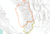
Planning area boundaries for Southern Sierra and Tehachapi Conservation Action Plans (project-level CAPs). Abridged versions of the two CAPs are presented in the Framework’s Appendix.
The RCMAP (Rangeland Condition Monitoring Assessment and Projection) dataset quantifies the percent cover of rangeland components across the western U.S. using Landsat imagery from 1985-2020. The RCMAP product suite consists of eight fractional components: annual herbaceous, bare ground, herbaceous, litter, non-sagebrush shrub, perennial herbaceous, sagebrush, shrub and rule-based error maps including the temporal trends of each component. Several enhancements were made to the RCMAP process relative to prior generations. We used an updated version of the 2016 base training data, with a more aggressive forest mask and reduced shrub and sagebrush cover bias in pinyon-juniper woodlands. We pooled training data in areas...
The RCMAP (Rangeland Condition Monitoring Assessment and Projection) dataset quantifies the percent cover of rangeland components across the western U.S. using Landsat imagery from 1985-2020. The RCMAP product suite consists of eight fractional components: annual herbaceous, bare ground, herbaceous, litter, non-sagebrush shrub, perennial herbaceous, sagebrush, shrub and rule-based error maps including the temporal trends of each component. Several enhancements were made to the RCMAP process relative to prior generations. We used an updated version of the 2016 base training data, with a more aggressive forest mask and reduced shrub and sagebrush cover bias in pinyon-juniper woodlands. We pooled training data in areas...
The RCMAP (Rangeland Condition Monitoring Assessment and Projection) dataset quantifies the percent cover of rangeland components across western North America using Landsat imagery from 1985-2023. The RCMAP product suite consists of ten fractional components: annual herbaceous, bare ground, herbaceous, litter, non-sagebrush shrub, perennial herbaceous, sagebrush, shrub, tree, and shrub height in addition to the temporal trends of each component. Several enhancements were made to the RCMAP process relative to prior generations. First, high-resolution training was revised using an improved neural-net classifier and modelling approach. These data serve as foundation to the RCMAP approach. The training database was...
This project used the NatureServe Climate Change Vulnerability Index tool to assess vulnerability of 140 bird species that breed in the Sierra Nevada and will develop a peer-reviewed Climate Change Adaptation Strategy for Sierra Nevada bird species that are most vulnerable to climate change. The Strategy provides recommendations for actions that managers can take now and in the future to bolster resilience to climate change.
Categories: Data,
Project;
Types: Map Service,
OGC WFS Layer,
OGC WMS Layer,
OGC WMS Service;
Tags: 2011,
Applications and Tools,
CA,
California Landscape Conservation Cooperative,
Conservation NGOs,
Our study addresses the general question of the degree to which wildlife species can adapt to, or possibly even modify, effects from climate change. We focused on five species of mammals in the alpine zone of the Sierra Nevada mountain range, including the federally endangered Sierra Nevada bighorn sheep and the American pika, a species recently proposed for listing due to the loss of populations from altered climatic conditions. It was expected that there will be an upward expansion of trees and shrubs from lower elevations and that many or even most alpine meadows will be converted to woody dominated communities. Meadows provide critical habitat for many alpine mammal species, and their conversion could represent...
Categories: Project;
Types: Map Service,
OGC WFS Layer,
OGC WMS Layer,
OGC WMS Service;
Tags: 2009,
CASC,
Completed,
Mammals,
Mammals,
These data describe tree mortality and the factors associated with tree mortality for a variety of plots in Sequoia National Park. Most of the data were collected between 2014 and 2017 (during an extremely severe drought), along with some comparison data from 2004 to 2007. These data support the following publication: Stephenson, N.L., Das, A.J., Ampersee, N.J., Bulaon, B.M., and Yee, J.L., In review. Which trees die during drought? The key role of insect host-tree selection, Journal of Ecology
Categories: Data;
Tags: California,
Forestry,
Sequoia National Park,
Sierra Nevada,
USGS Science Data Catalog (SDC),
|

|
