Filters: Tags: Socorro County (X)
293 results (83ms)|
Filters
Date Range
Types Contacts
Categories Tag Types
|
The 'Map - Southeastern New Mexico - Lincoln, Chaves, Otero, Eddy Counties' file is part of the Grover Heinrichs mining collection. Grover was the Vice President of Heinrichs GEOEXploration, located in Tucson, Arizona. The collection contains over 1,400 folders including economic geology reports, maps, photos, correspondence, drill logs and other related materials. The focus of much of the information is on the western United States, particularly Arizona, but the collection also includes files on mining activity throughout the United States, foreign countries, and 82 mineral commodities.
The 'Magdalena Area' file is part of the Grover Heinrichs mining collection. Grover was the Vice President of Heinrichs GEOEXploration, located in Tucson, Arizona. The collection contains over 1,400 folders including economic geology reports, maps, photos, correspondence, drill logs and other related materials. The focus of much of the information is on the western United States, particularly Arizona, but the collection also includes files on mining activity throughout the United States, foreign countries, and 82 mineral commodities.
Categories: Data;
Tags: Dataset,
New Mexico,
Socorro County,
United States,
geoscientificInformation,
Geomorphic features mapped from historical aerial photographs (1935, 1950s, 1970s, and 1996), satellite imagery (November 2006), and digital aerial imagery (Standard Imagery LiDAR Composite; Spectrum Mapping, LLC, 2005) are provided in shapefiles for each year of data. Features mapped are tops of the arroyo walls, edges of the arroyo bottom (covering the active floodplain and channel), tops of channel banks, the channel centerline, canopy cover, and 2006 flood sand deposits. In addition, shapefiles containing a reference arroyo centerline, points at 0.5-km intervals along the arroyo centerline, and polygons identifying the 0.5-km arroyo segments are provided. Individual metadata files describe the contents of each...
High-precision (Real-time kinematic) Global Positioning System (GPS) surveys were conducted along the lower Rio Puerco in April 2002, January 2007, April 2010, and April 2014 to support a long-term study of geomorphic processes and the geomorphic history of the arroyo. The study reach extends from the confluence with the Rio San Jose 67 km downvalley to the old Highway 85 bridge near the USGS streamgage near Bernardo, NM. Individual shapefiles were created for data from each survey. Associated metadata files include the names of surveyors and equipment used. The survey extents varied, but all have overlapping points, including repeat surveys of arroyo cross sections. Results from analyses of these data were published...
The U.S. Geological Survey (USGS), working in cooperation with the U.S. Fish and Wildlife Service, installed a groundwater and vegetation monitoring network in a proposed wetland area east of the Rio Grande near Bernardo, New Mexico on the NM Boys and Girls Ranch, at a site now known as the Blue Heron Wildlife Preserve (BHWP). In September of 2016, baseline vegetation data were collected across the BHWP to assess vegetation changes with time in the proposed wetland area as it is established and maintained. A second round of vegetation surveys were conducted in August of 2018 for comparative purposes. The collection of this data will support conservation and management decisions.
Categories: Data;
Types: Map Service,
OGC WFS Layer,
OGC WMS Layer,
OGC WMS Service;
Tags: Bernardo,
Socorro County,
botany,
population and community ecology,
relative abundance analysis,
Consumptive use (CU) of water is an important factor for determining water availability and groundwater storage. Many regional stakeholders and water-supply managers in the Upper Rio Grande Basin have indicated CU is of primary concern in their water-management strategies, yet CU data is sparse for this area. This polygon feature class, which represents irrigated acres for 2015, is a geospatial component of the U.S. Geological Survey National Water Census Upper Rio Grande Basin (URGB) focus area study's effort to improve quantification of CU in parts of New Mexico, west Texas, and northern Chihuahua. These digital data accompany Ivahnenko, T.I., Flickinger, A.K., Galanter, A.E., Douglas-Mankin, K.R., Pedraza, D.E.,...
Types: Map Service,
OGC WFS Layer,
OGC WMS Layer,
OGC WMS Service;
Tags: Abiquiu Reservoir,
Ahumada,
Alamosa,
Alamosa County,
Alamosa Creek,
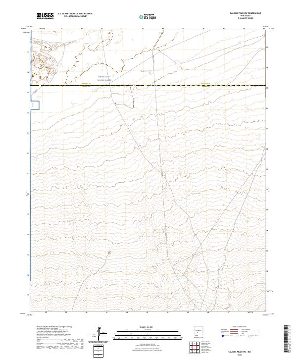
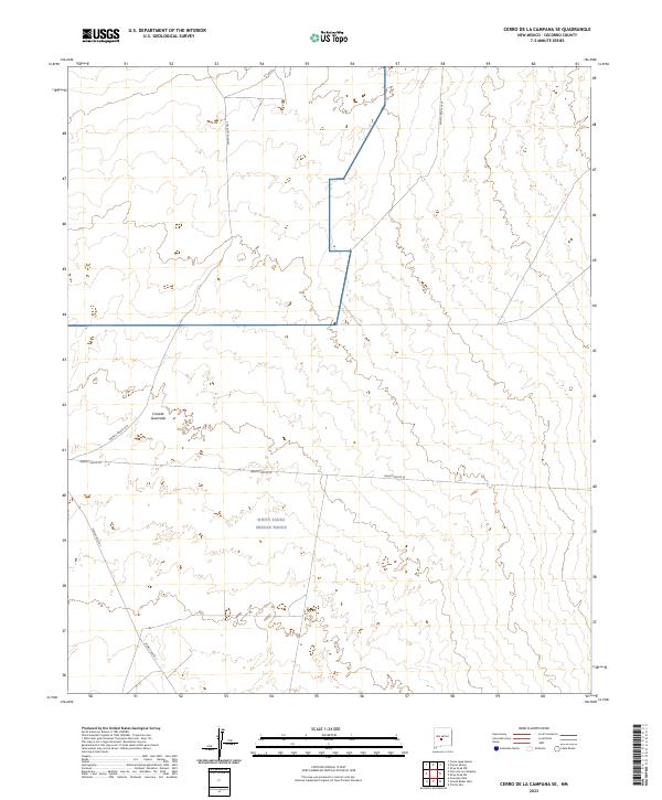
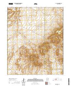
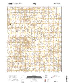
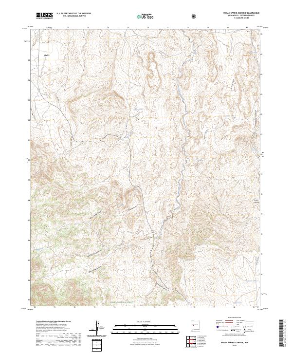
Layered geospatial PDF 7.5 Minute Quadrangle Map. Layers of geospatial data include orthoimagery, roads, grids, geographic names, elevation contours, hydrography, and other selected map features. This map is derived from GIS (geospatial information system) data. It represents a repackaging of GIS data in traditional map form, not creation of new information. The geospatial data in this map are from selected National Map data holdings and other government sources.
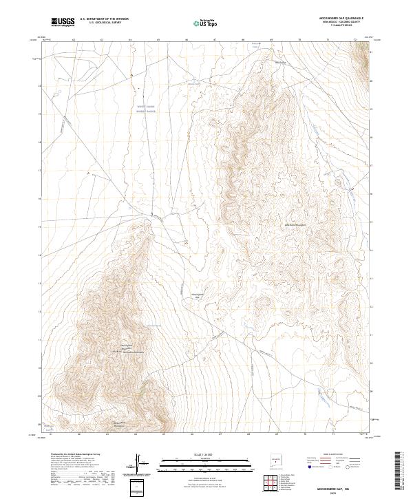
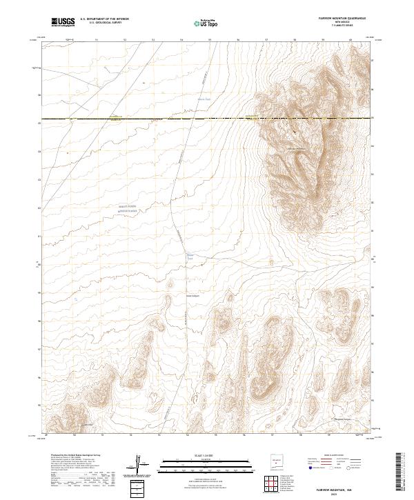
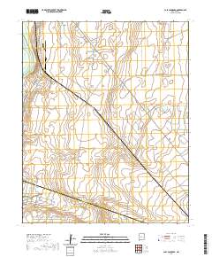
Layered geospatial PDF 7.5 Minute Quadrangle Map. Layers of geospatial data include orthoimagery, roads, grids, geographic names, elevation contours, hydrography, and other selected map features. This map is derived from GIS (geospatial information system) data. It represents a repackaging of GIS data in traditional map form, not creation of new information. The geospatial data in this map are from selected National Map data holdings and other government sources.
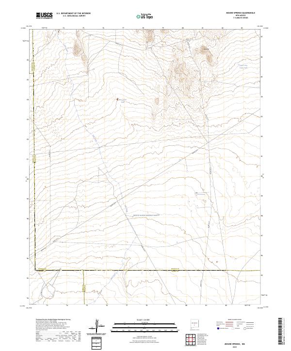
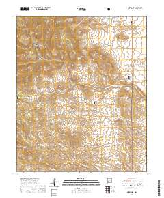
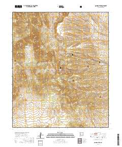
Layered geospatial PDF 7.5 Minute Quadrangle Map. Layers of geospatial data include orthoimagery, roads, grids, geographic names, elevation contours, hydrography, and other selected map features. This map is derived from GIS (geospatial information system) data. It represents a repackaging of GIS data in traditional map form, not creation of new information. The geospatial data in this map are from selected National Map data holdings and other government sources.
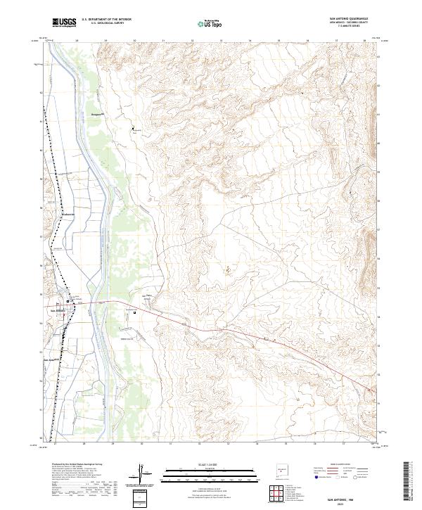
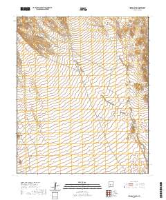
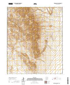
Layered geospatial PDF 7.5 Minute Quadrangle Map. Layers of geospatial data include orthoimagery, roads, grids, geographic names, elevation contours, hydrography, and other selected map features. This map is derived from GIS (geospatial information system) data. It represents a repackaging of GIS data in traditional map form, not creation of new information. The geospatial data in this map are from selected National Map data holdings and other government sources.
Layered geospatial PDF 7.5 Minute Quadrangle Map. Layers of geospatial data include orthoimagery, roads, grids, geographic names, elevation contours, hydrography, and other selected map features. This map is derived from GIS (geospatial information system) data. It represents a repackaging of GIS data in traditional map form, not creation of new information. The geospatial data in this map are from selected National Map data holdings and other government sources.
Layered geospatial PDF 7.5 Minute Quadrangle Map. Layers of geospatial data include orthoimagery, roads, grids, geographic names, elevation contours, hydrography, and other selected map features. This map is derived from GIS (geospatial information system) data. It represents a repackaging of GIS data in traditional map form, not creation of new information. The geospatial data in this map are from selected National Map data holdings and other government sources.
Layered geospatial PDF 7.5 Minute Quadrangle Map. Layers of geospatial data include orthoimagery, roads, grids, geographic names, elevation contours, hydrography, and other selected map features. This map is derived from GIS (geospatial information system) data. It represents a repackaging of GIS data in traditional map form, not creation of new information. The geospatial data in this map are from selected National Map data holdings and other government sources.
Layered geospatial PDF 7.5 Minute Quadrangle Map. Layers of geospatial data include orthoimagery, roads, grids, geographic names, elevation contours, hydrography, and other selected map features. This map is derived from GIS (geospatial information system) data. It represents a repackaging of GIS data in traditional map form, not creation of new information. The geospatial data in this map are from selected National Map data holdings and other government sources.
Layered geospatial PDF 7.5 Minute Quadrangle Map. Layers of geospatial data include orthoimagery, roads, grids, geographic names, elevation contours, hydrography, and other selected map features. This map is derived from GIS (geospatial information system) data. It represents a repackaging of GIS data in traditional map form, not creation of new information. The geospatial data in this map are from selected National Map data holdings and other government sources.
Layered geospatial PDF 7.5 Minute Quadrangle Map. Layers of geospatial data include orthoimagery, roads, grids, geographic names, elevation contours, hydrography, and other selected map features. This map is derived from GIS (geospatial information system) data. It represents a repackaging of GIS data in traditional map form, not creation of new information. The geospatial data in this map are from selected National Map data holdings and other government sources.
Layered geospatial PDF 7.5 Minute Quadrangle Map. Layers of geospatial data include orthoimagery, roads, grids, geographic names, elevation contours, hydrography, and other selected map features. This map is derived from GIS (geospatial information system) data. It represents a repackaging of GIS data in traditional map form, not creation of new information. The geospatial data in this map are from selected National Map data holdings and other government sources.
Layered geospatial PDF 7.5 Minute Quadrangle Map. Layers of geospatial data include orthoimagery, roads, grids, geographic names, elevation contours, hydrography, and other selected map features. This map is derived from GIS (geospatial information system) data. It represents a repackaging of GIS data in traditional map form, not creation of new information. The geospatial data in this map are from selected National Map data holdings and other government sources.
Layered geospatial PDF 7.5 Minute Quadrangle Map. Layers of geospatial data include orthoimagery, roads, grids, geographic names, elevation contours, hydrography, and other selected map features. This map is derived from GIS (geospatial information system) data. It represents a repackaging of GIS data in traditional map form, not creation of new information. The geospatial data in this map are from selected National Map data holdings and other government sources.
Layered geospatial PDF 7.5 Minute Quadrangle Map. Layers of geospatial data include orthoimagery, roads, grids, geographic names, elevation contours, hydrography, and other selected map features. This map is derived from GIS (geospatial information system) data. It represents a repackaging of GIS data in traditional map form, not creation of new information. The geospatial data in this map are from selected National Map data holdings and other government sources.
|

|
