Filters: Tags: Species Distribution (X)
411 results (66ms)|
Filters
|
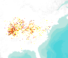
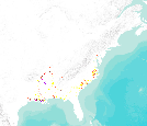
The Polygons represent the USGS NHD 12 digit HUC polygons which contain known winter roost trees for Northern long-eared bat (Myotis septentrionalis).
Categories: Data;
Types: Downloadable,
Map Service,
OGC WFS Layer,
OGC WMS Layer,
Shapefile;
Tags: Administrative Units,
Biogeographical regions,
Biota,
Natural risk zones,
Protected sites,

This dataset represents actual and predicted suitable habitat for Liriodendron tuliperfia (yellow-poplar, species code 621) in the Eastern United States as measured by importance value based on data obtained from the Forest Inventory and Analysis (FIA) project, current climate conditions, and future climate projections. This summary unit of this dataset is a 20 by 20 kilometer cell. The actual importance value (IV) was calculated based on the number of stems and basal area of a given tree species relative to other tree species on a plot using about 100,000 FIA plots (representing nearly 3 million tree records) in the 37 states within the United States east of the 100th meridian. These importance values were summarized...

This dataset represents actual and predicted suitable habitat for Nyssa sylvatica var. biflora (swamp tupelo, species code 694) in the Eastern United States as measured by importance value based on data obtained from the Forest Inventory and Analysis (FIA) project, current climate conditions, and future climate projections. This summary unit of this dataset is a 20 by 20 kilometer cell. The actual importance value (IV) was calculated based on the number of stems and basal area of a given tree species relative to other tree species on a plot using about 100,000 FIA plots (representing nearly 3 million tree records) in the 37 states within the United States east of the 100th meridian. These importance values were...

This dataset represents actual and predicted suitable habitat for Quercus ellipsoidalis (northern pin oak, species code 809) in the Eastern United States as measured by importance value based on data obtained from the Forest Inventory and Analysis (FIA) project, current climate conditions, and future climate projections. This summary unit of this dataset is a 20 by 20 kilometer cell. The actual importance value (IV) was calculated based on the number of stems and basal area of a given tree species relative to other tree species on a plot using about 100,000 FIA plots (representing nearly 3 million tree records) in the 37 states within the United States east of the 100th meridian. These importance values were summarized...

This dataset represents actual and predicted suitable habitat for Tilia americana (American basswood, species code 951) in the Eastern United States as measured by importance value based on data obtained from the Forest Inventory and Analysis (FIA) project, current climate conditions, and future climate projections. This summary unit of this dataset is a 20 by 20 kilometer cell. The actual importance value (IV) was calculated based on the number of stems and basal area of a given tree species relative to other tree species on a plot using about 100,000 FIA plots (representing nearly 3 million tree records) in the 37 states within the United States east of the 100th meridian. These importance values were summarized...

This dataset represents actual and predicted suitable habitat for Pinus palustris (longleaf pine, species code 121) in the Eastern United States as measured by importance value based on data obtained from the Forest Inventory and Analysis (FIA) project, current climate conditions, and future climate projections. This summary unit of this dataset is a 20 by 20 kilometer cell. The actual importance value (IV) was calculated based on the number of stems and basal area of a given tree species relative to other tree species on a plot using about 100,000 FIA plots (representing nearly 3 million tree records) in the 37 states within the United States east of the 100th meridian. These importance values were summarized to...
This dataset represents actual and predicted suitable habitat for Juglans nigra (black walnut, species code 602) in the Eastern United States as measured by importance value based on data obtained from the Forest Inventory and Analysis (FIA) project, current climate conditions, and future climate projections. This summary unit of this dataset is a 20 by 20 kilometer cell. The actual importance value (IV) was calculated based on the number of stems and basal area of a given tree species relative to other tree species on a plot using about 100,000 FIA plots (representing nearly 3 million tree records) in the 37 states within the United States east of the 100th meridian. These importance values were summarized to 20...

This dataset represents actual and predicted suitable habitat for Nyssa ogeche (Ogechee tupelo, species code 692) in the Eastern United States as measured by importance value based on data obtained from the Forest Inventory and Analysis (FIA) project, current climate conditions, and future climate projections. This summary unit of this dataset is a 20 by 20 kilometer cell. The actual importance value (IV) was calculated based on the number of stems and basal area of a given tree species relative to other tree species on a plot using about 100,000 FIA plots (representing nearly 3 million tree records) in the 37 states within the United States east of the 100th meridian. These importance values were summarized to...
This dataset represents actual and predicted suitable habitat for Nyssa aquatica (water tupelo, species code 691) in the Eastern United States as measured by importance value based on data obtained from the Forest Inventory and Analysis (FIA) project, current climate conditions, and future climate projections. This summary unit of this dataset is a 20 by 20 kilometer cell. The actual importance value (IV) was calculated based on the number of stems and basal area of a given tree species relative to other tree species on a plot using about 100,000 FIA plots (representing nearly 3 million tree records) in the 37 states within the United States east of the 100th meridian. These importance values were summarized to...

This dataset represents actual and predicted suitable habitat for Carya aquatica (water hickory, species code 401) in the Eastern United States as measured by importance value based on data obtained from the Forest Inventory and Analysis (FIA) project, current climate conditions, and future climate projections. This summary unit of this dataset is a 20 by 20 kilometer cell. The actual importance value (IV) was calculated based on the number of stems and basal area of a given tree species relative to other tree species on a plot using about 100,000 FIA plots (representing nearly 3 million tree records) in the 37 states within the United States east of the 100th meridian. These importance values were summarized to...

These data are statistical model outputs for appressed muhly (Muhlenbergia appressa) species distribution, completed by Frank Davisâ Biogeography Lab at UC Santa Barbara. The UCSB Biogeography Lab used Maxent to generate predictions of habitat occupancy for ~70 species for the CA Energy Commissionâs project âCumulative Biological Impacts Framework for Solar Energy in the CA Desertâ, 500-10-021. Species distribution models were produced at 270 m resolution using a subset of 22 environmental variables. Models were evaluated with 10-foldcross validated AUC scores. Results are preliminary and have notyet been reviewed by expert biologists. Both continuous probability surfaces and binary layers are available...
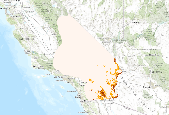
These data are statistical model outputs for Gila woodpecker (Melanerpes uropygialis) species distribution, completed by Frank Davisâ Biogeography Lab at UC Santa Barbara. The UCSB Biogeography Lab used Maxent to generate predictions of habitat occupancy for ~70 species for the CA Energy Commissionâs project âCumulative Biological Impacts Framework for Solar Energy in the CA Desertâ, 500-10-021. Species distribution models were produced at 270 m resolution using a subset of 22 environmental variables. Models were evaluated with 10-foldcross validated AUC scores. Results are preliminary and have notyet been reviewed by expert biologists. Both continuous probability surfaces and binary layers are available...

These data are statistical model outputs for Parry's spineflower (Chorizanthe parryi var parryi) species distribution, completed by Frank Davisâ Biogeography Lab at UC Santa Barbara. The UCSB Biogeography Lab used Maxent to generate predictions of habitat occupancy for ~70 species for the CA Energy Commissionâs project âCumulative Biological Impacts Framework for Solar Energy in the CA Desertâ, 500-10-021. Species distribution models were produced at 270 m resolution using a subset of 22 environmental variables. Models were evaluated with 10-foldcross validated AUC scores. Results are preliminary and have notyet been reviewed by expert biologists. Both continuous probability surfaces and binary layers are...

These data are statistical model outputs for red-diamond rattlesnake (Crotalus ruber) species distribution, completed by Frank Davisâ Biogeography Lab at UC Santa Barbara. The UCSB Biogeography Lab used Maxent to generate predictions of habitat occupancy for ~70 species for the CA Energy Commissionâs project âCumulative Biological Impacts Framework for Solar Energy in the CA Desertâ, 500-10-021. Species distribution models were produced at 270 m resolution using a subset of 22 environmental variables. Models were evaluated with 10-foldcross validated AUC scores. Results are preliminary and have notyet been reviewed by expert biologists. Both continuous probability surfaces and binary layers are available...

These data are statistical model outputs for scrub lotus (Acmispon argyraeus var multicaulis) species distribution, completed by Frank Davisâ Biogeography Lab at UC Santa Barbara. The UCSB Biogeography Lab used Maxent to generate predictions of habitat occupancy for ~70 species for the CA Energy Commissionâs project âCumulative Biological Impacts Framework for Solar Energy in the CA Desertâ, 500-10-021. Species distribution models were produced at 270 m resolution using a subset of 22 environmental variables. Models were evaluated with 10-foldcross validated AUC scores. Results are preliminary and have notyet been reviewed by expert biologists. Both continuous probability surfaces and binary layers are...

This dataset represents actual and predicted suitable habitat for Asimina triloba (pawpaw, species code 367) as measured by importance value based on data obtained from the Forest Inventory and Analysis (FIA) project, current climate conditions, and future climate projections. This summary unit of this dataset is a 20 by 20 kilometer cell. The actual importance value (IV) was calculated based on the number of stems and basal area of a given tree species relative to other tree species on a plot using about 100,000 FIA plots (representing nearly 3 million tree records) in the 37 states within the United States east of the 100th meridian. These importance values were summarized to 20 by 20 kilometer grid cells. Current...

This dataset represents actual and predicted suitable habitat for Prunus serotina (black cherry, species code 762) in the Eastern United States as measured by importance value based on data obtained from the Forest Inventory and Analysis (FIA) project, current climate conditions, and future climate projections. This summary unit of this dataset is a 20 by 20 kilometer cell. The actual importance value (IV) was calculated based on the number of stems and basal area of a given tree species relative to other tree species on a plot using about 100,000 FIA plots (representing nearly 3 million tree records) in the 37 states within the United States east of the 100th meridian. These importance values were summarized to...
GAP distribution models represent the areas where species are predicted to occur based on habitat associations. GAP distribution models are the spatial arrangement of environments suitable for occupation by a species. In other words, a species distribution is created using a deductive model to predict areas suitable for occupation within a species range. To represent these suitable environments, GAP compiled existing GAP data, where available, and compiled additional data where needed. Existing data sources were the Southwest Regional Gap Analysis Project (SWReGAP) and the Southeast Gap Analysis Project (SEGAP) as well as a data compiled by Sanborn Solutions and Mason, Bruce and Girard. Habitat associations were...
Categories: Data;
Types: ArcGIS REST Map Service,
Map Service;
Tags: Biodiversity,
Conservation,
GAP,
Gap Analysis,
Species Distribution,

This dataset represents actual and predicted suitable habitat for Quercus durandii (Durand oak, species code 808) in the Eastern United States as measured by importance value based on data obtained from the Forest Inventory and Analysis (FIA) project, current climate conditions, and future climate projections. This summary unit of this dataset is a 20 by 20 kilometer cell. The actual importance value (IV) was calculated based on the number of stems and basal area of a given tree species relative to other tree species on a plot using about 100,000 FIA plots (representing nearly 3 million tree records) in the 37 states within the United States east of the 100th meridian. These importance values were summarized to...

This dataset represents actual and predicted suitable habitat for Carya illinoensis (pecan, species code 404) in the Eastern United States as measured by importance value based on data obtained from the Forest Inventory and Analysis (FIA) project, current climate conditions, and future climate projections. This summary unit of this dataset is a 20 by 20 kilometer cell. The actual importance value (IV) was calculated based on the number of stems and basal area of a given tree species relative to other tree species on a plot using about 100,000 FIA plots (representing nearly 3 million tree records) in the 37 states within the United States east of the 100th meridian. These importance values were summarized to 20 by...
|

|
