Filters
Date Range
Extensions
Types
Contacts
Categories
Tag Types
Tag Schemes
|
Geospatial data includes structures and other selected map features.
Tags: Adair,
Allen,
Anderson,
Ballard,
Barren, All tags...
Bath,
Bell,
Boone,
Bourbon,
Boyd,
Boyle,
Bracken,
Breathitt,
Breckinridge,
Bullitt,
Butler,
Caldwell,
Calloway,
Campbell,
Campground,
Carlisle,
Carroll,
Carter,
Casey,
Christian,
Clark,
Clay,
Clinton,
College / University,
Courthouse,
Crittenden,
Cumberland,
Daviess,
Downloadable Data,
Edmonson,
Elliott,
Estill,
Fayette,
Fire Station/ EMS Station,
Fleming,
Floyd,
Franklin,
Fulton,
Gallatin,
Garrard,
GeoPackage,
Grant,
Graves,
Grayson,
Green,
Greenup,
Hancock,
Hardin,
Harlan,
Harrison,
Hart,
Henderson,
Henry,
Hickman,
Hopkins,
Hospital/Medical Center,
Information Center,
Jackson,
Jefferson,
Jessamine,
Johnson,
KY,
Kenton,
Kentucky,
Knott,
Knox,
Larue,
Laurel,
Law Enforcement,
Lawrence,
Lee,
Leslie,
Letcher,
Lewis,
Lincoln,
Livingston,
Logan,
Lyon,
Madison,
Magoffin,
Marion,
Marshall,
Martin,
Mason,
McCracken,
McCreary,
McLean,
Meade,
Menifee,
Mercer,
Metcalfe,
Monroe,
Montgomery,
Morgan,
Muhlenberg,
National Structures Dataset (NSD),
National Structures Dataset (NSD),
Nelson,
Nicholas,
Ohio,
Oldham,
Open Geospatial Consortium GeoPackage 1.2,
Owen,
Owsley,
Pendleton,
Perry,
Pike,
Post Office,
Powell,
Prison/ Correctional Facility,
Pulaski,
Robertson,
Rockcastle,
Rowan,
Russell,
School,
School:Elementary,
School:High School,
School:Middle School,
Scott,
Shelby,
Simpson,
Spencer,
State,
State,
State Capitol,
Structures,
Taylor,
Technical School,
Todd,
Town Hall,
Trade School,
Trailhead,
Trigg,
Trimble,
US,
Union,
United States,
Visitor Center,
Warren,
Washington,
Wayne,
Webster,
Whitley,
Wolfe,
Woodford,
structure, Fewer tags
Geospatial data includes structures and other selected map features.
Tags: Adams,
Allen,
Ashland,
Ashtabula,
Athens, All tags...
Auglaize,
Belmont,
Brown,
Butler,
Campground,
Carroll,
Champaign,
Clark,
Clermont,
Clinton,
College / University,
Columbiana,
Coshocton,
Courthouse,
Crawford,
Cuyahoga,
Darke,
Defiance,
Delaware,
Downloadable Data,
Erie,
Fairfield,
Fayette,
Fire Station/ EMS Station,
Franklin,
Fulton,
Gallia,
Geauga,
GeoPackage,
Greene,
Guernsey,
Hamilton,
Hancock,
Hardin,
Harrison,
Henry,
Highland,
Hocking,
Holmes,
Hospital/Medical Center,
Huron,
Information Center,
Jackson,
Jefferson,
Knox,
Lake,
Law Enforcement,
Lawrence,
Licking,
Logan,
Lorain,
Lucas,
Madison,
Mahoning,
Marion,
Medina,
Meigs,
Mercer,
Miami,
Monroe,
Montgomery,
Morgan,
Morrow,
Muskingum,
National Structures Dataset (NSD),
National Structures Dataset (NSD),
Noble,
OH,
Ohio,
Open Geospatial Consortium GeoPackage 1.2,
Ottawa,
Paulding,
Perry,
Pickaway,
Pike,
Portage,
Post Office,
Preble,
Prison/ Correctional Facility,
Putnam,
Richland,
Ross,
Sandusky,
School,
School:Elementary,
School:High School,
School:Middle School,
Scioto,
Seneca,
Shelby,
Stark,
State,
State,
State Capitol,
Structures,
Summit,
Technical School,
Town Hall,
Trade School,
Trailhead,
Trumbull,
Tuscarawas,
US,
Union,
United States,
Van Wert,
Vinton,
Visitor Center,
Warren,
Washington,
Wayne,
Williams,
Wood,
Wyandot,
structure, Fewer tags
Geospatial data includes structures and other selected map features.
Tags: Adams,
Asotin,
Benton,
Campground,
Chelan, All tags...
Clallam,
Clark,
College / University,
Columbia,
Courthouse,
Cowlitz,
Douglas,
Downloadable Data,
Ferry,
Fire Station/ EMS Station,
Franklin,
Garfield,
GeoPackage,
Grant,
Grays Harbor,
Hospital/Medical Center,
Information Center,
Island,
Jefferson,
King,
Kitsap,
Kittitas,
Klickitat,
Law Enforcement,
Lewis,
Lincoln,
Mason,
National Structures Dataset (NSD),
National Structures Dataset (NSD),
Okanogan,
Open Geospatial Consortium GeoPackage 1.2,
Pacific,
Pend Oreille,
Pierce,
Post Office,
Prison/ Correctional Facility,
San Juan,
School,
School:Elementary,
School:High School,
School:Middle School,
Skagit,
Skamania,
Snohomish,
Spokane,
State,
State,
State Capitol,
Stevens,
Structures,
Technical School,
Thurston,
Town Hall,
Trade School,
Trailhead,
US,
United States,
Visitor Center,
WA,
Wahkiakum,
Walla Walla,
Washington,
Whatcom,
Whitman,
Yakima,
structure, Fewer tags
Geospatial data includes structures and other selected map features.
Tags: Adair,
Alfalfa,
Atoka,
Beaver,
Beckham, All tags...
Blaine,
Bryan,
Caddo,
Campground,
Canadian,
Carter,
Cherokee,
Choctaw,
Cimarron,
Cleveland,
Coal,
College / University,
Comanche,
Cotton,
Courthouse,
Craig,
Creek,
Custer,
Delaware,
Dewey,
Downloadable Data,
Ellis,
Fire Station/ EMS Station,
Garfield,
Garvin,
GeoPackage,
Grady,
Grant,
Greer,
Harmon,
Harper,
Haskell,
Hospital/Medical Center,
Hughes,
Information Center,
Jackson,
Jefferson,
Johnston,
Kay,
Kingfisher,
Kiowa,
Latimer,
Law Enforcement,
Le Flore,
Lincoln,
Logan,
Love,
Major,
Marshall,
Mayes,
McClain,
McCurtain,
McIntosh,
Murray,
Muskogee,
National Structures Dataset (NSD),
National Structures Dataset (NSD),
Noble,
Nowata,
OK,
Okfuskee,
Oklahoma,
Oklahoma,
Okmulgee,
Open Geospatial Consortium GeoPackage 1.2,
Osage,
Ottawa,
Pawnee,
Payne,
Pittsburg,
Pontotoc,
Post Office,
Pottawatomie,
Prison/ Correctional Facility,
Pushmataha,
Roger Mills,
Rogers,
School,
School:Elementary,
School:High School,
School:Middle School,
Seminole,
Sequoyah,
State,
State,
State Capitol,
Stephens,
Structures,
Technical School,
Texas,
Tillman,
Town Hall,
Trade School,
Trailhead,
Tulsa,
US,
United States,
Visitor Center,
Wagoner,
Washington,
Washita,
Woods,
Woodward,
structure, Fewer tags
Geospatial data includes structures and other selected map features.
Tags: Allegany,
Anne Arundel,
Baltimore,
Calvert,
Campground, All tags...
Caroline,
Carroll,
Cecil,
Charles,
College / University,
Courthouse,
Dorchester,
Downloadable Data,
Fire Station/ EMS Station,
Frederick,
Garrett,
GeoPackage,
Harford,
Hospital/Medical Center,
Howard,
Information Center,
Kent,
Law Enforcement,
MD,
Maryland,
Montgomery,
National Structures Dataset (NSD),
National Structures Dataset (NSD),
Open Geospatial Consortium GeoPackage 1.2,
Post Office,
Prince George's,
Prison/ Correctional Facility,
Queen Anne's,
School,
School:Elementary,
School:High School,
School:Middle School,
Somerset,
St. Mary's,
State,
State,
State Capitol,
Structures,
Talbot,
Technical School,
Town Hall,
Trade School,
Trailhead,
US,
United States,
Visitor Center,
Washington,
Wicomico,
Worcester,
structure, Fewer tags

The Geographic Names Information System (GNIS) is the Federal standard for geographic nomenclature. The U.S. Geological Survey developed the GNIS for the U.S. Board on Geographic Names, a Federal inter-agency body chartered by public law to maintain uniform feature name usage throughout the Government and to promulgate standard names to the public. The GNIS is the official repository of domestic geographic names data; the official vehicle for geographic names use by all departments of the Federal Government; and the source for applying geographic names to Federal electronic and printed products of all types. See http://geonames.usgs.gov for additional information.
Types: Citation;
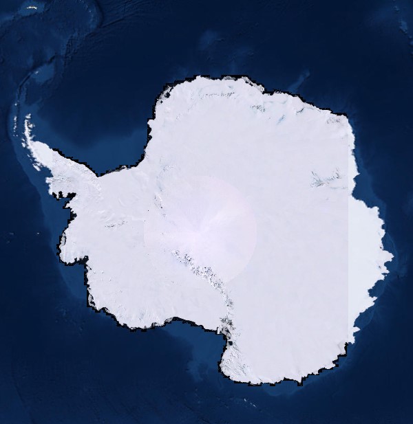
Tags: Antarctica,
Borough,
Census Area,
Commonwealth,
County, All tags...
District,
Downloadable Data,
Feature class,
Feature coordinates,
Feature county,
Feature description,
Feature designation,
Feature history,
Feature identification,
Feature name,
Feature state,
Geographic Names,
Geographic feature,
Geographic name,
Geographical feature,
Geographical name,
Legacy GNIS,
Municipio,
National Geographic Names Information System (GNIS),
Official feature name,
Outlying Area,
Parish,
Place name,
Populated Place,
State,
State,
TXT (pipes),
Territory,
Topographic Map,
United States,
Variant name,
economy,
environment,
imageryBaseMapsEarthCover,
inlandWaters,
location,
society,
structure,
transportation,
utilitiesCommunication, Fewer tags

The Geographic Names Information System (GNIS) is the Federal standard for geographic nomenclature. The U.S. Geological Survey developed the GNIS for the U.S. Board on Geographic Names, a Federal inter-agency body chartered by public law to maintain uniform feature name usage throughout the Government and to promulgate standard names to the public. The GNIS is the official repository of domestic geographic names data; the official vehicle for geographic names use by all departments of the Federal Government; and the source for applying geographic names to Federal electronic and printed products of all types. See http://geonames.usgs.gov for additional information.
Types: Citation;
Tags: Antarctica,
Borough,
Census Area,
Commonwealth,
County, All tags...
District,
Downloadable Data,
Feature class,
Feature coordinates,
Feature county,
Feature description,
Feature designation,
Feature history,
Feature identification,
Feature name,
Feature state,
Geographic Names,
Geographic feature,
Geographic name,
Geographical feature,
Geographical name,
Legacy GNIS,
Municipio,
National Geographic Names Information System (GNIS),
Official feature name,
Outlying Area,
Parish,
Place name,
Populated Place,
State,
State,
TXT (pipes),
Territory,
Topographic Map,
United States,
Variant name,
economy,
environment,
imageryBaseMapsEarthCover,
inlandWaters,
location,
society,
structure,
transportation,
utilitiesCommunication, Fewer tags

The Geographic Names Information System (GNIS) is the Federal standard for geographic nomenclature. The U.S. Geological Survey developed the GNIS for the U.S. Board on Geographic Names, a Federal inter-agency body chartered by public law to maintain uniform feature name usage throughout the Government and to promulgate standard names to the public. The GNIS is the official repository of domestic geographic names data; the official vehicle for geographic names use by all departments of the Federal Government; and the source for applying geographic names to Federal electronic and printed products of all types. See http://geonames.usgs.gov for additional information.
Types: Citation,
Map Service,
OGC WFS Layer,
OGC WMS Layer,
OGC WMS Service;
Tags: Antarctica,
Borough,
Census Area,
Commonwealth,
County, All tags...
District,
Downloadable Data,
Feature class,
Feature coordinates,
Feature county,
Feature description,
Feature designation,
Feature history,
Feature identification,
Feature name,
Feature state,
Geographic Names,
Geographic feature,
Geographic name,
Geographical feature,
Geographical name,
Legacy GNIS,
Municipio,
National Geographic Names Information System (GNIS),
Official feature name,
Outlying Area,
Parish,
Place name,
Populated Place,
State,
State,
TXT (pipes),
Territory,
Topographic Map,
United States,
Variant name,
economy,
environment,
imageryBaseMapsEarthCover,
inlandWaters,
location,
society,
structure,
transportation,
utilitiesCommunication, Fewer tags

The Geographic Names Information System (GNIS) is the Federal standard for geographic nomenclature. The U.S. Geological Survey developed the GNIS for the U.S. Board on Geographic Names, a Federal inter-agency body chartered by public law to maintain uniform feature name usage throughout the Government and to promulgate standard names to the public. The GNIS is the official repository of domestic geographic names data; the official vehicle for geographic names use by all departments of the Federal Government; and the source for applying geographic names to Federal electronic and printed products of all types. See http://geonames.usgs.gov for additional information.
Types: Citation;
Tags: Antarctica,
Borough,
Census Area,
Commonwealth,
County, All tags...
District,
Downloadable Data,
Feature class,
Feature coordinates,
Feature county,
Feature description,
Feature designation,
Feature history,
Feature identification,
Feature name,
Feature state,
Geographic Names,
Geographic feature,
Geographic name,
Geographical feature,
Geographical name,
Legacy GNIS,
Municipio,
National Geographic Names Information System (GNIS),
Official feature name,
Outlying Area,
Parish,
Place name,
Populated Place,
State,
State,
TXT (pipes),
Territory,
Topographic Map,
United States,
Variant name,
economy,
environment,
imageryBaseMapsEarthCover,
inlandWaters,
location,
society,
structure,
transportation,
utilitiesCommunication, Fewer tags

The Geographic Names Information System (GNIS) is the Federal standard for geographic nomenclature. The U.S. Geological Survey developed the GNIS for the U.S. Board on Geographic Names, a Federal inter-agency body chartered by public law to maintain uniform feature name usage throughout the Government and to promulgate standard names to the public. The GNIS is the official repository of domestic geographic names data; the official vehicle for geographic names use by all departments of the Federal Government; and the source for applying geographic names to Federal electronic and printed products of all types.
Tags: ANT,
Antarctica,
Antarctica,
Antarctica,
Antarctica, All tags...
BGN,
Board on Geographic Names,
Commonwealth,
Downloadable Data,
Esri File GeoDatabase 10,
Feature class,
Feature coordinates,
Feature description,
Feature designation,
Feature history,
Feature indentification,
Feature name,
FileGDB,
GNIS,
Geographic Names,
Geographic Names Antarctica,
Geographic Names Information System,
Geographic feature,
Geographic name,
Geographical feature,
Geographical name,
National,
National Geographic Names Information System (GNIS),
National Geographic Names Information System (GNIS),
Official feature name,
Place name,
Topographic Map,
U.S. Board on Geographic Names,
U.S. Geological Survey,
USA,
USBGN,
USGS,
United States,
United States,
Variant name,
antarctic,
database,
economy,
environment,
feature,
gazetteer,
geographic,
geographic names,
geographical,
geography,
geospatial,
imageryBaseMapsEarthCover,
location,
map,
name,
place,
placename,
society,
structure,
topographic map,
toponymy, Fewer tags
The Geographic Names Information System (GNIS) is the Federal standard for geographic nomenclature. The U.S. Geological Survey developed the GNIS for the U.S. Board on Geographic Names, a Federal inter-agency body chartered by public law to maintain uniform feature name usage throughout the Government and to promulgate standard names to the public. The GNIS is the official repository of domestic geographic names data; the official vehicle for geographic names use by all departments of the Federal Government; and the source for applying geographic names to Federal electronic and printed products of all types.
Tags: ANT,
Antarctica,
Antarctica,
Antarctica,
Antarctica, All tags...
BGN,
Board on Geographic Names,
Commonwealth,
Downloadable Data,
Feature class,
Feature coordinates,
Feature description,
Feature designation,
Feature history,
Feature indentification,
Feature name,
GNIS,
GeoPackage,
Geographic Names,
Geographic Names Antarctica,
Geographic Names Information System,
Geographic feature,
Geographic name,
Geographical feature,
Geographical name,
National,
National Geographic Names Information System (GNIS),
National Geographic Names Information System (GNIS),
Official feature name,
Open Geospatial Consortium GeoPackage 1.2,
Place name,
Topographic Map,
U.S. Board on Geographic Names,
U.S. Geological Survey,
USA,
USBGN,
USGS,
United States,
United States,
Variant name,
antarctic,
database,
economy,
environment,
feature,
gazetteer,
geographic,
geographic names,
geographical,
geography,
geospatial,
imageryBaseMapsEarthCover,
location,
map,
name,
place,
placename,
society,
structure,
topographic map,
toponymy, Fewer tags

This dataset is the second installment of a yearly connectivity update for forested habitat within the Great Lakes Restoration Initiative's (GLRI) Terrestrial Habitats & Connectivity (TH&C) work group's Pilot Area. The Pilot Area is a region of the northern Great Lakes Basin between Ashland, WI and the Keweenaw Peninsula and is bounded by Lake Superior in the north and the basin boundary in the south, including a 70 km buffer. Each year the TH&C selects project proposals for funding within the pilot area. These proposals involve either restoration, research, or land acquisition aimed at improving or increasing forest connectivity in this area. The intended purpose of each year’s update is to understand the effects...
Tags: Connectivity,
Dispersal (Organisms),
Ecology,
Forest Habitat,
Great Lakes, All tags...
Habitat Fragmentation,
Land Use Change,
USGS Science Data Catalog (SDC),
Wildlife Biology,
biota,
environment,
imageryBaseMapsEarthCover,
structure, Fewer tags

This dataset is a compilation of several different datasets with a 1-mile buffer. It is used as an input for the USFWS Fuels Management Allocation and Accountability System (FAAS), which determines the percentage of the Fuels Management budget allocated to each of 8 regions. These data are valid for a period of three years, after which the FAAS model will be re-run with updated input data.
Categories: Data;
Types: ArcGIS REST Map Service,
ArcGIS Service Definition,
Citation,
Downloadable,
Map Service;
Tags: California,
Nevada,
North America,
Oregon,
United States of America, All tags...
Wildlife Refuge,
constraints,
electric lines,
energy infrastructure,
environment,
environment,
environment,
kV,
kilovolt,
power lines,
structure,
structure,
transmission,
utilitiesCommunication,
utilitiesCommunication,
utilitiesCommunication,
voltage, Fewer tags
The Geographic Names Information System (GNIS) is the Federal standard for geographic nomenclature. The U.S. Geological Survey developed the GNIS for the U.S. Board on Geographic Names, a Federal inter-agency body chartered by public law to maintain uniform feature name usage throughout the Government and to promulgate standard names to the public. The GNIS is the official repository of domestic geographic names data; the official vehicle for geographic names use by all departments of the Federal Government; and the source for applying geographic names to Federal electronic and printed products of all types.
Tags: Antarctica,
Antarctica,
BGN,
Beaverhead,
Big Horn, All tags...
Blaine,
Board on Geographic Names,
Borough,
Broadwater,
Carbon,
Carter,
Cascade,
Census Area,
Chouteau,
Commonwealth,
County,
Custer,
Daniels,
Dawson,
Deer Lodge,
District,
Downloadable Data,
Esri File GeoDatabase 10,
Fallon,
Feature class,
Feature coordinates,
Feature county,
Feature description,
Feature designation,
Feature history,
Feature indentification,
Feature name,
Feature state,
Fergus,
FileGDB,
Flathead,
GNIS,
Gallatin,
Garfield,
Geographic Names,
Geographic Names Full Model,
Geographic Names Information System,
Geographic feature,
Geographic name,
Geographical feature,
Geographical name,
Glacier,
Golden Valley,
Granite,
Hill,
Jefferson,
Judith Basin,
Lake,
Lewis and Clark,
Liberty,
Lincoln,
MT,
Madison,
McCone,
Meagher,
Mineral,
Missoula,
Montana,
Municipio,
Musselshell,
National Geographic Names Information System (GNIS),
National Geographic Names Information System (GNIS),
Official feature name,
Outlying Area,
Parish,
Park,
Petroleum,
Phillips,
Place name,
Pondera,
Populated Place,
Powder River,
Powell,
Prairie,
Ravalli,
Richland,
Roosevelt,
Rosebud,
Sanders,
Sheridan,
Silver Bow,
State,
Stillwater,
Sweet Grass,
Territories,
Territory,
Teton,
Toole,
Topographic Map,
Treasure,
U.S. Board on Geographic Names,
U.S. Geological Survey,
US,
USA,
USBGN,
USGS,
United States,
United States,
United States,
Valley,
Variant name,
Wheatland,
Wibaux,
Yellowstone,
antarctic,
database,
economy,
environment,
feature,
gazetteer,
geographic,
geographic names,
geographical,
geography,
geospatial,
imageryBaseMapsEarthCover,
inlandWaters,
location,
map,
name,
place,
placename,
society,
structure,
topographic map,
toponymy, Fewer tags
The Geographic Names Information System (GNIS) is the Federal standard for geographic nomenclature. The U.S. Geological Survey developed the GNIS for the U.S. Board on Geographic Names, a Federal inter-agency body chartered by public law to maintain uniform feature name usage throughout the Government and to promulgate standard names to the public. The GNIS is the official repository of domestic geographic names data; the official vehicle for geographic names use by all departments of the Federal Government; and the source for applying geographic names to Federal electronic and printed products of all types.
Tags: Adair,
Adams,
Allamakee,
Antarctica,
Antarctica, All tags...
Appanoose,
Audubon,
BGN,
Benton,
Black Hawk,
Board on Geographic Names,
Boone,
Borough,
Bremer,
Buchanan,
Buena Vista,
Butler,
Calhoun,
Carroll,
Cass,
Cedar,
Census Area,
Cerro Gordo,
Cherokee,
Chickasaw,
Clarke,
Clay,
Clayton,
Clinton,
Commonwealth,
County,
Crawford,
Dallas,
Davis,
Decatur,
Delaware,
Des Moines,
Dickinson,
District,
Downloadable Data,
Dubuque,
Emmet,
Esri File GeoDatabase 10,
Fayette,
Feature class,
Feature coordinates,
Feature county,
Feature description,
Feature designation,
Feature history,
Feature indentification,
Feature name,
Feature state,
FileGDB,
Floyd,
Franklin,
Fremont,
GNIS,
Geographic Names,
Geographic Names Full Model,
Geographic Names Information System,
Geographic feature,
Geographic name,
Geographical feature,
Geographical name,
Greene,
Grundy,
Guthrie,
Hamilton,
Hancock,
Hardin,
Harrison,
Henry,
Howard,
Humboldt,
IA,
Ida,
Iowa,
Iowa,
Jackson,
Jasper,
Jefferson,
Johnson,
Jones,
Keokuk,
Kossuth,
Lee,
Linn,
Louisa,
Lucas,
Lyon,
Madison,
Mahaska,
Marion,
Marshall,
Mills,
Mitchell,
Monona,
Monroe,
Montgomery,
Municipio,
Muscatine,
National Geographic Names Information System (GNIS),
National Geographic Names Information System (GNIS),
O'Brien,
Official feature name,
Osceola,
Outlying Area,
Page,
Palo Alto,
Parish,
Place name,
Plymouth,
Pocahontas,
Polk,
Populated Place,
Pottawattamie,
Poweshiek,
Ringgold,
Sac,
Scott,
Shelby,
Sioux,
State,
Story,
Tama,
Taylor,
Territories,
Territory,
Topographic Map,
U.S. Board on Geographic Names,
U.S. Geological Survey,
US,
USA,
USBGN,
USGS,
Union,
United States,
United States,
United States,
Van Buren,
Variant name,
Wapello,
Warren,
Washington,
Wayne,
Webster,
Winnebago,
Winneshiek,
Woodbury,
Worth,
Wright,
antarctic,
database,
economy,
environment,
feature,
gazetteer,
geographic,
geographic names,
geographical,
geography,
geospatial,
imageryBaseMapsEarthCover,
inlandWaters,
location,
map,
name,
place,
placename,
society,
structure,
topographic map,
toponymy, Fewer tags
The Geographic Names Information System (GNIS) is the Federal standard for geographic nomenclature. The U.S. Geological Survey developed the GNIS for the U.S. Board on Geographic Names, a Federal inter-agency body chartered by public law to maintain uniform feature name usage throughout the Government and to promulgate standard names to the public. The GNIS is the official repository of domestic geographic names data; the official vehicle for geographic names use by all departments of the Federal Government; and the source for applying geographic names to Federal electronic and printed products of all types.
Tags: Adams,
Alcorn,
Amite,
Antarctica,
Antarctica, All tags...
Attala,
BGN,
Benton,
Board on Geographic Names,
Bolivar,
Borough,
Calhoun,
Carroll,
Census Area,
Chickasaw,
Choctaw,
Claiborne,
Clarke,
Clay,
Coahoma,
Commonwealth,
Copiah,
County,
Covington,
DeSoto,
District,
Downloadable Data,
Esri File GeoDatabase 10,
Feature class,
Feature coordinates,
Feature county,
Feature description,
Feature designation,
Feature history,
Feature indentification,
Feature name,
Feature state,
FileGDB,
Forrest,
Franklin,
GNIS,
Geographic Names,
Geographic Names Full Model,
Geographic Names Information System,
Geographic feature,
Geographic name,
Geographical feature,
Geographical name,
George,
Greene,
Grenada,
Hancock,
Harrison,
Hinds,
Holmes,
Humphreys,
Issaquena,
Itawamba,
Jackson,
Jasper,
Jefferson,
Jefferson Davis,
Jones,
Kemper,
Lafayette,
Lamar,
Lauderdale,
Lawrence,
Leake,
Lee,
Leflore,
Lincoln,
Lowndes,
MS,
Madison,
Marion,
Marshall,
Mississippi,
Monroe,
Montgomery,
Municipio,
National Geographic Names Information System (GNIS),
National Geographic Names Information System (GNIS),
Neshoba,
Newton,
Noxubee,
Official feature name,
Oktibbeha,
Outlying Area,
Panola,
Parish,
Pearl River,
Perry,
Pike,
Place name,
Pontotoc,
Populated Place,
Prentiss,
Quitman,
Rankin,
Scott,
Sharkey,
Simpson,
Smith,
State,
Stone,
Sunflower,
Tallahatchie,
Tate,
Territories,
Territory,
Tippah,
Tishomingo,
Topographic Map,
Tunica,
U.S. Board on Geographic Names,
U.S. Geological Survey,
US,
USA,
USBGN,
USGS,
Union,
United States,
United States,
United States,
Variant name,
Walthall,
Warren,
Washington,
Wayne,
Webster,
Wilkinson,
Winston,
Yalobusha,
Yazoo,
antarctic,
database,
economy,
environment,
feature,
gazetteer,
geographic,
geographic names,
geographical,
geography,
geospatial,
imageryBaseMapsEarthCover,
inlandWaters,
location,
map,
name,
place,
placename,
society,
structure,
topographic map,
toponymy, Fewer tags

The Geographic Names Information System (GNIS) is the Federal standard for geographic nomenclature. The U.S. Geological Survey developed the GNIS for the U.S. Board on Geographic Names, a Federal inter-agency body chartered by public law to maintain uniform feature name usage throughout the Government and to promulgate standard names to the public. The GNIS is the official repository of domestic geographic names data; the official vehicle for geographic names use by all departments of the Federal Government; and the source for applying geographic names to Federal electronic and printed products of all types.
Tags: Antarctica,
Antarctica,
BGN,
Beaver,
Board on Geographic Names, All tags...
Borough,
Box Elder,
Cache,
Carbon,
Census Area,
Commonwealth,
County,
Daggett,
Davis,
District,
Downloadable Data,
Duchesne,
Emery,
Feature class,
Feature coordinates,
Feature county,
Feature description,
Feature designation,
Feature history,
Feature indentification,
Feature name,
Feature state,
GNIS,
Garfield,
GeoPackage,
Geographic Names,
Geographic Names Full Model,
Geographic Names Information System,
Geographic feature,
Geographic name,
Geographical feature,
Geographical name,
Grand,
Iron,
Juab,
Kane,
Millard,
Morgan,
Municipio,
National Geographic Names Information System (GNIS),
National Geographic Names Information System (GNIS),
Official feature name,
Open Geospatial Consortium GeoPackage 1.2,
Outlying Area,
Parish,
Piute,
Place name,
Populated Place,
Rich,
Salt Lake,
San Juan,
Sanpete,
Sevier,
State,
Summit,
Territories,
Territory,
Tooele,
Topographic Map,
U.S. Board on Geographic Names,
U.S. Geological Survey,
US,
USA,
USBGN,
USGS,
UT,
Uintah,
United States,
United States,
United States,
Utah,
Utah,
Variant name,
Wasatch,
Washington,
Wayne,
Weber,
antarctic,
database,
economy,
environment,
feature,
gazetteer,
geographic,
geographic names,
geographical,
geography,
geospatial,
imageryBaseMapsEarthCover,
inlandWaters,
location,
map,
name,
place,
placename,
society,
structure,
topographic map,
toponymy, Fewer tags
The Geographic Names Information System (GNIS) is the Federal standard for geographic nomenclature. The U.S. Geological Survey developed the GNIS for the U.S. Board on Geographic Names, a Federal inter-agency body chartered by public law to maintain uniform feature name usage throughout the Government and to promulgate standard names to the public. The GNIS is the official repository of domestic geographic names data; the official vehicle for geographic names use by all departments of the Federal Government; and the source for applying geographic names to Federal electronic and printed products of all types.
Tags: Antarctica,
Antarctica,
BGN,
Board on Geographic Names,
Borough, All tags...
Census Area,
Commonwealth,
County,
DE,
Delaware,
District,
Downloadable Data,
Esri File GeoDatabase 10,
Feature class,
Feature coordinates,
Feature county,
Feature description,
Feature designation,
Feature history,
Feature indentification,
Feature name,
Feature state,
FileGDB,
GNIS,
Geographic Names,
Geographic Names Full Model,
Geographic Names Information System,
Geographic feature,
Geographic name,
Geographical feature,
Geographical name,
Kent,
Municipio,
National Geographic Names Information System (GNIS),
National Geographic Names Information System (GNIS),
New Castle,
Official feature name,
Outlying Area,
Parish,
Place name,
Populated Place,
State,
Sussex,
Territories,
Territory,
Topographic Map,
U.S. Board on Geographic Names,
U.S. Geological Survey,
US,
USA,
USBGN,
USGS,
United States,
United States,
United States,
Variant name,
antarctic,
database,
economy,
environment,
feature,
gazetteer,
geographic,
geographic names,
geographical,
geography,
geospatial,
imageryBaseMapsEarthCover,
inlandWaters,
location,
map,
name,
place,
placename,
society,
structure,
topographic map,
toponymy, Fewer tags
The Geographic Names Information System (GNIS) is the Federal standard for geographic nomenclature. The U.S. Geological Survey developed the GNIS for the U.S. Board on Geographic Names, a Federal inter-agency body chartered by public law to maintain uniform feature name usage throughout the Government and to promulgate standard names to the public. The GNIS is the official repository of domestic geographic names data; the official vehicle for geographic names use by all departments of the Federal Government; and the source for applying geographic names to Federal electronic and printed products of all types.
Tags: Addison,
Antarctica,
Antarctica,
BGN,
Bennington, All tags...
Board on Geographic Names,
Borough,
Caledonia,
Census Area,
Chittenden,
Commonwealth,
County,
District,
Downloadable Data,
Essex,
Feature class,
Feature coordinates,
Feature county,
Feature description,
Feature designation,
Feature history,
Feature indentification,
Feature name,
Feature state,
Franklin,
GNIS,
GeoPackage,
Geographic Names,
Geographic Names Full Model,
Geographic Names Information System,
Geographic feature,
Geographic name,
Geographical feature,
Geographical name,
Grand Isle,
Lamoille,
Municipio,
National Geographic Names Information System (GNIS),
National Geographic Names Information System (GNIS),
Official feature name,
Open Geospatial Consortium GeoPackage 1.2,
Orange,
Orleans,
Outlying Area,
Parish,
Place name,
Populated Place,
Rutland,
State,
Territories,
Territory,
Topographic Map,
U.S. Board on Geographic Names,
U.S. Geological Survey,
US,
USA,
USBGN,
USGS,
United States,
United States,
United States,
VT,
Variant name,
Vermont,
Washington,
Windham,
Windsor,
antarctic,
database,
economy,
environment,
feature,
gazetteer,
geographic,
geographic names,
geographical,
geography,
geospatial,
imageryBaseMapsEarthCover,
inlandWaters,
location,
map,
name,
place,
placename,
society,
structure,
topographic map,
toponymy, Fewer tags
|
|

