Filters: Tags: Suffolk County (X)
264 results (90ms)|
Filters
Date Range
Extensions Types Contacts
Categories Tag Types
|
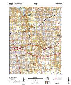
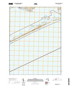
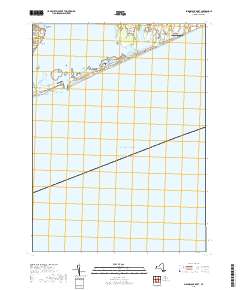
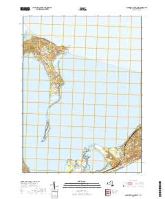
Layered geospatial PDF 7.5 Minute Quadrangle Map. Layers of geospatial data include orthoimagery, roads, grids, geographic names, elevation contours, hydrography, and other selected map features. This map is derived from GIS (geospatial information system) data. It represents a repackaging of GIS data in traditional map form, not creation of new information. The geospatial data in this map are from selected National Map data holdings and other government sources.
Layered geospatial PDF 7.5 Minute Quadrangle Map. Layers of geospatial data include orthoimagery, roads, grids, geographic names, elevation contours, hydrography, and other selected map features. This map is derived from GIS (geospatial information system) data. It represents a repackaging of GIS data in traditional map form, not creation of new information. The geospatial data in this map are from selected National Map data holdings and other government sources.
Layered geospatial PDF 7.5 Minute Quadrangle Map. Layers of geospatial data include orthoimagery, roads, grids, geographic names, elevation contours, hydrography, and other selected map features. This map is derived from GIS (geospatial information system) data. It represents a repackaging of GIS data in traditional map form, not creation of new information. The geospatial data in this map are from selected National Map data holdings and other government sources.
Layered geospatial PDF 7.5 Minute Quadrangle Map. Layers of geospatial data include orthoimagery, roads, grids, geographic names, elevation contours, hydrography, and other selected map features. This map is derived from GIS (geospatial information system) data. It represents a repackaging of GIS data in traditional map form, not creation of new information. The geospatial data in this map are from selected National Map data holdings and other government sources.
Layered geospatial PDF 7.5 Minute Quadrangle Map. Layers of geospatial data include orthoimagery, roads, grids, geographic names, elevation contours, hydrography, and other selected map features. This map is derived from GIS (geospatial information system) data. It represents a repackaging of GIS data in traditional map form, not creation of new information. The geospatial data in this map are from selected National Map data holdings and other government sources.
Layered geospatial PDF 7.5 Minute Quadrangle Map. Layers of geospatial data include orthoimagery, roads, grids, geographic names, elevation contours, hydrography, and other selected map features. This map is derived from GIS (geospatial information system) data. It represents a repackaging of GIS data in traditional map form, not creation of new information. The geospatial data in this map are from selected National Map data holdings and other government sources.
The data contained in this data release support USGS Scientific Investigations Report 2020-5023, "Distribution of selected hydrogeologic characteristics of the upper glacial and Magothy aquifers, Long Island, New York" (Walter and Finkelstein, 2020). This data release contains estimates of aquifer texture describing the Long Island aquifer system. These estimates in total can be considered a model of aquifer texture describing unconsolidated sediments in the following principal units: 1) Upper glacial aquifer, 2) Jameco aquifer, 3) Monmouth Greensand confining unit, and 4) Magothy aquifer. The Lloyd aquifer, a major aquifer on Long Island, is not included in the model due to a lack of available data. Aquifer texture...
Summary Fire Island National Seashore (FIIS) occupies 42 km of the barrier island for which it is named that lies off the southern shore of western and central Suffolk County, Long Island, N.Y. Fire Island is underlain by a complex aquifer system consisting of unconsolidated glacial, lacustrine, deltaic, and marine deposits of clay, silt, sand, and gravel that range in age from Late Cretaceous to Holocene. Accelerated sea level rise, storms, rising temperatures, and changes in patterns of precipitation are all expected to drive significant ecological change. Among the most vulnerable resources are the Island’s fresh groundwater resources. The potential for climate-driven changes in the quantity and quality of...
Categories: Data,
Project;
Types: Downloadable,
Map Service,
OGC WFS Layer,
OGC WMS Layer,
Shapefile;
Tags: Climate Change,
Climate Change,
ClimateChange,
Cooperative Water Program,
Ecosystem Health,
Introduction Mosquitoes are the principle vector of the West Nile Virus (WNV) which causes infections in humans and animals and has emerged as a public health threat throughout Long Island, NY. The WNV was first detected among birds and mosquitoes by the Suffolk County Department of Health Services (SCDHS) in 2000. In response to the public health concern, the USGS in cooperation with the SCDHS, began a 3-year study in 2002 to sample surface waters in selected wetlands for insecticides which were sprayed seasonally from a truck or helicopter as part of the county's vector-control program. These insecticides include Altosid (methoprene) and Scourge [1:3 ratio of resmethrin and piperonyl butoxide (PBO)]. Methoprene...
This data release contains coastal wetland synthesis products for the geographic region of north shore Long Island, New York. Metrics for resiliency, including unvegetated to vegetated ratio (UVVR), marsh elevation, and mean tidal range, are calculated for smaller units delineated from a Digital Elevation Model, providing the spatial variability of physical factors that influence wetland health. Through scientific efforts initiated with the Hurricane Sandy Science Plan, the U.S. Geological Survey has been expanding national assessment of coastal change hazards and forecast products to coastal wetlands with the intent of providing Federal, State, and local managers with tools to estimate the vulnerability and ecosystem...
Categories: Data;
Types: Downloadable,
Map Service,
OGC WFS Layer,
OGC WMS Layer,
Shapefile;
Tags: Atlantic Ocean,
LTER,
Long Island Sound,
Long-Term Ecological Research,
Nassau County,
Integrated terrain models covering 16,357 square kilometers of the Massachusetts coastal zone and offshore waters were built to provide a continuous elevation and bathymetry terrain model for ocean planning purposes. The area is divided into the following four geographical areas to reduce file size and facilitate publishing: Massachusetts Bay from the Massachusetts-New Hampshire border south to Provincetown and Scituate and east to Stellwagen Bank; Cape Cod Bay from Provincetown to Scituate and south to Hyannis; Buzzards Bay from the Cape Cod Canal southwest to the State border including the Elizabeth Islands and extending north to Fall River and Mount Hope Bay; and Nantucket and Vineyard Sounds, from Hyannis south...
Layered geospatial PDF 7.5 Minute Quadrangle Map. Layers of geospatial data include orthoimagery, roads, grids, geographic names, elevation contours, hydrography, and other selected map features. This map is derived from GIS (geospatial information system) data. It represents a repackaging of GIS data in traditional map form, not creation of new information. The geospatial data in this map are from selected National Map data holdings and other government sources.
Layered geospatial PDF 7.5 Minute Quadrangle Map. Layers of geospatial data include orthoimagery, roads, grids, geographic names, elevation contours, hydrography, and other selected map features. This map is derived from GIS (geospatial information system) data. It represents a repackaging of GIS data in traditional map form, not creation of new information. The geospatial data in this map are from selected National Map data holdings and other government sources.
Layered geospatial PDF 7.5 Minute Quadrangle Map. Layers of geospatial data include orthoimagery, roads, grids, geographic names, elevation contours, hydrography, and other selected map features. This map is derived from GIS (geospatial information system) data. It represents a repackaging of GIS data in traditional map form, not creation of new information. The geospatial data in this map are from selected National Map data holdings and other government sources.
Layered geospatial PDF 7.5 Minute Quadrangle Map. Layers of geospatial data include orthoimagery, roads, grids, geographic names, elevation contours, hydrography, and other selected map features. This map is derived from GIS (geospatial information system) data. It represents a repackaging of GIS data in traditional map form, not creation of new information. The geospatial data in this map are from selected National Map data holdings and other government sources.
Layered geospatial PDF 7.5 Minute Quadrangle Map. Layers of geospatial data include orthoimagery, roads, grids, geographic names, elevation contours, hydrography, and other selected map features. This map is derived from GIS (geospatial information system) data. It represents a repackaging of GIS data in traditional map form, not creation of new information. The geospatial data in this map are from selected National Map data holdings and other government sources.
Layered geospatial PDF 7.5 Minute Quadrangle Map. Layers of geospatial data include orthoimagery, roads, grids, geographic names, elevation contours, hydrography, and other selected map features. This map is derived from GIS (geospatial information system) data. It represents a repackaging of GIS data in traditional map form, not creation of new information. The geospatial data in this map are from selected National Map data holdings and other government sources.
This dataset has been archived; it has been superseded by version 3.0 (November 2021) which can be found at https://doi.org/10.5066/P954DLLC . The data contained in this data release support USGS Scientific Investigations Report 2020-5023, "Distribution of selected hydrogeologic characteristics of the upper glacial and Magothy aquifers, Long Island, New York" (Walter and Finkelstein, 2020). This data release contains estimates of aquifer texture describing the Long Island aquifer system. These estimates in total can be considered a model of aquifer texture describing unconsolidated sediments in the following principal units: 1) Upper glacial aquifer, 2) Jameco aquifer, 3) Monmouth Greensand confining unit, and...
This data release contains the output from a Soil-Water-Balance (SWB) model (Westenbroek and others, 2010), used to estimate potential recharge to the Long Island regional aquifer system from 1900-2019. Output data for two SWB simulations are included. The first simulation uses available land-use/land-cover datasets to estimate recharge with changing land use from 1900-2019 (referred to as the post-development simulation). The second simulation assumed a forested, undeveloped (predevelopment simulation) condition across Long Island for the same period. The same soil coverages and time-series climate data were used throughout both simulations. Potential recharge was spatially distributed as gridded output across...
|

|
