Filters: Tags: Suwannee River (X)
5 results (52ms)|
Filters
Contacts
(Less)
|
Freshwater mussels (Unionidae) are among the most imperiled groups of organisms in the world. Unionids are plagued with a lack of basic information regarding species distributions, life history characteristics, and ecological and biological requirements. We assessed the influence of hydrologic factors on the occurrence of the Suwannee Moccasinshell, Medionidus walkeri, a federally threatened freshwater mussel species endemic to the Suwannee River basin in Georgia and Florida. We also assessed the influence of survey effort on detection of M. walkeri during field surveys. All current (2013-2016) mussel survey records in the Suwannee River Basin were compiled, and cumulative discharge contributed by upstream springs...
Categories: Data;
Tags: Conservation,
Distribution,
Hydrology,
Ichetucknee River,
Imperiled species,
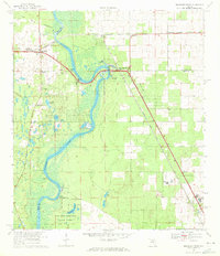
USGS Historical Quadrangle in GeoPDF.

A previously-developed groundwater model of the Suwannee River Basin was modified and calibrated to represent transient conditions. A simulation of recent conditions was developed for the 372-month period 1970-2000, and was compared with a simulation of future conditions for a similar-length period 2039-2069, which uses downscaled GCM (Global Climate Model) data. The MODFLOW groundwater-simulation code was used in both of these simulations, and two different MODFLOW boundary condition “packages” (River and Streamflow Routing Packages) were used to represent interactions between surface-water and groundwater features. The parameters for the simulation of future conditions were developed from dynamically downscaled...
This is an ArcGIS shapefile which depicts the seasonal salinity dynamics of 32 Gulf of Mexico estuaries. To characterize the dynamic nature of estuarine salinity gradients, a multivariate methodology (Bulger et al. 1993) was applied to derive five bio-salinity zones in four salinity seasons for 32 Gulf of Mexico estuaries (Christensen et al. 1997). This seasonal salinity zone spatial framework built upon and refined earlier studies which characterized salinity on an annual-averaged basis (NOAA 1985, Orlando et al. 1993, NOAA 2007). Precipitation, flow gage data, and monthly salinity averages were evaluated to determine which months would be used to represent the high, low, and transitional (increasing and decreasing)...
Categories: Data;
Tags: Academics & scientific researchers,
Apalachee Bay,
Apalachicola Bay,
Aransas Bay,
Atchafalaya Bay,
Assessment of egg deposition is widely used to provide an index of spawning efforts for lithophilic-spawning fishes. However, little is known about the collection techniques efficacy and bias when collecting fish eggs. We conducted a literature review to assess egg collection methods and evaluate egg retention and capture on egg mats. The literature review provided a summary of different gear types used to collect fish eggs, possible bias from the gears, and egg 'abundance' reporting strategies.
|

|
