Filters: Tags: Tennessee (X)
7,226 results (161ms)|
Filters
Date Range
Extensions (Less)
Types (Less)
Contacts (Less)
Categories (Less)
Tag Types
|
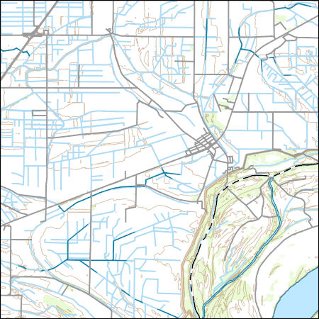
Layers of geospatial data include contours, boundaries, land cover, hydrography, roads, transportation, geographic names, structures, and other selected map features.

This map layer consists of federally owned or administered lands of the United States, Puerto Rico, and the U.S. Virgin Islands. For the most part, only areas of 320 acres or more are included; some smaller areas deemed to be important or significant are also included. There may be private inholdings within the boundaries of Federal lands in this map layer. Some established Federal lands which are larger than 320 acres are not included in this map layer, because their boundaries were not available from the owning or administering agency.
Layers of geospatial data include contours, boundaries, land cover, hydrography, roads, transportation, geographic names, structures, and other selected map features.
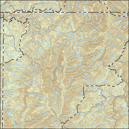
Layers of geospatial data include contours, boundaries, land cover, hydrography, roads, transportation, geographic names, structures, and other selected map features.
This dataset provides timeseries data on water quality and quantity, as collected or computed from outside sources. The format is many tables with one row per time series observation (1 tab-delimited file per site-variable combination, 1 zip file per site). This compilation of data is intended for use in estimating or interpreting metabolism. Sites were included if they met the initial criteria of having at least 100 dissolved oxygen observations and one of the accepted NWIS site types ('ST','ST-CA','ST-DCH','ST-TS', or 'SP'). This dataset is part of a larger data release of metabolism model inputs and outputs for 356 streams and rivers across the United States (https://doi.org/10.5066/F70864KX). The complete release...
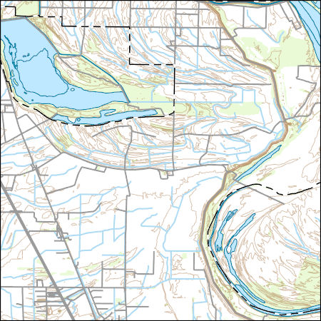
USGS Topo Map Vector Data (Vector) 49316 Wilson, Arkansas 20200915 for 7.5 x 7.5 minute FileGDB 10.1
Layers of geospatial data include contours, boundaries, land cover, hydrography, roads, transportation, geographic names, structures, and other selected map features.
This data release component contains model inputs including river basin attributes, weather forcing data, and simulated and observed river discharge.
The U. S. Geological Survey (USGS) makes long-term seismic hazard forecasts that are used in building codes. The hazard models usually consider only natural seismicity; non-tectonic (man-made) earthquakes are excluded because they are transitory or too small. In the past decade, however, thousands of earthquakes related to underground fluid injection have occurred in the central and eastern U.S. (CEUS), and some have caused damage. In response, the USGS is now also making short-term forecasts that account for the hazard from these induced earthquakes. A uniform earthquake catalog is assembled by combining and winnowing pre-existing source catalogs. Seismicity statistics are analyzed to develop recurrence models,...
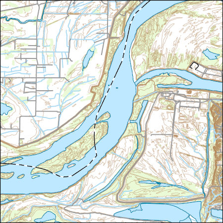
USGS Topo Map Vector Data (Vector) 26994 Luxora, Arkansas 20200916 for 7.5 x 7.5 minute FileGDB 10.1
Layers of geospatial data include contours, boundaries, land cover, hydrography, roads, transportation, geographic names, structures, and other selected map features.
This geodatabase contains the official boundary of the Southeast Aquatic Resource Partnership with State Boundaries. The boundary was originally developed by the United States Fish and Wildlife Service and was updated in 2020 to reflect revisions from the Southeast Aquatic Resource Partnership, a recognized Fish Habitat Partnership (FHP) of the National Fish Habitat Partnership.
Categories: Data;
Types: ArcGIS REST Map Service,
ArcGIS Service Definition,
Downloadable,
Map Service;
Tags: Alabama,
Analytical boundary,
Aquatic habitats,
Boundaries,
Boundary,
Monthly Aquaculture and Irrigation Water-Use Estimates for the Mississippi Alluvial Plain, 1999-2017
These monthly water-use rasters estimate the total amount of groundwater used for aquaculture and irrigation purposes within the Mississippi Alluvial Plain during the growing season (April-October). This dataset contains 133 monthly water-use rasters that are totals of 6 different categories: aquaculture, cotton, corn, rice, soybeans, and all other crops. Units are in cubic meters per square mile. Aquaculture and irrigation water-use estimates are included in this data release in two different formats: georeferenced TIFFs (GeoTIFFs) for simple viewing and geospatial operations and a network common data form (NetCDF) for use in modeling applications and with each month as a separate raster array table.
This data release consists of the data used to develop SPAtially Referenced Regression On Watershed(SPARROW) attributes models for estimating loads of total phosphorus and total nitrogen in Tennessee streams. These data support the publication containing the Tennessee SPARROW models results (Hoos and others, 2019) and include model input used in the South Atlantic-Gulf Drainages and Tennessee River Basin (SAGT) nutrient SPARROW models (Hoos and McMahon, 2009; Garcia and others, 2011) as well as model input for river basins in Tennessee not included in the domain of the published SAGT SPARROW models. Also included in this data release are model coefficients, the software required to execute the Tennessee SPARROW...
These data are high-resolution bathymetry (riverbed elevation) and depth-averaged velocities in ASCII format, generated from hydrographic and velocimetric surveys of the Mississippi River near structure A1700 on Interstate 155 near Caruthersville, Missouri, in 2008, 2011, 2014 and 2018. Hydrographic data were collected using a high-resolution multibeam echosounder mapping system (MBMS), which consists of a multibeam echosounder (MBES) and an inertial navigation system (INS) mounted on a marine survey vessel. Data were collected as the vessel traversed the river along planned survey lines distributed throughout the reach. Data collection software integrated and stored the depth data from the MBES and the horizontal...
These monthly water-use rasters estimate the total amount of groundwater used for aquaculture and irrigation purposes within the Mississippi Alluvial Plain during the growing season (April-October). This dataset contains 798 monthly water-use rasters for 6 different categories: aquaculture, cotton, corn, rice, soybeans, and all other crops. Units are in cubic meters per square mile.
The annual water-use rasters estimate the total amount of groundwater used for aquaculture and irrigation purposes within the Mississippi Alluvial Plain. This dataset contains 19 annual water-use rasters that are totals of 6 different use categories: aquaculture, cotton, corn, rice, soybeans, and all other crops. Units are in cubic meters per square mile.

This map layer shows Indian lands of the United States. For the most part, only areas of 320 acres or more are included; some smaller areas deemed to be important or significant are also included. Federally-administered lands within a reservation are included for continuity; these may or may not be considered part of the reservation and are simply described with their feature type and the administrating Federal agency. Some established Indian lands which are larger than 320 acres are not included in this map layer because their boundaries were not available from the owning or administering agency.
The Critical Minerals in Archived Mine Samples Database (CMDB) contains chemistry and geologic information for historic ore and ore-related rock samples from mineral deposits in the United States. In addition, the database contains samples from archetypal deposits from 27 other countries in North America, South America, Asia, Africa and Europe. Samples were obtained from archived ore collections under the U.S. Geological Survey's project titled "Quick Assessment of Rare and Critical Metals in Ore Deposits: A National Assessment" (2008 to 2013) in an effort to begin an assessment of the Nations' previously mined ore deposits for critical minerals. Mineralized and altered rock samples were provided by the Colorado...
Categories: Data;
Types: ArcGIS REST Map Service,
ArcGIS Service Definition,
Downloadable,
Map Service,
OGC WFS Layer,
OGC WMS Layer,
Shapefile;
Tags: Alaska,
Argentina,
Arizona,
Arkansas,
Australia,
The U.S. Geological Survey (USGS) has developed and implemented an algorithm that identifies burned areas in dense time series of Landsat image stacks to produce the Landsat Burned Area Essential Climate Variable (BAECV) products. The algorithm makes use of predictors derived from individual Landsat scenes, lagged reference conditions, and change metrics between the scene and reference conditions. Outputs of the BAECV algorithm consist of pixel-level burn probabilities for each Landsat scene, and annual burn probability, burn classification, and burn date composites. These products were generated for the conterminous United States for 1984 through 2015. These data are also available for download at https://rmgsc.cr.usgs.gov/outgoing/baecv/BAECV_CONUS_v1.1_2017/...
Values for area of all occupied habitat were only obtained for species whose occupancy models predicted a marked proportion of the species' population was likely present in non-forest habitats.
These data identify the time (0-1 min, 1-2 min,or 2-3 min) and distance (≤50 meters, >50 meters) category when birds were first detected during 3-minutes point counts at stop locations associated with North American Breeding Bird Survey routes or route equivalents that were surveyed on dates between 2009 and 2016 and provide point location coordinates of stop locations along North American Breeding Bird Survey routes or route equivalents within (or within 60 miles) the Gulf Coastal Plains & Ozarks Landscape Conservation Cooperative boundary.
|

|
