Filters: Tags: Titanium (X)
63 results (85ms)|
Filters
Date Range
Extensions Types Contacts
Categories Tag Types
|
NOTE: This data release has been superseded by version 2.0, available here: https://doi.org/10.5066/P9U6SODG
This location is part of the Arizona Mineral Industry Location System (AzMILS), an inventory of mineral occurences, prospects and mine locations in Arizona. Maricopa677 is located in T3S R5W Sec 32 S2 in the Citrus Valley East - 7.5 Min quad. This collection consists of various reports, maps, records and related materials acquired by the Arizona Department of Mines and Mineral Resources regarding mining properties in Arizona. Information was obtained by various means, including the property owners, exploration companies, consultants, verbal interviews, field visits, newspapers and publications. Some sections may be redacted for copyright. Please see the access statement.
Categories: Data;
Tags: 1980s,
Arizona,
Citrus Valley East - 7.5 Min,
Dataset,
Gila Bend Mts. physiographic area,
This location is part of the Arizona Mineral Industry Location System (AzMILS), an inventory of mineral occurences, prospects and mine locations in Arizona. Pinal509 is located in T8S R12E Sec 3 C in the Ninetysix Hills Se - 7.5 Min quad. This collection consists of various reports, maps, records and related materials acquired by the Arizona Department of Mines and Mineral Resources regarding mining properties in Arizona. Information was obtained by various means, including the property owners, exploration companies, consultants, verbal interviews, field visits, newspapers and publications. Some sections may be redacted for copyright. Please see the access statement.
The U.S. Geological Survey (USGS) has compiled a geodatabase containing mineral-related geospatial data for 10 countries of interest in Southwest Asia (area of study): Afghanistan, Cambodia, Laos, India, Indonesia, Iran, Nepal, North Korea, Pakistan, and Thailand. The data can be used in analyses of the extractive fuel and nonfuel mineral industries and related economic and physical infrastructure integral for the successful operation of the mineral industries within the area of study as well as the movement of mineral products across domestic and global markets. This geodatabase reflects the USGS ongoing commitment to its mission of understanding the nature and distribution of global mineral commodity supply chains...
This location is part of the Arizona Mineral Industry Location System (AzMILS), an inventory of mineral occurences, prospects and mine locations in Arizona. Maricopa24 is located in T1S R3W Sec 31 SW in the Buckeye - 15 Min quad. This collection consists of various reports, maps, records and related materials acquired by the Arizona Department of Mines and Mineral Resources regarding mining properties in Arizona. Information was obtained by various means, including the property owners, exploration companies, consultants, verbal interviews, field visits, newspapers and publications. Some sections may be redacted for copyright. Please see the access statement.
Categories: Data;
Tags: 1980s,
Arizona,
Buckeye - 15 Min,
Buckeye Hills metallic mineral dist.,
Buckeye Hills physiographic area,
Compilation of Geospatial Data (GIS) for the Mineral Industries and Related Infrastructure of Africa
This geodatabase reflects the U.S. Geological Survey’s (USGS) ongoing commitment to its mission of understanding the nature and distribution of global mineral commodity supply chains by updating and publishing the georeferenced locations of mineral commodity production and processing facilities, mineral exploration and development sites, and mineral commodity exporting ports in Africa. The geodatabase and geospatial data layers serve to create a new geographic information product in the form of a geospatial portable document format (PDF) map. The geodatabase contains data layers from USGS, foreign governmental, and open-source sources as follows: (1) mineral production and processing facilities, (2) mineral exploration...
This data release provides descriptions of more than 100 mining districts, mines, and mineral occurrences (deposits and prospects) within the United States that are reported to contain enrichments of rhenium (Re). These mineral occurrences include mined deposits, exploration prospects, and other occurrences with notable concentrations of rhenium. The inclusion of a particular mineral occurrence in this database is not meant to imply that it has economic potential. Rather, these occurrences were included to capture the distribution and characteristics of the known, reported rhenium occurrences in the United States. Rhenium is one of the rarest elements in the Earth's crust. Most rhenium occurs in the mineral molybdenite,...
Categories: Data;
Types: ArcGIS REST Map Service,
ArcGIS Service Definition,
Downloadable,
Map Service;
Tags: Alaska,
Arizona,
BLM,
Bureau of Land Management,
Colorado,
This data release contains the U.S. salient statistics and world production data extracted from the TITANIUM AND TITANIUM DIOXIDE data sheet of the USGS Mineral Commodity Summaries 2024.
This Titanium_vanadium_deposits_references.csv file contains the full and abbreviated references used in the Titanium_vanadium_deposits_concentrate_grade.csv, Titanium_vanadium_deposits.csv, and Titanium_vanadium_deposits.shp files. Also included with this data release are the following files: Titanium_vanadium_deposits.csv file, which lists the deposits and associated information such as the host intrusion, location, grade, and tonnage data, along with other miscellaneous descriptive data about the deposits; Titanium_vanadium_deposits.shp file, which duplicates the information in the Titanium_vanadium_deposits.csv file in a spatial format for use in a GIS; Titanium_vanadium_column_headings.csv file, which correlates...
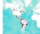
This data set consists of records for over 900 mineral facilities in Latin America and Canada. The mineral facilities include mines, plants, smelters, or refineries of aluminum, cement, coal, copper, diamond, gold, iron and steel, nickel, platinum-group metals, salt, and silver, among others. Records include attributes such as commodity, country, location, company name, facility type and capacity if applicable, and generalized coordinates. The data were compiled from multiple sources, including the 2003 and 2004 USGS Minerals Yearbooks (Latin America and Candada volume), data to be published in the 2005 Minerals Yearbook Latin America and Canada Volume, minerals statistics and information from the USGS minerals...
This location is part of the Arizona Mineral Industry Location System (AzMILS), an inventory of mineral occurences, prospects and mine locations in Arizona. Maricopa68 is located in T3N R4W Sec 36 S2 in the White Tank Mts - 15 Min quad. This collection consists of various reports, maps, records and related materials acquired by the Arizona Department of Mines and Mineral Resources regarding mining properties in Arizona. Information was obtained by various means, including the property owners, exploration companies, consultants, verbal interviews, field visits, newspapers and publications. Some sections may be redacted for copyright. Please see the access statement.
This data release provides multi-element data for drill core samples from the Mesoproterozoic Nonesuch Formation and Copper Harbor Conglomerate at the Copperwood copper deposit, Michigan, USA. Copper was determined by assay, and sulfur by inductively coupled plasma-optical emission spectrometry (ICP-OES) after aqua regia digestion for most samples. Multi-element whole rock analyses were determined for selected samples. The Copperwood copper deposit is a sediment-hosted stratiform copper deposit in the Presque Isle Syncline of the Upper Peninsula of Michigan. The deposit has a 2018 mineral resource estimate of 42.2 million metric tons (Mt) of measured plus indicated mineral resources in the Lower Copper Bearing Sequence...
Categories: Data;
Tags: Copper Harbor Conglomerate,
Copperwood copper deposit,
Michigan,
NGDB,
National Geochemical Database,
The Blue Ridge belt in northwestern North Carolina and northeastern Tennessee is composed chiefly of 1,000-million to 1,100-million-year-old metamorphic and plutonic rocks that have been thrust many miles northwestward across unmetamorphosed Cambrian(?) and Cambrian sedimentary rocks of the Unaka belt. The Blue Ridge thrust sheet is rooted on the southeast along the Brevard zone, a zone of strike-slip faulting along which metamorphic and plutonic rocks of the Inner Piedmont belt are juxtaposed with rocks of the Blue Ridge. Near the southeastern edge of the Blue Ridge belt, the Blue Ridge thrust sheet is breached by erosion, and the rocks beneath are exposed in the Grandfather Mountain window, which is 45 miles long...
This location is part of the Arizona Mineral Industry Location System (AzMILS), an inventory of mineral occurences, prospects and mine locations in Arizona. Maricopa677 is located in T3S R5W Sec 32 S2 in the Citrus Valley East - 7.5 Min quad. This collection consists of various reports, maps, records and related materials acquired by the Arizona Department of Mines and Mineral Resources regarding mining properties in Arizona. Information was obtained by various means, including the property owners, exploration companies, consultants, verbal interviews, field visits, newspapers and publications. Some sections may be redacted for copyright. Please see the access statement.

This dataset consists of records for over 1,500 mineral facilities in Africa and the Middle East. The mineral facilities include mines, plants, mills , or refineries of aluminum, cement, coal, copper, diamond, gold, iron and steel, nickel, platinum-group metals, salt, and silver, among others. Records include attributes such as commodity, country, site, company name, plant capacity if applicable, and generalized coordinates. The data were compiled from multiple sources, including the 2004 USGS Minerals Yearbook (Africa and Middle East volume), minerals statistics and information from the USGS minerals information Web site (http://minerals.usgs.gov/minerals/), and data collected by USGS minerals information country...
Geologists from the Alaska Division of Geological & Geophysical Surveys (DGGS) Mineral Resources Section conducted four weeks of helicopter-supported mapping and fieldwork from June 26 through July 24, 2013. The Styx River project in the Lime Hills C-1 Quadrangle was part of the State-funded Airborne Geophysical/Geological Mineral Inventory (AGGMI) program as part of the State's Strategic Minerals Assessment Project, an initiative designed to evaluate Alaska's potential for rare-earth elements, PGEs, and other similarly supply-challenged resources. The Styx River project area has active and ongoing mineral exploration for deposit types including porphyry copper/molybdenum/gold, reduced intrusion-related gold, and...
This data release provides descriptions of more than 120 mineral regions, mines, and mineral deposits within the United States that are reported to contain enrichments of tin (Sn). This data release only includes sites with publicly available records of past production of tin, or a defined resource of tin, or both. The inclusion of a particular mineral deposit in this database is not meant to imply that it has economic potential; it may be produced only as a byproduct at some sites. Rather, these deposits were included to capture the distribution of characteristics of the known, reported tin deposits in the United States. This logic also applies to the other commodities listed with tin in some occurrences. The...
Categories: Data;
Types: ArcGIS REST Map Service,
ArcGIS Service Definition,
Downloadable,
Map Service;
Tags: Alabama,
Alaska,
BLM,
Bureau of Land Management,
California,
This data release contains geochemical data from selected U.S. Geological Survey (USGS) projects from the 1960s-1980s that were previously unpublished as digital data. The objective of those projects was to describe the geology, determine petrologic and geochemical characteristics, or to evaluate the mineral resource potential of Federal Lands and adjacent study areas. These data comprise geochemical analyses from 36,498 samples--27,223 rock samples, 4,091 sediment samples, 2,351 soil samples, 330 heavy-mineral pan concentrate samples, 297 organic material samples, 58 mineral samples, 27 water samples, 11 miscellaneous samples, and 2,110 unspecified media samples. More than 78 percent of these samples were analyzed...
Categories: Data;
Types: Downloadable,
Map Service,
OGC WFS Layer,
OGC WMS Layer,
Shapefile;
Tags: "Geochemistry",
"Mineral Resources"],
Alaska,
California,
Colorado,
The Bureau of Mines has investigated a process to produce titanium powder directly from titanium salts. If successful, such a process could lower the cost and increase the use of titanium. In this study, K2TiF6, K2 TiF5 , and TiF3 were reduced with potassium in the temperature range of 650ø to 750ø C. Under certain conditions, titanium powder 1.6 to 3.3 microns in size was produced. After leaching the product with a 0.1M HC1 solution, powder impurities as low - as 0.04 pct potassium and 0.28 pct fluorine were obtained. - However, oxygen levels of over 1 pct and the frequent formation of insoluble byproducts demonstrate the need for further research to make the powder suitable for powder metallurgy applications.
Tags: Titanium
This Titanium_vanadium_deposits_concentrate_grade.csv file contains data about the concentrate grade of titanium-vanadium deposits hosted in mafic-ultramafic layered intrusions and massif anorthosite intrusions around the world. Also included with this data release are the following files: Titanium_vanadium_deposits.csv file, which lists the deposits and associated information such as the host intrusion, location, grade, and tonnage data, along with other miscellaneous descriptive data about the deposits; Titanium_vanadium_deposits.shp file, which duplicates the information in the Titanium_vanadium_deposits.csv file in a spatial format for use in a GIS; Titanium_vanadium_column_headings.csv file, which correlates...
|

|
