Filters
Date Range
Contacts
Categories
Tag Types
Tag Schemes
|
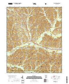
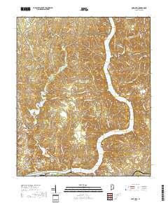
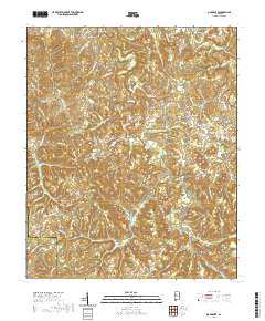
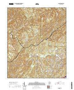
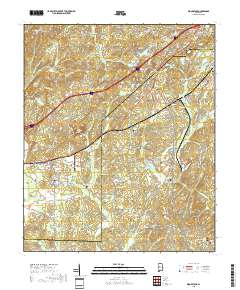
Layered geospatial PDF 7.5 Minute Quadrangle Map. Layers of geospatial data include orthoimagery, roads, grids, geographic names, elevation contours, hydrography, and other selected map features. This map is derived from GIS (geospatial information system) data. It represents a repackaging of GIS data in traditional map form, not creation of new information. The geospatial data in this map are from selected National Map data holdings and other government sources.
Tags: 7.5 x 7.5 minute,
Alabama,
Bibb County,
Downloadable Data,
Duncanville, AL, All tags...
EarthCover,
Geospatial PDF,
Geospatial PDF,
Hale County,
Imagery and Base Maps,
Map,
Public Land Survey System,
Tuscaloosa County,
U.S. National Grid,
US,
US Topo,
US Topo Historical,
boundary,
contour,
geographic names,
hydrography,
imageryBaseMapsEarthCover,
orthoimage,
structures,
topographic,
transportation,
woodland, Fewer tags
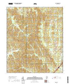
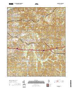
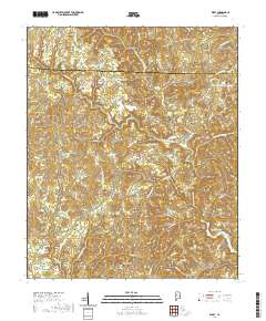
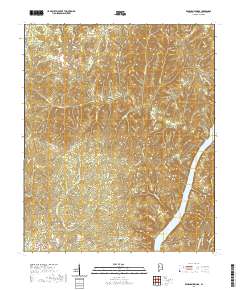
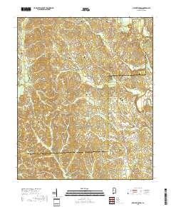
Layered geospatial PDF 7.5 Minute Quadrangle Map. Layers of geospatial data include orthoimagery, roads, grids, geographic names, elevation contours, hydrography, and other selected map features. This map is derived from GIS (geospatial information system) data. It represents a repackaging of GIS data in traditional map form, not creation of new information. The geospatial data in this map are from selected National Map data holdings and other government sources.
Tags: 7.5 x 7.5 minute,
Alabama,
Downloadable Data,
EarthCover,
Geospatial PDF, All tags...
Geospatial PDF,
Greene County,
Imagery and Base Maps,
Map,
Public Land Survey System,
Tuscaloosa County,
U.S. National Grid,
US,
US Topo,
US Topo Current,
boundary,
contour,
geographic names,
hydrography,
imageryBaseMapsEarthCover,
orthoimage,
structures,
topographic,
transportation,
woodland, Fewer tags
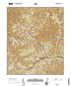
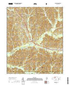
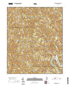
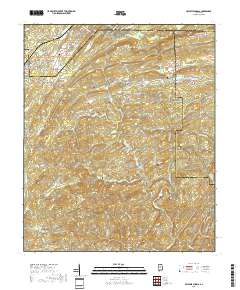
Layered geospatial PDF 7.5 Minute Quadrangle Map. Layers of geospatial data include orthoimagery, roads, grids, geographic names, elevation contours, hydrography, and other selected map features. This map is derived from GIS (geospatial information system) data. It represents a repackaging of GIS data in traditional map form, not creation of new information. The geospatial data in this map are from selected National Map data holdings and other government sources.
Tags: 7.5 x 7.5 minute,
Alabama,
Brookwood, AL,
Downloadable Data,
EarthCover, All tags...
Geospatial PDF,
Geospatial PDF,
Imagery and Base Maps,
Map,
Public Land Survey System,
Tuscaloosa County,
U.S. National Grid,
US,
US Topo,
US Topo Historical,
boundary,
contour,
geographic names,
hydrography,
imageryBaseMapsEarthCover,
orthoimage,
structures,
topographic,
transportation,
woodland, Fewer tags
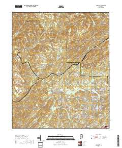
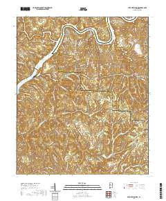
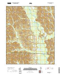
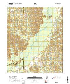
Layered geospatial PDF 7.5 Minute Quadrangle Map. Layers of geospatial data include orthoimagery, roads, grids, geographic names, elevation contours, hydrography, and other selected map features. This map is derived from GIS (geospatial information system) data. It represents a repackaging of GIS data in traditional map form, not creation of new information. The geospatial data in this map are from selected National Map data holdings and other government sources.
Tags: 7.5 x 7.5 minute,
Abernant, AL,
Alabama,
Downloadable Data,
EarthCover, All tags...
Geospatial PDF,
Geospatial PDF,
Imagery and Base Maps,
Jefferson County,
Map,
Public Land Survey System,
Tuscaloosa County,
U.S. National Grid,
US,
US Topo,
US Topo Historical,
boundary,
contour,
geographic names,
hydrography,
imageryBaseMapsEarthCover,
orthoimage,
structures,
topographic,
transportation,
woodland, Fewer tags
Layered geospatial PDF 7.5 Minute Quadrangle Map. Layers of geospatial data include orthoimagery, roads, grids, geographic names, elevation contours, hydrography, and other selected map features. This map is derived from GIS (geospatial information system) data. It represents a repackaging of GIS data in traditional map form, not creation of new information. The geospatial data in this map are from selected National Map data holdings and other government sources.
Tags: 7.5 x 7.5 minute,
Alabama,
Downloadable Data,
EarthCover,
Geospatial PDF, All tags...
Geospatial PDF,
Imagery and Base Maps,
Lake Nicol, AL,
Map,
Public Land Survey System,
Tuscaloosa County,
U.S. National Grid,
US,
US Topo,
US Topo Historical,
boundary,
contour,
geographic names,
hydrography,
imageryBaseMapsEarthCover,
orthoimage,
structures,
topographic,
transportation,
woodland, Fewer tags
Layered geospatial PDF 7.5 Minute Quadrangle Map. Layers of geospatial data include orthoimagery, roads, grids, geographic names, elevation contours, hydrography, and other selected map features. This map is derived from GIS (geospatial information system) data. It represents a repackaging of GIS data in traditional map form, not creation of new information. The geospatial data in this map are from selected National Map data holdings and other government sources.
Tags: 7.5 x 7.5 minute,
Alabama,
Cottondale, AL,
Downloadable Data,
EarthCover, All tags...
Geospatial PDF,
Geospatial PDF,
Imagery and Base Maps,
Map,
Public Land Survey System,
Tuscaloosa County,
U.S. National Grid,
US,
US Topo,
US Topo Historical,
boundary,
contour,
geographic names,
hydrography,
imageryBaseMapsEarthCover,
orthoimage,
structures,
topographic,
transportation,
woodland, Fewer tags
Layered geospatial PDF 7.5 Minute Quadrangle Map. Layers of geospatial data include orthoimagery, roads, grids, geographic names, elevation contours, hydrography, and other selected map features. This map is derived from GIS (geospatial information system) data. It represents a repackaging of GIS data in traditional map form, not creation of new information. The geospatial data in this map are from selected National Map data holdings and other government sources.
Tags: 7.5 x 7.5 minute,
Alabama,
Bibb County,
Downloadable Data,
EarthCover, All tags...
Geospatial PDF,
Geospatial PDF,
Hale County,
Imagery and Base Maps,
Map,
Public Land Survey System,
Tuscaloosa County,
U.S. National Grid,
US,
US Topo,
US Topo Current,
boundary,
contour,
geographic names,
hydrography,
imageryBaseMapsEarthCover,
orthoimage,
structures,
topographic,
transportation,
woodland, Fewer tags

Layered geospatial PDF 7.5 Minute Quadrangle Map. Layers of geospatial data include orthoimagery, roads, grids, geographic names, elevation contours, hydrography, and other selected map features. This map is derived from GIS (geospatial information system) data. It represents a repackaging of GIS data in traditional map form, not creation of new information. The geospatial data in this map are from selected National Map data holdings and other government sources.
Tags: 7.5 x 7.5 minute,
Alabama,
Downloadable Data,
EarthCover,
Geospatial PDF, All tags...
Geospatial PDF,
Greene County,
Imagery and Base Maps,
Map,
Public Land Survey System,
Ralph, AL,
Tuscaloosa County,
U.S. National Grid,
US,
US Topo,
US Topo Historical,
boundary,
contour,
geographic names,
hydrography,
imageryBaseMapsEarthCover,
orthoimage,
structures,
topographic,
transportation,
woodland, Fewer tags
Layered geospatial PDF 7.5 Minute Quadrangle Map. Layers of geospatial data include orthoimagery, roads, grids, geographic names, elevation contours, hydrography, and other selected map features. This map is derived from GIS (geospatial information system) data. It represents a repackaging of GIS data in traditional map form, not creation of new information. The geospatial data in this map are from selected National Map data holdings and other government sources.
Tags: 7.5 x 7.5 minute,
Alabama,
Downloadable Data,
EarthCover,
Geospatial PDF, All tags...
Geospatial PDF,
Imagery and Base Maps,
Jefferson County,
Map,
Public Land Survey System,
Tuscaloosa County,
U.S. National Grid,
US,
US Topo,
US Topo Current,
boundary,
contour,
geographic names,
hydrography,
imageryBaseMapsEarthCover,
orthoimage,
structures,
topographic,
transportation,
woodland, Fewer tags
Layered geospatial PDF 7.5 Minute Quadrangle Map. Layers of geospatial data include orthoimagery, roads, grids, geographic names, elevation contours, hydrography, and other selected map features. This map is derived from GIS (geospatial information system) data. It represents a repackaging of GIS data in traditional map form, not creation of new information. The geospatial data in this map are from selected National Map data holdings and other government sources.
Tags: 7.5 x 7.5 minute,
Alabama,
Downloadable Data,
EarthCover,
Fayette County, All tags...
Geospatial PDF,
Geospatial PDF,
Imagery and Base Maps,
Map,
Public Land Survey System,
Tuscaloosa County,
U.S. National Grid,
US,
US Topo,
US Topo Current,
Walker County,
boundary,
contour,
geographic names,
hydrography,
imageryBaseMapsEarthCover,
orthoimage,
structures,
topographic,
transportation,
woodland, Fewer tags
Layered geospatial PDF 7.5 Minute Quadrangle Map. Layers of geospatial data include orthoimagery, roads, grids, geographic names, elevation contours, hydrography, and other selected map features. This map is derived from GIS (geospatial information system) data. It represents a repackaging of GIS data in traditional map form, not creation of new information. The geospatial data in this map are from selected National Map data holdings and other government sources.
Tags: 7.5 x 7.5 minute,
Alabama,
Downloadable Data,
EarthCover,
Geospatial PDF, All tags...
Geospatial PDF,
Imagery and Base Maps,
Jefferson County,
Map,
Public Land Survey System,
Tuscaloosa County,
Tutwiler School, AL,
U.S. National Grid,
US,
US Topo,
US Topo Historical,
Walker County,
boundary,
contour,
geographic names,
hydrography,
imageryBaseMapsEarthCover,
orthoimage,
structures,
topographic,
transportation,
woodland, Fewer tags
Layered geospatial PDF 7.5 Minute Quadrangle Map. Layers of geospatial data include orthoimagery, roads, grids, geographic names, elevation contours, hydrography, and other selected map features. This map is derived from GIS (geospatial information system) data. It represents a repackaging of GIS data in traditional map form, not creation of new information. The geospatial data in this map are from selected National Map data holdings and other government sources.
Tags: 7.5 x 7.5 minute,
Alabama,
Downloadable Data,
EarthCover,
Fayette County, All tags...
Geospatial PDF,
Geospatial PDF,
Imagery and Base Maps,
Map,
Newtonville, AL,
Pickens County,
Public Land Survey System,
Tuscaloosa County,
U.S. National Grid,
US,
US Topo,
US Topo Historical,
boundary,
contour,
geographic names,
hydrography,
imageryBaseMapsEarthCover,
orthoimage,
structures,
topographic,
transportation,
woodland, Fewer tags
Layered geospatial PDF 7.5 Minute Quadrangle Map. Layers of geospatial data include orthoimagery, roads, grids, geographic names, elevation contours, hydrography, and other selected map features. This map is derived from GIS (geospatial information system) data. It represents a repackaging of GIS data in traditional map form, not creation of new information. The geospatial data in this map are from selected National Map data holdings and other government sources.
Tags: 7.5 x 7.5 minute,
Alabama,
Downloadable Data,
EarthCover,
Geospatial PDF, All tags...
Geospatial PDF,
Imagery and Base Maps,
Jefferson County,
Map,
Public Land Survey System,
Tuscaloosa County,
U.S. National Grid,
US,
US Topo,
US Topo Current,
boundary,
contour,
geographic names,
hydrography,
imageryBaseMapsEarthCover,
orthoimage,
structures,
topographic,
transportation,
woodland, Fewer tags
Layered geospatial PDF 7.5 Minute Quadrangle Map. Layers of geospatial data include orthoimagery, roads, grids, geographic names, elevation contours, hydrography, and other selected map features. This map is derived from GIS (geospatial information system) data. It represents a repackaging of GIS data in traditional map form, not creation of new information. The geospatial data in this map are from selected National Map data holdings and other government sources.
Tags: 7.5 x 7.5 minute,
Alabama,
Downloadable Data,
EarthCover,
Geospatial PDF, All tags...
Geospatial PDF,
Imagery and Base Maps,
Map,
Public Land Survey System,
Tuscaloosa County,
U.S. National Grid,
US,
US Topo,
US Topo Current,
boundary,
contour,
geographic names,
hydrography,
imageryBaseMapsEarthCover,
orthoimage,
structures,
topographic,
transportation,
woodland, Fewer tags
Layered geospatial PDF 7.5 Minute Quadrangle Map. Layers of geospatial data include orthoimagery, roads, grids, geographic names, elevation contours, hydrography, and other selected map features. This map is derived from GIS (geospatial information system) data. It represents a repackaging of GIS data in traditional map form, not creation of new information. The geospatial data in this map are from selected National Map data holdings and other government sources.
Tags: 7.5 x 7.5 minute,
Alabama,
Bibb County,
Downloadable Data,
EarthCover, All tags...
Geospatial PDF,
Geospatial PDF,
Halfmile Shoals, AL,
Imagery and Base Maps,
Jefferson County,
Map,
Public Land Survey System,
Shelby County,
Tuscaloosa County,
U.S. National Grid,
US,
US Topo,
US Topo Historical,
boundary,
contour,
geographic names,
hydrography,
imageryBaseMapsEarthCover,
orthoimage,
structures,
topographic,
transportation,
woodland, Fewer tags
Layered geospatial PDF 7.5 Minute Quadrangle Map. Layers of geospatial data include orthoimagery, roads, grids, geographic names, elevation contours, hydrography, and other selected map features. This map is derived from GIS (geospatial information system) data. It represents a repackaging of GIS data in traditional map form, not creation of new information. The geospatial data in this map are from selected National Map data holdings and other government sources.
Tags: 7.5 x 7.5 minute,
Alabama,
Downloadable Data,
EarthCover,
Geospatial PDF, All tags...
Geospatial PDF,
Greene County,
Imagery and Base Maps,
Map,
Pickens County,
Public Land Survey System,
Tuscaloosa County,
U.S. National Grid,
US,
US Topo,
US Topo Current,
boundary,
contour,
geographic names,
hydrography,
imageryBaseMapsEarthCover,
orthoimage,
structures,
topographic,
transportation,
woodland, Fewer tags
Layered geospatial PDF 7.5 Minute Quadrangle Map. Layers of geospatial data include orthoimagery, roads, grids, geographic names, elevation contours, hydrography, and other selected map features. This map is derived from GIS (geospatial information system) data. It represents a repackaging of GIS data in traditional map form, not creation of new information. The geospatial data in this map are from selected National Map data holdings and other government sources.
Tags: 7.5 x 7.5 minute,
Alabama,
Bibb County,
Downloadable Data,
EarthCover, All tags...
Geospatial PDF,
Geospatial PDF,
Imagery and Base Maps,
Map,
Public Land Survey System,
Tuscaloosa County,
U.S. National Grid,
US,
US Topo,
US Topo Historical,
Woodstock, AL,
boundary,
contour,
geographic names,
hydrography,
imageryBaseMapsEarthCover,
orthoimage,
structures,
topographic,
transportation,
woodland, Fewer tags
Layered geospatial PDF 7.5 Minute Quadrangle Map. Layers of geospatial data include orthoimagery, roads, grids, geographic names, elevation contours, hydrography, and other selected map features. This map is derived from GIS (geospatial information system) data. It represents a repackaging of GIS data in traditional map form, not creation of new information. The geospatial data in this map are from selected National Map data holdings and other government sources.
Tags: 7.5 x 7.5 minute,
Alabama,
Downloadable Data,
EarthCover,
Fayette County, All tags...
Geospatial PDF,
Geospatial PDF,
Imagery and Base Maps,
Map,
New Lexington, AL,
Public Land Survey System,
Tuscaloosa County,
U.S. National Grid,
US,
US Topo,
US Topo Historical,
boundary,
contour,
geographic names,
hydrography,
imageryBaseMapsEarthCover,
orthoimage,
structures,
topographic,
transportation,
woodland, Fewer tags
This data release contains programmed pyrolysis, organic petrographic (reflectance), and semiquantitative X-ray diffraction mineralogy data for subsurface coal and shale samples from around the world. Samples were subjected to hydrous or anhydrous pyrolysis experiments at varying temperatures and the resulting residues were analyzed via programmed pyrolysis and reflectance to document changes in thermal maturity.
Categories: Data;
Tags: Alabama,
Alaska,
Alberta,
Australia,
Bihar, All tags...
Caldwell Parish,
California,
Canada,
Carter County,
China,
Choctaw County,
Clark County,
Colorado,
England,
Fairfax County,
Freestone County,
Garfield County,
Gibson County,
Greeley County,
HI,
Harrison County,
Illinois,
India,
Indiana,
Jefferson County,
Kalmar County,
Kansas,
Kentucky,
Knox County,
LOI,
Leduc County,
Louisiana,
Marion County,
McLean County,
Mississippi,
Montana,
North Dakota,
Nowata County,
OI,
Ohio,
Oklahoma,
Oland,
PI,
Powell County,
Red River Parish,
Richland County,
Rock-Eval,
S1,
S2,
S3,
San Saba County,
Santa Barbara County,
Sweden,
Texas,
Tmax,
Tuscaloosa County,
USGS Science Data Catalog (SDC),
United States,
Val Verde County,
Virginia,
Ward County,
carbonate,
chlorite,
feldspar,
geochemistry,
hydrogen enrichment index,
illite,
kaolinite,
loss on ignition,
mineralogy,
organic content,
oxygen enrichment index,
production index,
pyrite,
pyrolysis,
quartz,
smectite,
solid bitumen reflectance,
thermal maturity,
total organic carbon,
vitrinite reflectance, Fewer tags
|
|

