Filters: Tags: USGS (X) > partyWithName: U.S. Geological Survey (X)
12,540,084 results (795ms)|
Filters
Contacts
(Less)
|

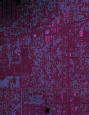
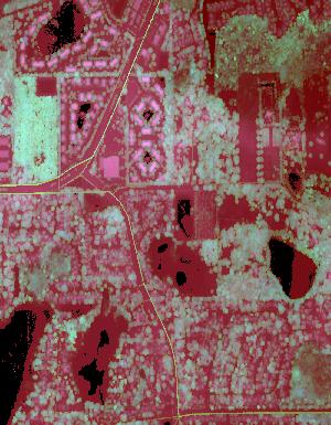
These data are orthorectified radar intensity images (ORI) derived from interferometric synthetic aperture radar (ifsar) data. An ORI is a high-resolution image derived from ifsar which has geometric distortions removed. Unlike optical imagery, ifsar can be collected in cloudy conditions. The USGS performs minimal quality assurance and no reprocessing of the ORI data. USGS distributes the ORI data as received from the contractors, partners or contributing entities.

These data are orthorectified radar intensity images (ORI) derived from interferometric synthetic aperture radar (ifsar) data. An ORI is a high-resolution image derived from ifsar which has geometric distortions removed. Unlike optical imagery, ifsar can be collected in cloudy conditions. The USGS performs minimal quality assurance and no reprocessing of the ORI data. USGS distributes the ORI data as received from the contractors, partners or contributing entities.

These data are orthorectified radar intensity images (ORI) derived from interferometric synthetic aperture radar (ifsar) data. An ORI is a high-resolution image derived from ifsar which has geometric distortions removed. Unlike optical imagery, ifsar can be collected in cloudy conditions. The USGS performs minimal quality assurance and no reprocessing of the ORI data. USGS distributes the ORI data as received from the contractors, partners or contributing entities.

These data are orthorectified radar intensity images (ORI) derived from interferometric synthetic aperture radar (ifsar) data. An ORI is a high-resolution image derived from ifsar which has geometric distortions removed. Unlike optical imagery, ifsar can be collected in cloudy conditions. The USGS performs minimal quality assurance and no reprocessing of the ORI data. USGS distributes the ORI data as received from the contractors, partners or contributing entities.

These data are orthorectified radar intensity images (ORI) derived from interferometric synthetic aperture radar (ifsar) data. An ORI is a high-resolution image derived from ifsar which has geometric distortions removed. Unlike optical imagery, ifsar can be collected in cloudy conditions. The USGS performs minimal quality assurance and no reprocessing of the ORI data. USGS distributes the ORI data as received from the contractors, partners or contributing entities.
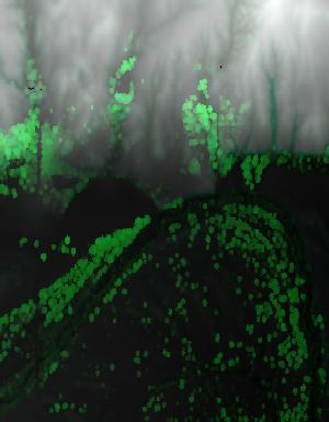
Lidar (Light detection and ranging) discrete-return point cloud data are available in the American Society for Photogrammetry and Remote Sensing (ASPRS) LAS format. The LAS format is a standardized binary format for storing 3-dimensional point cloud data and point attributes along with header information and variable length records specific to the data. Millions of data points are stored as a 3-dimensional data cloud as a series of x (longitude), y (latitude) and z (elevation) points. A few older projects in this collection are in ASCII format. Please refer to http://www.asprs.org/Committee-General/LASer-LAS-File-Format-Exchange-Activities.html for additional information. This data set is a LAZ (compressed LAS)...

These data are orthorectified radar intensity images (ORI) derived from interferometric synthetic aperture radar (ifsar) data. An ORI is a high-resolution image derived from ifsar which has geometric distortions removed. Unlike optical imagery, ifsar can be collected in cloudy conditions. The USGS performs minimal quality assurance and no reprocessing of the ORI data. USGS distributes the ORI data as received from the contractors, partners or contributing entities.
Lidar (Light detection and ranging) discrete-return point cloud data are available in the American Society for Photogrammetry and Remote Sensing (ASPRS) LAS format. The LAS format is a standardized binary format for storing 3-dimensional point cloud data and point attributes along with header information and variable length records specific to the data. Millions of data points are stored as a 3-dimensional data cloud as a series of x (longitude), y (latitude) and z (elevation) points. A few older projects in this collection are in ASCII format. Please refer to http://www.asprs.org/Committee-General/LASer-LAS-File-Format-Exchange-Activities.html for additional information. This data set is a LAZ (compressed LAS)...
The 2002 U.S. Geological Survey (USGS) National Seismic Hazard Maps display earthquake ground motions for various probability levels across the United States and are applied in seismic provisions of building codes, insurance rate structures, risk assessments, and other public policy. This update of the maps incorporates new findings on earthquake ground shaking, faults, seismicity, and geodesy. The resulting maps are derived from seismic hazard curves calculated on a grid of sites across the United States that describe the frequency of exceeding a set of ground motions.
Types: Citation;
Tags: B/C site class boundary,
EHP,
Earthquake Hazards Program,
GHSC,
Geologic Hazards Science Center,
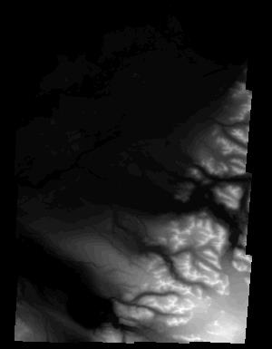
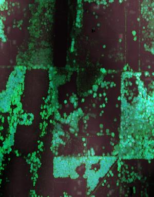
These data are Digital Surface Models (DSM) derived from interferometric synthetic aperture radar (ifsar) data. A DSM is a 3 dimensional representation of surface elevations in an area, including elevations of man-made structures and vegetation. The USGS performs minimal quality assurance and no reprocessing of the DSM data. USGS distributes the DSM data as received from the contractors, partners or contributing entities.
Types: Citation;
Tags: Cartography,
DSM,
Digital Mapping,
Digital Surface Model,
Digital Terrain Model,
Lidar (Light detection and ranging) discrete-return point cloud data are available in the American Society for Photogrammetry and Remote Sensing (ASPRS) LAS format. The LAS format is a standardized binary format for storing 3-dimensional point cloud data and point attributes along with header information and variable length records specific to the data. Millions of data points are stored as a 3-dimensional data cloud as a series of x (longitude), y (latitude) and z (elevation) points. A few older projects in this collection are in ASCII format. Please refer to http://www.asprs.org/Committee-General/LASer-LAS-File-Format-Exchange-Activities.html for additional information. This data set is a LAZ (compressed LAS)...
Lidar (Light detection and ranging) discrete-return point cloud data are available in the American Society for Photogrammetry and Remote Sensing (ASPRS) LAS format. The LAS format is a standardized binary format for storing 3-dimensional point cloud data and point attributes along with header information and variable length records specific to the data. Millions of data points are stored as a 3-dimensional data cloud as a series of x (longitude), y (latitude) and z (elevation) points. A few older projects in this collection are in ASCII format. Please refer to http://www.asprs.org/Committee-General/LASer-LAS-File-Format-Exchange-Activities.html for additional information. This data set is a LAZ (compressed LAS)...
Lidar (Light detection and ranging) discrete-return point cloud data are available in the American Society for Photogrammetry and Remote Sensing (ASPRS) LAS format. The LAS format is a standardized binary format for storing 3-dimensional point cloud data and point attributes along with header information and variable length records specific to the data. Millions of data points are stored as a 3-dimensional data cloud as a series of x (longitude), y (latitude) and z (elevation) points. A few older projects in this collection are in ASCII format. Please refer to http://www.asprs.org/Committee-General/LASer-LAS-File-Format-Exchange-Activities.html for additional information. This data set is a LAZ (compressed LAS)...
Lidar (Light detection and ranging) discrete-return point cloud data are available in the American Society for Photogrammetry and Remote Sensing (ASPRS) LAS format. The LAS format is a standardized binary format for storing 3-dimensional point cloud data and point attributes along with header information and variable length records specific to the data. Millions of data points are stored as a 3-dimensional data cloud as a series of x (longitude), y (latitude) and z (elevation) points. A few older projects in this collection are in ASCII format. Please refer to http://www.asprs.org/Committee-General/LASer-LAS-File-Format-Exchange-Activities.html for additional information. This data set is a LAZ (compressed LAS)...
Lidar (Light detection and ranging) discrete-return point cloud data are available in the American Society for Photogrammetry and Remote Sensing (ASPRS) LAS format. The LAS format is a standardized binary format for storing 3-dimensional point cloud data and point attributes along with header information and variable length records specific to the data. Millions of data points are stored as a 3-dimensional data cloud as a series of x (longitude), y (latitude) and z (elevation) points. A few older projects in this collection are in ASCII format. Please refer to http://www.asprs.org/Committee-General/LASer-LAS-File-Format-Exchange-Activities.html for additional information. This data set is a LAZ (compressed LAS)...

Lidar (Light detection and ranging) discrete-return point cloud data are available in the American Society for Photogrammetry and Remote Sensing (ASPRS) LAS format. The LAS format is a standardized binary format for storing 3-dimensional point cloud data and point attributes along with header information and variable length records specific to the data. Millions of data points are stored as a 3-dimensional data cloud as a series of x (longitude), y (latitude) and z (elevation) points. A few older projects in this collection are in ASCII format. Please refer to http://www.asprs.org/Committee-General/LASer-LAS-File-Format-Exchange-Activities.html for additional information. This data set is a LAZ (compressed LAS)...

Lidar (Light detection and ranging) discrete-return point cloud data are available in the American Society for Photogrammetry and Remote Sensing (ASPRS) LAS format. The LAS format is a standardized binary format for storing 3-dimensional point cloud data and point attributes along with header information and variable length records specific to the data. Millions of data points are stored as a 3-dimensional data cloud as a series of x (longitude), y (latitude) and z (elevation) points. A few older projects in this collection are in ASCII format. Please refer to http://www.asprs.org/Committee-General/LASer-LAS-File-Format-Exchange-Activities.html for additional information. This data set is a LAZ (compressed LAS)...
Lidar (Light detection and ranging) discrete-return point cloud data are available in the American Society for Photogrammetry and Remote Sensing (ASPRS) LAS format. The LAS format is a standardized binary format for storing 3-dimensional point cloud data and point attributes along with header information and variable length records specific to the data. Millions of data points are stored as a 3-dimensional data cloud as a series of x (longitude), y (latitude) and z (elevation) points. A few older projects in this collection are in ASCII format. Please refer to http://www.asprs.org/Committee-General/LASer-LAS-File-Format-Exchange-Activities.html for additional information. This data set is a LAZ (compressed LAS)...

Lidar (Light detection and ranging) discrete-return point cloud data are available in the American Society for Photogrammetry and Remote Sensing (ASPRS) LAS format. The LAS format is a standardized binary format for storing 3-dimensional point cloud data and point attributes along with header information and variable length records specific to the data. Millions of data points are stored as a 3-dimensional data cloud as a series of x (longitude), y (latitude) and z (elevation) points. A few older projects in this collection are in ASCII format. Please refer to http://www.asprs.org/Committee-General/LASer-LAS-File-Format-Exchange-Activities.html for additional information. This data set is a LAZ (compressed LAS)...
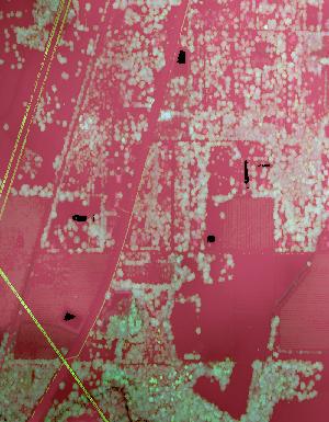
This dataset contains images obtained from unmanned aerial systems (UAS) flown in the Cape Cod National Seashore. The objective of the field work was to evaluate the quality and cost of mapping from UAS images. Low-altitude (approximately 120 meters above ground level) digital images were obtained from cameras in a fixed-wing unmanned aerial vehicle (UAV) flown from the lawn adjacent to the Coast Guard Beach parking lot on 1 March, 2016. The UAV was a Skywalker X8 flying wing operated by Raptor Maps, Inc., contractors to the U.S. Geological Survey. U.S. Geological Survey technicians deployed and mapped 28 targets that appear in some of the images for use as ground control points. All activities were conducted according...
|

|
