Filters: Tags: Utah (X) > Types: Citation (X)
3,591 results (37ms)|
Filters
Date Range
Extensions
Types Contacts
Categories Tag Types
|
Future climates are simulated by general circulation models (GCM) using climate change scenarios (IPCC 2014). To project climate change for the sagebrush biome, we used 11 GCMs and two climate change scenarios from the IPCC Fifth Assessment, representative concentration pathways (RCPs) 4.5 and 8.5 (Moss et al. 2010, Van Vuuren et al. 2011). RCP4.5 scenario represents a future where climate policies limit and achieve stabilization of greenhouse gas concentrations to 4.5 W m-2 by 2100. RCP8.5 scenario might be called a business-as-usual scenario, where high emissions of greenhouse gases continue in the absence of climate change policies. The two selected time frames allow comparison of near-term (2020-2050) and longer-term...
Categories: Data;
Types: Citation,
Downloadable,
GeoTIFF,
Map Service,
Raster;
Tags: Arizona,
CRS,
California,
Climate,
Colorado,
This dataset represents ease of access to bottomland areas for vegetation treatments. Access may be by road, 4x4 near road, hike in by field crews or requiring overnight camping or raft access. Access is considered for each side of the river separately.
Categories: Data;
Types: Citation,
Downloadable,
Map Service,
OGC WFS Layer,
OGC WMS Layer,
Shapefile;
Tags: Arches National Park,
Canyonlands National Park,
Colorado River,
Grand County,
Moab,
Future climates are simulated by general circulation models (GCM) using climate change scenarios (IPCC 2014). To project climate change for the sagebrush biome, we used 11 GCMs and two climate change scenarios from the IPCC Fifth Assessment, representative concentration pathways (RCPs) 4.5 and 8.5 (Moss et al. 2010, Van Vuuren et al. 2011). RCP4.5 scenario represents a future where climate policies limit and achieve stabilization of greenhouse gas concentrations to 4.5 W m-2 by 2100. RCP8.5 scenario might be called a business-as-usual scenario, where high emissions of greenhouse gases continue in the absence of climate change policies. The two selected time frames allow comparison of near-term (2020-2050) and longer-term...
Categories: Data;
Types: Citation,
Downloadable,
GeoTIFF,
Map Service,
Raster;
Tags: Arizona,
CRS,
California,
Climate,
Colorado,
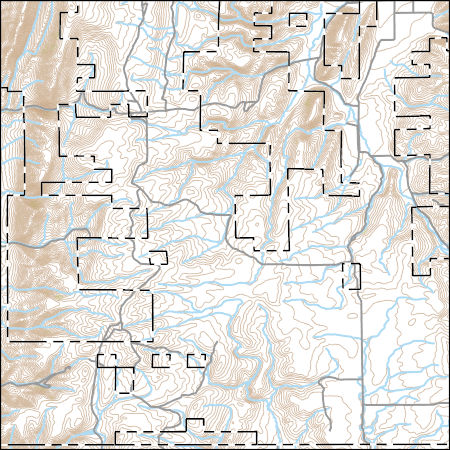
USGS Topo Map Vector Data (Vector) 34636 Pegram Creek, Idaho 20200715 for 7.5 x 7.5 minute Shapefile
Layers of geospatial data include contours, boundaries, land cover, hydrography, roads, transportation, geographic names, structures, and other selected map features.
Types: Citation;
Tags: 7.5 x 7.5 minute,
7.5 x 7.5 minute,
Bear Lake County,
Combined Vector,
Combined Vector,
Water quality and optical absorbance data for journal article entitled, "The removal kinetics of dissolved organic matter and the optical clarity of groundwater" by Francis H. Chapelle, Yuan Shen, Eric W. Strom, and Ronald Benner. Hydrogeology Journal. In Press.
This is a model showing general habitat diversity, including both the structural and cover type diversity. See Open File Report, Rasmussen and Shafroth, Colorado River Conservation Planning for geoprocessing details.
Categories: Data;
Types: Citation,
Downloadable,
Map Service,
OGC WFS Layer,
OGC WMS Layer,
Shapefile;
Tags: Arches National Park,
Canyonlands National Park,
Colorado River,
Grand County,
Moab,
Sage-grouse (Centrocercus spp.) were abundant in all of Utah's 29 counties at the time of European settlement wherever sagebrush (Artemisia spp.) occurred. Greater Sage-Grouse (G. urophasianus) inhabited areas north and west of the Colorado River, and Gunnison Sage-Grouse (G. minimus) occupied suitable habitat south and east of the Colorado River. The largest Greater Sage-Grouse populations in Utah are currently restricted to suitable habitats in Box Elder, Garfield, Rich, Uintah, and Wayne Counties. A remnant breeding population of Gunnison Sage-Grouse occurs in eastern San Juan County. We stratified Greater Sage-Grouse populations (1971-2000) by counties where the 1996 to 2000 moving average for estimated spring...
Categories: Publication;
Types: Citation,
Journal Citation;
Tags: Artemisia tridentata,
Centrocercus minimus,
Centrocercus urophasianus,
DemoAtomFeed,
Gunnison sage-grouse,
Southern Utah comprises 4 major physiographic divisions: the Great Basin, Colorado Plateau, Central Rocky Mountains, and Southern Rocky Mountains, which have been partitioned into faunal regions. We discuss the uniqueness of southern Utah and the amount of land set aside for recreation and preservation, and we encourage the study and preservation of its water resources. The stonefly (Plecoptera) fauna of 13 counties in southern Utah was surveyed. We found 58 species representing 34 genera and 8 families. Three new state records for Utah and many new county records for southern Utah are presented, along with a discussion of distribution patterns and faunal affinities of each species. Distribution patterns indicate...
Future climates are simulated by general circulation models (GCM) using climate change scenarios (IPCC 2014). To project climate change for the sagebrush biome, we used 11 GCMs and two climate change scenarios from the IPCC Fifth Assessment, representative concentration pathways (RCPs) 4.5 and 8.5 (Moss et al. 2010, Van Vuuren et al. 2011). RCP4.5 scenario represents a future where climate policies limit and achieve stabilization of greenhouse gas concentrations to 4.5 W m-2 by 2100. RCP8.5 scenario might be called a business-as-usual scenario, where high emissions of greenhouse gases continue in the absence of climate change policies. The two selected time frames allow comparison of near-term (2020-2050) and longer-term...
Categories: Data;
Types: Citation,
Downloadable,
GeoTIFF,
Map Service,
Raster;
Tags: Arizona,
CRS,
California,
Climate,
Colorado,
This data set contains imagery from the National Agriculture Imagery Program (NAIP). The NAIP program is administered by USDA FSA and has been established to support two main FSA strategic goals centered on agricultural production. These are, increase stewardship of America's natural resources while enhancing the environment, and to ensure commodities are procured and distributed effectively and efficiently to increase food security. The NAIP program supports these goals by acquiring and providing ortho imagery that has been collected during the agricultural growing season in the U.S. The NAIP ortho imagery is tailored to meet FSA requirements and is a fundamental tool used to support FSA farm and conservation programs....
This data set contains imagery from the National Agriculture Imagery Program (NAIP). The NAIP program is administered by USDA FSA and has been established to support two main FSA strategic goals centered on agricultural production. These are, increase stewardship of America's natural resources while enhancing the environment, and to ensure commodities are procured and distributed effectively and efficiently to increase food security. The NAIP program supports these goals by acquiring and providing ortho imagery that has been collected during the agricultural growing season in the U.S. The NAIP ortho imagery is tailored to meet FSA requirements and is a fundamental tool used to support FSA farm and conservation programs....
This data set contains imagery from the National Agriculture Imagery Program (NAIP). The NAIP program is administered by USDA FSA and has been established to support two main FSA strategic goals centered on agricultural production. These are, increase stewardship of America's natural resources while enhancing the environment, and to ensure commodities are procured and distributed effectively and efficiently to increase food security. The NAIP program supports these goals by acquiring and providing ortho imagery that has been collected during the agricultural growing season in the U.S. The NAIP ortho imagery is tailored to meet FSA requirements and is a fundamental tool used to support FSA farm and conservation programs....
|

|
