Filters: Tags: Vector (X) > Date Range: {"choice":"year"} (X)
2 results (54ms)|
Filters
Date Types (for Date Range)
Contacts
Categories Tag Types Tag Schemes |
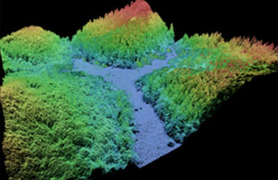
This data collection of the 3D Elevation Program (3DEP) consists of Lidar Point Cloud (LPC) projects as provided to the USGS. These point cloud files contain all the original lidar points collected, with the original spatial reference and units preserved. These data may have been used as the source of updates to the 1/3-arcsecond, 1-arcsecond, and 2-arcsecond seamless 3DEP Digital Elevation Models (DEMs). The 3DEP data holdings serve as the elevation layer of The National Map, and provide foundational elevation information for earth science studies and mapping applications in the United States. Lidar (Light detection and ranging) discrete-return point cloud data are available in LAZ format. The LAZ format is a lossless...
These data were released prior to the October 1, 2016 effective date for the USGS’s policy dictating the review, approval, and release of scientific data as referenced in USGS Survey Manual Chapter 502.8 Fundamental Science Practices: Review and Approval of Scientific Data for Release. This vector coverage of hydrography centerlines was derived from the National Hydrography Dataset (NHD), and encompasses all of Ohio and portions of Indiana, Michigan, Kentucky, West Virginia, Pennsylvania, and New York. This coverage is comprised of 105 Catalog Units (CUs) obtained from http://nhd.usgs.gov/. Each CU approximately represents a single 8-digit Hydrologic Unit Code (HUC).
|

|
