Filters: Tags: Well (X) > Categories: Data (X)
11 results (9ms)|
Filters
Date Range
Extensions Types
Contacts
Tag Types
|
The Appalachians are a landscape filled with globally-significant biological diversity and cultural resources that provides essential benefits to large cities and surrounding human communities. The region is also rich in energy resources that meet national and regional demands for energy. As wind, natural gas, and oil energy development expand along with traditional coal, there is an increasing need for research to inform discussions on how to meet immediate and future energy needs while sustaining the health of natural systems. To help address this need, the Appalachian LCC awarded a grant to The Nature Conservancy to assess current and future energy development across the entire region. Assessing Future Energy...
Categories: Data;
Tags: Academics & scientific researchers,
AppLCC,
Appalachian,
Conservation NGOs,
Data,

The Watershed Boundary Dataset (WBD) from The National Map (TNM) defines the perimeter of drainage areas formed by the terrain and other landscape characteristics. The drainage areas are nested within each other so that a large drainage area, such as the Upper Mississippi River, will be composed of multiple smaller drainage areas, such as the Wisconsin River. Each of these smaller areas can further be subdivided into smaller and smaller drainage areas. The WBD uses six different levels in this hierarchy, with the smallest averaging about 30,000 acres. The WBD is made up of polygons nested into six levels of data respectively defined by Regions, Subregions, Basins, Subbasins, Watersheds, and Subwatersheds. For additional...

The National Hydrography Dataset (NHD) is a feature-based database that interconnects and uniquely identifies the stream segments or reaches that make up the nation's surface water drainage system. NHD data was originally developed at 1:100,000-scale and exists at that scale for the whole country. This high-resolution NHD, generally developed at 1:24,000/1:12,000 scale, adds detail to the original 1:100,000-scale NHD. (Data for Alaska, Puerto Rico and the Virgin Islands was developed at high-resolution, not 1:100,000 scale.) Local resolution NHD is being developed where partners and data exist. The NHD contains reach codes for networked features, flow direction, names, and centerline representations for areal water...
Categories: Data;
Types: Citation;
Tags: Administrative watershed units,
Area of Complex Channels,
Area to be submerged,
Basin,
Bay/Inlet,
This data release provides the descriptions of approximately 20 U.S. sites that include mineral regions, mines, and mineral occurrences (deposits and prospects) that contain enrichments of lithium (Li). This release includes sites that have a contained resource and (or) past production of lithium metal greater than 15,000 metric tons. Sites in this database occur in Arkansas, California, Nevada, North Carolina, and Utah. There are several deposits that were not included in the database because they did not meet the cutoff requirement, and those occur in Arizona, Colorado, the New England area, New Mexico, South Dakota, and Wyoming. In the United States, lithium was first mined from pegmatite orebodies in South...
As part of a study to analyze the effects of sea-level rise on groundwater resources of Colonial National Historical Park, a monitoring network was established on Historic Jamestown Island, Virginia, to evaluate current levels of and changes in groundwater elevation and water quality. The monitoring network includes 45 wells and piezometers, 3 marsh sites, and 2 surface-water sites distributed across 5 sampling locations on Jamestown Island. Field parameters, including water temperature, specific conductance, pH, and dissolved oxygen, were collected at the marsh and surface-water sites. Field parameters and water levels were collected from the wells and piezometers. Information provided in this data release was...
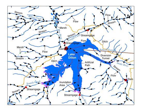
The USGS National Hydrography Dataset (NHD) is a comprehensive set of digital spatial data that encodes information about naturally occurring and constructed bodies of surface water (lakes, ponds, and reservoirs), paths through which water flows (canals, ditches, streams, and rivers), and related entities such as point features (springs, wells, stream gages, and dams). The information encoded about these features includes classification and other characteristics, delineation, geographic name, position and related measures, a "reach code" through which other information can be related to the NHD, and the direction of water flow. The network of reach codes delineating water and transported material flow allows users...
Categories: Data;
Tags: Administrative watershed units,
Area of Complex Channels,
Area to be submerged,
Aroostook County,
Artificial path,
Spreadsheets of Tooele, Parowan, and Goshen Valley historical power consumption coefficients for active irrigation wells as of 2016 measured by U.S. Geological Survey, Utah Water Science Center, hydrologic technicians. The power consumption coefficients included in this data release were transcribed from paper format to electronic format. The coefficient of variation is included in this data set for wells with more than three historical power consumption coefficients. The 2016 power usage for each well is included and was provided by the Utah Department of Natural Resources, Division of Water Rights. The Goshen Valley data set also includes annual groundwater withdrawal for active irrigation wells as of 2016; this...
The U.S. Geological Survey, in cooperation with the Puerto Rico Department of Natural and Environmental Resources, completed a study to determine whether a relation exists between the extent of forest cover and the magnitude of base flow at two sets of paired drainage basins in the highlands of the municipalities of Adjuntas and Utuado within the mountainous interior of Puerto Rico. One set of paired basins includes the Río Guaónica and Río Tanamá, both tributaries of the Río Grande de Arecibo. The other set includes two smaller basins in the drainage basin of the Río Coabey, which is a tributary of the Río Tanamá. The paired basins in each set have similar rainfall patterns, geologic substrate, and aspect; the...

The USGS National Hydrography Dataset (NHD) service from The National Map (TNM) is a comprehensive set of digital spatial data that encodes information about naturally occurring and constructed bodies of surface water (lakes, ponds, and reservoirs), paths through which water flows (canals, ditches, streams, and rivers), and related entities such as point features (springs, wells, stream gages, and dams). The information encoded about these features includes classification and other characteristics, delineation, geographic name, position and related measures, a "reach code" through which other information can be related to the NHD, and the direction of water flow. The network of reach codes delineating water and...
Categories: Data;
Types: ArcGIS REST Map Service,
Map Service;
Tags: HU,
Hydrography,
NGP-TNM,
NHD,
Overlay Map Service,
A complete set of wells associated with oil, natural gas, and coal bed natural gas development in the western states as of August 31, 2005. This is a static dataset even though liquid energy development is a highly dynamic endeavor. Because these well location datasets are generally housed and managed by various state-based agencies (typically the state Oil and Gas Conservation Commissions) a uniform, spatially precise coverage for the has not been available to date. This layer consolidates the best available well location data from MT, WY, CO, and UT(ID does not report any liquid energy development) and standardizes the attributites. The user is cautioned that this layer only contains known and reported wells and...
Categories: Data;
Types: Downloadable,
Map Service,
OGC WFS Layer,
OGC WMS Layer,
Shapefile;
Tags: Coal Bed Methane,
Coal Bed Natural Gas,
Colorado,
Conservation Assessment,
Gas,
The U.S. Geological Survey developed a coupled groundwater and surface-water flow (GSFLOW) model to represent the aquifers of the Colorado Plateau and Upper Colorado River Basin. The study area covers approximately 142,000 square miles and includes parts of Arizona, Colorado, New Mexico, Utah, and Wyoming. To support this modeling effort, groundwater well withdrawal volume data were needed from January 01, 1980 to September 30, 2022. These data were retrieved from online state databases. In addition to withdrawal-volume data, well-construction data including depths and/or perforated casing intervals were recorded when available from the databases and/or scanned driller’s logs. Arizona groundwater-withdrawal volume...
|

|