Filters
Date Types (for Date Range)
Extensions
Types
Contacts
Categories
Tag Types
Tag Schemes
|

Geospatial data is comprised of government boundaries.
Types: Citation;
Tags: Adams,
Allen,
Bartholomew,
Benton,
Blackford, All tags...
Boone,
Boundaries,
Brown,
Carroll,
Cass,
Clark,
Clay,
Clinton,
County or Equivalent,
Crawford,
Daviess,
DeKalb,
Dearborn,
Decatur,
Delaware,
Downloadable Data,
Dubois,
Elkhart,
Esri File GeoDatabase 10,
Fayette,
FileGDB,
Floyd,
Fountain,
Franklin,
Fulton,
Gibson,
Grant,
Greene,
Hamilton,
Hancock,
Harrison,
Hendricks,
Henry,
Howard,
Huntington,
IN,
Incorporated Place,
Indiana,
Jackson,
Jasper,
Jay,
Jefferson,
Jennings,
Johnson,
Jurisdictional,
Knox,
Kosciusko,
LaGrange,
LaPorte,
Lake,
Lawrence,
Madison,
Marion,
Marshall,
Martin,
Miami,
Minor Civil Division,
Monroe,
Montgomery,
Morgan,
National Boundary Dataset (NBD),
National Boundary Dataset (NBD),
Native American Area,
Newton,
Noble,
Ohio,
Orange,
Owen,
PLSS First Division,
PLSS Special Survey,
PLSS Township,
Parke,
Perry,
Pike,
Porter,
Posey,
Public Land Survey System,
Pulaski,
Putnam,
Randolph,
Reserve,
Ripley,
Rush,
Scott,
Shelby,
Spencer,
St. Joseph,
Starke,
State,
State,
State or Territory,
Steuben,
Sullivan,
Switzerland,
Tippecanoe,
Tipton,
U.S. National Grid,
US,
Unincorporated Place,
Union,
United States,
Vanderburgh,
Vermillion,
Vigo,
Wabash,
Warren,
Warrick,
Washington,
Wayne,
Wells,
White,
Whitley,
boundaries,
boundary,
cadastral surveys,
geographic names,
land ownership,
land use maps,
legal land descriptions,
political and administrative boundaries,
zoning maps, Fewer tags

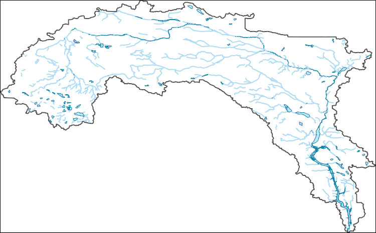
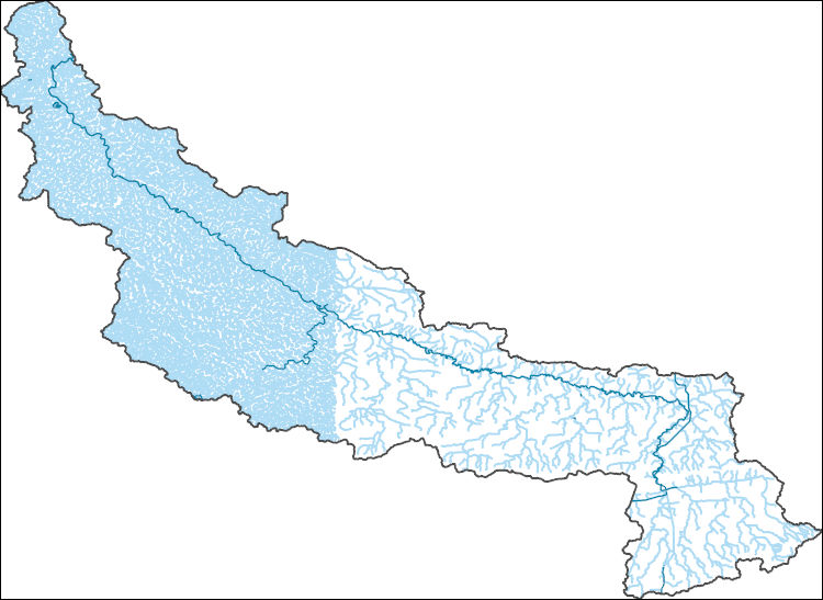
The Watershed Boundary Dataset (WBD) is a comprehensive aggregated collection of hydrologic unit data consistent with the national criteria for delineation and resolution. It defines the areal extent of surface water drainage to a point except in coastal or lake front areas where there could be multiple outlets as stated by the "Federal Standards and Procedures for the National Watershed Boundary Dataset (WBD)" "Standard" (https://pubs.usgs.gov/tm/11/a3/). Watershed boundaries are determined solely upon science-based hydrologic principles, not favoring any administrative boundaries or special projects, nor particular program or agency. This dataset represents the hydrologic unit boundaries to the 12-digit (6th level)...
Tags: 10-digit,
12-digit,
14-digit,
16-digit,
2-digit, All tags...
4-digit,
6-digit,
8-digit,
Adair,
Adams,
Albany,
Allen,
Anderson,
Andrew,
Antelope,
Appanoose,
Arapahoe,
Arthur,
Atchison,
Audrain,
Audubon,
Aurora,
Banner,
Barnes,
Barton,
Basin,
Bates,
Beadle,
Beaverhead,
Bennett,
Benton,
Big Horn,
Billings,
Blaine,
Bon Homme,
Boone,
Boulder,
Bourbon,
Bowman,
Box Butte,
Boyd,
Broadwater,
Brookings,
Broomfield,
Brown,
Brule,
Buchanan,
Buena Vista,
Buffalo,
Burke,
Burleigh,
Burt,
Butler,
Butte,
CO,
Caldwell,
Callaway,
Camden,
Campbell,
Carbon,
Carroll,
Carter,
Cascade,
Cass,
Cedar,
Chaffee,
Chariton,
Charles Mix,
Chase,
Cherokee,
Cherry,
Cheyenne,
Chouteau,
Christian,
Clark,
Clarke,
Clay,
Clear Creek,
Clinton,
Cloud,
Codington,
Coffey,
Cole,
Colfax,
Colorado,
Converse,
Cooper,
Corson,
Crawford,
Crook,
Cuming,
Custer,
Dade,
Dakota,
Dallas,
Daniels,
Daviess,
Davis,
Davison,
Dawes,
Dawson,
Day,
DeKalb,
Decatur,
Deer Lodge,
Dent,
Denver,
Deuel,
Dewey,
Dickey,
Dickinson,
Divide,
Dixon,
Dodge,
Doniphan,
Douglas,
Downloadable Data,
Dundy,
Dunn,
Eddy,
Edmunds,
El Paso,
Elbert,
Ellis,
Ellsworth,
Emmet,
Emmons,
Fall River,
Fallon,
Faulk,
Fergus,
Fillmore,
Flathead,
Foster,
Franklin,
Fremont,
Frontier,
Furnas,
Gage,
Gallatin,
Garden,
Garfield,
Gasconade,
Geary,
Gentry,
GeoPackage,
Gilpin,
Glacier,
Golden Valley,
Goshen,
Gosper,
Gove,
Graham,
Grand,
Granite,
Grant,
Greeley,
Greene,
Gregory,
Grundy,
Guthrie,
HU-2,
HU-2 Region,
HU2_10,
HUC,
Haakon,
Hall,
Hamilton,
Hamlin,
Hand,
Hanson,
Harding,
Harlan,
Harrison,
Hayes,
Henry,
Hettinger,
Hickory,
Hill,
Hitchcock,
Holt,
Hooker,
Hot Springs,
Howard,
Howell,
Hughes,
Hutchinson,
Hyde,
Hydrography,
Hydrologic Unit Code,
Hydrologic Units,
IA,
ID,
Ida,
Idaho,
Iowa,
Jackson,
Jefferson,
Jerauld,
Jewell,
Johnson,
Jones,
Judith Basin,
KS,
Kansas,
Kearney,
Keith,
Keya Paha,
Kidder,
Kimball,
Kingsbury,
Kit Carson,
Knox,
LaMoure,
Laclede,
Lafayette,
Lake,
Lancaster,
Lane,
Laramie,
Larimer,
Lawrence,
Leavenworth,
Lemhi,
Lewis and Clark,
Liberty,
Lincoln,
Linn,
Livingston,
Logan,
Loup,
Lucas,
Lyman,
Lyon,
MN,
MO,
MT,
Macon,
Madison,
Maries,
Marion,
Marshall,
McCone,
McCook,
McHenry,
McIntosh,
McKenzie,
McLean,
McPherson,
Meade,
Meagher,
Mellette,
Mercer,
Merrick,
Miami,
Miller,
Mills,
Miner,
Minnehaha,
Minnesota,
Missouri,
Mitchell,
Moniteau,
Monona,
Monroe,
Montana,
Montgomery,
Moody,
Morgan,
Morrill,
Morris,
Morton,
Mountrail,
Murray,
Musselshell,
ND,
NE,
Nance,
National Watershed Boundary Dataset (WBD),
National Watershed Boundary Dataset (WBD),
Natrona,
Nebraska,
Nemaha,
Ness,
Niobrara,
Nobles,
Nodaway,
North Dakota,
Norton,
Nuckolls,
O'Brien,
Oglala Lakota,
Oliver,
Open Geospatial Consortium GeoPackage 1.2,
Osage,
Osborne,
Osceola,
Otoe,
Ottawa,
Page,
Palo Alto,
Park,
Pawnee,
Pennington,
Perkins,
Petroleum,
Pettis,
Phelps,
Phillips,
Pierce,
Pipestone,
Platte,
Plymouth,
Polk,
Pondera,
Pottawatomie,
Pottawattamie,
Potter,
Powder River,
Powell,
Prairie,
Pulaski,
Putnam,
Randolph,
Ransom,
Ravalli,
Rawlins,
Ray,
Red Willow,
Region,
Republic,
Rice,
Richardson,
Richland,
Riley,
Ringgold,
Roberts,
Rock,
Rooks,
Roosevelt,
Rosebud,
Routt,
Rush,
Russell,
SD,
Sac,
Saline,
Sanborn,
Sargent,
Sarpy,
Saunders,
Schuyler,
Scott,
Scotts Bluff,
Sedgwick,
Seward,
Shawnee,
Shelby,
Sheridan,
Sherman,
Silver Bow,
Sioux,
Slope,
Smith,
South Dakota,
Spink,
St. Charles,
St. Clair,
St. Louis,
Stanley,
Stanton,
Stark,
Stillwater,
Stutsman,
Sub-basin,
Sub-region,
Sublette,
Subwatershed,
Sullivan,
Sully,
Summit,
Sweet Grass,
Sweetwater,
Taylor,
Teller,
Teton,
Texas,
Thayer,
Thomas,
Thurston,
Todd,
Toole,
Treasure,
Trego,
Tripp,
Turner,
US,
Union,
United States,
Valley,
Vernon,
WBD,
WY,
Wabaunsee,
Wallace,
Walworth,
Ward,
Warren,
Washakie,
Washington,
Watershed,
Watershed Boundary Dataset,
Wayne,
Webster,
Weld,
Wells,
Weston,
Wheatland,
Wheeler,
Wibaux,
Wichita,
Williams,
Woodbury,
Worth,
Wright,
Wyandotte,
Wyoming,
Yankton,
Yellowstone,
York,
Yuma,
Ziebach,
inlandWaters, Fewer tags

These data were released prior to the October 1, 2016 effective date for the USGS’s policy dictating the review, approval, and release of scientific data as referenced in USGS Survey Manual Chapter 502.8 Fundamental Science Practices: Review and Approval of Scientific Data for Release. Digital surfaces and thicknesses of selected hydrogeologic units of the Floridan aquifer system were developed to define an updated hydrogeologic framework as part of the U.S. Geological Survey Groundwater Resources Program. This feature class contains a gridded surface depicting the top of the OCAPLPZ in feet relative to NGVD29.
Tags: Alabama,
Florida,
Floridan aquifer system,
Geology,
Georgia, All tags...
Hydrogeology,
NSDI,
OCAPLPZ,
Ocala-Avon Park low permeability zone,
Regional Groundwater Availability Study,
South Carolina,
Stratigraphy,
USGS,
USGS Science Data Catalog (SDC),
United States Geological Survey,
above,
altitude,
below,
clip,
contours,
environment,
extent,
geoscientificInformation,
gridded,
head differences,
head gradient,
inlandWaters,
inlandWaters,
open to aquifer,
raster,
top,
wells, Fewer tags

These data were released prior to the October 1, 2016 effective date for the USGS’s policy dictating the review, approval, and release of scientific data as referenced in USGS Survey Manual Chapter 502.8 Fundamental Science Practices: Review and Approval of Scientific Data for Release. This digital geospatial data set consists of locations of coal, oil, gas and water wells shown as data points in the report, "Structure, Outcrop, and Subcrop of the Bedrock Aquifers Along the Western Margin of the Denver Basin, Colorado" (Robson and others, 1998).
Tags: Colorado, Front Range,
NSDI,
USGS Science Data Catalog (SDC),
environment,
geophysical logs, All tags...
geoscientificInformation,
inlandWaters,
inlandWaters,
wells, Fewer tags

The Geographic Names Information System (GNIS) is the Federal standard for geographic nomenclature. The U.S. Geological Survey developed the GNIS for the U.S. Board on Geographic Names, a Federal inter-agency body chartered by public law to maintain uniform feature name usage throughout the Government and to promulgate standard names to the public. The GNIS is the official repository of domestic geographic names data; the official vehicle for geographic names use by all departments of the Federal Government; and the source for applying geographic names to Federal electronic and printed products of all types.
Tags: Adams,
Antarctica,
Antarctica,
BGN,
Barnes, All tags...
Benson,
Billings,
Board on Geographic Names,
Borough,
Bottineau,
Bowman,
Burke,
Burleigh,
Cass,
Cavalier,
Census Area,
Commonwealth,
County,
Dickey,
District,
Divide,
Downloadable Data,
Dunn,
Eddy,
Emmons,
Feature class,
Feature coordinates,
Feature county,
Feature description,
Feature designation,
Feature history,
Feature indentification,
Feature name,
Feature state,
Foster,
GNIS,
Geographic Names,
Geographic Names Domestic Names,
Geographic Names Information System,
Geographic feature,
Geographic name,
Geographical feature,
Geographical name,
Golden Valley,
Grand Forks,
Grant,
Griggs,
Hettinger,
Kidder,
LaMoure,
Logan,
McHenry,
McIntosh,
McKenzie,
McLean,
Mercer,
Morton,
Mountrail,
Municipio,
ND,
National Geographic Names Information System (GNIS),
National Geographic Names Information System (GNIS),
Nelson,
North Dakota,
Official feature name,
Oliver,
Outlying Area,
Parish,
Pembina,
Pierce,
Place name,
Populated Place,
Ramsey,
Ransom,
Renville,
Richland,
Rolette,
Sargent,
Sheridan,
Sioux,
Slope,
Stark,
State,
Steele,
Stutsman,
TXT (pipes),
Territories,
Territory,
Topographic Map,
Towner,
Traill,
U.S. Board on Geographic Names,
U.S. Geological Survey,
US,
USA,
USBGN,
USGS,
UTF-8 Pipe Delimited Text File nan,
United States,
United States,
United States,
Variant name,
Walsh,
Ward,
Wells,
Williams,
antarctic,
database,
economy,
environment,
feature,
gazetteer,
geographic,
geographic names,
geographical,
geography,
geospatial,
imageryBaseMapsEarthCover,
inlandWaters,
location,
map,
name,
place,
placename,
society,
structure,
topographic map,
toponymy, Fewer tags

The Geographic Names Information System (GNIS) is the Federal standard for geographic nomenclature. The U.S. Geological Survey developed the GNIS for the U.S. Board on Geographic Names, a Federal inter-agency body chartered by public law to maintain uniform feature name usage throughout the Government and to promulgate standard names to the public. The GNIS is the official repository of domestic geographic names data; the official vehicle for geographic names use by all departments of the Federal Government; and the source for applying geographic names to Federal electronic and printed products of all types.
Tags: Adams,
Antarctica,
Antarctica,
BGN,
Barnes, All tags...
Benson,
Billings,
Board on Geographic Names,
Borough,
Bottineau,
Bowman,
Burke,
Burleigh,
Cass,
Cavalier,
Census Area,
Commonwealth,
County,
Dickey,
District,
Divide,
Downloadable Data,
Dunn,
Eddy,
Emmons,
Esri File GeoDatabase 10,
Feature class,
Feature coordinates,
Feature county,
Feature description,
Feature designation,
Feature history,
Feature indentification,
Feature name,
Feature state,
FileGDB,
Foster,
GNIS,
Geographic Names,
Geographic Names Full Model,
Geographic Names Information System,
Geographic feature,
Geographic name,
Geographical feature,
Geographical name,
Golden Valley,
Grand Forks,
Grant,
Griggs,
Hettinger,
Kidder,
LaMoure,
Logan,
McHenry,
McIntosh,
McKenzie,
McLean,
Mercer,
Morton,
Mountrail,
Municipio,
ND,
National Geographic Names Information System (GNIS),
National Geographic Names Information System (GNIS),
Nelson,
North Dakota,
Official feature name,
Oliver,
Outlying Area,
Parish,
Pembina,
Pierce,
Place name,
Populated Place,
Ramsey,
Ransom,
Renville,
Richland,
Rolette,
Sargent,
Sheridan,
Sioux,
Slope,
Stark,
State,
Steele,
Stutsman,
Territories,
Territory,
Topographic Map,
Towner,
Traill,
U.S. Board on Geographic Names,
U.S. Geological Survey,
US,
USA,
USBGN,
USGS,
United States,
United States,
United States,
Variant name,
Walsh,
Ward,
Wells,
Williams,
antarctic,
database,
economy,
environment,
feature,
gazetteer,
geographic,
geographic names,
geographical,
geography,
geospatial,
imageryBaseMapsEarthCover,
inlandWaters,
location,
map,
name,
place,
placename,
society,
structure,
topographic map,
toponymy, Fewer tags
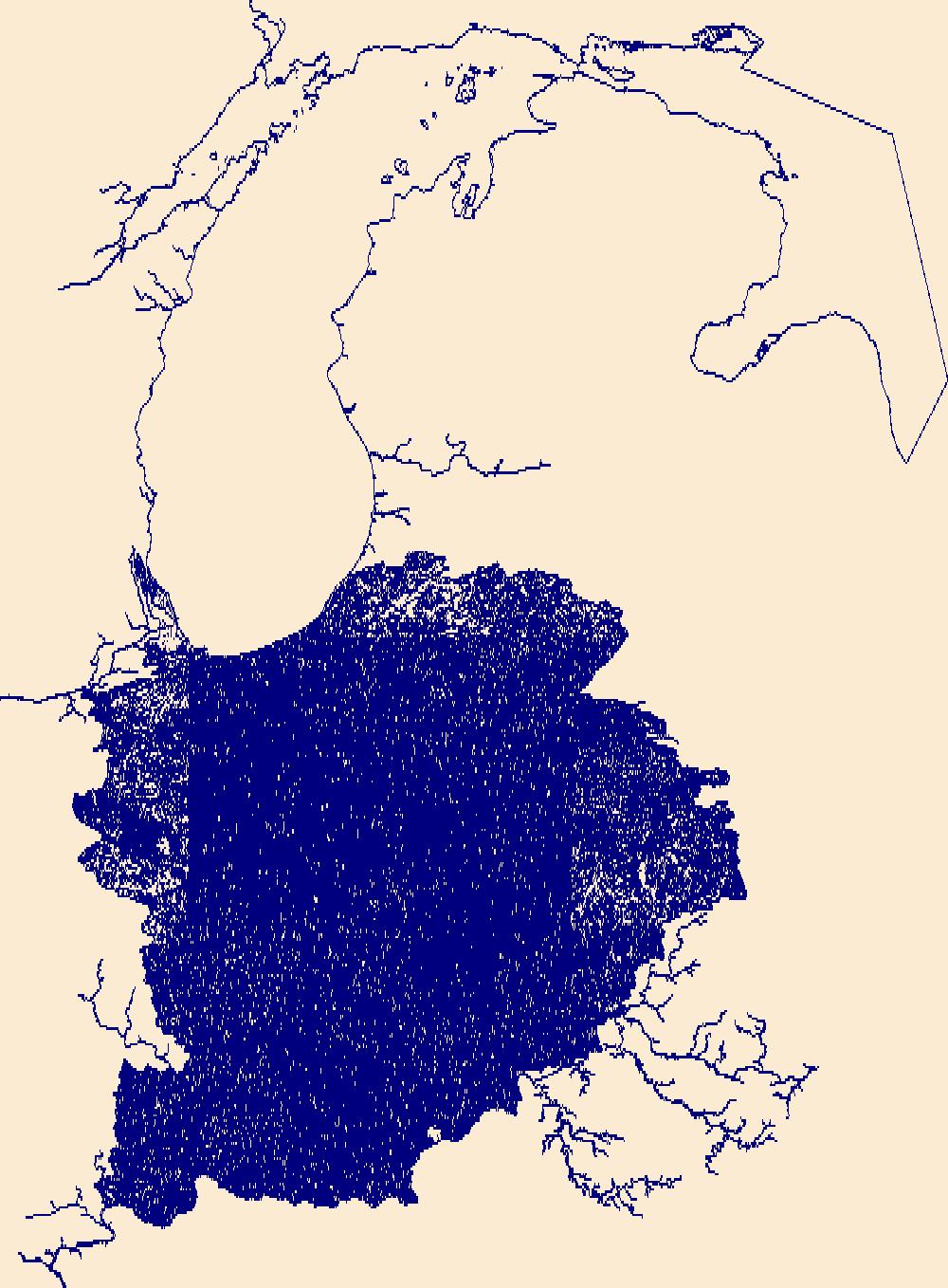
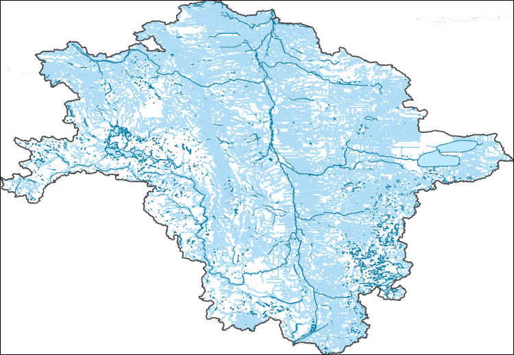
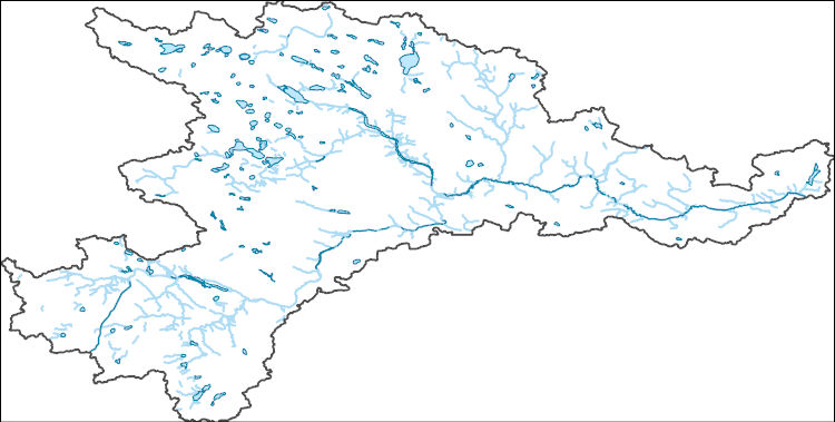
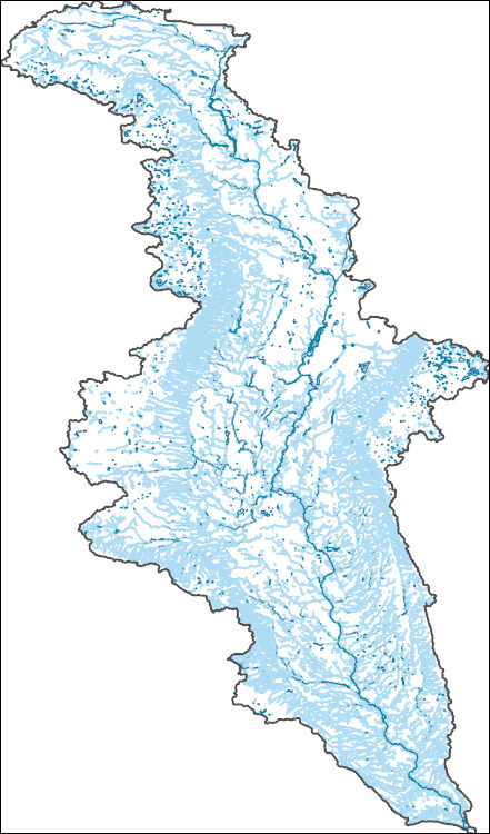
The National Hydrography Dataset (NHD) is a feature-based database that interconnects and uniquely identifies the stream segments or reaches that make up the nation's surface water drainage system. NHD data was originally developed at 1:100,000-scale and exists at that scale for the whole country. This high-resolution NHD, generally developed at 1:24,000/1:12,000 scale, adds detail to the original 1:100,000-scale NHD. (Data for Alaska, Puerto Rico and the Virgin Islands was developed at high-resolution, not 1:100,000 scale.) Local resolution NHD is being developed where partners and data exist. The NHD contains reach codes for networked features, flow direction, names, and centerline representations for areal water...
Tags: Adams,
Administrative watershed units,
Administrative watershed units,
Allen,
Area of Complex Channels, All tags...
Area to be submerged,
Bartholomew,
Basin,
Basin,
Bay/Inlet,
Benton,
Blackford,
Boone,
Boundaries,
Boundary,
Bridge,
Brown,
Canal/Ditch,
Carroll,
Cass,
Clark,
Clay,
Clinton,
Coastline,
Connector,
Crawford,
Dam/Weir,
Daviess,
DeKalb,
Dearborn,
Decatur,
Delaware,
Downloadable Data,
Drainage areas for surface water,
Drainageway,
Dubois,
Elkhart,
Estuary,
Fayette,
Flow direction network,
Floyd,
Flume,
ForeShore,
Fountain,
Franklin,
Fulton,
Gaging Station,
Gate,
GeoPackage,
Gibson,
Grant,
Greene,
HU10,
HU12,
HU14,
HU16,
HU2,
HU4,
HU6,
HU8,
HUC,
Hamilton,
Hancock,
Harrison,
Hazard Zone,
Hendricks,
Henry,
Howard,
Huntington,
Hydrographic,
Hydrography,
Hydrography,
Hydrography,
Hydrologic Unit Code,
Hydrologic Units,
IN,
Ice mass,
Indiana,
Inundation Area,
Jackson,
Jasper,
Jay,
Jefferson,
Jennings,
Johnson,
Knox,
Kosciusko,
LaGrange,
LaPorte,
Lake,
Lawrence,
Levee,
Line,
Lock Chamber,
Madison,
Marion,
Marsh,
Marshall,
Martin,
Miami,
Monroe,
Montgomery,
Morgan,
National Hydrography Dataset (NHD),
National Hydrography Dataset (NHD) Best Resolution,
National Hydrography Dataset (NHD) Best Resolution,
Newton,
Noble,
Nonearthen Shore,
Ohio,
Open Geospatial Consortium GeoPackage 1.2,
Orange,
Orthoimage,
Owen,
Parke,
Perry,
Pike,
Playa,
Point,
PointEvent,
Pond,
Porter,
Posey,
Pulaski,
Putnam,
Randolph,
Rapids,
Rapids,
Reach,
Reach code,
Reef,
Region,
Reservoir,
Ripley,
Rock,
Rush,
Scott,
Sea/Ocean,
Shelby,
Sink/Rise,
Sounding Datum Line,
Special Use Zone,
Special Use Zone Limit,
Spencer,
Spillway,
St. Joseph,
Starke,
State,
State,
State_Indiana,
Steuben,
Stream,
Stream/River,
Sub-basin,
Sub-region,
Subbasin,
Submerged Stream,
Subregion,
Subwatershed,
Sullivan,
Surface water systems,
Swamp,
Switzerland,
Tippecanoe,
Tipton,
Topographic,
Tunnel,
US,
Underground Conduit,
Union,
United States,
Vanderburgh,
Vermillion,
Vigo,
WBD,
WBD,
Wabash,
Wall,
Warren,
Warrick,
Wash,
Washington,
Water Intake Outflow,
Waterfall,
Watershed,
Watershed Boundaries,
Watershed Boundary Dataset,
Watershed Boundary Dataset,
Wayne,
Well,
Wells,
White,
Whitley,
artificial path,
boundaries,
dams,
drainage systems and characteristics,
inlandWaters,
lakes,
ngda,
rivers, Fewer tags

Significant changes in nitrogen loads to Jamaica Bay have likely occurred with progressive improvements to Water Pollution Control Plants (WCWPs) that discharge into the Bay. Data available from the New York City Department of Environmental Protection and others will be used to determine loads from WPCPs, combined sewer overflows, and the atmosphere. Selected wells within the USGS water quality database, including those near the landfills that are immediately adjacent to Jamaica Bay, will be used to determine concentrations of nutrients in shallow ground water that enter the bay from ground water seepage. To facilitate evaluation of ground water loads, an existing USGS Finite element model that simulates sub...
Categories: Data,
Project;
Types: Downloadable,
Map Service,
OGC WFS Layer,
OGC WMS Layer,
Shapefile;
Tags: Coastal Science,
Coastal Science,
Completed,
Cooperative Water Program,
GW or SW, All tags...
GW or SW,
GW or SW,
Gateway National Recreation Area,
Groundwater-Quality Monitoring,
Groundwater-Quality Monitoring,
Groundwater-Quality Monitoring,
Jamaica Bay NY,
NY,
Nearshore Environmental Health,
Nearshore Environmental Health,
Nearshore Environmental Health,
New York,
USGS New York Water Science Center,
WSC,
Water Quality,
Water Quality,
Water Quality,
Water quality,
groundwater,
wells, Fewer tags
The National Hydrography Dataset (NHD) is a feature-based database that interconnects and uniquely identifies the stream segments or reaches that make up the nation's surface water drainage system. NHD data was originally developed at 1:100,000-scale and exists at that scale for the whole country. This high-resolution NHD, generally developed at 1:24,000/1:12,000 scale, adds detail to the original 1:100,000-scale NHD. (Data for Alaska, Puerto Rico and the Virgin Islands was developed at high-resolution, not 1:100,000 scale.) Local resolution NHD is being developed where partners and data exist. The NHD contains reach codes for networked features, flow direction, names, and centerline representations for areal water...
Tags: Administrative watershed units,
Administrative watershed units,
Area of Complex Channels,
Area to be submerged,
Barnes, All tags...
Basin,
Basin,
Bay/Inlet,
Becker,
Beltrami,
Benson,
Big Stone,
Boundaries,
Boundary,
Bridge,
Canal/Ditch,
Cass,
Cavalier,
Clay,
Clearwater,
Coastline,
Connector,
Dam/Weir,
Dickey,
Downloadable Data,
Drainage areas for surface water,
Drainageway,
Eddy,
Esri Shapefile nan,
Estuary,
Flow direction network,
Flume,
ForeShore,
Foster,
Gaging Station,
Gate,
Grand Forks,
Grant,
Griggs,
HU-4,
HU-4 Subregion,
HU10,
HU12,
HU14,
HU16,
HU2,
HU4,
HU4_0902,
HU6,
HU8,
HUC,
Hazard Zone,
Hydrographic,
Hydrography,
Hydrography,
Hydrography,
Hydrologic Unit Code,
Hydrologic Units,
Ice mass,
Inundation Area,
Itasca,
Kittson,
Koochiching,
Lake of the Woods,
Levee,
Line,
Lock Chamber,
MN,
Mahnomen,
Marsh,
Marshall,
McHenry,
McLean,
Minnesota,
ND,
National Hydrography Dataset (NHD),
National Hydrography Dataset (NHD) Best Resolution,
National Hydrography Dataset (NHD) Best Resolution,
Nelson,
Nonearthen Shore,
Norman,
North Dakota,
Orthoimage,
Otter Tail,
Pembina,
Pennington,
Pierce,
Playa,
Point,
PointEvent,
Polk,
Pond,
Ramsey,
Ransom,
Rapids,
Rapids,
Reach,
Reach code,
Red Lake,
Reef,
Region,
Reservoir,
Richland,
Roberts,
Rock,
Rolette,
Roseau,
SD,
Sargent,
Sea/Ocean,
Shapefile,
Sheridan,
Sink/Rise,
Sounding Datum Line,
South Dakota,
Special Use Zone,
Special Use Zone Limit,
Spillway,
Steele,
Stevens,
Stream,
Stream/River,
Stutsman,
Sub-basin,
Sub-region,
Subbasin,
Submerged Stream,
Subregion,
Subwatershed,
Surface water systems,
Swamp,
Topographic,
Towner,
Traill,
Traverse,
Tunnel,
US,
Underground Conduit,
United States,
WBD,
WBD,
Wall,
Walsh,
Wash,
Water Intake Outflow,
Waterfall,
Watershed,
Watershed Boundaries,
Watershed Boundary Dataset,
Watershed Boundary Dataset,
Well,
Wells,
Wilkin,
artificial path,
boundaries,
dams,
drainage systems and characteristics,
inlandWaters,
lakes,
ngda,
rivers, Fewer tags

The National Hydrography Dataset (NHD) is a feature-based database that interconnects and uniquely identifies the stream segments or reaches that make up the nation's surface water drainage system. NHD data was originally developed at 1:100,000-scale and exists at that scale for the whole country. This high-resolution NHD, generally developed at 1:24,000/1:12,000 scale, adds detail to the original 1:100,000-scale NHD. (Data for Alaska, Puerto Rico and the Virgin Islands was developed at high-resolution, not 1:100,000 scale.) Local resolution NHD is being developed where partners and data exist. The NHD contains reach codes for networked features, flow direction, names, and centerline representations for areal water...
Tags: Administrative watershed units,
Administrative watershed units,
Area of Complex Channels,
Area to be submerged,
Aurora, All tags...
Barnes,
Basin,
Basin,
Bay/Inlet,
Beadle,
Bon Homme,
Boundaries,
Boundary,
Bridge,
Brown,
Canal/Ditch,
Clark,
Coastline,
Connector,
Dam/Weir,
Davison,
Day,
Dickey,
Douglas,
Downloadable Data,
Drainage areas for surface water,
Drainageway,
Eddy,
Edmunds,
Esri Shapefile nan,
Estuary,
Faulk,
Flow direction network,
Flume,
ForeShore,
Foster,
Gaging Station,
Gate,
HU-4,
HU-4 Subregion,
HU10,
HU12,
HU14,
HU16,
HU2,
HU4,
HU4_1016,
HU6,
HU8,
HUC,
Hand,
Hanson,
Hazard Zone,
Hutchinson,
Hyde,
Hydrographic,
Hydrography,
Hydrography,
Hydrography,
Hydrologic Unit Code,
Hydrologic Units,
Ice mass,
Inundation Area,
Jerauld,
Kidder,
Kingsbury,
LaMoure,
Levee,
Line,
Lock Chamber,
Logan,
Marsh,
Marshall,
McCook,
McIntosh,
McPherson,
Miner,
ND,
National Hydrography Dataset (NHD),
National Hydrography Dataset (NHD) Best Resolution,
National Hydrography Dataset (NHD) Best Resolution,
Nonearthen Shore,
North Dakota,
Orthoimage,
Playa,
Point,
PointEvent,
Pond,
Potter,
Ransom,
Rapids,
Rapids,
Reach,
Reach code,
Reef,
Region,
Reservoir,
Roberts,
Rock,
SD,
Sanborn,
Sargent,
Sea/Ocean,
Shapefile,
Sheridan,
Sink/Rise,
Sounding Datum Line,
South Dakota,
Special Use Zone,
Special Use Zone Limit,
Spillway,
Spink,
Stream,
Stream/River,
Stutsman,
Sub-basin,
Sub-region,
Subbasin,
Submerged Stream,
Subregion,
Subwatershed,
Surface water systems,
Swamp,
Topographic,
Tunnel,
Turner,
US,
Underground Conduit,
United States,
WBD,
WBD,
Wall,
Walworth,
Wash,
Water Intake Outflow,
Waterfall,
Watershed,
Watershed Boundaries,
Watershed Boundary Dataset,
Watershed Boundary Dataset,
Well,
Wells,
Yankton,
artificial path,
boundaries,
dams,
drainage systems and characteristics,
inlandWaters,
lakes,
ngda,
rivers, Fewer tags
The National Hydrography Dataset (NHD) is a feature-based database that interconnects and uniquely identifies the stream segments or reaches that make up the nation's surface water drainage system. NHD data was originally developed at 1:100,000-scale and exists at that scale for the whole country. This high-resolution NHD, generally developed at 1:24,000/1:12,000 scale, adds detail to the original 1:100,000-scale NHD. (Data for Alaska, Puerto Rico and the Virgin Islands was developed at high-resolution, not 1:100,000 scale.) Local resolution NHD is being developed where partners and data exist. The NHD contains reach codes for networked features, flow direction, names, and centerline representations for areal water...
Tags: Administrative watershed units,
Administrative watershed units,
Area of Complex Channels,
Area to be submerged,
Basin, All tags...
Basin,
Bay/Inlet,
Benson,
Boundaries,
Boundary,
Bridge,
Canal/Ditch,
Coastline,
Connector,
Dam/Weir,
Downloadable Data,
Drainage areas for surface water,
Drainageway,
Eddy,
Esri Shapefile nan,
Estuary,
Flow direction network,
Flume,
ForeShore,
Gaging Station,
Gate,
HU-8,
HU-8 Subbasin,
HU10,
HU12,
HU14,
HU16,
HU2,
HU4,
HU6,
HU8,
HU8_09020202,
HUC,
Hazard Zone,
Hydrographic,
Hydrography,
Hydrography,
Hydrography,
Hydrologic Unit Code,
Hydrologic Units,
Ice mass,
Inundation Area,
Levee,
Line,
Lock Chamber,
Marsh,
McHenry,
McLean,
ND,
National Hydrography Dataset (NHD),
National Hydrography Dataset (NHD) Best Resolution,
National Hydrography Dataset (NHD) Best Resolution,
Nonearthen Shore,
North Dakota,
Orthoimage,
Pierce,
Playa,
Point,
PointEvent,
Pond,
Rapids,
Rapids,
Reach,
Reach code,
Reef,
Region,
Reservoir,
Rock,
Sea/Ocean,
Shapefile,
Sheridan,
Sink/Rise,
Sounding Datum Line,
Special Use Zone,
Special Use Zone Limit,
Spillway,
Stream,
Stream/River,
Sub-basin,
Sub-region,
Subbasin,
Submerged Stream,
Subregion,
Subwatershed,
Surface water systems,
Swamp,
Topographic,
Tunnel,
US,
Underground Conduit,
United States,
WBD,
WBD,
Wall,
Wash,
Water Intake Outflow,
Waterfall,
Watershed,
Watershed Boundaries,
Watershed Boundary Dataset,
Watershed Boundary Dataset,
Well,
Wells,
artificial path,
boundaries,
dams,
drainage systems and characteristics,
inlandWaters,
lakes,
ngda,
rivers, Fewer tags
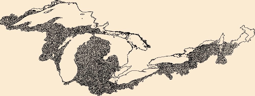
The Watershed Boundary Dataset (WBD) is a comprehensive aggregated collection of hydrologic unit data consistent with the national criteria for delineation and resolution. It defines the areal extent of surface water drainage to a point except in coastal or lake front areas where there could be multiple outlets as stated by the "Federal Standards and Procedures for the National Watershed Boundary Dataset (WBD)" "Standard" (https://pubs.usgs.gov/tm/11/a3/). Watershed boundaries are determined solely upon science-based hydrologic principles, not favoring any administrative boundaries or special projects, nor particular program or agency. This dataset represents the hydrologic unit boundaries to the 12-digit (6th level)...
Tags: 10-digit,
12-digit,
14-digit,
16-digit,
2-digit, All tags...
4-digit,
6-digit,
8-digit,
Adams,
Addison,
Aitkin,
Alcona,
Alger,
Allegan,
Allegany,
Allen,
Alpena,
Antrim,
Arenac,
Ashland,
Ashtabula,
Auglaize,
Baraga,
Barry,
Basin,
Bay,
Bayfield,
Bennington,
Benzie,
Berrien,
Branch,
Brown,
Caledonia,
Calhoun,
Calumet,
Carlton,
Cass,
Cattaraugus,
Cayuga,
Charlevoix,
Chautauqua,
Cheboygan,
Chemung,
Chippewa,
Chittenden,
Clare,
Clinton,
Columbia,
Cook,
Coos,
Cortland,
Crawford,
Cuyahoga,
DeKalb,
Defiance,
Delta,
Dickinson,
Dodge,
Door,
Douglas,
Downloadable Data,
Eaton,
Elkhart,
Emmet,
Erie,
Essex,
Florence,
Fond du Lac,
Forest,
Franklin,
Fulton,
Geauga,
Genesee,
GeoPackage,
Gladwin,
Gogebic,
Grand Isle,
Grand Traverse,
Gratiot,
Green Lake,
HU-2,
HU-2 Region,
HU2_04,
HUC,
Hamilton,
Hancock,
Hardin,
Henry,
Herkimer,
Hillsdale,
Houghton,
Huron,
Hydrography,
Hydrologic Unit Code,
Hydrologic Units,
IL,
IN,
Illinois,
Indiana,
Ingham,
Ionia,
Iosco,
Iron,
Isabella,
Itasca,
Jackson,
Jefferson,
Kalamazoo,
Kalkaska,
Kenosha,
Kent,
Kewaunee,
Keweenaw,
Kosciusko,
LaGrange,
LaPorte,
Lake,
Lamoille,
Langlade,
Lapeer,
Leelanau,
Lenawee,
Lewis,
Livingston,
Lorain,
Lucas,
Luce,
ME,
MI,
MN,
Mackinac,
Macomb,
Madison,
Maine,
Manistee,
Manitowoc,
Marathon,
Marinette,
Marion,
Marquette,
Mason,
Mecosta,
Medina,
Menominee,
Mercer,
Michigan,
Midland,
Milwaukee,
Minnesota,
Missaukee,
Monroe,
Montcalm,
Montmorency,
Muskegon,
NH,
NY,
National Watershed Boundary Dataset (WBD),
National Watershed Boundary Dataset (WBD),
New Hampshire,
New York,
Newaygo,
Niagara,
Noble,
OH,
Oakland,
Oceana,
Oconto,
Ogemaw,
Ohio,
Oneida,
Onondaga,
Ontario,
Ontonagon,
Open Geospatial Consortium GeoPackage 1.2,
Orange,
Orleans,
Osceola,
Oscoda,
Oswego,
Otsego,
Ottawa,
Outagamie,
Oxford,
Ozaukee,
PA,
Paulding,
Pennsylvania,
Pine,
Portage,
Porter,
Potter,
Presque Isle,
Putnam,
Racine,
Region,
Richland,
Roscommon,
Rutland,
Saginaw,
Sandusky,
Sanilac,
Schoolcraft,
Schuyler,
Seneca,
Shawano,
Sheboygan,
Shelby,
Shiawassee,
Somerset,
St. Clair,
St. Joseph,
St. Lawrence,
St. Louis,
Stark,
Steuben,
Sub-basin,
Sub-region,
Subwatershed,
Summit,
Tioga,
Tompkins,
Trumbull,
Tuscola,
US,
United States,
VT,
Van Buren,
Van Wert,
Vermont,
Vilas,
WBD,
WI,
Warren,
Washington,
Washtenaw,
Watershed,
Watershed Boundary Dataset,
Waukesha,
Waupaca,
Waushara,
Wayne,
Wells,
Wexford,
Whitley,
Williams,
Windsor,
Winnebago,
Wisconsin,
Wood,
Wyandot,
Wyoming,
Yates,
inlandWaters, Fewer tags

The Watershed Boundary Dataset (WBD) is a comprehensive aggregated collection of hydrologic unit data consistent with the national criteria for delineation and resolution. It defines the areal extent of surface water drainage to a point except in coastal or lake front areas where there could be multiple outlets as stated by the "Federal Standards and Procedures for the National Watershed Boundary Dataset (WBD)" "Standard" (https://pubs.usgs.gov/tm/11/a3/). Watershed boundaries are determined solely upon science-based hydrologic principles, not favoring any administrative boundaries or special projects, nor particular program or agency. This dataset represents the hydrologic unit boundaries to the 12-digit (6th level)...
Tags: 10-digit,
12-digit,
14-digit,
16-digit,
2-digit, All tags...
4-digit,
6-digit,
8-digit,
Adams,
Addison,
Aitkin,
Alcona,
Alger,
Allegan,
Allegany,
Allen,
Alpena,
Antrim,
Arenac,
Ashland,
Ashtabula,
Auglaize,
Baraga,
Barry,
Basin,
Bay,
Bayfield,
Bennington,
Benzie,
Berrien,
Branch,
Brown,
Caledonia,
Calhoun,
Calumet,
Carlton,
Cass,
Cattaraugus,
Cayuga,
Charlevoix,
Chautauqua,
Cheboygan,
Chemung,
Chippewa,
Chittenden,
Clare,
Clinton,
Columbia,
Cook,
Coos,
Cortland,
Crawford,
Cuyahoga,
DeKalb,
Defiance,
Delta,
Dickinson,
Dodge,
Door,
Douglas,
Downloadable Data,
Eaton,
Elkhart,
Emmet,
Erie,
Esri Shapefile nan,
Essex,
Florence,
Fond du Lac,
Forest,
Franklin,
Fulton,
Geauga,
Genesee,
Gladwin,
Gogebic,
Grand Isle,
Grand Traverse,
Gratiot,
Green Lake,
HU-2,
HU-2 Region,
HU2_04,
HUC,
Hamilton,
Hancock,
Hardin,
Henry,
Herkimer,
Hillsdale,
Houghton,
Huron,
Hydrography,
Hydrologic Unit Code,
Hydrologic Units,
IL,
IN,
Illinois,
Indiana,
Ingham,
Ionia,
Iosco,
Iron,
Isabella,
Itasca,
Jackson,
Jefferson,
Kalamazoo,
Kalkaska,
Kenosha,
Kent,
Kewaunee,
Keweenaw,
Kosciusko,
LaGrange,
LaPorte,
Lake,
Lamoille,
Langlade,
Lapeer,
Leelanau,
Lenawee,
Lewis,
Livingston,
Lorain,
Lucas,
Luce,
ME,
MI,
MN,
Mackinac,
Macomb,
Madison,
Maine,
Manistee,
Manitowoc,
Marathon,
Marinette,
Marion,
Marquette,
Mason,
Mecosta,
Medina,
Menominee,
Mercer,
Michigan,
Midland,
Milwaukee,
Minnesota,
Missaukee,
Monroe,
Montcalm,
Montmorency,
Muskegon,
NH,
NY,
National Watershed Boundary Dataset (WBD),
National Watershed Boundary Dataset (WBD),
New Hampshire,
New York,
Newaygo,
Niagara,
Noble,
OH,
Oakland,
Oceana,
Oconto,
Ogemaw,
Ohio,
Oneida,
Onondaga,
Ontario,
Ontonagon,
Orange,
Orleans,
Osceola,
Oscoda,
Oswego,
Otsego,
Ottawa,
Outagamie,
Oxford,
Ozaukee,
PA,
Paulding,
Pennsylvania,
Pine,
Portage,
Porter,
Potter,
Presque Isle,
Putnam,
Racine,
Region,
Richland,
Roscommon,
Rutland,
Saginaw,
Sandusky,
Sanilac,
Schoolcraft,
Schuyler,
Seneca,
Shapefile,
Shawano,
Sheboygan,
Shelby,
Shiawassee,
Somerset,
St. Clair,
St. Joseph,
St. Lawrence,
St. Louis,
Stark,
Steuben,
Sub-basin,
Sub-region,
Subwatershed,
Summit,
Tioga,
Tompkins,
Trumbull,
Tuscola,
US,
United States,
VT,
Van Buren,
Van Wert,
Vermont,
Vilas,
WBD,
WI,
Warren,
Washington,
Washtenaw,
Watershed,
Watershed Boundary Dataset,
Waukesha,
Waupaca,
Waushara,
Wayne,
Wells,
Wexford,
Whitley,
Williams,
Windsor,
Winnebago,
Wisconsin,
Wood,
Wyandot,
Wyoming,
Yates,
inlandWaters, Fewer tags
The National Hydrography Dataset (NHD) is a feature-based database that interconnects and uniquely identifies the stream segments or reaches that make up the nation's surface water drainage system. NHD data was originally developed at 1:100,000-scale and exists at that scale for the whole country. This high-resolution NHD, generally developed at 1:24,000/1:12,000 scale, adds detail to the original 1:100,000-scale NHD. (Data for Alaska, Puerto Rico and the Virgin Islands was developed at high-resolution, not 1:100,000 scale.) Local resolution NHD is being developed where partners and data exist. The NHD contains reach codes for networked features, flow direction, names, and centerline representations for areal water...
Tags: Administrative watershed units,
Administrative watershed units,
Area of Complex Channels,
Area to be submerged,
Aurora, All tags...
Barnes,
Basin,
Basin,
Bay/Inlet,
Beadle,
Bon Homme,
Boundaries,
Boundary,
Bridge,
Brown,
Canal/Ditch,
Clark,
Coastline,
Connector,
Dam/Weir,
Davison,
Day,
Dickey,
Douglas,
Downloadable Data,
Drainage areas for surface water,
Drainageway,
Eddy,
Edmunds,
Estuary,
Faulk,
Flow direction network,
Flume,
ForeShore,
Foster,
Gaging Station,
Gate,
GeoPackage,
HU-4,
HU-4 Subregion,
HU10,
HU12,
HU14,
HU16,
HU2,
HU4,
HU4_1016,
HU6,
HU8,
HUC,
Hand,
Hanson,
Hazard Zone,
Hutchinson,
Hyde,
Hydrographic,
Hydrography,
Hydrography,
Hydrography,
Hydrologic Unit Code,
Hydrologic Units,
Ice mass,
Inundation Area,
Jerauld,
Kidder,
Kingsbury,
LaMoure,
Levee,
Line,
Lock Chamber,
Logan,
Marsh,
Marshall,
McCook,
McIntosh,
McPherson,
Miner,
ND,
National Hydrography Dataset (NHD),
National Hydrography Dataset (NHD) Best Resolution,
National Hydrography Dataset (NHD) Best Resolution,
Nonearthen Shore,
North Dakota,
Open Geospatial Consortium GeoPackage 1.2,
Orthoimage,
Playa,
Point,
PointEvent,
Pond,
Potter,
Ransom,
Rapids,
Rapids,
Reach,
Reach code,
Reef,
Region,
Reservoir,
Roberts,
Rock,
SD,
Sanborn,
Sargent,
Sea/Ocean,
Sheridan,
Sink/Rise,
Sounding Datum Line,
South Dakota,
Special Use Zone,
Special Use Zone Limit,
Spillway,
Spink,
Stream,
Stream/River,
Stutsman,
Sub-basin,
Sub-region,
Subbasin,
Submerged Stream,
Subregion,
Subwatershed,
Surface water systems,
Swamp,
Topographic,
Tunnel,
Turner,
US,
Underground Conduit,
United States,
WBD,
WBD,
Wall,
Walworth,
Wash,
Water Intake Outflow,
Waterfall,
Watershed,
Watershed Boundaries,
Watershed Boundary Dataset,
Watershed Boundary Dataset,
Well,
Wells,
Yankton,
artificial path,
boundaries,
dams,
drainage systems and characteristics,
inlandWaters,
lakes,
ngda,
rivers, Fewer tags

The National Hydrography Dataset (NHD) is a feature-based database that interconnects and uniquely identifies the stream segments or reaches that make up the nation's surface water drainage system. NHD data was originally developed at 1:100,000-scale and exists at that scale for the whole country. This high-resolution NHD, generally developed at 1:24,000/1:12,000 scale, adds detail to the original 1:100,000-scale NHD. (Data for Alaska, Puerto Rico and the Virgin Islands was developed at high-resolution, not 1:100,000 scale.) Local resolution NHD is being developed where partners and data exist. The NHD contains reach codes for networked features, flow direction, names, and centerline representations for areal water...
Tags: Administrative watershed units,
Administrative watershed units,
Area of Complex Channels,
Area to be submerged,
Aurora, All tags...
Barnes,
Basin,
Basin,
Bay/Inlet,
Beadle,
Bon Homme,
Boundaries,
Boundary,
Bridge,
Brown,
Canal/Ditch,
Clark,
Coastline,
Connector,
Dam/Weir,
Davison,
Day,
Dickey,
Douglas,
Downloadable Data,
Drainage areas for surface water,
Drainageway,
Eddy,
Edmunds,
Esri File GeoDatabase 10,
Estuary,
Faulk,
FileGDB,
Flow direction network,
Flume,
ForeShore,
Foster,
Gaging Station,
Gate,
HU-4,
HU-4 Subregion,
HU10,
HU12,
HU14,
HU16,
HU2,
HU4,
HU4_1016,
HU6,
HU8,
HUC,
Hand,
Hanson,
Hazard Zone,
Hutchinson,
Hyde,
Hydrographic,
Hydrography,
Hydrography,
Hydrography,
Hydrologic Unit Code,
Hydrologic Units,
Ice mass,
Inundation Area,
Jerauld,
Kidder,
Kingsbury,
LaMoure,
Levee,
Line,
Lock Chamber,
Logan,
Marsh,
Marshall,
McCook,
McIntosh,
McPherson,
Miner,
ND,
National Hydrography Dataset (NHD),
National Hydrography Dataset (NHD) Best Resolution,
National Hydrography Dataset (NHD) Best Resolution,
Nonearthen Shore,
North Dakota,
Orthoimage,
Playa,
Point,
PointEvent,
Pond,
Potter,
Ransom,
Rapids,
Rapids,
Reach,
Reach code,
Reef,
Region,
Reservoir,
Roberts,
Rock,
SD,
Sanborn,
Sargent,
Sea/Ocean,
Sheridan,
Sink/Rise,
Sounding Datum Line,
South Dakota,
Special Use Zone,
Special Use Zone Limit,
Spillway,
Spink,
Stream,
Stream/River,
Stutsman,
Sub-basin,
Sub-region,
Subbasin,
Submerged Stream,
Subregion,
Subwatershed,
Surface water systems,
Swamp,
Topographic,
Tunnel,
Turner,
US,
Underground Conduit,
United States,
WBD,
WBD,
Wall,
Walworth,
Wash,
Water Intake Outflow,
Waterfall,
Watershed,
Watershed Boundaries,
Watershed Boundary Dataset,
Watershed Boundary Dataset,
Well,
Wells,
Yankton,
artificial path,
boundaries,
dams,
drainage systems and characteristics,
inlandWaters,
lakes,
ngda,
rivers, Fewer tags
The National Hydrography Dataset (NHD) is a feature-based database that interconnects and uniquely identifies the stream segments or reaches that make up the nation's surface water drainage system. NHD data was originally developed at 1:100,000-scale and exists at that scale for the whole country. This high-resolution NHD, generally developed at 1:24,000/1:12,000 scale, adds detail to the original 1:100,000-scale NHD. (Data for Alaska, Puerto Rico and the Virgin Islands was developed at high-resolution, not 1:100,000 scale.) Local resolution NHD is being developed where partners and data exist. The NHD contains reach codes for networked features, flow direction, names, and centerline representations for areal water...
Tags: Administrative watershed units,
Administrative watershed units,
Area of Complex Channels,
Area to be submerged,
Basin, All tags...
Basin,
Bay/Inlet,
Boundaries,
Boundary,
Bridge,
Canal/Ditch,
Coastline,
Connector,
Dam/Weir,
Downloadable Data,
Drainage areas for surface water,
Drainageway,
Eddy,
Esri File GeoDatabase 10,
Estuary,
FileGDB,
Flow direction network,
Flume,
ForeShore,
Foster,
Gaging Station,
Gate,
HU-8,
HU-8 Subbasin,
HU10,
HU12,
HU14,
HU16,
HU2,
HU4,
HU6,
HU8,
HU8_10160001,
HUC,
Hazard Zone,
Hydrographic,
Hydrography,
Hydrography,
Hydrography,
Hydrologic Unit Code,
Hydrologic Units,
Ice mass,
Inundation Area,
Kidder,
Levee,
Line,
Lock Chamber,
Marsh,
ND,
National Hydrography Dataset (NHD),
National Hydrography Dataset (NHD) Best Resolution,
National Hydrography Dataset (NHD) Best Resolution,
Nonearthen Shore,
North Dakota,
Orthoimage,
Playa,
Point,
PointEvent,
Pond,
Rapids,
Rapids,
Reach,
Reach code,
Reef,
Region,
Reservoir,
Rock,
Sea/Ocean,
Sheridan,
Sink/Rise,
Sounding Datum Line,
Special Use Zone,
Special Use Zone Limit,
Spillway,
Stream,
Stream/River,
Stutsman,
Sub-basin,
Sub-region,
Subbasin,
Submerged Stream,
Subregion,
Subwatershed,
Surface water systems,
Swamp,
Topographic,
Tunnel,
US,
Underground Conduit,
United States,
WBD,
WBD,
Wall,
Wash,
Water Intake Outflow,
Waterfall,
Watershed,
Watershed Boundaries,
Watershed Boundary Dataset,
Watershed Boundary Dataset,
Well,
Wells,
artificial path,
boundaries,
dams,
drainage systems and characteristics,
inlandWaters,
lakes,
ngda,
rivers, Fewer tags
The National Hydrography Dataset (NHD) is a feature-based database that interconnects and uniquely identifies the stream segments or reaches that make up the nation's surface water drainage system. NHD data was originally developed at 1:100,000-scale and exists at that scale for the whole country. This high-resolution NHD, generally developed at 1:24,000/1:12,000 scale, adds detail to the original 1:100,000-scale NHD. (Data for Alaska, Puerto Rico and the Virgin Islands was developed at high-resolution, not 1:100,000 scale.) Local resolution NHD is being developed where partners and data exist. The NHD contains reach codes for networked features, flow direction, names, and centerline representations for areal water...
Tags: Adams,
Administrative watershed units,
Administrative watershed units,
Allen,
Area of Complex Channels, All tags...
Area to be submerged,
Auglaize,
Basin,
Basin,
Bay/Inlet,
Boundaries,
Boundary,
Bridge,
Canal/Ditch,
Coastline,
Connector,
Dam/Weir,
Downloadable Data,
Drainage areas for surface water,
Drainageway,
Esri Shapefile nan,
Estuary,
Flow direction network,
Flume,
ForeShore,
Gaging Station,
Gate,
HU-8,
HU-8 Subbasin,
HU10,
HU12,
HU14,
HU16,
HU2,
HU4,
HU6,
HU8,
HU8_04100004,
HUC,
Hazard Zone,
Hydrographic,
Hydrography,
Hydrography,
Hydrography,
Hydrologic Unit Code,
Hydrologic Units,
IN,
Ice mass,
Indiana,
Inundation Area,
Levee,
Line,
Lock Chamber,
Marsh,
Mercer,
National Hydrography Dataset (NHD),
National Hydrography Dataset (NHD) Best Resolution,
National Hydrography Dataset (NHD) Best Resolution,
Nonearthen Shore,
OH,
Ohio,
Orthoimage,
Playa,
Point,
PointEvent,
Pond,
Rapids,
Rapids,
Reach,
Reach code,
Reef,
Region,
Reservoir,
Rock,
Sea/Ocean,
Shapefile,
Shelby,
Sink/Rise,
Sounding Datum Line,
Special Use Zone,
Special Use Zone Limit,
Spillway,
Stream,
Stream/River,
Sub-basin,
Sub-region,
Subbasin,
Submerged Stream,
Subregion,
Subwatershed,
Surface water systems,
Swamp,
Topographic,
Tunnel,
US,
Underground Conduit,
United States,
Van Wert,
WBD,
WBD,
Wall,
Wash,
Water Intake Outflow,
Waterfall,
Watershed,
Watershed Boundaries,
Watershed Boundary Dataset,
Watershed Boundary Dataset,
Well,
Wells,
artificial path,
boundaries,
dams,
drainage systems and characteristics,
inlandWaters,
lakes,
ngda,
rivers, Fewer tags

The National Hydrography Dataset (NHD) is a feature-based database that interconnects and uniquely identifies the stream segments or reaches that make up the nation's surface water drainage system. NHD data was originally developed at 1:100,000-scale and exists at that scale for the whole country. This high-resolution NHD, generally developed at 1:24,000/1:12,000 scale, adds detail to the original 1:100,000-scale NHD. (Data for Alaska, Puerto Rico and the Virgin Islands was developed at high-resolution, not 1:100,000 scale.) Local resolution NHD is being developed where partners and data exist. The NHD contains reach codes for networked features, flow direction, names, and centerline representations for areal water...
Tags: Adams,
Administrative watershed units,
Administrative watershed units,
Allen,
Area of Complex Channels, All tags...
Area to be submerged,
Bartholomew,
Basin,
Basin,
Bay/Inlet,
Benton,
Blackford,
Boone,
Boundaries,
Boundary,
Bridge,
Brown,
Canal/Ditch,
Carroll,
Cass,
Clark,
Clay,
Clinton,
Coastline,
Connector,
Crawford,
Dam/Weir,
Daviess,
DeKalb,
Dearborn,
Decatur,
Delaware,
Downloadable Data,
Drainage areas for surface water,
Drainageway,
Dubois,
Elkhart,
Esri Shapefile nan,
Estuary,
Fayette,
Flow direction network,
Floyd,
Flume,
ForeShore,
Fountain,
Franklin,
Fulton,
Gaging Station,
Gate,
Gibson,
Grant,
Greene,
HU10,
HU12,
HU14,
HU16,
HU2,
HU4,
HU6,
HU8,
HUC,
Hamilton,
Hancock,
Harrison,
Hazard Zone,
Hendricks,
Henry,
Howard,
Huntington,
Hydrographic,
Hydrography,
Hydrography,
Hydrography,
Hydrologic Unit Code,
Hydrologic Units,
IN,
Ice mass,
Indiana,
Inundation Area,
Jackson,
Jasper,
Jay,
Jefferson,
Jennings,
Johnson,
Knox,
Kosciusko,
LaGrange,
LaPorte,
Lake,
Lawrence,
Levee,
Line,
Lock Chamber,
Madison,
Marion,
Marsh,
Marshall,
Martin,
Miami,
Monroe,
Montgomery,
Morgan,
National Hydrography Dataset (NHD),
National Hydrography Dataset (NHD) Best Resolution,
National Hydrography Dataset (NHD) Best Resolution,
Newton,
Noble,
Nonearthen Shore,
Ohio,
Orange,
Orthoimage,
Owen,
Parke,
Perry,
Pike,
Playa,
Point,
PointEvent,
Pond,
Porter,
Posey,
Pulaski,
Putnam,
Randolph,
Rapids,
Rapids,
Reach,
Reach code,
Reef,
Region,
Reservoir,
Ripley,
Rock,
Rush,
Scott,
Sea/Ocean,
Shapefile,
Shelby,
Sink/Rise,
Sounding Datum Line,
Special Use Zone,
Special Use Zone Limit,
Spencer,
Spillway,
St. Joseph,
Starke,
State,
State,
State_Indiana,
Steuben,
Stream,
Stream/River,
Sub-basin,
Sub-region,
Subbasin,
Submerged Stream,
Subregion,
Subwatershed,
Sullivan,
Surface water systems,
Swamp,
Switzerland,
Tippecanoe,
Tipton,
Topographic,
Tunnel,
US,
Underground Conduit,
Union,
United States,
Vanderburgh,
Vermillion,
Vigo,
WBD,
WBD,
Wabash,
Wall,
Warren,
Warrick,
Wash,
Washington,
Water Intake Outflow,
Waterfall,
Watershed,
Watershed Boundaries,
Watershed Boundary Dataset,
Watershed Boundary Dataset,
Wayne,
Well,
Wells,
White,
Whitley,
artificial path,
boundaries,
dams,
drainage systems and characteristics,
inlandWaters,
lakes,
ngda,
rivers, Fewer tags

Geospatial data includes structures and other selected map features.
Tags: Adams,
Allen,
Bartholomew,
Benton,
Blackford, All tags...
Boone,
Brown,
Campground,
Carroll,
Cass,
Clark,
Clay,
Clinton,
College / University,
Courthouse,
Crawford,
Daviess,
DeKalb,
Dearborn,
Decatur,
Delaware,
Downloadable Data,
Dubois,
Elkhart,
Fayette,
Fire Station/ EMS Station,
Floyd,
Fountain,
Franklin,
Fulton,
GeoPackage,
Gibson,
Grant,
Greene,
Hamilton,
Hancock,
Harrison,
Hendricks,
Henry,
Hospital/Medical Center,
Howard,
Huntington,
IN,
Indiana,
Information Center,
Jackson,
Jasper,
Jay,
Jefferson,
Jennings,
Johnson,
Knox,
Kosciusko,
LaGrange,
LaPorte,
Lake,
Law Enforcement,
Lawrence,
Madison,
Marion,
Marshall,
Martin,
Miami,
Monroe,
Montgomery,
Morgan,
National Structures Dataset (NSD),
National Structures Dataset (NSD),
Newton,
Noble,
Ohio,
Open Geospatial Consortium GeoPackage 1.2,
Orange,
Owen,
Parke,
Perry,
Pike,
Porter,
Posey,
Post Office,
Prison/ Correctional Facility,
Pulaski,
Putnam,
Randolph,
Ripley,
Rush,
School,
School:Elementary,
School:High School,
School:Middle School,
Scott,
Shelby,
Spencer,
St. Joseph,
Starke,
State,
State,
State Capitol,
Steuben,
Structures,
Sullivan,
Switzerland,
Technical School,
Tippecanoe,
Tipton,
Town Hall,
Trade School,
Trailhead,
US,
Union,
United States,
Vanderburgh,
Vermillion,
Vigo,
Visitor Center,
Wabash,
Warren,
Warrick,
Washington,
Wayne,
Wells,
White,
Whitley,
structure, Fewer tags
Geospatial data includes structures and other selected map features.
Tags: Adams,
Allen,
Bartholomew,
Benton,
Blackford, All tags...
Boone,
Brown,
Campground,
Carroll,
Cass,
Clark,
Clay,
Clinton,
College / University,
Courthouse,
Crawford,
Daviess,
DeKalb,
Dearborn,
Decatur,
Delaware,
Downloadable Data,
Dubois,
Elkhart,
Esri Shapefile nan,
Fayette,
Fire Station/ EMS Station,
Floyd,
Fountain,
Franklin,
Fulton,
Gibson,
Grant,
Greene,
Hamilton,
Hancock,
Harrison,
Hendricks,
Henry,
Hospital/Medical Center,
Howard,
Huntington,
IN,
Indiana,
Information Center,
Jackson,
Jasper,
Jay,
Jefferson,
Jennings,
Johnson,
Knox,
Kosciusko,
LaGrange,
LaPorte,
Lake,
Law Enforcement,
Lawrence,
Madison,
Marion,
Marshall,
Martin,
Miami,
Monroe,
Montgomery,
Morgan,
National Structures Dataset (NSD),
National Structures Dataset (NSD),
Newton,
Noble,
Ohio,
Orange,
Owen,
Parke,
Perry,
Pike,
Porter,
Posey,
Post Office,
Prison/ Correctional Facility,
Pulaski,
Putnam,
Randolph,
Ripley,
Rush,
School,
School:Elementary,
School:High School,
School:Middle School,
Scott,
Shapefile,
Shelby,
Spencer,
St. Joseph,
Starke,
State,
State,
State Capitol,
Steuben,
Structures,
Sullivan,
Switzerland,
Technical School,
Tippecanoe,
Tipton,
Town Hall,
Trade School,
Trailhead,
US,
Union,
United States,
Vanderburgh,
Vermillion,
Vigo,
Visitor Center,
Wabash,
Warren,
Warrick,
Washington,
Wayne,
Wells,
White,
Whitley,
structure, Fewer tags
|
|

