Filters
Date Types (for Date Range)
Contacts
Tag Types
Tag Schemes
|
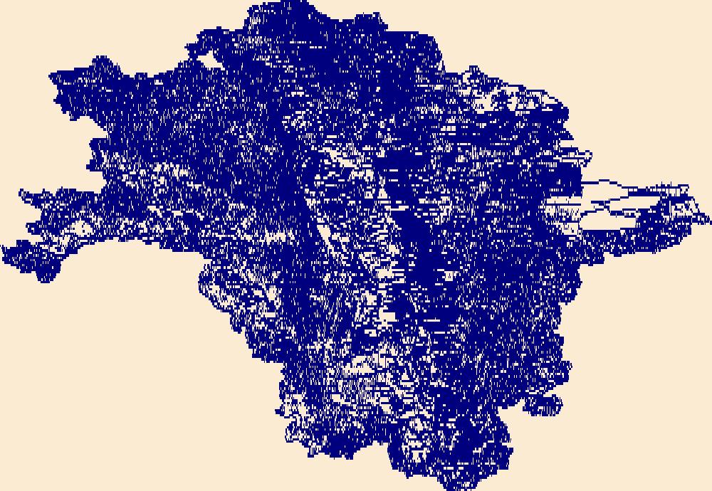
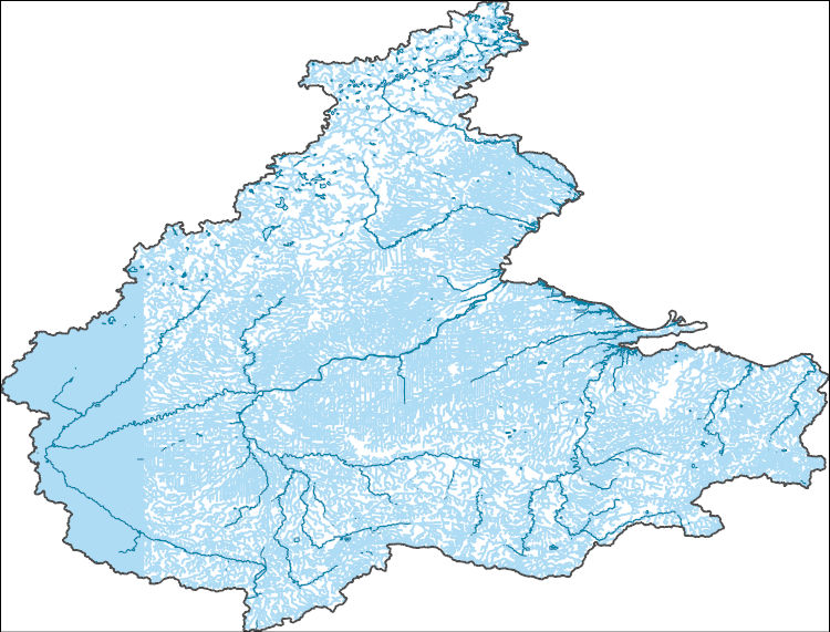
The High Resolution National Hydrography Dataset Plus (NHDPlus HR) is an integrated set of geospatial data layers, including the best available National Hydrography Dataset (NHD), the 10-meter 3D Elevation Program Digital Elevation Model (3DEP DEM), and the National Watershed Boundary Dataset (WBD). The NHDPlus HR combines the NHD, 3DEP DEMs, and WBD to create a stream network with linear referencing, feature naming, "value added attributes" (VAAs), elevation-derived catchments, and other features for hydrologic data analysis. The stream network with linear referencing is a system of data relationships applied to hydrographic systems so that one stream reach "flows" into another and "events" can be tied to and traced...
Tags: Barnes County,
Becker County,
Beltrami County,
Benson County,
Big Stone County, All tags...
Cass County,
Cavalier County,
Clay County,
Clearwater County,
Dickey County,
Downloadable Data,
Eddy County,
FileGDB,
FileGDB 10.1,
Foster County,
Grand Forks County,
Grant County,
Griggs County,
HU-4 Subregion,
HU-4 Subregion,
HU4_0902,
Hydrography,
Itasca County,
Kittson County,
Koochiching County,
Lake of the Woods County,
MN,
Mahnomen County,
Marshall County,
Marshall County,
McHenry County,
McLean County,
Minnesota,
ND,
NHDPlus HR Rasters,
NHDPlus High Resolution (NHDPlus HR),
National Hydrography Dataset (NHD),
National Hydrography Dataset Plus High Resolution (NHDPlus HR),
National Hydrography Dataset Plus High Resolution (NHDPlus HR) Current,
Nelson County,
Norman County,
North Dakota,
Otter Tail County,
Pembina County,
Pennington County,
Pierce County,
Polk County,
Ramsey County,
Ransom County,
Red Lake County,
Richland County,
Roberts County,
Rolette County,
Roseau County,
SD,
Sargent County,
Sheridan County,
South Dakota,
Steele County,
Stevens County,
Stutsman County,
Towner County,
Traill County,
Traverse County,
US,
United States,
Walsh County,
Wells County,
Wilkin County,
base maps,
cartography,
catchments,
channels,
digital elevation models,
drainage basins,
earth sciences,
elevation,
environment,
geographic information systems,
geoscientific,
geospatial analysis,
hydrographic datasets,
hydrographic features,
hydrology,
imagery,
inland waters,
lakes,
land surface characteristics,
reservoirs,
river reaches,
rivers,
streamflow,
streamflow data,
streams,
topography,
water bodies,
water quality,
water resources,
watersheds, Fewer tags

The High Resolution National Hydrography Dataset Plus (NHDPlus HR) is an integrated set of geospatial data layers, including the best available National Hydrography Dataset (NHD), the 10-meter 3D Elevation Program Digital Elevation Model (3DEP DEM), and the National Watershed Boundary Dataset (WBD). The NHDPlus HR combines the NHD, 3DEP DEMs, and WBD to create a stream network with linear referencing, feature naming, "value added attributes" (VAAs), elevation-derived catchments, and other features for hydrologic data analysis. The stream network with linear referencing is a system of data relationships applied to hydrographic systems so that one stream reach "flows" into another and "events" can be tied to and traced...
Tags: Adams County,
Allen County,
Auglaize County,
Bartholomew County,
Benton County, All tags...
Blackford County,
Boone County,
Brown County,
Carroll County,
Cass County,
Champaign County,
Clark County,
Clark County,
Clay County,
Clay County,
Clinton County,
Coles County,
Crawford County,
Crawford County,
Cumberland County,
Darke County,
Daviess County,
Decatur County,
Delaware County,
Douglas County,
Downloadable Data,
Dubois County,
Edgar County,
Edwards County,
Effingham County,
Fayette County,
Fayette County,
FileGDB,
FileGDB 10.1,
Ford County,
Fountain County,
Fulton County,
Gallatin County,
Gibson County,
Grant County,
Greene County,
HU-4 Subregion,
HU-4 Subregion,
HU4_0512,
Hamilton County,
Hamilton County,
Hancock County,
Hendricks County,
Henry County,
Howard County,
Huntington County,
Hydrography,
IL,
IN,
Illinois,
Indiana,
Iroquois County,
Jackson County,
Jasper County,
Jasper County,
Jay County,
Jefferson County,
Jefferson County,
Jennings County,
Johnson County,
Knox County,
Kosciusko County,
Lawrence County,
Lawrence County,
Livingston County,
Madison County,
Marion County,
Marion County,
Marshall County,
Martin County,
Mercer County,
Miami County,
Monroe County,
Montgomery County,
Morgan County,
Moultrie County,
NHDPlus HR Rasters,
NHDPlus High Resolution (NHDPlus HR),
National Hydrography Dataset (NHD),
National Hydrography Dataset Plus High Resolution (NHDPlus HR),
National Hydrography Dataset Plus High Resolution (NHDPlus HR) Current,
Noble County,
OH,
Ohio,
Orange County,
Owen County,
Parke County,
Pike County,
Posey County,
Pulaski County,
Putnam County,
Randolph County,
Richland County,
Ripley County,
Rush County,
Scott County,
Shelby County,
Shelby County,
Spencer County,
Starke County,
Sullivan County,
Tippecanoe County,
Tipton County,
US,
United States,
Vanderburgh County,
Vermilion County,
Vermillion County,
Vigo County,
Wabash County,
Wabash County,
Warren County,
Warrick County,
Washington County,
Wayne County,
Wells County,
White County,
White County,
Whitley County,
base maps,
cartography,
catchments,
channels,
digital elevation models,
drainage basins,
earth sciences,
elevation,
environment,
geographic information systems,
geoscientific,
geospatial analysis,
hydrographic datasets,
hydrographic features,
hydrology,
imagery,
inland waters,
lakes,
land surface characteristics,
reservoirs,
river reaches,
rivers,
streamflow,
streamflow data,
streams,
topography,
water bodies,
water quality,
water resources,
watersheds, Fewer tags
The High Resolution National Hydrography Dataset Plus (NHDPlus HR) is an integrated set of geospatial data layers, including the best available National Hydrography Dataset (NHD), the 10-meter 3D Elevation Program Digital Elevation Model (3DEP DEM), and the National Watershed Boundary Dataset (WBD). The NHDPlus HR combines the NHD, 3DEP DEMs, and WBD to create a stream network with linear referencing, feature naming, "value added attributes" (VAAs), elevation-derived catchments, and other features for hydrologic data analysis. The stream network with linear referencing is a system of data relationships applied to hydrographic systems so that one stream reach "flows" into another and "events" can be tied to and traced...
Tags: Adams County,
Allen County,
Allen County,
Ashland County,
Auglaize County, All tags...
Branch County,
Crawford County,
DeKalb County,
Defiance County,
Downloadable Data,
Erie County,
FileGDB,
FileGDB 10.1,
Fulton County,
HU-4 Subregion,
HU-4 Subregion,
HU4_0410,
Hancock County,
Hardin County,
Henry County,
Hillsdale County,
Huron County,
Hydrography,
IN,
Indiana,
Ingham County,
Jackson County,
Lenawee County,
Livingston County,
Lorain County,
Lucas County,
MI,
Marion County,
Mercer County,
Michigan,
Monroe County,
NHDPlus HR Rasters,
NHDPlus High Resolution (NHDPlus HR),
National Hydrography Dataset (NHD),
National Hydrography Dataset Plus High Resolution (NHDPlus HR),
National Hydrography Dataset Plus High Resolution (NHDPlus HR) Current,
Noble County,
OH,
Oakland County,
Ohio,
Ottawa County,
Paulding County,
Putnam County,
Richland County,
Sandusky County,
Seneca County,
Shelby County,
Steuben County,
US,
United States,
Van Wert County,
Washtenaw County,
Wayne County,
Wells County,
Williams County,
Wood County,
Wyandot County,
base maps,
cartography,
catchments,
channels,
digital elevation models,
drainage basins,
earth sciences,
elevation,
environment,
geographic information systems,
geoscientific,
geospatial analysis,
hydrographic datasets,
hydrographic features,
hydrology,
imagery,
inland waters,
lakes,
land surface characteristics,
reservoirs,
river reaches,
rivers,
streamflow,
streamflow data,
streams,
topography,
water bodies,
water quality,
water resources,
watersheds, Fewer tags
|
|

