Filters: Tags: Wisconsin (X)
9,489 results (14ms)|
Filters
Contacts
(Less)
|
High radium (Ra) concentrations in potable portions of the Cambrian-Ordovician (C-O) aquifer system were investigated using water-quality data and environmental tracers ( 3H, 3Hetrit, SF6 , 14C and 4Herad) of groundwater age from 80 public-supply wells (PSWs). Groundwater ages were estimated by calibration of tracers to lumped parameter models and ranged from modern (1 Myr) in the most downgradient, confined portions of the potable system. More than 80 and 40 percent of mean groundwater ages were older than 1000 and 50,000 yr, respectively. Anoxic, Fe-reducing conditions and increased mineralization develop with time in the aquifer system and mobilize Ra into solution resulting in the frequent occurrence of combined...
The glacial aquifer system of the United States encompasses all or parts of 25 states and is the most widely used supply of drinking water in the Nation (Maupin and Barber, 2005; Maupin and Arnold, 2010). A series of seven raster data sets were derived from a database of water-well drillers' records that was compiled in partial fulfillment of the goals of the U.S. Geological Survey’s Groundwater Availability and Use assessment program (U.S. Geological Survey, 2002). They contain hydrogeologic information for areas of the U.S. that are north of the southern limit of Pleistocene glaciation, including the total thickness of glacial deposits, thickness of coarse-grained sediment within the glacial deposits, specific-capacity...
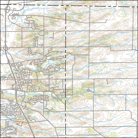
Layers of geospatial data include contours, boundaries, land cover, hydrography, roads, transportation, geographic names, structures, and other selected map features.

This map layer consists of federally owned or administered lands of the United States, Puerto Rico, and the U.S. Virgin Islands. For the most part, only areas of 320 acres or more are included; some smaller areas deemed to be important or significant are also included. There may be private inholdings within the boundaries of Federal lands in this map layer. Some established Federal lands which are larger than 320 acres are not included in this map layer, because their boundaries were not available from the owning or administering agency.
The 'Northern Wisconsin, Wausau Area' file is part of the Grover Heinrichs mining collection. Grover was the Vice President of Heinrichs GEOEXploration, located in Tucson, Arizona. The collection contains over 1,400 folders including economic geology reports, maps, photos, correspondence, drill logs and other related materials. The focus of much of the information is on the western United States, particularly Arizona, but the collection also includes files on mining activity throughout the United States, foreign countries, and 82 mineral commodities.
Categories: Data;
Tags: Dataset,
United States,
Wisconsin,
geoscientificInformation,
mineral resources,
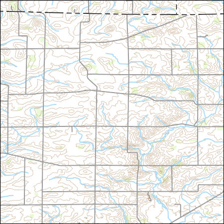
Layers of geospatial data include contours, boundaries, land cover, hydrography, roads, transportation, geographic names, structures, and other selected map features.
Types: Citation;
Tags: 7.5 x 7.5 minute,
7.5 x 7.5 minute,
Boone County,
Combined Vector,
Combined Vector,
This dataset provides timeseries data on water quality and quantity, as collected or computed from outside sources. The format is many tables with one row per time series observation (1 tab-delimited file per site-variable combination, 1 zip file per site). This compilation of data is intended for use in estimating or interpreting metabolism. Sites were included if they met the initial criteria of having at least 100 dissolved oxygen observations and one of the accepted NWIS site types ('ST','ST-CA','ST-DCH','ST-TS', or 'SP'). This dataset is part of a larger data release of metabolism model inputs and outputs for 356 streams and rivers across the United States (https://doi.org/10.5066/F70864KX). The complete release...
The glacial aquifer system of the United States encompasses all or parts of 25 states and is the most widely used supply of drinking water in the Nation (Maupin and Barber, 2005; Maupin and Arnold, 2010). A series of seven raster data sets were derived from a database of water-well drillers' records that was compiled in partial fulfillment of the goals of the U.S. Geological Survey’s Groundwater Availability and Use assessment program (U.S. Geological Survey, 2002). They contain hydrogeologic information for areas of the U.S. that are north of the southern limit of Pleistocene glaciation, including the total thickness of glacial deposits, thickness of coarse-grained sediment within the glacial deposits, specific-capacity...
This data release component contains model inputs including river basin attributes, weather forcing data, and simulated and observed river discharge.
The U. S. Geological Survey (USGS) makes long-term seismic hazard forecasts that are used in building codes. The hazard models usually consider only natural seismicity; non-tectonic (man-made) earthquakes are excluded because they are transitory or too small. In the past decade, however, thousands of earthquakes related to underground fluid injection have occurred in the central and eastern U.S. (CEUS), and some have caused damage. In response, the USGS is now also making short-term forecasts that account for the hazard from these induced earthquakes. A uniform earthquake catalog is assembled by combining and winnowing pre-existing source catalogs. Seismicity statistics are analyzed to develop recurrence models,...
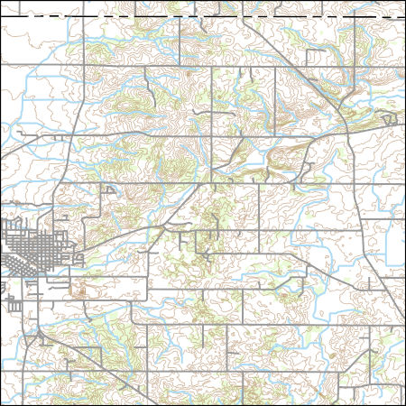
Layers of geospatial data include contours, boundaries, land cover, hydrography, roads, transportation, geographic names, structures, and other selected map features.
Types: Citation;
Tags: 7.5 x 7.5 minute,
7.5 x 7.5 minute,
Combined Vector,
Combined Vector,
Combined Vector,
Observed water temperatures from 1980-2019 were compiled for 2,332 lakes in the US. These data were used as training, test, and error-estimation data for process-guided deep learning models and the evaluation of process-based models. The data are formatted as a single csv (comma separated values) file with attributes corresponding to the unique combination of lake identifier, time, and depth. Data came from a variety of sources, including the Water Quality Portal, the North Temperate Lakes Long-Term Ecological Research Project, and digitized temperature records from the MN Department of Natural Resources. This dataset is part of a larger data release of lake temperature model inputs and outputs for these same lakes...
This dataset consists of 176 wideband magnetotelluric (MT) stations collected from 2015-2019 across parts of Minnesota, Wisconsin and the Upper Peninsula of Michigan. The U.S. Geological Survey (USGS) acquired these data as part of regional investigations into the geologic and tectonic framework of the area and to support mineral resource investigations. These data have been used to generate a 3D regional conductivity model of the area. Files included in this publication include measured electric- and magnetic-field time series as well as estimated impedance and vertical-magnetic field transfer functions. The data included here are for MT station pen107 in the Penokean Orogeny survey region. A shapefile with station...
This dataset consists of 176 wideband magnetotelluric (MT) stations collected from 2015-2019 across parts of Minnesota, Wisconsin and the Upper Peninsula of Michigan. The U.S. Geological Survey (USGS) acquired these data as part of regional investigations into the geologic and tectonic framework of the area and to support mineral resource investigations. These data have been used to generate a 3D regional conductivity model of the area. Files included in this publication include measured electric- and magnetic-field time series as well as estimated impedance and vertical-magnetic field transfer functions. The data included here are for MT station pen116 in the Penokean Orogeny survey region. A shapefile with station...
This dataset consists of 176 wideband magnetotelluric (MT) stations collected from 2015-2019 across parts of Minnesota, Wisconsin and the Upper Peninsula of Michigan. The U.S. Geological Survey (USGS) acquired these data as part of regional investigations into the geologic and tectonic framework of the area and to support mineral resource investigations. These data have been used to generate a 3D regional conductivity model of the area. Files included in this publication include measured electric- and magnetic-field time series as well as estimated impedance and vertical-magnetic field transfer functions. The data included here are for MT station pen120 in the Penokean Orogeny survey region. A shapefile with station...
This dataset consists of 176 wideband magnetotelluric (MT) stations collected from 2015-2019 across parts of Minnesota, Wisconsin and the Upper Peninsula of Michigan. The U.S. Geological Survey (USGS) acquired these data as part of regional investigations into the geologic and tectonic framework of the area and to support mineral resource investigations. These data have been used to generate a 3D regional conductivity model of the area. Files included in this publication include measured electric- and magnetic-field time series as well as estimated impedance and vertical-magnetic field transfer functions. The data included here are for MT station pen117 in the Penokean Orogeny survey region. A shapefile with station...
This dataset consists of 176 wideband magnetotelluric (MT) stations collected from 2015-2019 across parts of Minnesota, Wisconsin and the Upper Peninsula of Michigan. The U.S. Geological Survey (USGS) acquired these data as part of regional investigations into the geologic and tectonic framework of the area and to support mineral resource investigations. These data have been used to generate a 3D regional conductivity model of the area. Files included in this publication include measured electric- and magnetic-field time series as well as estimated impedance and vertical-magnetic field transfer functions. The data included here are for MT station pen010 in the Penokean Orogeny survey region. A shapefile with station...
This dataset consists of 176 wideband magnetotelluric (MT) stations collected from 2015-2019 across parts of Minnesota, Wisconsin and the Upper Peninsula of Michigan. The U.S. Geological Survey (USGS) acquired these data as part of regional investigations into the geologic and tectonic framework of the area and to support mineral resource investigations. These data have been used to generate a 3D regional conductivity model of the area. Files included in this publication include measured electric- and magnetic-field time series as well as estimated impedance and vertical-magnetic field transfer functions. The data included here are for MT station pen007 in the Penokean Orogeny survey region. A shapefile with station...
This dataset consists of 176 wideband magnetotelluric (MT) stations collected from 2015-2019 across parts of Minnesota, Wisconsin and the Upper Peninsula of Michigan. The U.S. Geological Survey (USGS) acquired these data as part of regional investigations into the geologic and tectonic framework of the area and to support mineral resource investigations. These data have been used to generate a 3D regional conductivity model of the area. Files included in this publication include measured electric- and magnetic-field time series as well as estimated impedance and vertical-magnetic field transfer functions. The data included here are for MT station wup413 in the Western Upper Peninsula survey region. A shapefile with...
This dataset consists of 176 wideband magnetotelluric (MT) stations collected from 2015-2019 across parts of Minnesota, Wisconsin and the Upper Peninsula of Michigan. The U.S. Geological Survey (USGS) acquired these data as part of regional investigations into the geologic and tectonic framework of the area and to support mineral resource investigations. These data have been used to generate a 3D regional conductivity model of the area. Files included in this publication include measured electric- and magnetic-field time series as well as estimated impedance and vertical-magnetic field transfer functions. The data included here are for MT station wup403 in the Western Upper Peninsula survey region. A shapefile with...
|