Filters
Date Types (for Date Range)
Contacts
Tag Types
Tag Schemes
|
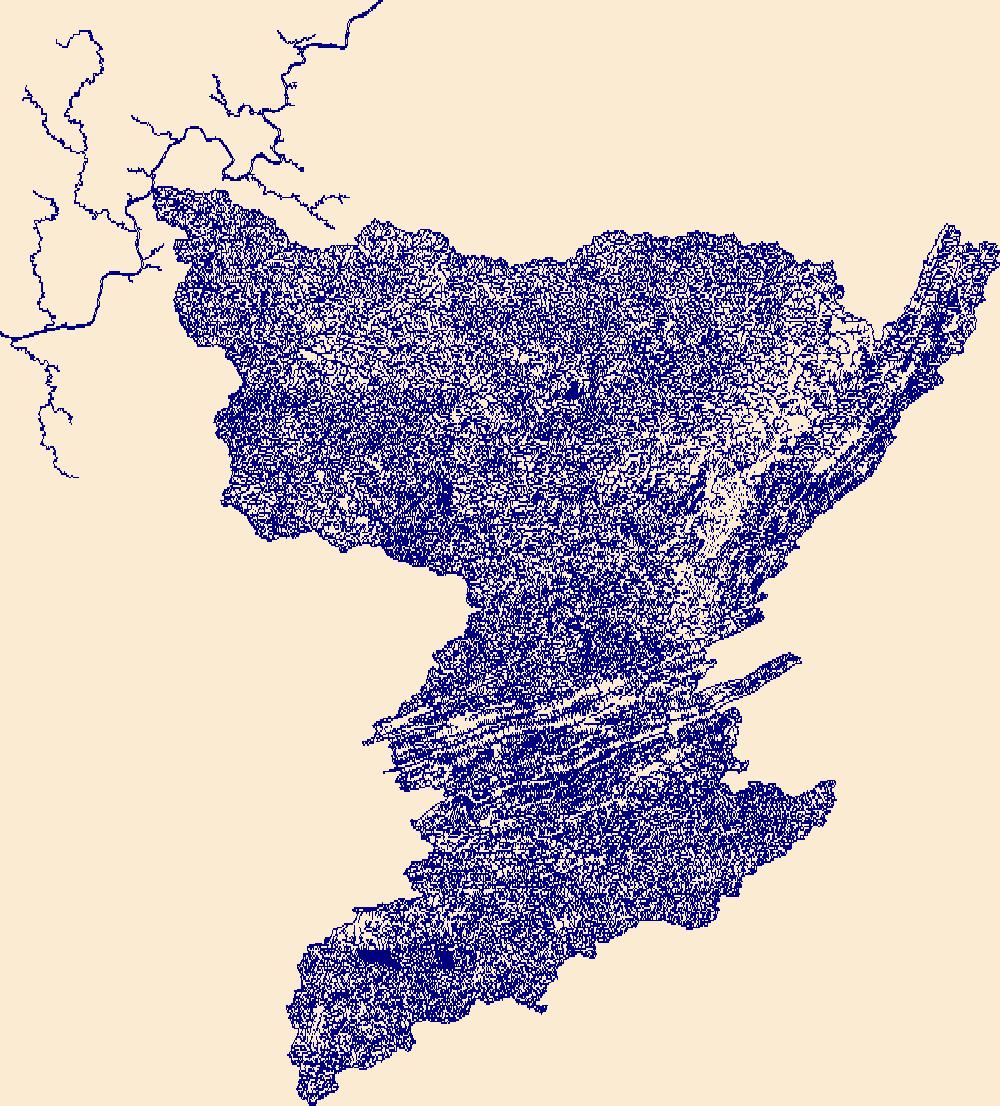
The High Resolution National Hydrography Dataset Plus (NHDPlus HR) is an integrated set of geospatial data layers, including the best available National Hydrography Dataset (NHD), the 10-meter 3D Elevation Program Digital Elevation Model (3DEP DEM), and the National Watershed Boundary Dataset (WBD). The NHDPlus HR combines the NHD, 3DEP DEMs, and WBD to create a stream network with linear referencing, feature naming, "value added attributes" (VAAs), elevation-derived catchments, and other features for hydrologic data analysis. The stream network with linear referencing is a system of data relationships applied to hydrographic systems so that one stream reach "flows" into another and "events" can be tied to and traced...
Tags: Alleghany County,
Alleghany County,
Ashe County,
Bath County,
Bland County, All tags...
Boone County,
Braxton County,
Cabell County,
Caldwell County,
Calhoun County,
Carroll County,
Clay County,
Craig County,
Downloadable Data,
Fayette County,
FileGDB,
FileGDB 10.1,
Floyd County,
Franklin County,
Galax County,
Giles County,
Grayson County,
Greenbrier County,
HU-4 Subregion,
HU-4 Subregion,
HU4_0505,
Highland County,
Hydrography,
Jackson County,
Johnson County,
Kanawha County,
Lincoln County,
Logan County,
Mason County,
McDowell County,
Mercer County,
Monroe County,
Montgomery County,
NC,
NHDPlus HR Rasters,
NHDPlus High Resolution (NHDPlus HR),
National Hydrography Dataset (NHD),
National Hydrography Dataset Plus High Resolution (NHDPlus HR),
National Hydrography Dataset Plus High Resolution (NHDPlus HR) Current,
Nicholas County,
North Carolina,
Patrick County,
Pendleton County,
Pocahontas County,
Pulaski County,
Putnam County,
Radford County,
Raleigh County,
Randolph County,
Roane County,
Smyth County,
Summers County,
Surry County,
TN,
Tazewell County,
Tennessee,
US,
United States,
VA,
Virginia,
WV,
Washington County,
Watauga County,
Webster County,
West Virginia,
Wilkes County,
Wyoming County,
Wythe County,
base maps,
cartography,
catchments,
channels,
digital elevation models,
drainage basins,
earth sciences,
elevation,
environment,
geographic information systems,
geoscientific,
geospatial analysis,
hydrographic datasets,
hydrographic features,
hydrology,
imagery,
inland waters,
lakes,
land surface characteristics,
reservoirs,
river reaches,
rivers,
streamflow,
streamflow data,
streams,
topography,
water bodies,
water quality,
water resources,
watersheds, Fewer tags
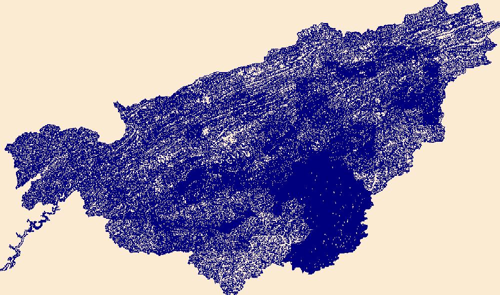
The High Resolution National Hydrography Dataset Plus (NHDPlus HR) is an integrated set of geospatial data layers, including the National Hydrography Dataset (NHD), National Watershed Boundary Dataset (WBD), and 3D Elevation Program Digital Elevation Model (3DEP DEM). The NHDPlus HR combines the NHD, 3DEP DEMs, and WBD to a data suite that includes the NHD stream network with linear referencing functionality, the WBD hydrologic units, elevation-derived catchment areas for each stream segment, "value added attributes" (VAAs), and other features that enhance hydrologic data analysis and routing.
Tags: 4-digit hydrologic unit,
Anderson County,
Ashe County,
Avery County,
Bell County, All tags...
Bland County,
Bledsoe County,
Blount County,
Bristol County,
Buchanan County,
Buncombe County,
Caldwell County,
Campbell County,
Carter County,
Cherokee County,
Claiborne County,
Clay County,
Cocke County,
Cumberland County,
Dickenson County,
Downloadable Data,
Fentress County,
FileGDB,
GA,
Georgia,
Graham County,
Grainger County,
Grayson County,
Greene County,
Greenville County,
HU-4 Subregion,
HU4,
HU4_0601,
Hamblen County,
Hancock County,
Harlan County,
Hawkins County,
Haywood County,
Henderson County,
Hydrography,
Jackson County,
Jefferson County,
Johnson County,
KY,
Kentucky,
Knox County,
Lee County,
Letcher County,
Loudon County,
Macon County,
Madison County,
McDowell County,
McMinn County,
Meigs County,
Mitchell County,
Monroe County,
Morgan County,
NC,
NHDPlus HR Rasters,
NHDPlus High Resolution (NHDPlus HR),
National Hydrography Dataset (NHD),
National Hydrography Dataset Plus High Resolution (NHDPlus HR),
National Hydrography Dataset Plus High Resolution (NHDPlus HR) Current,
North Carolina,
Norton County,
Pickens County,
Putnam County,
Rabun County,
Rhea County,
Roane County,
Russell County,
SC,
Scott County,
Sevier County,
Smyth County,
South Carolina,
Sullivan County,
Swain County,
TN,
Tazewell County,
Tennessee,
Transylvania County,
US,
Unicoi County,
Union County,
United States,
VA,
Virginia,
WV,
Washington County,
Watauga County,
West Virginia,
Wise County,
Wythe County,
Yancey County,
base maps,
cartography,
catchments,
channels,
digital elevation models,
drainage basins,
earthsciences,
environment,
geographic information systems,
geoscientificInformation,
geospatial analysis,
hydrographic datasets,
hydrographic features,
hydrology,
inlandWaters,
lakes,
land surface characteristics,
reservoirs,
river reaches,
rivers,
streamflow,
streamflow data,
streams,
surface water quality,
topography,
water resources,
waterbodies,
watersheds, Fewer tags
|
|

