Filters: Tags: Yukon (X)
164 results (124ms)|
Filters
Date Range
Extensions Types
Contacts
Categories Tag Types
|
Data included are DNA sequences used to identify species boundaries among Ichthyophonus-like parasites. Sequences were generated for three gene regions from each parasite isolate. DNA sequences can be downloaded from GenBank (https://www.ncbi.nlm.nih.gov/) as text or fasta files. Accession numbers for each sequence are included in the data table (.csv file). Data includes 87 sequences (99,383 total nucleotides). Once manuscript is accepted there are no restrictions on dissemination of these data.
Categories: Data;
Tags: Aquatic Biology,
Bering Sea,
DNA sequencing,
Environmental Health,
Genetics,
Layers of geospatial data include contours, boundaries, land cover, hydrography, roads, transportation, geographic names, structures, and other selected map features.
Aspects of the thaw lake cycle were investigated in Old Crow Flats (OCF), a 5600 km2 peatland with thousands of thermokarst lakes in the continuous permafrost of northern Yukon. It is located in the traditional territory of the Vuntut Gwitch'n, who expressed concern that climatic change may be affecting the permafrost and lakes of OCF. Field data collected in 2008-2011 provided the first assessment of spatial variability in permafrost temperatures across the treeline ecotone in OCF. Lake-bottom temperatures were recorded near the shores of four thermokarst lakes and talik configuration was defined beneath the lakes by jet-drilling to determine conditions controlling permafrost degradation in the area. Analytical...
Categories: Publication;
Types: Citation;
Tags: M3-Improve Permafrost Mapping,
Modeling,
Old Crow Flats,
Yukon,
and Monitoring
Region(s) of distribution of Humpback Whitefish (Coregonus pidschian) (Gmelin, 1789) in the Arctic as digitized for U.S. Geological Survey Scientific Investigations Report 2016-5038. For details on the project and purpose, see the report at https://doi.org/10.3133/sir20165038. Complete metadata for the collection of species datasets is in the metadata document "Dataset_for_Alaska_Marine_Fish_Ecology_Catalog.xml" at https://doi.org/10.5066/F7M61HD7. Source(s) for this digitized data layer are listed in the metadata Process Steps section. Note that the original source may show an extended area; some datasets were limited to the published map boundary. Distributions of marine fishes are shown in adjacent Arctic seas...
Categories: Data;
Types: Citation,
Downloadable,
Map Service,
OGC WFS Layer,
OGC WMS Layer,
Shapefile;
Tags: (Gmelin, 1789),
Alaska,
Arctic,
Arctic,
Beaufort Sea,
Region(s) of distribution of Variegated Snailfish (Liparis gibbus) Bean, 1881 in the Arctic as digitized for U.S. Geological Survey Scientific Investigations Report 2016-5038. For details on the project and purpose, see the report at https://doi.org/10.3133/sir20165038. Complete metadata for the collection of species datasets is in the metadata document "Dataset_for_Alaska_Marine_Fish_Ecology_Catalog.xml" at https://doi.org/10.5066/F7M61HD7. Source(s) for this digitized data layer are listed in the metadata Process Steps section. Note that the original source may show an extended area; some datasets were limited to the published map boundary. Distributions of marine fishes are shown in adjacent Arctic seas where...
Categories: Data;
Types: Citation,
Downloadable,
Map Service,
OGC WFS Layer,
OGC WMS Layer,
Shapefile;
Tags: Alaska,
Arctic,
Arctic,
Bean, 1881,
Beaufort Sea,
Region(s) of distribution of Saddled Eelpout (Lycodes mucosus) Richardson, 1855 in the Arctic as digitized for U.S. Geological Survey Scientific Investigations Report 2016-5038. For details on the project and purpose, see the report at https://doi.org/10.3133/sir20165038. Complete metadata for the collection of species datasets is in the metadata document "Dataset_for_Alaska_Marine_Fish_Ecology_Catalog.xml" at https://doi.org/10.5066/F7M61HD7. Source(s) for this digitized data layer are listed in the metadata Process Steps section. Note that the original source may show an extended area; some datasets were limited to the published map boundary. Distributions of marine fishes are shown in adjacent Arctic seas where...
Categories: Data;
Types: Citation,
Downloadable,
Map Service,
OGC WFS Layer,
OGC WMS Layer,
Shapefile;
Tags: Alaska,
Arctic,
Arctic,
Beaufort Sea,
Bering Sea,
Region(s) of distribution of Arctic Smelt (Osmerus dentex) Steindachner & Kner, 1870 in the Arctic as digitized for U.S. Geological Survey Scientific Investigations Report 2016-5038. For details on the project and purpose, see the report at https://doi.org/10.3133/sir20165038. Complete metadata for the collection of species datasets is in the metadata document "Dataset_for_Alaska_Marine_Fish_Ecology_Catalog.xml" at https://doi.org/10.5066/F7M61HD7. Source(s) for this digitized data layer are listed in the metadata Process Steps section. Note that the original source may show an extended area; some datasets were limited to the published map boundary. Distributions of marine fishes are shown in adjacent Arctic seas...
Categories: Data;
Types: Citation,
Downloadable,
Map Service,
OGC WFS Layer,
OGC WMS Layer,
Shapefile;
Tags: (Steindachner & Kner, 1870),
Alaska,
Arctic,
Arctic,
Arctic Smelt,
Region(s) of distribution of Ribbed Sculpin (Triglops pingelii) (Reinhardt, 1837) in the Arctic as digitized for U.S. Geological Survey Scientific Investigations Report 2016-5038. For details on the project and purpose, see the report at https://doi.org/10.3133/sir20165038. Complete metadata for the collection of species datasets is in the metadata document "Dataset_for_Alaska_Marine_Fish_Ecology_Catalog.xml" at https://doi.org/10.5066/F7M61HD7. Source(s) for this digitized data layer are listed in the metadata Process Steps section. Note that the original source may show an extended area; some datasets were limited to the published map boundary. Distributions of marine fishes are shown in adjacent Arctic seas where...
Categories: Data;
Types: Citation,
Downloadable,
Map Service,
OGC WFS Layer,
OGC WMS Layer,
Shapefile;
Tags: Alaska,
Arctic,
Arctic,
Beaufort Sea,
Bering Sea,
Region(s) of distribution of Veteran Poacher (Podothecus veternus) Jordan & Starks, 1895 in the Arctic as digitized for U.S. Geological Survey Scientific Investigations Report 2016-5038. For details on the project and purpose, see the report at https://doi.org/10.3133/sir20165038. Complete metadata for the collection of species datasets is in the metadata document "Dataset_for_Alaska_Marine_Fish_Ecology_Catalog.xml" at https://doi.org/10.5066/F7M61HD7. Source(s) for this digitized data layer are listed in the metadata Process Steps section. Note that the original source may show an extended area; some datasets were limited to the published map boundary. Distributions of marine fishes are shown in adjacent Arctic...
Categories: Data;
Types: Citation,
Downloadable,
Map Service,
OGC WFS Layer,
OGC WMS Layer,
Shapefile;
Tags: Alaska,
Arctic,
Arctic,
Beaufort Sea,
Bering Sea,
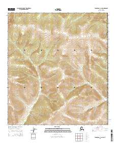
Layered GeoPDF Quadrangle Map. Layers of geospatial data include orthoimagery, roads, grids, geographic names, elevation contours, hydrography, and other selected map features.
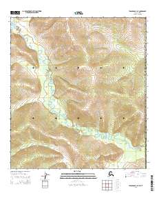
Layered GeoPDF Quadrangle Map. Layers of geospatial data include orthoimagery, roads, grids, geographic names, elevation contours, hydrography, and other selected map features.
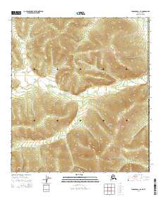
Layered GeoPDF Quadrangle Map. Layers of geospatial data include orthoimagery, roads, grids, geographic names, elevation contours, hydrography, and other selected map features.
"This Order transfers to the designated Minister for the Northern Pipeline Act, in relation to the pipeline only, the powers, duties and functions of the Minister of the Environment to administer, manage and control certain National Park reserve lands required for the pipeline."
Categories: Publication;
Types: Citation;
Tags: Adaptation planning 1-Best Management Practices,
Landscape Scale Conservation: Agency Management Plans,
Yukon
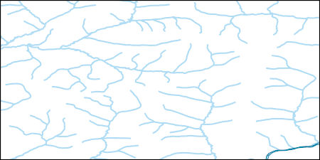
The National Hydrography Dataset (NHD) is a feature-based database that interconnects and uniquely identifies the stream segments or reaches that make up the nation's surface water drainage system. NHD data was originally developed at 1:100,000-scale and exists at that scale for the whole country. This high-resolution NHD, generally developed at 1:24,000/1:12,000 scale, adds detail to the original 1:100,000-scale NHD. (Data for Alaska, Puerto Rico and the Virgin Islands was developed at high-resolution, not 1:100,000 scale.) Local resolution NHD is being developed where partners and data exist. The NHD contains reach codes for networked features, flow direction, names, and centerline representations for areal water...
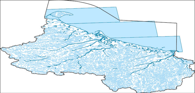
Region(s) of distribution of Arctic Cod (Boreogadus saida) (Lepechin, 1774) in the Arctic as digitized for U.S. Geological Survey Scientific Investigations Report 2016-5038. For details on the project and purpose, see the report at https://doi.org/10.3133/sir20165038. Complete metadata for the collection of species datasets is in the metadata document "Dataset_for_Alaska_Marine_Fish_Ecology_Catalog.xml" at https://doi.org/10.5066/F7M61HD7. Source(s) for this digitized data layer are listed in the metadata Process Steps section. Note that the original source may show an extended area; some datasets were limited to the published map boundary. Distributions of marine fishes are shown in adjacent Arctic seas where reliable...
Categories: Data;
Types: Citation,
Downloadable,
Map Service,
OGC WFS Layer,
OGC WMS Layer,
Shapefile;
Tags: (Lepechin, 1774),
Alaska,
Arctic,
Arctic,
Arctic Cod,
Region(s) of distribution of Pimpled Lumpsucker (Eumicrotremus andriashevi) Perminov, 1936 in the Arctic as digitized for U.S. Geological Survey Scientific Investigations Report 2016-5038. For details on the project and purpose, see the report at https://doi.org/10.3133/sir20165038. Complete metadata for the collection of species datasets is in the metadata document "Dataset_for_Alaska_Marine_Fish_Ecology_Catalog.xml" at https://doi.org/10.5066/F7M61HD7. Source(s) for this digitized data layer are listed in the metadata Process Steps section. Note that the original source may show an extended area; some datasets were limited to the published map boundary. Distributions of marine fishes are shown in adjacent Arctic...
Categories: Data;
Types: Citation,
Downloadable,
Map Service,
OGC WFS Layer,
OGC WMS Layer,
Shapefile;
Tags: Alaska,
Arctic,
Arctic,
Beaufort Sea,
Bering Sea,

The Yukon Territory is underlain by a great variety of rock types ranging in age from Early Proterozoic to Recent and representing diverse environments including epicratonic basins, subsiding shelves, foreland basins, island arcs and deep ocean basins. Episodes of compressional and extensional deformation, transcurrent faulting, metamorphism and plutonism further complicate the map pattern. This complex geological record has been described in terms of the interactions of several terranes (large parts of the earth's crust which preserve a common geological record) with each other and with the margin of ancestral North America.
Region(s) of distribution of Adolf’s Eelpout (Lycodes adolfi) Nielsen & Fosså, 1993 in the Arctic as digitized for U.S. Geological Survey Scientific Investigations Report 2016-5038. For details on the project and purpose, see the report at https://doi.org/10.3133/sir20165038. Complete metadata for the collection of species datasets is in the metadata document "Dataset_for_Alaska_Marine_Fish_Ecology_Catalog.xml" at https://doi.org/10.5066/F7M61HD7. Source(s) for this digitized data layer are listed in the metadata Process Steps section. Note that the original source may show an extended area; some datasets were limited to the published map boundary. Distributions of marine fishes are shown in adjacent Arctic seas...
Categories: Data;
Types: Citation,
Downloadable,
Map Service,
OGC WFS Layer,
OGC WMS Layer,
Shapefile;
Tags: Adolf’s Eelpout,
Alaska,
Arctic,
Arctic,
Beaufort Sea,
Region(s) of distribution of Greenland Halibut (Reinhardtius hippoglossoides) (Walbaum, 1792) in the Arctic as digitized for U.S. Geological Survey Scientific Investigations Report 2016-5038. For details on the project and purpose, see the report at https://doi.org/10.3133/sir20165038. Complete metadata for the collection of species datasets is in the metadata document "Dataset_for_Alaska_Marine_Fish_Ecology_Catalog.xml" at https://doi.org/10.5066/F7M61HD7. Source(s) for this digitized data layer are listed in the metadata Process Steps section. Note that the original source may show an extended area; some datasets were limited to the published map boundary. Distributions of marine fishes are shown in adjacent Arctic...
Categories: Data;
Types: Citation,
Downloadable,
Map Service,
OGC WFS Layer,
OGC WMS Layer,
Shapefile;
Tags: (Walbaum, 1792),
Alaska,
Arctic,
Arctic,
Beaufort Sea,
Region(s) of distribution of Dolly Varden (Salvelinus malma) (Walbaum, 1792) in the Arctic as digitized for U.S. Geological Survey Scientific Investigations Report 2016-5038. For details on the project and purpose, see the report at https://doi.org/10.3133/sir20165038. Complete metadata for the collection of species datasets is in the metadata document "Dataset_for_Alaska_Marine_Fish_Ecology_Catalog.xml" at https://doi.org/10.5066/F7M61HD7. Source(s) for this digitized data layer are listed in the metadata Process Steps section. Note that the original source may show an extended area; some datasets were limited to the published map boundary. Distributions of marine fishes are shown in adjacent Arctic seas where...
Categories: Data;
Types: Citation,
Downloadable,
Map Service,
OGC WFS Layer,
OGC WMS Layer,
Shapefile;
Tags: (Walbaum, 1792),
Alaska,
Arctic,
Arctic,
Beaufort Sea,
|

|
