Filters
Date Range
Types
Contacts
Categories
Tag Types
Tag Schemes
|
Layered GeoPDF 7.5 Minute Quadrangle Map. Layers of geospatial data include orthoimagery, roads, grids, geographic names, elevation contours, hydrography, and other selected map features.
Tags: 7.5 x 7.5 minute,
Arizona,
Downloadable Data,
EarthCover,
GeoPDF, All tags...
Imagery and Base Maps,
Map,
U.S. National Grid,
US,
US Topo,
US Topo Historical,
United States,
Wellton SE, AZ,
Yuma,
contour,
geographic names,
hydrography,
imageryBaseMapsEarthCover,
orthoimage,
structures,
topographic,
transportation, Fewer tags
Layered geospatial PDF Map. Layers of geospatial data include orthoimagery, roads, grids, geographic names, elevation contours, hydrography, and other selected map features.
Tags: 7.5 x 7.5 minute,
Colorado,
Downloadable Data,
EarthCover,
GeoPDF, All tags...
Imagery and Base Maps,
Map,
Otis SE, CO,
Public Land Survey System,
U.S. National Grid,
US,
US Topo,
US Topo Historical,
United States,
Washington,
Yuma,
boundary,
contour,
geographic names,
hydrography,
imageryBaseMapsEarthCover,
orthoimage,
structures,
topographic,
transportation,
woodland, Fewer tags
Layered GeoPDF 7.5 Minute Quadrangle Map. Layers of geospatial data include orthoimagery, roads, grids, geographic names, elevation contours, hydrography, and other selected map features.
Tags: 7.5 x 7.5 minute,
Arizona,
Downloadable Data,
Eagletail Mountains West, AZ,
EarthCover, All tags...
GeoPDF,
Imagery and Base Maps,
La Paz,
Map,
U.S. National Grid,
US,
US Topo,
US Topo Historical,
United States,
Yuma,
contour,
geographic names,
hydrography,
imageryBaseMapsEarthCover,
orthoimage,
structures,
topographic,
transportation, Fewer tags
Layered GeoPDF 7.5 Minute Quadrangle Map. Layers of geospatial data include orthoimagery, roads, grids, geographic names, elevation contours, hydrography, and other selected map features.
Tags: 7.5 x 7.5 minute,
Colorado,
De Nova NE, CO,
Downloadable Data,
EarthCover, All tags...
GeoPDF,
Imagery and Base Maps,
Map,
Public Land Survey System,
U.S. National Grid,
US,
US Topo,
US Topo Historical,
United States,
Washington,
Yuma,
boundary,
contour,
geographic names,
hydrography,
imageryBaseMapsEarthCover,
orthoimage,
structures,
topographic,
transportation,
woodland, Fewer tags
Layered GeoPDF 7.5 Minute Quadrangle Map. Layers of geospatial data include orthoimagery, roads, grids, geographic names, elevation contours, hydrography, and other selected map features.
Tags: 7.5 x 7.5 minute,
Arizona,
Cipriano Pass, AZ,
Downloadable Data,
EarthCover, All tags...
GeoPDF,
Imagery and Base Maps,
Map,
Public Land Survey System,
U.S. National Grid,
US,
US Topo,
US Topo Historical,
United States,
Yuma,
boundary,
contour,
geographic names,
hydrography,
imageryBaseMapsEarthCover,
orthoimage,
structures,
topographic,
transportation,
woodland, Fewer tags
Layered GeoPDF 7.5 Minute Quadrangle Map. Layers of geospatial data include orthoimagery, roads, grids, geographic names, elevation contours, hydrography, and other selected map features.
Tags: 7.5 x 7.5 minute,
Arizona,
Aztec Hills, AZ,
Downloadable Data,
EarthCover, All tags...
GeoPDF,
Imagery and Base Maps,
Map,
Public Land Survey System,
U.S. National Grid,
US,
US Topo,
US Topo Historical,
United States,
Yuma,
boundary,
contour,
geographic names,
hydrography,
imageryBaseMapsEarthCover,
orthoimage,
structures,
topographic,
transportation,
woodland, Fewer tags
Layered GeoPDF 7.5 Minute Quadrangle Map. Layers of geospatial data include orthoimagery, roads, grids, geographic names, elevation contours, hydrography, and other selected map features.
Tags: 7.5 x 7.5 minute,
Aguila Mountains SW, AZ,
Arizona,
Downloadable Data,
EarthCover, All tags...
GeoPDF,
Imagery and Base Maps,
Map,
U.S. National Grid,
US,
US Topo,
US Topo Historical,
United States,
Yuma,
contour,
geographic names,
hydrography,
imageryBaseMapsEarthCover,
orthoimage,
structures,
topographic,
transportation, Fewer tags
Layered geospatial PDF Map. Layers of geospatial data include orthoimagery, roads, grids, geographic names, elevation contours, hydrography, and other selected map features.
Tags: 7.5 x 7.5 minute,
Colorado,
Downloadable Data,
EarthCover,
GeoPDF, All tags...
Imagery and Base Maps,
Map,
Public Land Survey System,
U.S. National Grid,
US,
US Topo,
US Topo Historical,
United States,
Wauneta, CO,
Yuma,
boundary,
contour,
geographic names,
hydrography,
imageryBaseMapsEarthCover,
orthoimage,
structures,
topographic,
transportation,
woodland, Fewer tags
Layered GeoPDF 7.5 Minute Quadrangle Map. Layers of geospatial data include orthoimagery, roads, grids, geographic names, elevation contours, hydrography, and other selected map features.
Tags: 7.5 x 7.5 minute,
Arizona,
Downloadable Data,
EarthCover,
GeoPDF, All tags...
Imagery and Base Maps,
Map,
Public Land Survey System,
Red Bluff Mountain East, AZ,
U.S. National Grid,
US,
US Topo,
US Topo Historical,
United States,
Yuma,
boundary,
contour,
geographic names,
hydrography,
imageryBaseMapsEarthCover,
orthoimage,
structures,
topographic,
transportation,
woodland, Fewer tags
Layered GeoPDF 7.5 Minute Quadrangle Map. Layers of geospatial data include orthoimagery, roads, grids, geographic names, elevation contours, hydrography, and other selected map features.
Tags: 7.5 x 7.5 minute,
Arizona,
Downloadable Data,
EarthCover,
Fortuna, AZ, All tags...
GeoPDF,
Imagery and Base Maps,
Map,
Public Land Survey System,
U.S. National Grid,
US,
US Topo,
US Topo Historical,
United States,
Yuma,
boundary,
contour,
geographic names,
hydrography,
imageryBaseMapsEarthCover,
orthoimage,
structures,
topographic,
transportation,
woodland, Fewer tags

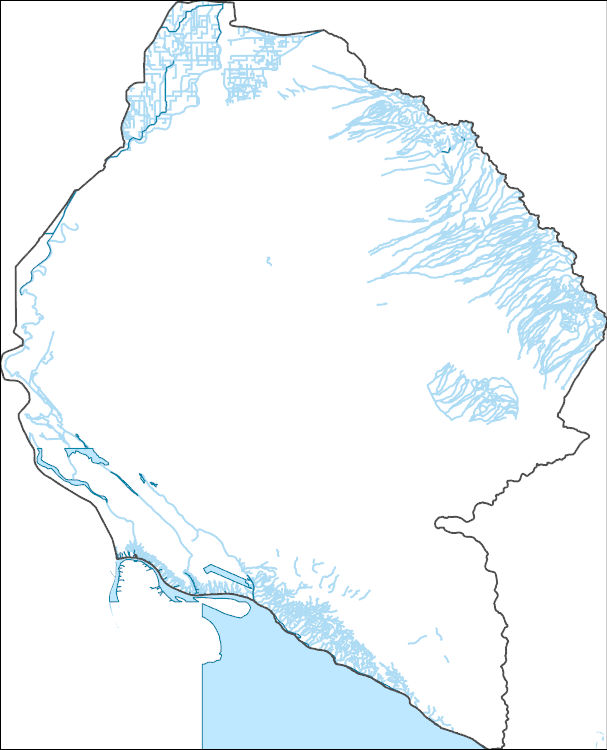
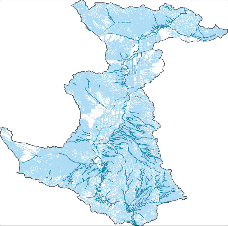
The National Hydrography Dataset (NHD) is a feature-based database that interconnects and uniquely identifies the stream segments or reaches that make up the nation's surface water drainage system. NHD data was originally developed at 1:100,000-scale and exists at that scale for the whole country. This high-resolution NHD, generally developed at 1:24,000/1:12,000 scale, adds detail to the original 1:100,000-scale NHD. (Data for Alaska, Puerto Rico and the Virgin Islands was developed at high-resolution, not 1:100,000 scale.) Local resolution NHD is being developed where partners and data exist. The NHD contains reach codes for networked features, flow direction, names, and centerline representations for areal water...
Tags: AZ,
Administrative watershed units,
Administrative watershed units,
Area of Complex Channels,
Area to be submerged, All tags...
Arizona,
Basin,
Basin,
Bay/Inlet,
Boundaries,
Boundary,
Bridge,
CA,
California,
Canal/Ditch,
Coastline,
Connector,
Dam/Weir,
Downloadable Data,
Drainage areas for surface water,
Drainageway,
Estuary,
Flow direction network,
Flume,
ForeShore,
Gaging Station,
Gate,
GeoPackage,
HU-8,
HU-8 Subbasin,
HU10,
HU12,
HU14,
HU16,
HU2,
HU4,
HU6,
HU8,
HU8_15030104,
HUC,
Hazard Zone,
Hydrographic,
Hydrography,
Hydrography,
Hydrography,
Hydrologic Unit Code,
Hydrologic Units,
Ice mass,
Imperial,
Inundation Area,
La Paz,
Levee,
Line,
Lock Chamber,
Marsh,
National Hydrography Dataset (NHD),
National Hydrography Dataset (NHD) Best Resolution,
National Hydrography Dataset (NHD) Best Resolution,
Nonearthen Shore,
Open Geospatial Consortium GeoPackage 1.2,
Orthoimage,
Playa,
Point,
PointEvent,
Pond,
Rapids,
Rapids,
Reach,
Reach code,
Reef,
Region,
Reservoir,
Riverside,
Rock,
San Bernardino,
Sea/Ocean,
Sink/Rise,
Sounding Datum Line,
Special Use Zone,
Special Use Zone Limit,
Spillway,
Stream,
Stream/River,
Sub-basin,
Sub-region,
Subbasin,
Submerged Stream,
Subregion,
Subwatershed,
Surface water systems,
Swamp,
Topographic,
Tunnel,
US,
Underground Conduit,
United States,
WBD,
WBD,
Wall,
Wash,
Water Intake Outflow,
Waterfall,
Watershed,
Watershed Boundaries,
Watershed Boundary Dataset,
Watershed Boundary Dataset,
Well,
Yuma,
artificial path,
boundaries,
dams,
drainage systems and characteristics,
inlandWaters,
lakes,
ngda,
rivers, Fewer tags
The National Hydrography Dataset (NHD) is a feature-based database that interconnects and uniquely identifies the stream segments or reaches that make up the nation's surface water drainage system. NHD data was originally developed at 1:100,000-scale and exists at that scale for the whole country. This high-resolution NHD, generally developed at 1:24,000/1:12,000 scale, adds detail to the original 1:100,000-scale NHD. (Data for Alaska, Puerto Rico and the Virgin Islands was developed at high-resolution, not 1:100,000 scale.) Local resolution NHD is being developed where partners and data exist. The NHD contains reach codes for networked features, flow direction, names, and centerline representations for areal water...
Tags: AZ,
Administrative watershed units,
Administrative watershed units,
Area of Complex Channels,
Area to be submerged, All tags...
Arizona,
Basin,
Basin,
Bay/Inlet,
Boundaries,
Boundary,
Bridge,
Canal/Ditch,
Coastline,
Connector,
Dam/Weir,
Downloadable Data,
Drainage areas for surface water,
Drainageway,
Esri Shapefile nan,
Estuary,
Flow direction network,
Flume,
ForeShore,
Gaging Station,
Gate,
HU-8,
HU-8 Subbasin,
HU10,
HU12,
HU14,
HU16,
HU2,
HU4,
HU6,
HU8,
HU8_15030108,
HUC,
Hazard Zone,
Hydrographic,
Hydrography,
Hydrography,
Hydrography,
Hydrologic Unit Code,
Hydrologic Units,
Ice mass,
Inundation Area,
Levee,
Line,
Lock Chamber,
Marsh,
National Hydrography Dataset (NHD),
National Hydrography Dataset (NHD) Best Resolution,
National Hydrography Dataset (NHD) Best Resolution,
Nonearthen Shore,
Orthoimage,
Playa,
Point,
PointEvent,
Pond,
Rapids,
Rapids,
Reach,
Reach code,
Reef,
Region,
Reservoir,
Rock,
Sea/Ocean,
Shapefile,
Sink/Rise,
Sounding Datum Line,
Special Use Zone,
Special Use Zone Limit,
Spillway,
Stream,
Stream/River,
Sub-basin,
Sub-region,
Subbasin,
Submerged Stream,
Subregion,
Subwatershed,
Surface water systems,
Swamp,
Topographic,
Tunnel,
US,
Underground Conduit,
United States,
WBD,
WBD,
Wall,
Wash,
Water Intake Outflow,
Waterfall,
Watershed,
Watershed Boundaries,
Watershed Boundary Dataset,
Watershed Boundary Dataset,
Well,
Yuma,
artificial path,
boundaries,
dams,
drainage systems and characteristics,
inlandWaters,
lakes,
ngda,
rivers, Fewer tags
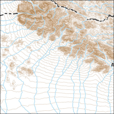
Layers of geospatial data include contours, boundaries, land cover, hydrography, roads, transportation, geographic names, structures, and other selected map features.
Types: Citation;
Tags: 7.5 x 7.5 minute,
7_5_Min,
AZ,
Arizona,
Combined Vector, All tags...
Combined Vector,
Combined Vector,
Downloadable Data,
Esri File GeoDatabase 10,
FileGDB,
Public Land Survey System,
Topo Map Vector Data,
US,
United States,
Yuma,
boundary,
contours,
geographic names,
hydrography,
structures,
transportation,
woodland, Fewer tags

Geospatial data is comprised of government boundaries.
Types: Citation;
Tags: AZ,
Apache,
Arizona,
Boundaries,
Cochise, All tags...
Coconino,
County or Equivalent,
Downloadable Data,
Esri File GeoDatabase 10,
FileGDB,
Gila,
Graham,
Greenlee,
Incorporated Place,
Jurisdictional,
La Paz,
Maricopa,
Minor Civil Division,
Mohave,
National Boundary Dataset (NBD),
National Boundary Dataset (NBD),
Native American Area,
Navajo,
PLSS First Division,
PLSS Special Survey,
PLSS Township,
Pima,
Pinal,
Public Land Survey System,
Reserve,
Santa Cruz,
State,
State,
State or Territory,
U.S. National Grid,
US,
Unincorporated Place,
United States,
Yavapai,
Yuma,
boundaries,
boundary,
cadastral surveys,
geographic names,
land ownership,
land use maps,
legal land descriptions,
political and administrative boundaries,
zoning maps, Fewer tags

The Watershed Boundary Dataset (WBD) is a comprehensive aggregated collection of hydrologic unit data consistent with the national criteria for delineation and resolution. It defines the areal extent of surface water drainage to a point except in coastal or lake front areas where there could be multiple outlets as stated by the "Federal Standards and Procedures for the National Watershed Boundary Dataset (WBD)" "Standard" (https://pubs.usgs.gov/tm/11/a3/). Watershed boundaries are determined solely upon science-based hydrologic principles, not favoring any administrative boundaries or special projects, nor particular program or agency. This dataset represents the hydrologic unit boundaries to the 12-digit (6th level)...
Tags: 10-digit,
12-digit,
14-digit,
16-digit,
2-digit, All tags...
4-digit,
6-digit,
8-digit,
Adair,
Adams,
Albany,
Allen,
Anderson,
Andrew,
Antelope,
Appanoose,
Arapahoe,
Arthur,
Atchison,
Audrain,
Audubon,
Aurora,
Banner,
Barnes,
Barton,
Basin,
Bates,
Beadle,
Beaverhead,
Bennett,
Benton,
Big Horn,
Billings,
Blaine,
Bon Homme,
Boone,
Boulder,
Bourbon,
Bowman,
Box Butte,
Boyd,
Broadwater,
Brookings,
Broomfield,
Brown,
Brule,
Buchanan,
Buena Vista,
Buffalo,
Burke,
Burleigh,
Burt,
Butler,
Butte,
CO,
Caldwell,
Callaway,
Camden,
Campbell,
Carbon,
Carroll,
Carter,
Cascade,
Cass,
Cedar,
Chaffee,
Chariton,
Charles Mix,
Chase,
Cherokee,
Cherry,
Cheyenne,
Chouteau,
Christian,
Clark,
Clarke,
Clay,
Clear Creek,
Clinton,
Cloud,
Codington,
Coffey,
Cole,
Colfax,
Colorado,
Converse,
Cooper,
Corson,
Crawford,
Crook,
Cuming,
Custer,
Dade,
Dakota,
Dallas,
Daniels,
Daviess,
Davis,
Davison,
Dawes,
Dawson,
Day,
DeKalb,
Decatur,
Deer Lodge,
Dent,
Denver,
Deuel,
Dewey,
Dickey,
Dickinson,
Divide,
Dixon,
Dodge,
Doniphan,
Douglas,
Downloadable Data,
Dundy,
Dunn,
Eddy,
Edmunds,
El Paso,
Elbert,
Ellis,
Ellsworth,
Emmet,
Emmons,
Fall River,
Fallon,
Faulk,
Fergus,
Fillmore,
Flathead,
Foster,
Franklin,
Fremont,
Frontier,
Furnas,
Gage,
Gallatin,
Garden,
Garfield,
Gasconade,
Geary,
Gentry,
GeoPackage,
Gilpin,
Glacier,
Golden Valley,
Goshen,
Gosper,
Gove,
Graham,
Grand,
Granite,
Grant,
Greeley,
Greene,
Gregory,
Grundy,
Guthrie,
HU-2,
HU-2 Region,
HU2_10,
HUC,
Haakon,
Hall,
Hamilton,
Hamlin,
Hand,
Hanson,
Harding,
Harlan,
Harrison,
Hayes,
Henry,
Hettinger,
Hickory,
Hill,
Hitchcock,
Holt,
Hooker,
Hot Springs,
Howard,
Howell,
Hughes,
Hutchinson,
Hyde,
Hydrography,
Hydrologic Unit Code,
Hydrologic Units,
IA,
ID,
Ida,
Idaho,
Iowa,
Jackson,
Jefferson,
Jerauld,
Jewell,
Johnson,
Jones,
Judith Basin,
KS,
Kansas,
Kearney,
Keith,
Keya Paha,
Kidder,
Kimball,
Kingsbury,
Kit Carson,
Knox,
LaMoure,
Laclede,
Lafayette,
Lake,
Lancaster,
Lane,
Laramie,
Larimer,
Lawrence,
Leavenworth,
Lemhi,
Lewis and Clark,
Liberty,
Lincoln,
Linn,
Livingston,
Logan,
Loup,
Lucas,
Lyman,
Lyon,
MN,
MO,
MT,
Macon,
Madison,
Maries,
Marion,
Marshall,
McCone,
McCook,
McHenry,
McIntosh,
McKenzie,
McLean,
McPherson,
Meade,
Meagher,
Mellette,
Mercer,
Merrick,
Miami,
Miller,
Mills,
Miner,
Minnehaha,
Minnesota,
Missouri,
Mitchell,
Moniteau,
Monona,
Monroe,
Montana,
Montgomery,
Moody,
Morgan,
Morrill,
Morris,
Morton,
Mountrail,
Murray,
Musselshell,
ND,
NE,
Nance,
National Watershed Boundary Dataset (WBD),
National Watershed Boundary Dataset (WBD),
Natrona,
Nebraska,
Nemaha,
Ness,
Niobrara,
Nobles,
Nodaway,
North Dakota,
Norton,
Nuckolls,
O'Brien,
Oglala Lakota,
Oliver,
Open Geospatial Consortium GeoPackage 1.2,
Osage,
Osborne,
Osceola,
Otoe,
Ottawa,
Page,
Palo Alto,
Park,
Pawnee,
Pennington,
Perkins,
Petroleum,
Pettis,
Phelps,
Phillips,
Pierce,
Pipestone,
Platte,
Plymouth,
Polk,
Pondera,
Pottawatomie,
Pottawattamie,
Potter,
Powder River,
Powell,
Prairie,
Pulaski,
Putnam,
Randolph,
Ransom,
Ravalli,
Rawlins,
Ray,
Red Willow,
Region,
Republic,
Rice,
Richardson,
Richland,
Riley,
Ringgold,
Roberts,
Rock,
Rooks,
Roosevelt,
Rosebud,
Routt,
Rush,
Russell,
SD,
Sac,
Saline,
Sanborn,
Sargent,
Sarpy,
Saunders,
Schuyler,
Scott,
Scotts Bluff,
Sedgwick,
Seward,
Shawnee,
Shelby,
Sheridan,
Sherman,
Silver Bow,
Sioux,
Slope,
Smith,
South Dakota,
Spink,
St. Charles,
St. Clair,
St. Louis,
Stanley,
Stanton,
Stark,
Stillwater,
Stutsman,
Sub-basin,
Sub-region,
Sublette,
Subwatershed,
Sullivan,
Sully,
Summit,
Sweet Grass,
Sweetwater,
Taylor,
Teller,
Teton,
Texas,
Thayer,
Thomas,
Thurston,
Todd,
Toole,
Treasure,
Trego,
Tripp,
Turner,
US,
Union,
United States,
Valley,
Vernon,
WBD,
WY,
Wabaunsee,
Wallace,
Walworth,
Ward,
Warren,
Washakie,
Washington,
Watershed,
Watershed Boundary Dataset,
Wayne,
Webster,
Weld,
Wells,
Weston,
Wheatland,
Wheeler,
Wibaux,
Wichita,
Williams,
Woodbury,
Worth,
Wright,
Wyandotte,
Wyoming,
Yankton,
Yellowstone,
York,
Yuma,
Ziebach,
inlandWaters, Fewer tags

The Geographic Names Information System (GNIS) is the Federal standard for geographic nomenclature. The U.S. Geological Survey developed the GNIS for the U.S. Board on Geographic Names, a Federal inter-agency body chartered by public law to maintain uniform feature name usage throughout the Government and to promulgate standard names to the public. The GNIS is the official repository of domestic geographic names data; the official vehicle for geographic names use by all departments of the Federal Government; and the source for applying geographic names to Federal electronic and printed products of all types.
Tags: Adams,
Alamosa,
Antarctica,
Antarctica,
Arapahoe, All tags...
Archuleta,
BGN,
Baca,
Bent,
Board on Geographic Names,
Borough,
Boulder,
Broomfield,
CO,
Census Area,
Chaffee,
Cheyenne,
Clear Creek,
Colorado,
Commonwealth,
Conejos,
Costilla,
County,
Crowley,
Custer,
Delta,
Denver,
District,
Dolores,
Douglas,
Downloadable Data,
Eagle,
El Paso,
Elbert,
Feature class,
Feature coordinates,
Feature county,
Feature description,
Feature designation,
Feature history,
Feature indentification,
Feature name,
Feature state,
Fremont,
GNIS,
Garfield,
Geographic Names,
Geographic Names Domestic Names,
Geographic Names Information System,
Geographic feature,
Geographic name,
Geographical feature,
Geographical name,
Gilpin,
Grand,
Gunnison,
Hinsdale,
Huerfano,
Jackson,
Jefferson,
Kiowa,
Kit Carson,
La Plata,
Lake,
Larimer,
Las Animas,
Lincoln,
Logan,
Mesa,
Mineral,
Moffat,
Montezuma,
Montrose,
Morgan,
Municipio,
National Geographic Names Information System (GNIS),
National Geographic Names Information System (GNIS),
Official feature name,
Otero,
Ouray,
Outlying Area,
Parish,
Park,
Phillips,
Pitkin,
Place name,
Populated Place,
Prowers,
Pueblo,
Rio Blanco,
Rio Grande,
Routt,
Saguache,
San Juan,
San Miguel,
Sedgwick,
State,
Summit,
TXT (pipes),
Teller,
Territories,
Territory,
Topographic Map,
U.S. Board on Geographic Names,
U.S. Geological Survey,
US,
USA,
USBGN,
USGS,
UTF-8 Pipe Delimited Text File nan,
United States,
United States,
United States,
Variant name,
Washington,
Weld,
Yuma,
antarctic,
database,
economy,
environment,
feature,
gazetteer,
geographic,
geographic names,
geographical,
geography,
geospatial,
imageryBaseMapsEarthCover,
inlandWaters,
location,
map,
name,
place,
placename,
society,
structure,
topographic map,
toponymy, Fewer tags

These data were compiled for evaluating plant water use, or river-reach level evapotranspiration (ET) data, in the riparian corridor of the Colorado River delta as specified under Minute 319 of the 1944 Water Treaty. Additionally, these data were compiled for evaluating restoration-level data in Reach 2 and Reach 4, as specified under Minute 323 of the 1944 Water Treaty. Objectives of our study were to measure the peak growing season evapotranspiration (ET) for the average of months in summer-fall (May to October) for the seven reaches, for the full riparian corridor, and for four restoration sites, from 2013 through 2022. The seven reach areas from the Northerly International Boundary (NIB) to the end of the delta...
Tags: 1944 Water Treaty,
Arizona,
Botany,
Colorado River,
Colorado River delta, All tags...
Ecology,
Geography,
Gulf of California,
Information Sciences,
International Boundary,
Land Use Change,
Landsat images,
Landsat time series,
Lower Colorado River delta,
Mexico,
Mexico,
Minute 319,
Minute 323,
Morelos Dam,
Remote Sensing,
San Luis,
USGS Science Data Catalog (SDC),
Yuma,
actual ET (ETa) in mm/day,
average growing season daily ET,
biogeography,
biota,
climatologyMeteorologyAtmosphere,
data release,
ecosystem monitoring,
enhanced vegetation index 2 (EVI2),
environment,
evapotranspiration,
evapotranspiration (ET) data,
geoscientificInformation,
geospatial datasets,
greenness (EVI2),
image collections,
imageryBaseMapsEarthCover,
inlandWaters,
land use and land cover,
land use change,
meteorological station data,
peak growing season evapotranspiration,
peak-season daily water use,
plant water use,
precipitation (atmospheric),
remediation,
remote sensing,
restoration,
riparian community,
riparian corridor,
riparian ecosystem,
riparian vegetation,
riparian woodland ecosystem,
riparian zones,
river ecosystems,
seaonal mean difference,
time series datasets,
vegetation,
vegetation greeness index (EVI2),
water use,
water use,
wetland ecosystems, Fewer tags
The National Hydrography Dataset (NHD) is a feature-based database that interconnects and uniquely identifies the stream segments or reaches that make up the nation's surface water drainage system. NHD data was originally developed at 1:100,000-scale and exists at that scale for the whole country. This high-resolution NHD, generally developed at 1:24,000/1:12,000 scale, adds detail to the original 1:100,000-scale NHD. (Data for Alaska, Puerto Rico and the Virgin Islands was developed at high-resolution, not 1:100,000 scale.) Local resolution NHD is being developed where partners and data exist. The NHD contains reach codes for networked features, flow direction, names, and centerline representations for areal water...
Tags: AZ,
Administrative watershed units,
Administrative watershed units,
Area of Complex Channels,
Area to be submerged, All tags...
Arizona,
Basin,
Basin,
Bay/Inlet,
Boundaries,
Boundary,
Bridge,
CA,
California,
Canal/Ditch,
Coastline,
Connector,
Dam/Weir,
Downloadable Data,
Drainage areas for surface water,
Drainageway,
Esri File GeoDatabase 10,
Estuary,
FileGDB,
Flow direction network,
Flume,
ForeShore,
Gaging Station,
Gate,
HU-8,
HU-8 Subbasin,
HU10,
HU12,
HU14,
HU16,
HU2,
HU4,
HU6,
HU8,
HU8_15030104,
HUC,
Hazard Zone,
Hydrographic,
Hydrography,
Hydrography,
Hydrography,
Hydrologic Unit Code,
Hydrologic Units,
Ice mass,
Imperial,
Inundation Area,
La Paz,
Levee,
Line,
Lock Chamber,
Marsh,
National Hydrography Dataset (NHD),
National Hydrography Dataset (NHD) Best Resolution,
National Hydrography Dataset (NHD) Best Resolution,
Nonearthen Shore,
Orthoimage,
Playa,
Point,
PointEvent,
Pond,
Rapids,
Rapids,
Reach,
Reach code,
Reef,
Region,
Reservoir,
Riverside,
Rock,
San Bernardino,
Sea/Ocean,
Sink/Rise,
Sounding Datum Line,
Special Use Zone,
Special Use Zone Limit,
Spillway,
Stream,
Stream/River,
Sub-basin,
Sub-region,
Subbasin,
Submerged Stream,
Subregion,
Subwatershed,
Surface water systems,
Swamp,
Topographic,
Tunnel,
US,
Underground Conduit,
United States,
WBD,
WBD,
Wall,
Wash,
Water Intake Outflow,
Waterfall,
Watershed,
Watershed Boundaries,
Watershed Boundary Dataset,
Watershed Boundary Dataset,
Well,
Yuma,
artificial path,
boundaries,
dams,
drainage systems and characteristics,
inlandWaters,
lakes,
ngda,
rivers, Fewer tags

The National Hydrography Dataset (NHD) is a feature-based database that interconnects and uniquely identifies the stream segments or reaches that make up the nation's surface water drainage system. NHD data was originally developed at 1:100,000-scale and exists at that scale for the whole country. This high-resolution NHD, generally developed at 1:24,000/1:12,000 scale, adds detail to the original 1:100,000-scale NHD. (Data for Alaska, Puerto Rico and the Virgin Islands was developed at high-resolution, not 1:100,000 scale.) Local resolution NHD is being developed where partners and data exist. The NHD contains reach codes for networked features, flow direction, names, and centerline representations for areal water...
Tags: AZ,
Administrative watershed units,
Administrative watershed units,
Area of Complex Channels,
Area to be submerged, All tags...
Arizona,
Basin,
Basin,
Bay/Inlet,
Boundaries,
Boundary,
Bridge,
CA,
California,
Canal/Ditch,
Coastline,
Connector,
Dam/Weir,
Downloadable Data,
Drainage areas for surface water,
Drainageway,
Esri Shapefile nan,
Estuary,
Flow direction network,
Flume,
ForeShore,
Gaging Station,
Gate,
HU-8,
HU-8 Subbasin,
HU10,
HU12,
HU14,
HU16,
HU2,
HU4,
HU6,
HU8,
HU8_15030104,
HUC,
Hazard Zone,
Hydrographic,
Hydrography,
Hydrography,
Hydrography,
Hydrologic Unit Code,
Hydrologic Units,
Ice mass,
Imperial,
Inundation Area,
La Paz,
Levee,
Line,
Lock Chamber,
Marsh,
National Hydrography Dataset (NHD),
National Hydrography Dataset (NHD) Best Resolution,
National Hydrography Dataset (NHD) Best Resolution,
Nonearthen Shore,
Orthoimage,
Playa,
Point,
PointEvent,
Pond,
Rapids,
Rapids,
Reach,
Reach code,
Reef,
Region,
Reservoir,
Riverside,
Rock,
San Bernardino,
Sea/Ocean,
Shapefile,
Sink/Rise,
Sounding Datum Line,
Special Use Zone,
Special Use Zone Limit,
Spillway,
Stream,
Stream/River,
Sub-basin,
Sub-region,
Subbasin,
Submerged Stream,
Subregion,
Subwatershed,
Surface water systems,
Swamp,
Topographic,
Tunnel,
US,
Underground Conduit,
United States,
WBD,
WBD,
Wall,
Wash,
Water Intake Outflow,
Waterfall,
Watershed,
Watershed Boundaries,
Watershed Boundary Dataset,
Watershed Boundary Dataset,
Well,
Yuma,
artificial path,
boundaries,
dams,
drainage systems and characteristics,
inlandWaters,
lakes,
ngda,
rivers, Fewer tags
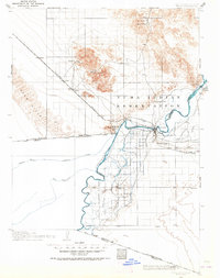
USGS Historical Quadrangle in GeoPDF.
Tags: 30 x 30 minute,
CA,
Downloadable Data,
GeoPDF,
GeoTIFF, All tags...
Historical Topographic Maps,
Historical Topographic Maps 30 x 30 Minute Map Series,
Map,
Yuma,
imageryBaseMapsEarthCover, Fewer tags
|
|

