Filters: Tags: alkalinity (X)
48 results (65ms)|
Filters
Date Range
Extensions (Less) Types (Less) Contacts (Less)
Categories (Less) Tag Types
|
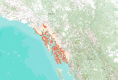
This dataset represents the soil pH from SSURGO and STATSGO soil descriptions for soil map units in the state of southern Alaska that lie within the North Pacific Landscape Conservation Cooperative.
These data were released prior to the October 1, 2016 effective date for the USGS’s policy dictating the review, approval, and release of scientific data as referenced in USGS Survey Manual Chapter 502.8 Fundamental Science Practices: Review and Approval of Scientific Data for Release. This map shows specific water-quality items and hydrologic data site information which come from QWDATA (Water Quality) and GWSI (Ground Water Information System). Both QWDATA and GWSI are subsystems of NWIS (National Water Inventory System)of the USGS (United States Geologic Survey). This map is for Uintah County, Utah. The scope and purpose of NWIS is defined on the web site: http://water.usgs.gov/public/pubs/FS/FS-027-98/
These data were released prior to the October 1, 2016 effective date for the USGS’s policy dictating the review, approval, and release of scientific data as referenced in USGS Survey Manual Chapter 502.8 Fundamental Science Practices: Review and Approval of Scientific Data for Release. This map shows specific water-quality items and hydrologic data site information which come from QWDATA (Water Quality) and GWSI (Ground Water Information System). Both QWDATA and GWSI are subsystems of NWIS (National Water Inventory System)of the USGS (United States Geologic Survey). This map is for Daggett County, Utah. The scope and purpose of NWIS is defined on the web site: http://water.usgs.gov/public/pubs/FS/FS-027-98/
This product consists of one tabular dataset and associated metadata of water quality information related to rivers, streams, and reservoirs in the Upper Mississippi River watershed between 2012 and 2016. This data release is a part of a national assessment of freshwater aquatic carbon fluxes. Data consist of organic and inorganic carbon related species, carbon dioxide and methane gas fluxes calculated from manual chamber measurements, nitrogen species, carbon isotopes, oxygen isotopes, cations, anions, trace metals, and various in situ measurements including: pH, water temperature, air temperature, barometric pressure, dissolved oxygen, turbidity, fluorescent dissolved organic matter, and specific conductance....
Categories: Data,
Project;
Types: Map Service,
OGC WFS Layer,
OGC WMS Layer,
OGC WMS Service;
Tags: Carbon,
Fluorescent Dissolved Organic Matter (fDOM),
Minnesota,
Shingobee,
Shingobee Headwaters Aquatic Ecosystems Project,
Data provided here describe geochemical correction of carbon-14 in dissolved inorganic carbon (DIC) for groundwater age dating. Datasets include major ion chemistry of groundwater samples, model parameter inputs, and final corrected carbon-14 in DIC. Geochemical correction was completed in two phases: determination of reactive phase mole transfers through an inverse geochemical model (PHREEQC; Parkhurst and Appleo, 1992) and tracking of isotopic mass transfer among phases (NetpathXL; Parkhusrtand Charlton, 2008). Parkhurst, D.L., and Appelo, C.A.J., 2013, Description of input and examples for PHREEQC version 3—A computer program for speciation, batch-reaction, one-dimensional transport, and inverse geochemical...
These data were released prior to the October 1, 2016 effective date for the USGS’s policy dictating the review, approval, and release of scientific data as referenced in USGS Survey Manual Chapter 502.8 Fundamental Science Practices: Review and Approval of Scientific Data for Release. This map shows specific water-quality items and hydrologic data site information which come from QWDATA (Water Quality) and GWSI (Ground Water Information System). Both QWDATA and GWSI are subsystems of NWIS (National Water Inventory System)of the USGS (United States Geologic Survey). This map is for Davis County, Utah. The scope and purpose of NWIS is defined on the web site: http://water.usgs.gov/public/pubs/FS/FS-027-98/
These data were released prior to the October 1, 2016 effective date for the USGS’s policy dictating the review, approval, and release of scientific data as referenced in USGS Survey Manual Chapter 502.8 Fundamental Science Practices: Review and Approval of Scientific Data for Release. This map shows specific water-quality items and hydrologic data site information which come from QWDATA (Water Quality) and GWSI (Ground Water Information System). Both QWDATA and GWSI are subsystems of NWIS (National Water Inventory System)of the USGS (United States Geologic Survey). This map is for Grand County, Utah. The scope and purpose of NWIS is defined on the web site: http://water.usgs.gov/public/pubs/FS/FS-027-98/
These data were released prior to the October 1, 2016 effective date for the USGS’s policy dictating the review, approval, and release of scientific data as referenced in USGS Survey Manual Chapter 502.8 Fundamental Science Practices: Review and Approval of Scientific Data for Release. This map shows specific water-quality items and hydrologic data site information which come from QWDATA (Water Quality) and GWSI (Ground Water Information System). Both QWDATA and GWSI are subsystems of NWIS (National Water Inventory System)of the USGS (United States Geologic Survey). This map is for Tooele County, Utah. The scope and purpose of NWIS is defined on the web site: http://water.usgs.gov/public/pubs/FS/FS-027-98/
These data were released prior to the October 1, 2016 effective date for the USGS’s policy dictating the review, approval, and release of scientific data as referenced in USGS Survey Manual Chapter 502.8 Fundamental Science Practices: Review and Approval of Scientific Data for Release. This map shows specific water-quality items and hydrologic data site information which come from QWDATA (Water Quality) and GWSI (Ground Water Information System). Both QWDATA and GWSI are subsystems of NWIS (National Water Inventory System)of the USGS (United States Geologic Survey). This map is for Wayne County, Utah. The scope and purpose of NWIS is defined on the web site: http://water.usgs.gov/public/pubs/FS/FS-027-98/
Much of the biogeochemical cycling research in catchments in the past 25 years has been driven by acid deposition research funding. This research has focused on vulnerable base-poor systems; catchments on alkaline lithologies have received little attention. In regions of high acid loadings, however, even well-buffered catchments are susceptible to forest decline and episodes of low alkalinity in streamwater. As part of a collaboration between the Czech and U.S. Geological Surveys, we compared biogeochemical patterns in two well-studied, well-buffered catchments: Pluhuv Bor in the western Czech Republic, which has received high loading of atmospheric acidity, and Sleepers River Research Watershed in Vermont, U.S.A.,...
Categories: Publication;
Types: Citation;
Tags: acidification,
alkalinity,
base cations,
buffering,
ca
These data were released prior to the October 1, 2016 effective date for the USGS’s policy dictating the review, approval, and release of scientific data as referenced in USGS Survey Manual Chapter 502.8 Fundamental Science Practices: Review and Approval of Scientific Data for Release. This map shows specific water-quality items and hydrologic data site information which come from QWDATA (Water Quality) and GWSI (Ground Water Information System). Both QWDATA and GWSI are subsystems of NWIS (National Water Inventory System)of the USGS (United States Geologic Survey). This map is for Boxelder County, Utah. The scope and purpose of NWIS is defined on the web site: http://water.usgs.gov/public/pubs/FS/FS-027-98/
This product consists of multiple tabular datasets and associated metadata of water quality information related to rivers, streams, and lakes in the Yukon River watershed between 2014 and 2018. This data release is apart of the National Aeronautics and Space Administration (NASA) funded Arctic-Boreal Vulnerability Experiment (ABoVE) and is an assessment of water quality and greenhouse gas fluxes within the interior of Alaska. Sampling frequency varied across locations, with some sites sampled twice a year or more. Data consist of: organic and inorganic carbon related species, carbon dioxide and methane gas fluxes calculated from manual chamber measurements, nitrogen species, carbon isotopes, oxygen and deuterium...
Categories: Data;
Types: Data,
Map Service,
OGC WFS Layer,
OGC WMS Layer,
OGC WMS Service;
Tags: Alaska,
Boot Lake,
CH4,
CO2,
CO2 Bubble Trap,
In 1991, the U.S. Geological Survey (USGS) began a study of more than 50 major river basins across the Nation as part of the National Water-Quality Assessment (NAWQA) project. One of the major goals of the NAWQA project was to determine how river water quality has changed over time. To support that goal, long-term consistent and comparable monitoring has been conducted by the USGS on streams and rivers throughout the Nation. Outside of the NAWQA project, the USGS and other Federal, State, and local agencies also have collected long-term water-quality data to support their own assessments of changing water quality. In 2017, data from these multiple sources were combined to support one of the most comprehensive assessments...
This U.S. Geological Survey (USGS) Data Release provides discrete water-quality data collected from four sites on the Kansas River and four of its tributaries during July 2012 through September 2016. The water-quality constituents included in this data release are the cyanotoxins microcystin and cylindrospermopsin, the taste-and-odor compounds geosmin and 2-methylisoborneol, major ions, alkalinity, nutrients, suspended sediment, indicator bacteria, and actinomycetes bacteria.
Categories: Data;
Types: Citation;
Tags: 2-methylisoborneol,
Actinomycetes bacteria,
Alkalinity,
Big Blue River nr Manhattan, KS,
Chlorophyll,
This U.S. Geological Survey (USGS) Data Release is focused on the geochemistry of wastewater (including flowback and produced water) samples, co-produced with natural gas, collected from the Marcellus Shale Energy and Environment Laboratory (MSEEL) site. MSEEL is a long-term field site and laboratory at the Northeast Natural Energy LLC (NNE) production facility, adjacent to the Monongahela River, located in western Monongalia County, West Virginia, USA. NNE began drilling two horizontal production wells, MIP (Morgantown Industrial Park) -5H and MIP-3H, in the Marcellus Shale in 2014. The wells were completed in December 2015. Large volumes of wastewater are generated with natural gas production. These wastewaters...
These data were released prior to the October 1, 2016 effective date for the USGS’s policy dictating the review, approval, and release of scientific data as referenced in USGS Survey Manual Chapter 502.8 Fundamental Science Practices: Review and Approval of Scientific Data for Release. This map shows specific water-quality items and hydrologic data site information which come from QWDATA (Water Quality) and GWSI (Ground Water Information System). Both QWDATA and GWSI are subsystems of NWIS (National Water Inventory System)of the USGS (United States Geologic Survey). This map is for Garfield County, Utah. The scope and purpose of NWIS is defined on the web site: http://water.usgs.gov/public/pubs/FS/FS-027-98/
These data were released prior to the October 1, 2016 effective date for the USGS’s policy dictating the review, approval, and release of scientific data as referenced in USGS Survey Manual Chapter 502.8 Fundamental Science Practices: Review and Approval of Scientific Data for Release. This map shows specific water-quality items and hydrologic data site information which come from QWDATA (Water Quality) and GWSI (Ground Water Information System). Both QWDATA and GWSI are subsystems of NWIS (National Water Inventory System)of the USGS (United States Geologic Survey). This map is for Cache County, Utah. The scope and purpose of NWIS is defined on the web site: http://water.usgs.gov/public/pubs/FS/FS-027-98/
These data were released prior to the October 1, 2016 effective date for the USGS’s policy dictating the review, approval, and release of scientific data as referenced in USGS Survey Manual Chapter 502.8 Fundamental Science Practices: Review and Approval of Scientific Data for Release. This map shows specific water-quality items and hydrologic data site information which come from QWDATA (Water Quality) and GWSI (Ground Water Information System). Both QWDATA and GWSI are subsystems of NWIS (National Water Inventory System)of the USGS (United States Geologic Survey). This map is for Iron County, Utah. The scope and purpose of NWIS is defined on the web site: http://water.usgs.gov/public/pubs/FS/FS-027-98/
These data were released prior to the October 1, 2016 effective date for the USGS’s policy dictating the review, approval, and release of scientific data as referenced in USGS Survey Manual Chapter 502.8 Fundamental Science Practices: Review and Approval of Scientific Data for Release. This map shows specific water-quality items and hydrologic data site information which come from QWDATA (Water Quality) and GWSI (Ground Water Information System). Both QWDATA and GWSI are subsystems of NWIS (National Water Inventory System)of the USGS (United States Geologic Survey). This map is for Sanpete County, Utah. The scope and purpose of NWIS is defined on the web site: http://water.usgs.gov/public/pubs/FS/FS-027-98/
These data were released prior to the October 1, 2016 effective date for the USGS’s policy dictating the review, approval, and release of scientific data as referenced in USGS Survey Manual Chapter 502.8 Fundamental Science Practices: Review and Approval of Scientific Data for Release. This map shows specific water-quality items and hydrologic data site information which come from QWDATA (Water Quality) and GWSI (Ground Water Information System). Both QWDATA and GWSI are subsystems of NWIS (National Water Inventory System)of the USGS (United States Geologic Survey). This map is for Rich County, Utah. The scope and purpose of NWIS is defined on the web site: http://water.usgs.gov/public/pubs/FS/FS-027-98/
|

|
