Filters: Tags: anadromous fish (X)
19 results (58ms)|
Filters
Date Range
Extensions (Less) Types (Less)
Contacts (Less)
Categories (Less) Tag Types
|

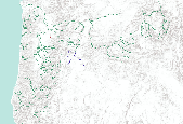
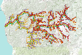
Oregon Fish Habitat Distribution These data describe areas of suitable habitat believed to be used currently by wild, natural, and/or hatchery fish populations. The term "currently" is defined as within the past five reproductive cycles. This information is based on sampling, the best professional opinion of Oregon Dept. of Fish and Wildlife or other natural resources agency staff biologists or modeling (see the fhdBasis field). Due to natural variations in run size, water conditions, or other environmental factors, some habitats identified may not be used annually. These data now comply with the Oregon Fish Habitat Distribution Data Standard that was adopted by the Oregon Geographic Information Council in...

Oregon Fish Habitat Distribution These data describe areas of suitable habitat believed to be used currently by wild, natural, and/or hatchery fish populations. The term "currently" is defined as within the past five reproductive cycles. This information is based on sampling, the best professional opinion of Oregon Dept. of Fish and Wildlife or other natural resources agency staff biologists or modeling (see the fhdBasis field). Due to natural variations in run size, water conditions, or other environmental factors, some habitats identified may not be used annually. These data now comply with the Oregon Fish Habitat Distribution Data Standard that was adopted by the Oregon Geographic Information Council in March,...
The Tongass National Forest has identified resources that are important to stakeholders and vulnerable to climate-related stressors. Cooperators will review an action plan and convene a workshop to be held in Southeast Alaska in 2016. The workshop will foster collaboration between scientists, managers, and stakeholders. Workshop goals include: sharing information about climate-related stressors and effects on NPLCC Priority Resources in the Tongass National Forest; developing strategic priorities for improving understanding, reducing risks, and increasing adaptive capacity and resilience; coordinating support for increasing knowledge and informing resource managers
Categories: Data,
Project;
Types: Map Service,
OGC WFS Layer,
OGC WMS Layer,
OGC WMS Service;
Tags: AK-0,
Alaska,
Anadromous fish,
Applications and Tools,
Change in air temperature and precipitation,
This data set documents the dry mass energy density, distribution, and stomach contents of age-0 chum salmon (Oncorhynchus keta) captured in the Kuskokwim Bay estuary in May and June 2004. The analysis of this data was published in Burrill et al. 2018 (DOI :10.1007/s00300-018-2297-2.).

Oregon Fish Habitat Distribution These data describe areas of suitable habitat believed to be used currently by wild, natural, and/or hatchery fish populations. The term "currently" is defined as within the past five reproductive cycles. This information is based on sampling, the best professional opinion of Oregon Dept. of Fish and Wildlife or other natural resources agency staff biologists or modeling (see the fhdBasis field). Due to natural variations in run size, water conditions, or other environmental factors, some habitats identified may not be used annually. These data now comply with the Oregon Fish Habitat Distribution Data Standard that was adopted by the Oregon Geographic Information Council in March,...

Oregon Fish Habitat Distribution These data describe areas of suitable habitat believed to be used currently by wild, natural, and/or hatchery fish populations. The term "currently" is defined as within the past five reproductive cycles. This information is based on sampling, the best professional opinion of Oregon Dept. of Fish and Wildlife or other natural resources agency staff biologists or modeling (see the fhdBasis field). Due to natural variations in run size, water conditions, or other environmental factors, some habitats identified may not be used annually. These data now comply with the Oregon Fish Habitat Distribution Data Standard that was adopted by the Oregon Geographic Information Council in March,...
Oregon Fish Habitat Distribution These data describe areas of suitable habitat believed to be used currently by wild, natural, and/or hatchery fish populations. The term "currently" is defined as within the past five reproductive cycles. This information is based on sampling, the best professional opinion of Oregon Dept. of Fish and Wildlife or other natural resources agency staff biologists or modeling (see the fhdBasis field). Due to natural variations in run size, water conditions, or other environmental factors, some habitats identified may not be used annually. These data now comply with the Oregon Fish Habitat Distribution Data Standard that was adopted by the Oregon Geographic Information Council in...
We will translate existing modeled hydroclimatic data into metrics used for water crossing design and replacement. WDFW permits (Hydraulic Code Rules, Chapter 220-110 WAC) and provides technical guidance for construction of hundreds of fish passable culverts, a number which is expected to rise dramatically in response to a 2013 federal court injunction directing the state to repair thousands of culverts that inhibit salmon migration. Current WDFW design guidance does not account for changes in hydrology resulting from climate change. This project will support the development of designs that maintain desired performance (e.g. connectivity benefits to aquatic organisms) throughout water crossings expected life.This...
Categories: Data,
Project;
Types: Map Service,
OGC WFS Layer,
OGC WMS Layer,
OGC WMS Service;
Tags: 2014,
Academics & scientific researchers,
Anadromous fish,
Applications and Tools,
Climate Change,
Known observations and distribution of Pacific Lamprey for Oregon, Washington, and Idaho from the Columbia River Fish and Wildlife Conservation Office managed database on behalf of the PLCI. Observation data includes points for Lampetra species when information provided. Current as of December 2020. Older datasets can be found in the archived data folder. Files available for download: Service Definition file (if downloaded files need to be extracted to then open in desktop programs) Zipped ESRI File Geodatabase, Zipped Shapefiles Layer files for ArcMap and ArcGIS Pro Google Earth kmz files Metadata Online interactive map with these datasets are available: AGOL: DataBasin: https://databasin.org/datasets/a243fb1346ca4258b6388c5f7a90aee4
Categories: Data;
Types: ArcGIS REST Map Service,
ArcGIS Service Definition,
Citation,
Downloadable,
Map Service;
Tags: Anadromous Fish,
Anadromous Fish,
Aquatic Species,
Aquatic Species,
Biota,

Oregon Fish Habitat Distribution These data describe areas of suitable habitat believed to be used currently by wild, natural, and/or hatchery fish populations. The term "currently" is defined as within the past five reproductive cycles. This information is based on sampling, the best professional opinion of Oregon Dept. of Fish and Wildlife or other natural resources agency staff biologists or modeling (see the fhdBasis field). Due to natural variations in run size, water conditions, or other environmental factors, some habitats identified may not be used annually. These data now comply with the Oregon Fish Habitat Distribution Data Standard that was adopted by the Oregon Geographic Information Council in March,...

Oregon Fish Habitat Distribution These data describe areas of suitable habitat believed to be used currently by wild, natural, and/or hatchery fish populations. The term "currently" is defined as within the past five reproductive cycles. This information is based on sampling, the best professional opinion of Oregon Dept. of Fish and Wildlife or other natural resources agency staff biologists or modeling (see the fhdBasis field). Due to natural variations in run size, water conditions, or other environmental factors, some habitats identified may not be used annually. These data now comply with the Oregon Fish Habitat Distribution Data Standard that was adopted by the Oregon Geographic Information Council in...

Group layer of areas of suitable habitat believed to be used by wild, natural, and/or hatchery fish populations by anadromous fish species.

Oregon Fish Habitat Distribution These data describe areas of suitable habitat believed to be used currently by wild, natural, and/or hatchery fish populations. The term "currently" is defined as within the past five reproductive cycles. This information is based on sampling, the best professional opinion of Oregon Dept. of Fish and Wildlife or other natural resources agency staff biologists or modeling (see the fhdBasis field). Due to natural variations in run size, water conditions, or other environmental factors, some habitats identified may not be used annually. These data now comply with the Oregon Fish Habitat Distribution Data Standard that was adopted by the Oregon Geographic Information Council in March,...

Oregon Fish Habitat Distribution These data describe areas of suitable habitat believed to be used currently by wild, natural, and/or hatchery fish populations. The term "currently" is defined as within the past five reproductive cycles. This information is based on sampling, the best professional opinion of Oregon Dept. of Fish and Wildlife or other natural resources agency staff biologists or modeling (see the fhdBasis field). Due to natural variations in run size, water conditions, or other environmental factors, some habitats identified may not be used annually. These data now comply with the Oregon Fish Habitat Distribution Data Standard that was adopted by the Oregon Geographic Information Council in...
This project will assess impacts of climate change on stream resources by considering the role of thermal heterogeneity and altered hydrologic regimes. The project will look at streams in Washington, Oregon, and California to develop a case study that stream stewards and conservation planners can use to assess vulnerability for Pacific salmon.Successful adaptation strategies for freshwater biota will consider how spatial patterns in water temperature may respond to climate change. Using remotely sensed spatially continuous maximum water temperature data for~ 30 large rivers throughout the lower portion of the NPLCC, we will map locations of cold water patches, identify potential hydroclimatic and landscape drivers,...
Categories: Data,
Project;
Types: Map Service,
OGC WFS Layer,
OGC WMS Layer,
OGC WMS Service;
Tags: 2014,
Academics & scientific researchers,
Anadromous fish,
Applications and Tools,
California,
The Cascadia Partner Forum fosters a network of natural resource practitioners working with the Great Northern and North Pacific Landscape Conservation Cooperatives to build the adaptive capacity of the landscape and species living within it. Funding from the North Pacific Landscape Conservation Cooperative will support vital portions of the 2014-2015 work plan of this partnership. Including Wildlinks 2014 conference, two fellows to support Cascadia Partner Forum work, and a transboundary workshop.The funding will allow two fellows (one from British Columbia and one from Washington) to assist the forum over 6 months on the following tasks: 1) Identify and upload data layers into the Conservation Planning Atlas for...
Categories: Data,
Project;
Types: Map Service,
OGC WFS Layer,
OGC WMS Layer,
OGC WMS Service;
Tags: 2014,
2015,
Academics & scientific researchers,
Academics & scientific researchers,
Anadromous fish,
This project will assess impacts of climate change on stream resources by considering the role of thermal heterogeneity and altered hydrologic regimes. The project will look at streams in Washington, Oregon, and California to develop a case study that stream stewards and conservation planners can use to assess vulnerability for Pacific salmon. Successful adaptation strategies for freshwater biota will consider how spatial patterns in water temperature may respond to climate change. Using remotely sensed spatially continuous maximum water temperature data for~ 30 large rivers throughout the lower portion of the NPLCC, we will map locations of cold water patches, identify potential hydroclimatic and landscape drivers,...
Categories: Data;
Types: Map Service,
OGC WFS Layer,
OGC WMS Layer,
OGC WMS Service;
Tags: Academics & scientific researchers,
Anadromous fish,
California,
Climate Change,
Conservation Planning,
Oregon Fish Habitat Distribution These data describe areas of suitable habitat believed to be used currently by wild, natural, and/or hatchery fish populations. The term "currently" is defined as within the past five reproductive cycles. This information is based on sampling, the best professional opinion of Oregon Dept. of Fish and Wildlife or other natural resources agency staff biologists or modeling (see the fhdBasis field). Due to natural variations in run size, water conditions, or other environmental factors, some habitats identified may not be used annually. These data now comply with the Oregon Fish Habitat Distribution Data Standard that was adopted by the Oregon Geographic Information Council in March,...
The Tongass National Forest has identified resources that are important to stakeholders and vulnerable to climate-related stressors. Cooperators will review an action plan and convene a workshop to be held in Southeast Alaska in 2016. The workshop will foster collaboration between scientists, managers, and stakeholders. Workshop goals include: sharing information about climate-related stressors and effects on NPLCC Priority Resources in the Tongass National Forest; developing strategic priorities for improving understanding, reducing risks, and increasing adaptive capacity and resilience; coordinating support for increasing knowledge and informing resource managers
Categories: Data;
Types: Map Service,
OGC WFS Layer,
OGC WMS Layer,
OGC WMS Service;
Tags: AK-0,
Alaska,
Anadromous fish,
Applications and Tools,
Change in air temperature and precipitation,
|

|
