Filters: Tags: birds (X)
1,659 results (13ms)|
Filters
Contacts
(Less)
|
In 2011 through 2013, when nests were found, notes were kept on whether it held eggs or hatchlings at the time of discovery, and how it was found. Ammodramus savannarum ammolegus (commonly referred to as the Arizona Grasshopper Sparrow) occurs in the desert and plains grasslands of southeastern Arizona, southwestern New Mexico, and northern Sonora, Mexico. Although a subspecies of conservation concern, this data was produced as part of the first intensive study of its life history and breeding ecology, providing baseline data and facilitating comparisons with other North American Grasshopper Sparrow subspecies. This study is described in the publication listed in the larger work citation of this metadata record.
This data set contains imagery from the National Agriculture Imagery Program (NAIP). The NAIP program is administered by USDA FSA and has been established to support two main FSA strategic goals centered on agricultural production. These are, increase stewardship of America's natural resources while enhancing the environment, and to ensure commodities are procured and distributed effectively and efficiently to increase food security. The NAIP program supports these goals by acquiring and providing ortho imagery that has been collected during the agricultural growing season in the U.S. The NAIP ortho imagery is tailored to meet FSA requirements and is a fundamental tool used to support FSA farm and conservation programs....
This data set contains imagery from the National Agriculture Imagery Program (NAIP). The NAIP program is administered by USDA FSA and has been established to support two main FSA strategic goals centered on agricultural production. These are, increase stewardship of America's natural resources while enhancing the environment, and to ensure commodities are procured and distributed effectively and efficiently to increase food security. The NAIP program supports these goals by acquiring and providing ortho imagery that has been collected during the agricultural growing season in the U.S. The NAIP ortho imagery is tailored to meet FSA requirements and is a fundamental tool used to support FSA farm and conservation programs....
Using funds from an NRDAR settlement, FWS obligated $557,810 ($2011) to TNC of Massachusetts for the purchase of permanent conservation easements on approximately 200 acres of riparian lands along the Housatonic River in Salisbury, Connecticut. Conservation of riparian habitat will help to (1) protect water quality; (2) protect nesting habitat for migratory songbirds and other wildlife, including several rare and endangered plants, turtles, salamanders and dragonflies; and (3) maintain the scenic, agrarian character of the region. These efforts provide a beneficial tradeoff from the harm to the river and associated wildlife caused by historical polychlorinated biphenyls (PCBs) contamination. Economic Impacts of...
Categories: Project;
Types: Map Service,
OGC WFS Layer,
OGC WMS Layer,
OGC WMS Service;
Tags: Amphibians,
Bank stabilization/erosion control,
Birds,
Connecticut,
Farmland Preservation,

Pacific-slope Flycatcher station lifetime productivity (STAPI) (log transformed) ranged between -0.034 and +0.606 with a mean value of +0.286 and a median value of +0.247. ________________________________________ Model 1 (3 parameters) Pacific-slope Flycatcher station lifetime productivity (STAPI) (log transformed) was a function of: a) INTERCEPT (0.3022), b) NLCD06AF90P (+0.01874) - percent all forest cover, 90m-resolution(3x aggregation of 30m-resolution), ranged between -1.901 and +6.011 (95% CL) with a mean value of +2.055 and a median value of +2.494, c) NLCD06IM33P (-0.02730) - percent impervious cover, 990m-resolution (33x aggregation of 30m-resolution), ranged between -1.057 and +5.084 (95% CL) with...

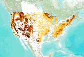
Average projected future (across 5 regional climate models using the A2 emissions scenario) density (birds per hectare) model of Streaked Horned Lark (Eremophila alpestris strigata) using a Boosted Regression Tree model (Hastie & Tibshirani 2000) informed by breeding season avian point count data, modeled vegetation types, and climate data from 1) Weather Research Forecasting Grell Model (WRFG) with boundary conditions driven by the Third Generation Coupled Global Climate Model (CGCM3); 2) Weather Research Forecasting Grell Model (WRFG) with boundary conditions driven by the Community Climate System Model (CCSM); 3) Regional Climate Model v3 (RCM3) with boundary conditions driven by the Geophysical Fluid Dynamics...

MAPS Station information: • Geographic locations and operating history of MAPS stations operated during the years 1989-2003. • A Microsoft Word document stations.doc describes field names

Louisiana Waterthrush - VizBand/Land AIC Model Selection Created: 05-Oct-2011 Louisiana Waterthrush annual capture rate of adult (ADULT) individuals (log transformed) ranged between -0.220 and +2.009 with a mean value of +0.895 and a median value of +0.794. ________________________________________ Model 1 (2 parameters) Louisiana Waterthrush annual capture rate of adult (ADULT) individuals (log transformed) was a function of: a) DIST2RIV15 (-0.30142) - distance (m) to stream, ranged between -1.104 and +0.772 (95% CL) with a mean value of -0.166 and a median value of -0.121, b) NLCD06DE33P (+0.46681) - percent deciduous forest cover, 990m-resolution (33x aggregation of 30m-resolution), ranged between +1.446 and...

Nashville Warbler - VizBand/Land AIC Model Selection Created: 17-May-2011 Nashville Warbler annual capture rate of adult (ADULT) individuals (log transformed) ranged between -0.233 and +2.357 with a mean value of +1.062 and a median value of +1.045. ________________________________________ Model 1 (3 parameters) Nashville Warbler annual capture rate of adult (ADULT) individuals (log transformed) was a function of: a) NLCD06CO2KP (-0.03933) - percent coniferous forest cover, 990m-resolution in a landscape context of 2km radius, ranged between +9.653 and +23.455 (95% CL) with a mean value of +16.554 and a median value of +18.030, b) STRMNET5K (+0.04352) - stream density (percent of pixels), 990m-resolution in a landscape...

Midwest MAPS Stations that operated 4 or more years between 1992 and 2008. Stations are classified by three categories of ability to effectively monitor priority species of continental concern and whether they were active in 2011. High Medium Total number of Species Captured >=15 >=10 Mean Capture Rate of Priority Species >=0.5 >=0.4 Total Number of Priority Species >=8 >=6 Percentage of Priority Species >=20 >=10 Other stations may be directed at restoration or single species MAPS Website

Bird survey routes in Craig County, OK

Link to brief summary

Distribution of hite-eyed Vireo mean adult day of capture at MAPS stations during the period 1992-2008 throughout Midwestern states (plus 250km buffer).

Habitat ranges for various native Hawaiian forest birds.

Habitat ranges for various native Hawaiian forest birds.

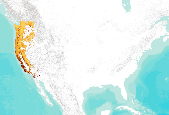
Current density (birds per hectare) model of Orange-crowned Warbler (Oreothlypis celata) using a Boosted Regression Tree model (Hastie & Tibshirani 2000) informed by breeding season avian point count data, modeled vegetation types, and climate data from PRISM (Daly et al. 2004) averaged for the years 1971-2000.

Current density (birds per hectare) model of Warbling Vireo (Vireo gilvus) using a Boosted Regression Tree model (Hastie & Tibshirani 2000) informed by breeding season avian point count data, modeled vegetation types, and climate data from PRISM (Daly et al. 2004) averaged for the years 1971-2000.
Hermit Warbler - VizBand/Land AIC Model Selection Created: 12-Aug-2011 Hermit Warbler annual capture rate of adult (ADULT) individuals (log transformed) ranged between -0.281 and +2.243 with a mean value of +0.981 and a median value of +0.875. ________________________________________ Model 1 (3 parameters) Hermit Warbler annual capture rate of adult (ADULT) individuals (log transformed) was a function of: a) GTOPO30_AL (+0.20641) - elevation (m), ranged between +5.119 and +8.376 (95% CL) with a mean value of +6.747 and a median value of +7.137, b) NLCD06AG5KP (-0.19572) - percent agricultural/grassland cover, 990m-resolution in a landscape context of 5km radius, ranged between -0.657 and +2.530 (95% CL) with a mean...
Introduction : Swainson’s Thrush is a medium sized (15-18cm) thrush which prefers to breed in dense shrub growth associated with spruce-fir forests. The "russet-backed" race prefers mixed forests and deciduous riparian woodlands of the coastal region from British Columbia, to northern California. These Pacific populations winter in mature tropical and secondary forests of Central America, whereas the "olive-backed" race that breeds in the Boreal and Rockies winters in S. America. Models of Monitoring Avian Productivity and Survival (MAPS) demographic data and high-resolution land cover data showed that Swainson’s Thrush prefers large intact forest patches with low perimeter to area ratios. On a regional...
Whooping cranes (Grus americana) of the Aransas-Wood Buffalo population migrate twice each year through the Great Plains in North America. Recovery activities for this endangered species include providing adequate places to stop and rest during migration, which are generally referred to as stopover sites. To assist in recovery efforts, initial estimates of stopover site use intensity are presented, which provide opportunity to identify areas across the migration range used more intensively by whooping cranes. We used location data acquired from 58 unique individuals fitted with platform transmitting terminals that collected global position system locations. Radio-tagged birds provided 2,158 stopover sites over 10...
Categories: Data,
Publication;
Types: Citation,
Downloadable,
GeoTIFF,
Map Service,
Raster;
Tags: North America,
biota,
birds,
endangered species,
migratory birds,
|

|
