Filters: Tags: british columbia (X)
648 results (67ms)|
Filters
Date Range
Extensions Types
Contacts
Categories Tag Types
|
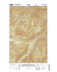
Layered GeoPDF 7.5 Minute Quadrangle Map. Layers of geospatial data include orthoimagery, roads, grids, geographic names, elevation contours, hydrography, and other selected map features.
Layered GeoPDF 7.5 Minute Quadrangle Map. Layers of geospatial data include orthoimagery, roads, grids, geographic names, elevation contours, hydrography, and other selected map features.
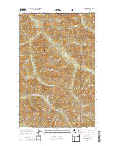
Layered GeoPDF 7.5 Minute Quadrangle Map. Layers of geospatial data include orthoimagery, roads, grids, geographic names, elevation contours, hydrography, and other selected map features.

The National Hydrography Dataset (NHD) is a feature-based database that interconnects and uniquely identifies the stream segments or reaches that make up the nation's surface water drainage system. NHD data was originally developed at 1:100,000-scale and exists at that scale for the whole country. This high-resolution NHD, generally developed at 1:24,000/1:12,000 scale, adds detail to the original 1:100,000-scale NHD. (Data for Alaska, Puerto Rico and the Virgin Islands was developed at high-resolution, not 1:100,000 scale.) Local resolution NHD is being developed where partners and data exist. The NHD contains reach codes for networked features, flow direction, names, and centerline representations for areal water...

The National Hydrography Dataset (NHD) is a feature-based database that interconnects and uniquely identifies the stream segments or reaches that make up the nation's surface water drainage system. NHD data was originally developed at 1:100,000-scale and exists at that scale for the whole country. This high-resolution NHD, generally developed at 1:24,000/1:12,000 scale, adds detail to the original 1:100,000-scale NHD. (Data for Alaska, Puerto Rico and the Virgin Islands was developed at high-resolution, not 1:100,000 scale.) Local resolution NHD is being developed where partners and data exist. The NHD contains reach codes for networked features, flow direction, names, and centerline representations for areal water...

The National Hydrography Dataset (NHD) is a feature-based database that interconnects and uniquely identifies the stream segments or reaches that make up the nation's surface water drainage system. NHD data was originally developed at 1:100,000-scale and exists at that scale for the whole country. This high-resolution NHD, generally developed at 1:24,000/1:12,000 scale, adds detail to the original 1:100,000-scale NHD. (Data for Alaska, Puerto Rico and the Virgin Islands was developed at high-resolution, not 1:100,000 scale.) Local resolution NHD is being developed where partners and data exist. The NHD contains reach codes for networked features, flow direction, names, and centerline representations for areal water...
This project will provide a comprehensive synthesis of beaver recolonization science and techniques for successful reintroduction or population expansion through a thorough, in-depth, coordinated review of all North American beaver-related information, including identification of research gaps and data needs, and recommendations for project implementation. This information will be disseminated through a series of one-day workshops.
Categories: Data,
Project;
Types: Map Service,
OGC WFS Layer,
OGC WMS Layer,
OGC WMS Service;
Tags: 2013,
AK-1,
Alaska,
Alaska,
Alaska,
The central objective of this project was to answer two questions: 1) how downscaled climate datasets, modeled vegetation changes, and information on estimated species sensitivities can be used to develop climate change adaptation strategies, and 2) how model results and datasets can be made more useful for informing the management of species and landscapes. To answer these questions, we identified enthusiastic partners working in two very different complex landscapes within the North Pacific Landscape Conservation Cooperative (NPLCC): 1) the British Columbia Park system, specifically the midcoast region, and 2) the National Wildlife Refuge system in the Willamette Valley, OR. The issues and concerns of each group...
Categories: Data;
Tags: Academics & scientific researchers,
B.C.,
BC Provincial parks,
British Columbia,
Conservation Planning,
This project will create a targeted and easily understandable guide to tools that support landscape-level planning in the face of climate change for NPLCC partners. The guide will build on previous NPLCC research on decision support needs with an emphasis on tools currently in use in the region. A survey of NPLCC partners will discover who is currently using or planning to use tools in the region, tools they are using, how well these tools are meeting their needs, and regional and outside experts engaged in tool use. Additional tools research will provide information on tools not currently in use in the region that could also provide needed functionality.
Categories: Data;
Types: Map Service,
OGC WFS Layer,
OGC WMS Layer,
OGC WMS Service;
Tags: Academics & scientific researchers,
Ak-1,
Alaska,
British Columbia,
CA-2,
For the past six years, the Bureau of Reclamation (BOR) has funded the USGS to study fish responses to restoration efforts and to construct a model relating stream habitat with fish population dynamics in the Methow River Basin, a tributary of the Columbia River. In the proposed study, we will use fish growth, distribution and movement (USGS data), foodweb data (Idaho State University), river flow (BOR data that we will expand) and water temperature data (from numerous agencies) to develop spatially-explicit bioenergetics models to assess effects of climate change on the viability of resident salmonid populations based on models being developed by USGS. The bioenergetics models will integrate such things as climate-change...
Categories: Data,
Project;
Types: Map Service,
OGC WFS Layer,
OGC WMS Layer,
OGC WMS Service;
Tags: Alberta,
British Columbia,
Bull Trout,
Climate Change,
Climate Change,
The GNLCC Multi-dimensional Synthesis is a synthesis of existing information in four categories to promote a common understanding of situation, existing information and information gaps, as well as providing an index of programmatic, resource and other climate and landscape related information for GNLCC. The synthesis includes: the GNLCC Resource Directory (organizations and initiatives); climate and ecological response (what does existing and projected climate information say and what are expected ecological effects); and monitoring (who is monitoring what).FY2011Objectives:Provide a Framework from which to organize the various monitoring and evaluation efforts. Included are key monitoring and evaluation questions...
Categories: Data,
Project;
Types: Map Service,
OGC WFS Layer,
OGC WMS Layer,
OGC WMS Service;
Tags: Alberta,
British Columbia,
CO-2,
CO-3,
CO-3,
We propose a collaborative project with the USGS, Wyoming State Climate Office, USFWS, USFS, and the NPS whereby we will assemble and maintain long-term records of climate from key stations in and around the Great Northern LCC and subject these records to a rigorous series of QA/QC procedures. Where appropriate we will use best available practices to infill missing data, and we will develop station histories (e.g., details of station moves, instrumentation changes, etc.) as a context for interpreting these records. We will then rigorously analyze patterns of long-term (50-100 years) variability and trends in these datasets, and provide summaries designed to meet the needs of non-climate specialists working in the...
Categories: Data,
Project;
Types: Map Service,
OGC WFS Layer,
OGC WMS Layer,
OGC WMS Service;
Tags: Alberta,
British Columbia,
CO-2,
CO-3,
CO-3,
The Canadian portion of the Crown of the Continent (CCoC) ecosystem has been identified as crucial for wolverines north of the US border to rescue or supply individuals and genes through dispersal to the highly fragmented population in the northern US Rocky Mountains. Highway 3, motorized recreation, and a growing resource extraction industry, however, increasingly fragment this critical landscape. This project will capitalize on multi-year wolverine occupancy and genetic data collected noninvasively in a >40,000 km2 area encompassing the core protected areas of the central Canadian Rocky Mountains to the north; and Glacier-Waterton Lakes National Park complex in the south. Our goal is to obtain spatially-explicit...
Categories: Data,
Project;
Types: Map Service,
OGC WFS Layer,
OGC WMS Layer,
OGC WMS Service;
Tags: Alberta,
Alpine,
Applications and Tools,
British Columbia,
Climate Change,
This layer has been updated in 2016 This shapefile represents the watersheds present within the Crown of the Continent Ecosystem (CCE) boundary.(Note: a different CCE boundary layer was used at the time of creation, so the area amounts within the CCE may not be accurate)This dataset was developed by the Crown Managers Partnership, as part of a transboundary collaborative management initiative for the Crown of the Continent Ecosystem, based on commonly identified management priorities that are relevant at the landscape scale. The CMP is collaborative group of land managers, scientists, and stakeholder in the CCE. For more information on the CMP and its collaborators, programs, and projects please visit: http://crownmanagers.org/
Categories: Data;
Types: Citation,
Downloadable,
Map Service,
OGC WFS Layer,
OGC WMS Layer,
Shapefile;
Tags: Alberta,
British Columbia,
CCE,
CMP,
Crown Manager's Partnership,
This dataset contains a seamless 1:1,000,000 scale British Columbia, Alberta and Montana lakes layer.
Categories: Data;
Types: Downloadable,
Map Service,
OGC WFS Layer,
OGC WMS Layer,
Shapefile;
Tags: 1:1 000 000,
1:1 000 000,
Alberta,
Alberta,
British Columbia,
A pool, or group of pools, within a specified geographic area that contain oil or natural gas. Fields are not specific to producing geological formation(s). Fields are used for well naming purposes relative to the well site surface coordinates and the objective formation of the well.
Watersheds boundaries for GVRD - represents Seymour Capilano and Coquitlam Watersheds. Data was obtained from GVRD in September 2000.
Province-wide SDE spatial view displaying dam locations. The public view displays a subset of the attribute data
TRIM-EBM is a 2D product containing TRIM 1 features excluding toponoymy, contours and DEM for which area based features have been closed to form polygons, symbol points have been replaced with polygons and vertical integration of streams has been removed 25 Meter Resolution Not available to the public for download. Must be purchased from BC Government
Assessment Watersheds are mesoscale aquatic units designed to replace the 3rd order 1:50K watersheds. Assessment Watersheds are based on groupings of fundamental watersheds using FWA watershed code and local code, with a target size of between 2,000ha and 10,000ha. Data prepared as a part of the BC Freshwater Atlas.
Types: Map Service,
OGC WFS Layer,
OGC WMS Layer,
OGC WMS Service;
Tags: BC,
British Columbia,
CWB ,
Canada,
Corporate Watershed Base ,
|

|
