Filters: Tags: cities (X)
55 results (18ms)|
Filters
Date Range
Extensions Types Contacts
Categories Tag Types Tag Schemes |
Population range for each city/town. pop_3: 1001-10,000 U.S. Populated Place Points represents populated places with population projected for 2030 that include census designated places, consolidated cities, and incorporated places within United States identified by the U.S. Census Bureau.
U.S. Cities represents locations for cities within United States with populations of 10,000 or greater (based on Census 2000 figures), all state capitals, and the national capital.
Population range for each city/town. pop_3: 1001-10,000 U.S. Populated Place Points represents populated places with population projected for 2030 that include census designated places, consolidated cities, and incorporated places within United States identified by the U.S. Census Bureau.
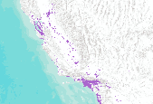
This is a map of populated areas with population density greater than or equal to 1 individual/ha (i.e., rural/exurban but including suburban and urban as defined by Marzluff et al. 2001) as determined from U.S. Census data corrected for public lands.
Categories: Data;
Types: Downloadable,
GeoTIFF,
Map Service,
Raster;
Tags: 2000 Census,
Arizona,
California,
Colorado,
Idaho,
Taxing Entities consist of a group of people who organize to tax themselves for specific purposes. These may include, but are not limited to: improvement and service districts for repairing or replacing a local road; water and sewer to provide infrastructure to a rural area for water and sewer facilities; conservation districts to help protect natural resources; and fire to provide fire protection services to rural areas, etc.
Categories: Data;
Types: Downloadable;
Tags: Boundaries,
Cities,
Counties,
Municipal,
Municipalities,

World Urban Areas represents the world's major urban areas with populations greater than 10,000. Source: DeLorme Publishing Company, Inc.
Population range for each city/town. pop_6: > 1,000,000 U.S. Populated Place Points represents populated places with population projected for 2030 that include census designated places, consolidated cities, and incorporated places within United States identified by the U.S. Census Bureau.
Population range for each city/town. pop_1: <100 U.S. Populated Place Points represents populated places with population projected for 2030 that include census designated places, consolidated cities, and incorporated places within United States identified by the U.S. Census Bureau.
Population range for each city/town. pop_2: 101-1000 U.S. Populated Place Points represents populated places that include census designated places, consolidated cities, and incorporated places within United States identified by the U.S. Census Bureau.

The DLG data files derived from the 1:2,000,000-scale maps contain selected base categories of cartographic data in digital form. The data files are derived from the sectional maps of the 1970 National Atlas of the United States of America. The Boundaries category includes boundary information collected in two separate subcategories: (1) Political Boundaries and (2) Administrative Boundaries. The Hydrography data includes data in three separate subcategories: (1) Streams, (2) Water Bodies, and (3) Hypsography (Continental Divide only). The Transportation category of data includes major transportation systems collected in three separate subcategories: (1) Roads and Trails, (2) Railroads, and (3) Cultural Features...
20 year Projected Urban Growth scenarios. Base year is 2000. Projected year in this dataset is 2020. Acquired from Cal-Atlas at http://www.atlas.ca.gov/download.html#/casil/society .

Municipal Boundaries for Wyoming Taxing Entities consist of a group of people who organize to tax themselves for specific purposes. These may include, but are not limited to : improvement and service districts for repairing or replacing a local road; water and sewer to provide infrastructure to a rural area for water and sewer facilities; conservation districts to help protect natural resources; and fire to provide fire protection services to rural areas, etc.

The Provincial Boundary layer, as part of the Saskatchewan Administrative Boundary data set, contains the annual copy of the GIS layer taken from Information Services Corporation of Saskatchewans live geospatial database at the end of each calendar year. The data is comprised of the geospatial location and attributional information for the provincial boundary of Saskatchewan. This data is suitable for use in Geographic Information Systems (GIS) and Computer Aided Drawing Systems (CAD).
Population range for each city/town. pop_3: 1001-10,000 U.S. Populated Place Points represents populated places that include census designated places, consolidated cities, and incorporated places within United States identified by the U.S. Census Bureau.
Population range for each city/town. pop_2: 101-1000 U.S. Populated Place Points represents populated places with population projected for 2030 that include census designated places, consolidated cities, and incorporated places within United States identified by the U.S. Census Bureau.
Understanding how ecological and cultural resources may change in the future is an important component of conservation planning and for the implementation of long-term environmental monitoring. We modeled six future scenarios of urbanization and sea level rise to investigate their potential effects on the Peninsular Florida Landscape Conservation Cooperative's Priority Resources (PFLCC 2016), which were identified as important for conservation through a cooperative multi-partner effort to prioritize conservation efforts on a state-wide scale. These data represent conservation targets for the Coastal Uplands, High Pine and Scrub, and Freshwater Aquatics Priority Resources at present, and under six future scenarios...

50 year Projected Urban Growth scenarios. Base year is 2000. Projected year in this dataset is 2020. Acquired from Cal-Atlas at http://www.atlas.ca.gov/download.html#/casil/society.
The Geographic Names Information System (GNIS), developed by the U.S. Geological Survey in cooperation with the U.S. Board on Geographic Names (BGN), contains information about physical and cultural geographic features in the United States and associated areas, both current and historical, but not including roads and highways. The database also contains geographic names in Antarctica. The database holds the Federally recognized name of each feature and defines the location of the feature by state, county, USGS topographic map, and geographic coordinates. Other feature attributes include names or spellings other than the official name, feature designations, feature class, historical and descriptive information, and...
Population range for each city/town. pop_1: <100 U.S. Populated Place Points represents populated places that include census designated places, consolidated cities, and incorporated places within United States identified by the U.S. Census Bureau.
Polygon shapefile showing municipal boundaries of Cities and Towns in Wyoming. Taxing entities consists of a group of people who organize to tax themselves for specific purposes.
Categories: Data;
Types: Downloadable,
Map Service,
OGC WFS Layer,
OGC WMS Layer,
Shapefile;
Tags: Cities,
LEAP,
data development,
wyoming
|

|
