Filters: Tags: conservation (X)
1,274 results (22ms)|
Filters
Contacts
(Less)
|
Our demands on natural systems outweigh the capacity of those systems to support us. This paper calls for an approach to development that consistently delivers ‘net benefit’ for biodiversity or ‘ecological enhancement’. Examples of enhancement are presented through four case studies in India undertaken between 2005 and 2010. Actions focus on improving the overall ecological structure, composition and functions of sites; strengthening ecological networks by creating new habitats and buffer areas; and improving the services provided by the ecosystems, without jeopardizing biodiversity. While recognizing the importance of quantitative metrics of impacts and mitigation measures to determine outcomes, such measures were...
Categories: Publication;
Types: Citation;
Tags: biological,
conservation,
control,
ecosystem,
habitat,

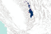
This dataset was created in order to facilitate transboundary conservation work and research projects, by integrating land cover maps into a single dataset from Cape Caution, BC, to Yakutat Bay, AK. It includes three levels of land classification, site index, elevation, hydric soils (yes/no), karst (yes/no), primary and secondary species, size class, and volume class. It also includes a number of other important attributes from individual datasets, which were not crosswalked between the different areas. This file represents Land Classification Level 2.

Priority Conservation Areas for the Willamette Valley - Puget Trough - Georgia Basin Ecoregion. October, 2003. The Willamette Valley-Puget Trough-Georgia Basin ecoregion is a long ribbon of broad valley lowlands and inland sea flanked by the rugged Cascade and coastal mountain ranges of British Columbia, Washington, and Oregon. It encompasses some 5,550,000 ha of Pacific inlet, coastal lowlands, islands, and intermontane lowland, and extends from the Sunshine Coast and eastern lowland of Vancouver Island along Georgia Strait, south through Puget Sound and the extensive plains and river floodplains in the Willamette Valley. Five expert technical teams collaborated on a series of analyses based on methods developed...
Hermit Warbler - VizBand/Land AIC Model Selection Created: 12-Aug-2011 Hermit Warbler annual capture rate of adult (ADULT) individuals (log transformed) ranged between -0.281 and +2.243 with a mean value of +0.981 and a median value of +0.875. ________________________________________ Model 1 (3 parameters) Hermit Warbler annual capture rate of adult (ADULT) individuals (log transformed) was a function of: a) GTOPO30_AL (+0.20641) - elevation (m), ranged between +5.119 and +8.376 (95% CL) with a mean value of +6.747 and a median value of +7.137, b) NLCD06AG5KP (-0.19572) - percent agricultural/grassland cover, 990m-resolution in a landscape context of 5km radius, ranged between -0.657 and +2.530 (95% CL) with a mean...
Introduction : Swainson’s Thrush is a medium sized (15-18cm) thrush which prefers to breed in dense shrub growth associated with spruce-fir forests. The "russet-backed" race prefers mixed forests and deciduous riparian woodlands of the coastal region from British Columbia, to northern California. These Pacific populations winter in mature tropical and secondary forests of Central America, whereas the "olive-backed" race that breeds in the Boreal and Rockies winters in S. America. Models of Monitoring Avian Productivity and Survival (MAPS) demographic data and high-resolution land cover data showed that Swainson’s Thrush prefers large intact forest patches with low perimeter to area ratios. On a regional...

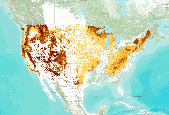
The Global Human Footprint Dataset of the Last of the Wild Project, Version 2, 2005 (LWP-2) is the Human Influence Index (HII) normalized by biome and realm. The HII is a global dataset of 1-kilometer grid cells, created from nine global data layers covering human population pressure (population density), human land use and infrastructure (built-up areas, nighttime lights, land use/land cover), and human access (coastlines, roads, railroads, navigable rivers). The dataset is produced by the Wildlife Conservation Society (WCS) and the Columbia University Center for International Earth Science Information Network (CIESIN). The Human Footprint Index (HF) expressses as a percentagethe relative human influence in each...

The Global Human Footprint Dataset of the Last of the Wild Project, Version 2, 2005 (LWP-2) is the Human Influence Index (HII) normalized by biome and realm. The HII is a global dataset of 1-kilometer grid cells, created from nine global data layers covering human population pressure (population density), human land use and infrastructure (built-up areas, nighttime lights, land use/land cover), and human access (coastlines, roads, railroads, navigable rivers). The dataset is produced by the Wildlife Conservation Society (WCS) and the Columbia University Center for International Earth Science Information Network (CIESIN). The Human Footprint Index (HF) expressses as a percentagethe relative human influence in each...

This layer locates conservation issues, conservation action and conservation research in the Indian subcontinent. This is a participatory layer and everybody is welcome to add locations with annotations. Downloaded from India Biodiversity Portal on January 17th, 2013. http://indiabiodiversity.org
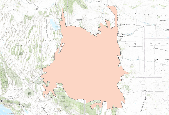
Landscape conservation cooperatives (LCCs) are conservation-science partnerships between the U.S. Fish and Wildlife Service, U.S. Geological Survey (USGS), and other federal agencies, states, tribes, NGOs, universities and stakeholders within a geographically defined area. They inform resource management decisions to address national-scale stressors-including habitat fragmentation, genetic isolation, spread of invasive species, and water scarcity-all of which are accelerated by climate change.

Conservation Initiative Areas for the Mississippi Chapter of The Nature Conservancy

The Global Human Footprint Dataset of the Last of the Wild Project, Version 2, 2005 (LWP-2) is the Human Influence Index (HII) normalized by biome and realm. The HII is a global dataset of 1-kilometer grid cells, created from nine global data layers covering human population pressure (population density), human land use and infrastructure (built-up areas, nighttime lights, land use/land cover), and human access (coastlines, roads, railroads, navigable rivers). The dataset is produced by the Wildlife Conservation Society (WCS) and the Columbia University Center for International Earth Science Information Network (CIESIN). Note: Data Basin does not allow downloads of this dataset. If you wish to download this data,...

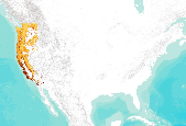
The Nature Conservancy (TNC) has derived climate suitability forecasts for most species of trees and shrubs considered to be ecological dominants of terrestrial Californian habitat types. Our plant projections are compiled as decision support tools to help Conservancy project staff, as well as our external partners, develop the necessary plans, priorities and strategies to successfully adapt to uncertain changes in future climate. In the recently completed Southern Sierra Partnership's 2010 Climate-Adapted Conservation Plan for the Southern Sierra Nevada and Tehachapi Mountains, species and habitat forecasts shown here informed the development of a regional conservation design that explicitly incorporates long-term...
The Nature Conservancy (TNC) has derived climate suitability forecasts for most species of trees and shrubs considered to be ecological dominants of terrestrial Californian habitat types. Our plant projections are compiled as decision support tools to help Conservancy project staff, as well as our external partners, develop the necessary plans, priorities and strategies to successfully adapt to uncertain changes in future climate. In the recently completed Southern Sierra Partnership's 2010 Climate-Adapted Conservation Plan for the Southern Sierra Nevada and Tehachapi Mountains, species and habitat forecasts shown here informed the development of a regional conservation design that explicitly incorporates long-term...
The Nature Conservancy (TNC) has derived climate suitability forecasts for most species of trees and shrubs considered to be ecological dominants of terrestrial Californian habitat types. Our plant projections are compiled as decision support tools to help Conservancy project staff, as well as our external partners, develop the necessary plans, priorities and strategies to successfully adapt to uncertain changes in future climate. In the recently completed Southern Sierra Partnership's 2010 Climate-Adapted Conservation Plan for the Southern Sierra Nevada and Tehachapi Mountains, species and habitat forecasts shown here informed the development of a regional conservation design that explicitly incorporates long-term...

The Nature Conservancy (TNC) has derived climate suitability forecasts for most species of trees and shrubs considered to be ecological dominants of terrestrial Californian habitat types. Our plant projections are compiled as decision support tools to help Conservancy project staff, as well as our external partners, develop the necessary plans, priorities and strategies to successfully adapt to uncertain changes in future climate. In the recently completed Southern Sierra Partnership's 2010 Climate-Adapted Conservation Plan for the Southern Sierra Nevada and Tehachapi Mountains, species and habitat forecasts shown here informed the development of a regional conservation design that explicitly incorporates long-term...

The Nature Conservancy (TNC) has derived climate suitability forecasts for most species of trees and shrubs considered to be ecological dominants of terrestrial Californian habitat types. Our plant projections are compiled as decision support tools to help Conservancy project staff, as well as our external partners, develop the necessary plans, priorities and strategies to successfully adapt to uncertain changes in future climate. In the recently completed Southern Sierra Partnership's 2010 Climate-Adapted Conservation Plan for the Southern Sierra Nevada and Tehachapi Mountains, species and habitat forecasts shown here informed the development of a regional conservation design that explicitly incorporates long-term...

The Nature Conservancy (TNC) has derived climate suitability forecasts for most species of trees and shrubs considered to be ecological dominants of terrestrial Californian habitat types. Our plant projections are compiled as decision support tools to help Conservancy project staff, as well as our external partners, develop the necessary plans, priorities and strategies to successfully adapt to uncertain changes in future climate. In the recently completed Southern Sierra Partnership's 2010 Climate-Adapted Conservation Plan for the Southern Sierra Nevada and Tehachapi Mountains, species and habitat forecasts shown here informed the development of a regional conservation design that explicitly incorporates long-term...
The Nature Conservancy (TNC) has derived climate suitability forecasts for most species of trees and shrubs considered to be ecological dominants of terrestrial Californian habitat types. Our plant projections are compiled as decision support tools to help Conservancy project staff, as well as our external partners, develop the necessary plans, priorities and strategies to successfully adapt to uncertain changes in future climate. In the recently completed Southern Sierra Partnership's 2010 Climate-Adapted Conservation Plan for the Southern Sierra Nevada and Tehachapi Mountains, species and habitat forecasts shown here informed the development of a regional conservation design that explicitly incorporates long-term...
GAP distribution models represent the areas where species are predicted to occur based on habitat associations. GAP distribution models are the spatial arrangement of environments suitable for occupation by a species. In other words, a species distribution is created using a deductive model to predict areas suitable for occupation within a species range. To represent these suitable environments, GAP compiled existing GAP data, where available, and compiled additional data where needed. Existing data sources were the Southwest Regional Gap Analysis Project (SWReGAP) and the Southeast Gap Analysis Project (SEGAP) as well as a data compiled by Sanborn Solutions and Mason, Bruce and Girard. Habitat associations were...
Categories: Data;
Types: ArcGIS REST Map Service,
Map Service;
Tags: Biodiversity,
Conservation,
GAP,
Gap Analysis,
Species Distribution,
Proportion of juniper land cover within a 18-km radius developed using a circular focal moving window analysis.
Categories: Data;
Types: Downloadable,
GeoTIFF,
Map Service,
Raster,
Shapefile;
Tags: Colorado,
Idaho,
Juniperus,
Montana,
United States,
|

|
